Anderson County Map, South Carolina

Anderson County Map Collection

We allow you to use our Anderson County map. Attribution is required.
Anderson County, South Carolina

Anderson County sits in the northwest corner of South Carolina, next to Georgia. It’s part of the region known as “The Upstate.” There’s a strong manufacturing base, but there’s plenty of farmland too. You’ll see old barns and silos next to modern factories.
The city of Anderson is the heart of the county. Locals call it “The Electric City” because it was one of the first places in the Southeast to get electricity. Anderson’s downtown is going through a revival.
Lake Hartwell cover 56,000 acres, perfect for boating, fishing, or just hanging out on the shore. It’s an interesting mix. Clemson University is just a stone’s throw away. This county has managed to keep its small-town vibe while still growing.
| Category | Details |
|---|---|
| County Name | Anderson County |
| County Seat | Anderson |
| Population | Approximately 212,000 |
| Cities, Towns, and Communities | Anderson, Belton, Honea Path, Pendleton, Williamston, Iva |
| Interstates and Highways | Interstate 85, U.S. Highway 76, U.S. Highway 178, U.S. Highway 29 |
| FIPS Code | 45-007 |
| Total Area (Land and Water) | 757 square miles (718 sq mi land, 39 sq mi water) |
| Adjacent Counties (and Direction) | Pickens County (North), Greenville County (Northeast), Laurens County (East), Abbeville County (South), Elbert County, Georgia (Southwest), Hart County, Georgia (West), Oconee County (Northwest) |
| Time Zone | Eastern Time Zone (EST) |
| State | South Carolina |
| Coordinates | 34°30’N, 82°38’W |
| Etymology | Named after Robert Anderson, a Revolutionary War hero |
| Major Landmarks | Lake Hartwell, Anderson University, Sadlers Creek State Park |
| Website | Anderson County Website |
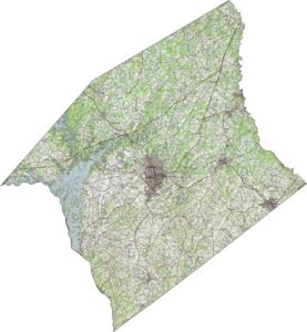
PHYSICAL MAP
Anderson County Topographic Map
The terrain here is classic rolling Piedmont. It’s gently rising and falling with steady rhythm. Hills aren’t dramatic, but they do add texture. In the north, it’s slightly higher and rougher, while the south smooths out a bit. You can zoom in on our map to see how the layout plays out.
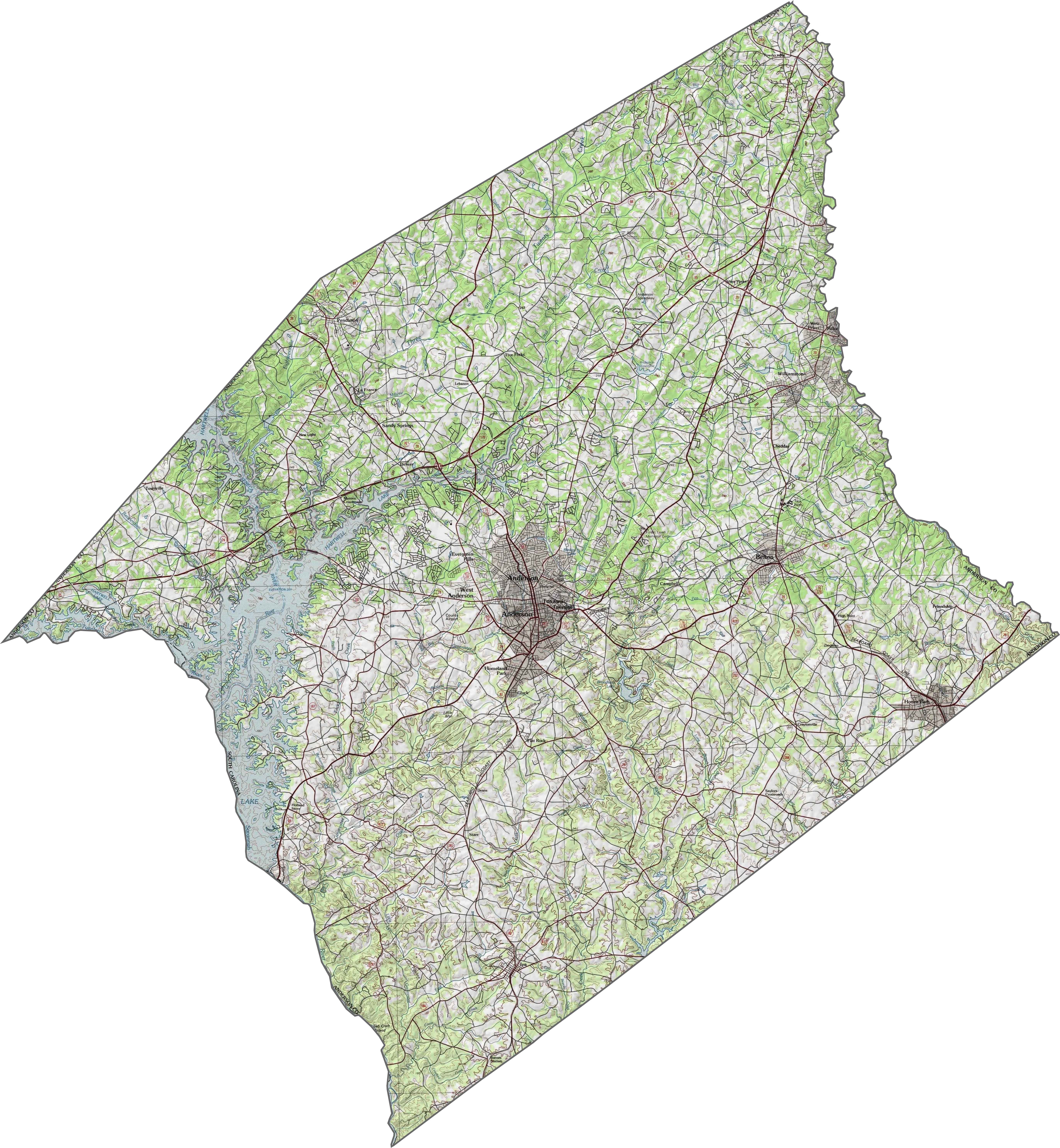
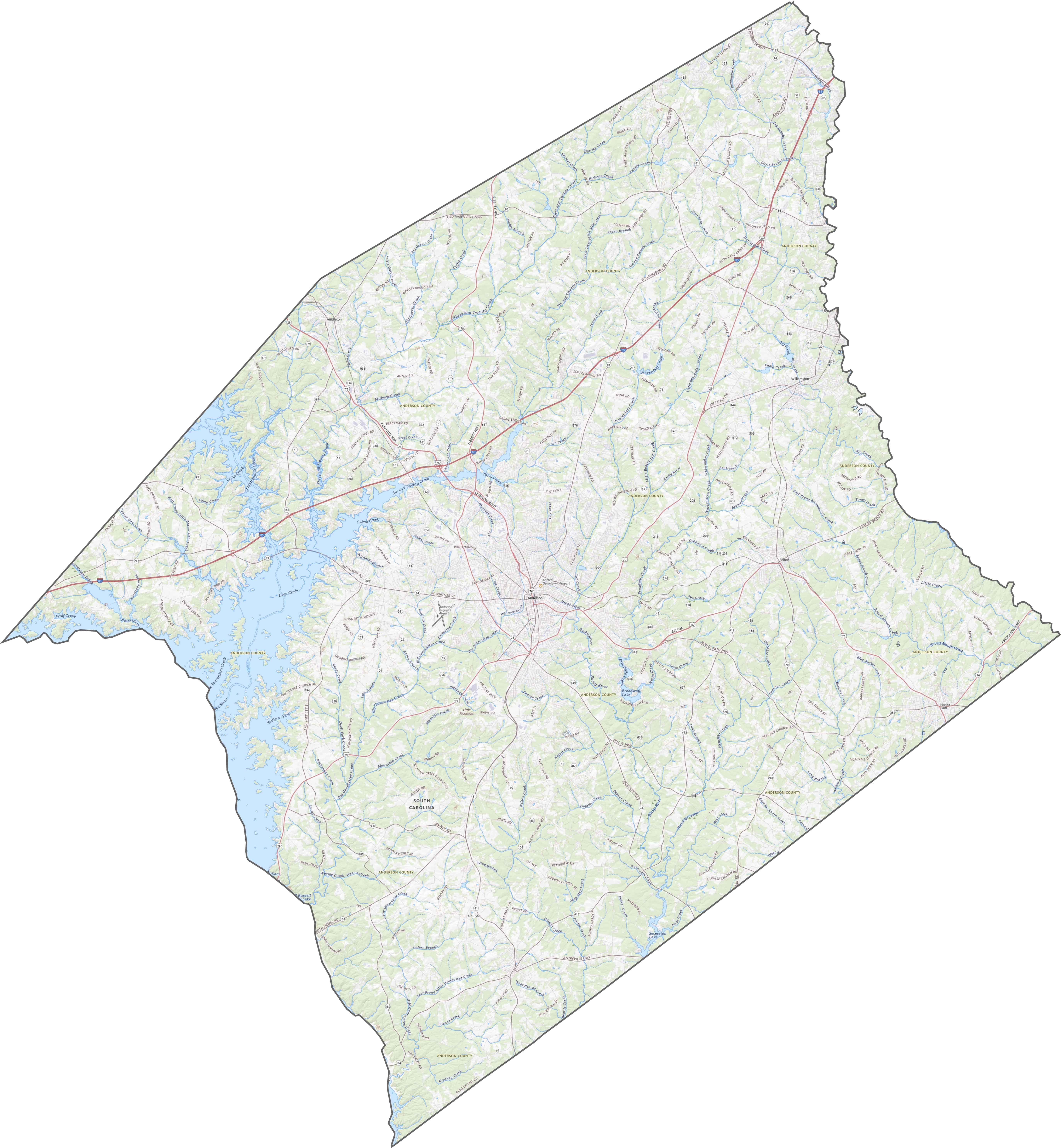
TRANSPORTATION MAP
Anderson County Road Map
Anderson County’s road network is dense in the middle but stretches thinner toward the edges. I-85 is the primary route here. Though that hub makes navigation easy, some routes loop unpredictably.
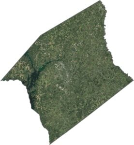
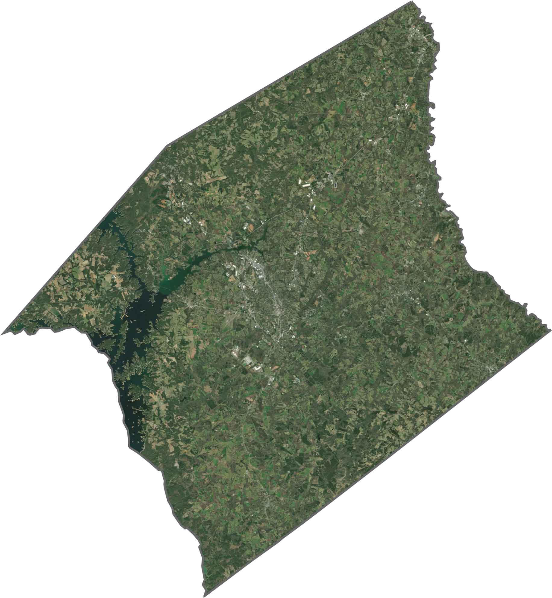
SATELLITE IMAGERY
Anderson County Satellite Map
Lakes steal the show from above, especially in the western corner which is home to Lake Hartwell. Even so, tree cover remains heavy throughout. Farmland and neighborhoods peek through the forest. Roads are easy to spot, but nature still wins the overall view.
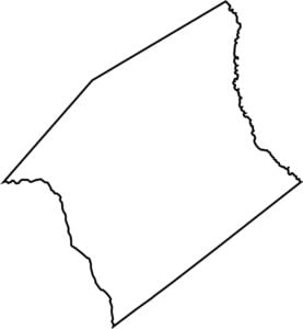
OUTLINE MAP
Anderson County Blank Map
Anderson County has an asymmetrical shape with curves and corners that don’t follow any strict pattern. The western edge is cut by the Savannah River, forming a natural boundary with Georgia. The Saluda River forms the eastern boundary.

Neighboring Counties
Here are the 7 neighboring counties of Anderson County:


South Carolina County Map

South Carolina’s 46 counties keep things interesting. Some swing to beach tunes, others hum with history. You’ll find gators, grits, and gospel… sometimes all in the same afternoon.