South Carolina County Map

South Carolina County Map Collection

We allow you to use our South Carolina County map. Attribution is required.
South Carolina County Maps
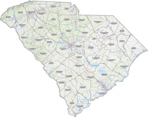
South Carolina is split into 46 counties. Click on any of the maps below to get a better look.


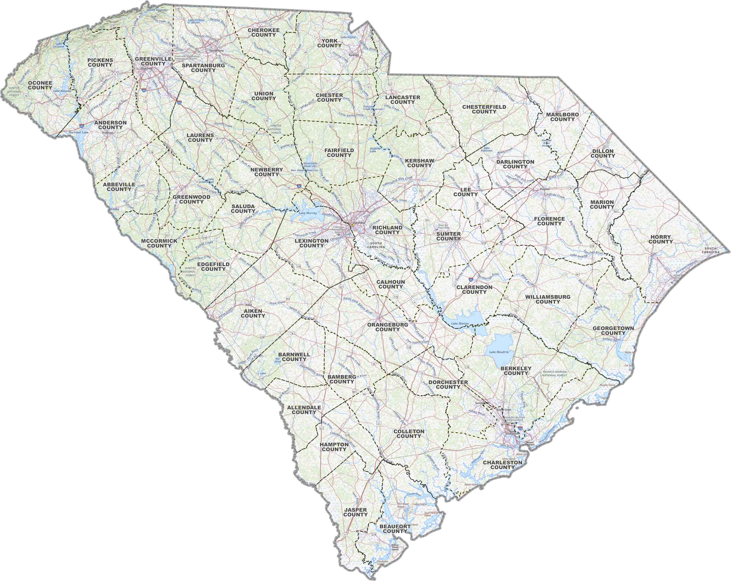
PHYSICAL MAP
South Carolina Topographic County Map
This map covers all the essentials across South Carolina. It includes county lines, interstates, towns and cities, rivers and lakes.
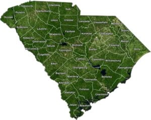
SATELLITE IMAGERY
South Carolina Satellite County Map
Here’s how South Carolina looks like from above with county lines. Understand its wetlands near the coast, pine forests inland, and towns throughout.
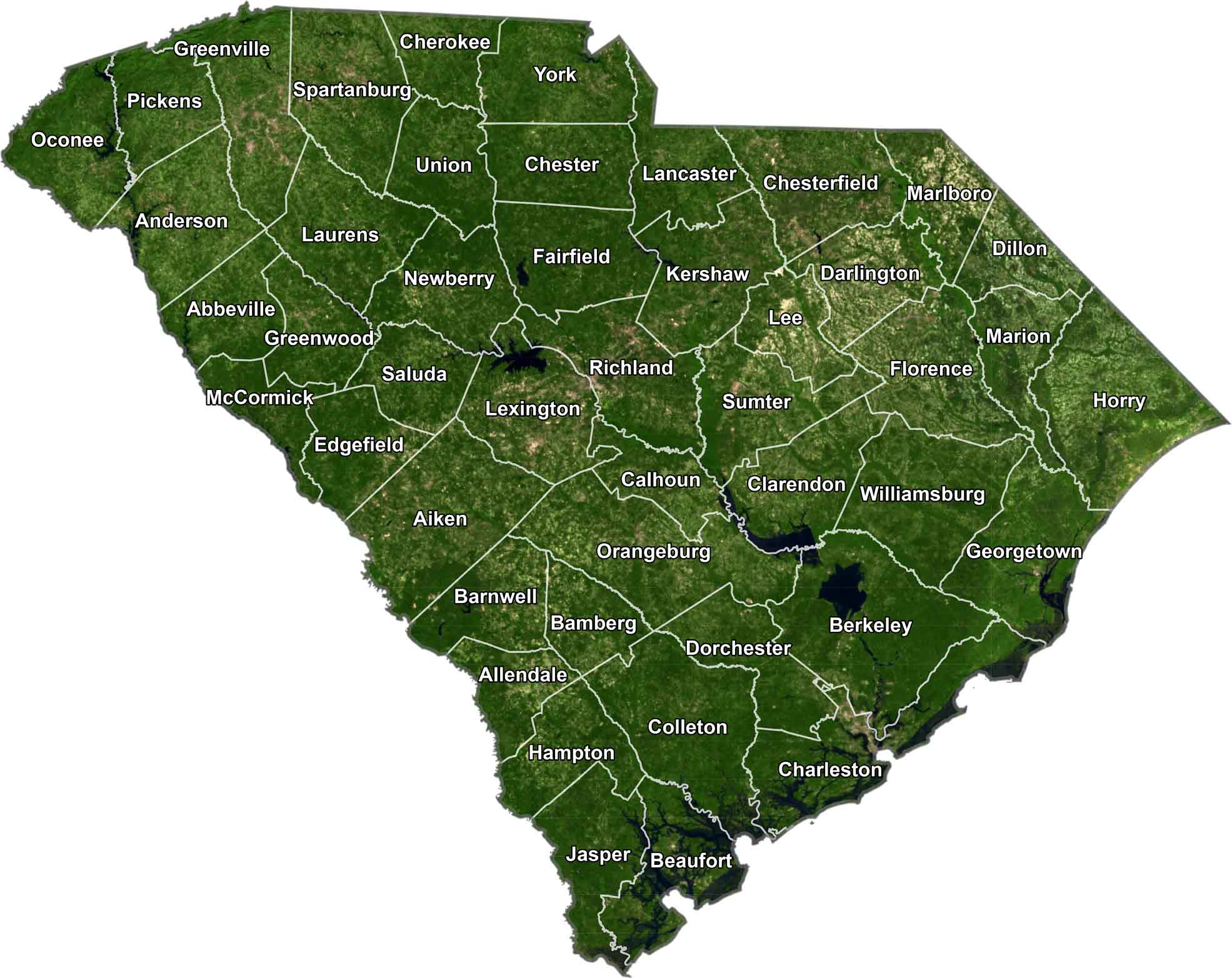
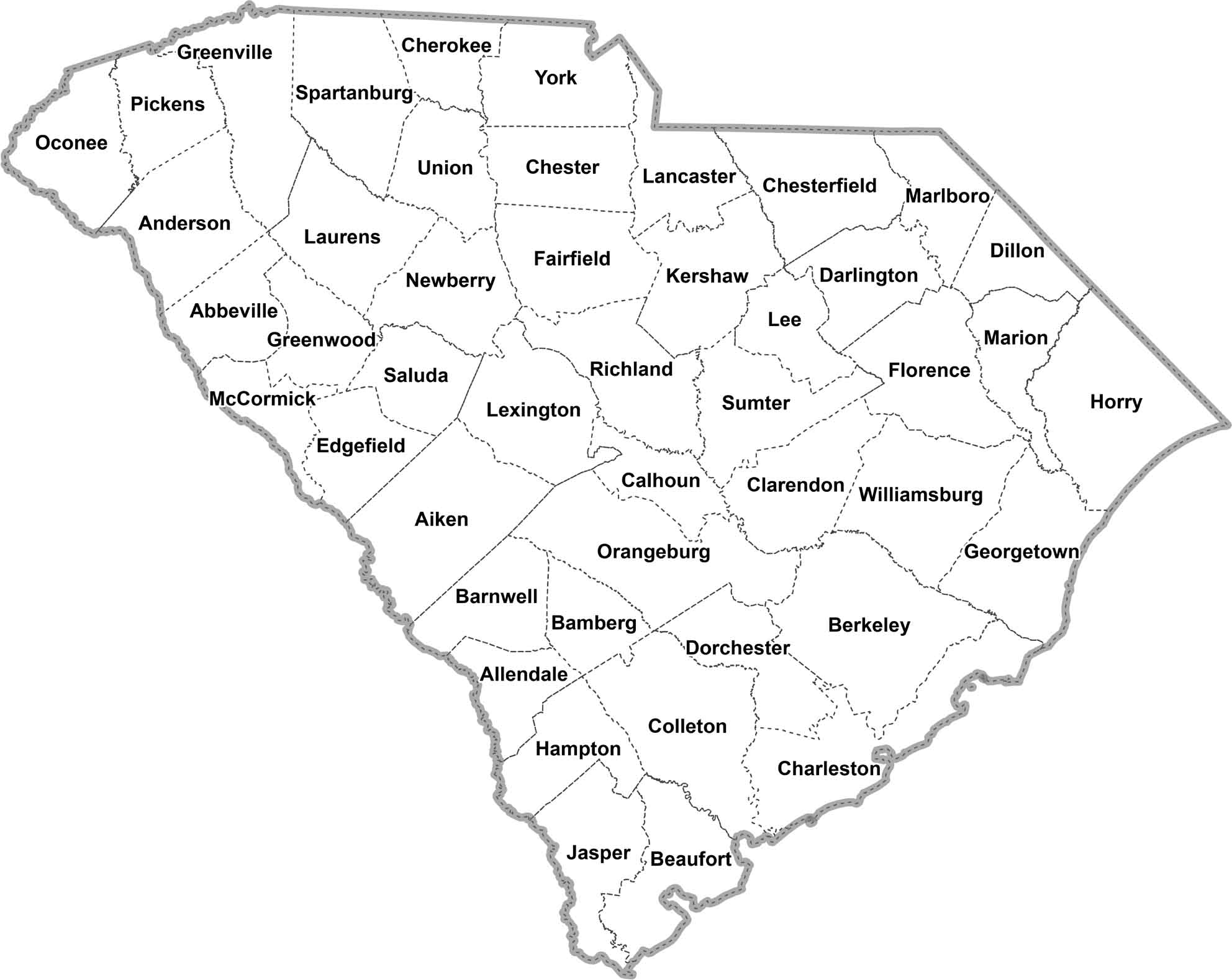
OUTLINE MAP
South Carolina Simple County Map
Just the basics for this map. It’s South Carolina’s counties laid out with clean lines and clear labels. See how the state is split up county-by-county.
South Carolina Counties
In South Carolina, Greenville County has the highest population. It’s part of the Upstate region and home to the city of Greenville. The least populous county is McCormick County. It’s situated in the western part of the state, mostly rural with a lot of forest land.
Most Populous: Greenville County
Least Populous: McCormick County

In terms of size, Horry County is the biggest (excluding water), covering about 1,255 square miles. It stretches from the North Carolina border down the coast and includes Myrtle Beach. The smallest county is McCormick County again, at just 359.1 square miles. But what it lacks in size it makes up for in lakes.
Largest Area: Horry County
Smallest Area: McCormick County
From the mountains to the sea, each of South Carolina’s counties has its own flavor. Like how Pickens County got split in half in 1826 because people on one side complained it was too far to ride to the courthouse. The newest county, Allendale County, was only created in 1919.
South Carolina County List
Here’s a complete list of all the counties in South Carolina with some details about each one:
| FIPS Code | Name | Land % | Water % | Total Area (sq mi) |
|---|---|---|---|---|
| 45-001 | Abbeville County | 96.0 | 4.0 | 512.0 |
| 45-003 | Aiken County | 99.1 | 0.9 | 1,080.1 |
| 45-005 | Allendale County | 99.0 | 1.0 | 412.4 |
| 45-007 | Anderson County | 94.5 | 5.5 | 755.7 |
| 45-009 | Bamberg County | 99.4 | 0.6 | 395.6 |
| 45-011 | Barnwell County | 98.4 | 1.6 | 557.3 |
| 45-013 | Beaufort County | 62.4 | 37.6 | 923.5 |
| 45-015 | Berkeley County | 89.4 | 10.6 | 1,233.9 |
| 45-017 | Calhoun County | 97.1 | 2.9 | 392.5 |
| 45-019 | Charleston County | 67.6 | 32.4 | 1,358.0 |
| 45-021 | Cherokee County | 98.9 | 1.1 | 397.9 |
| 45-023 | Chester County | 99.1 | 0.9 | 586.2 |
| 45-025 | Chesterfield County | 99.2 | 0.8 | 805.6 |
| 45-027 | Clarendon County | 87.2 | 12.8 | 695.7 |
| 45-029 | Colleton County | 93.2 | 6.8 | 1,133.3 |
| 45-031 | Darlington County | 99.0 | 1.0 | 566.3 |
| 45-033 | Dillon County | 99.6 | 0.4 | 406.8 |
| 45-035 | Dorchester County | 99.5 | 0.5 | 571.2 |
| 45-037 | Edgefield County | 98.8 | 1.2 | 507.1 |
| 45-039 | Fairfield County | 96.7 | 3.3 | 709.9 |
| 45-041 | Florence County | 99.5 | 0.5 | 804.3 |
| 45-043 | Georgetown County | 78.6 | 21.4 | 1,035.2 |
| 45-045 | Greenville County | 98.8 | 1.2 | 794.8 |
| 45-047 | Greenwood County | 98.2 | 1.8 | 462.9 |
| 45-049 | Hampton County | 99.5 | 0.5 | 562.7 |
| 45-051 | Horry County | 90.4 | 9.6 | 1,254.4 |
| 45-053 | Jasper County | 93.4 | 6.6 | 701.6 |
| 45-055 | Kershaw County | 98.1 | 1.9 | 740.3 |
| 45-057 | Lancaster County | 98.9 | 1.1 | 555.0 |
| 45-059 | Laurens County | 98.6 | 1.4 | 723.8 |
| 45-061 | Lee County | 99.7 | 0.3 | 411.2 |
| 45-063 | Lexington County | 92.3 | 7.7 | 757.6 |
| 45-065 | McCormick County | 91.2 | 8.8 | 393.9 |
| 45-067 | Marion County | 99.0 | 1.0 | 494.2 |
| 45-069 | Marlboro County | 98.8 | 1.2 | 485.5 |
| 45-071 | Newberry County | 97.3 | 2.7 | 647.3 |
| 45-073 | Oconee County | 93.0 | 7.0 | 673.6 |
| 45-075 | Orangeburg County | 98.1 | 1.9 | 1,127.9 |
| 45-077 | Pickens County | 96.9 | 3.1 | 512.6 |
| 45-079 | Richland County | 98.1 | 1.9 | 771.9 |
| 45-081 | Saluda County | 98.0 | 2.0 | 461.9 |
| 45-083 | Spartanburg County | 98.6 | 1.4 | 819.0 |
| 45-085 | Sumter County | 97.5 | 2.5 | 682.1 |
| 45-087 | Union County | 99.6 | 0.4 | 516.0 |
| 45-089 | Williamsburg County | 99.7 | 0.3 | 937.0 |
| 45-091 | York County | 97.8 | 2.2 | 695.8 |
Source: United States Census Bureau