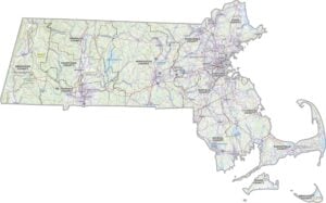
Massachusetts County Map

Massachusetts County Map Collection

We allow you to use our Massachusetts County map. Attribution is required.
Massachusetts County Maps
Massachusetts is divided into 14 counties. Click on any of our maps for more geographic details.


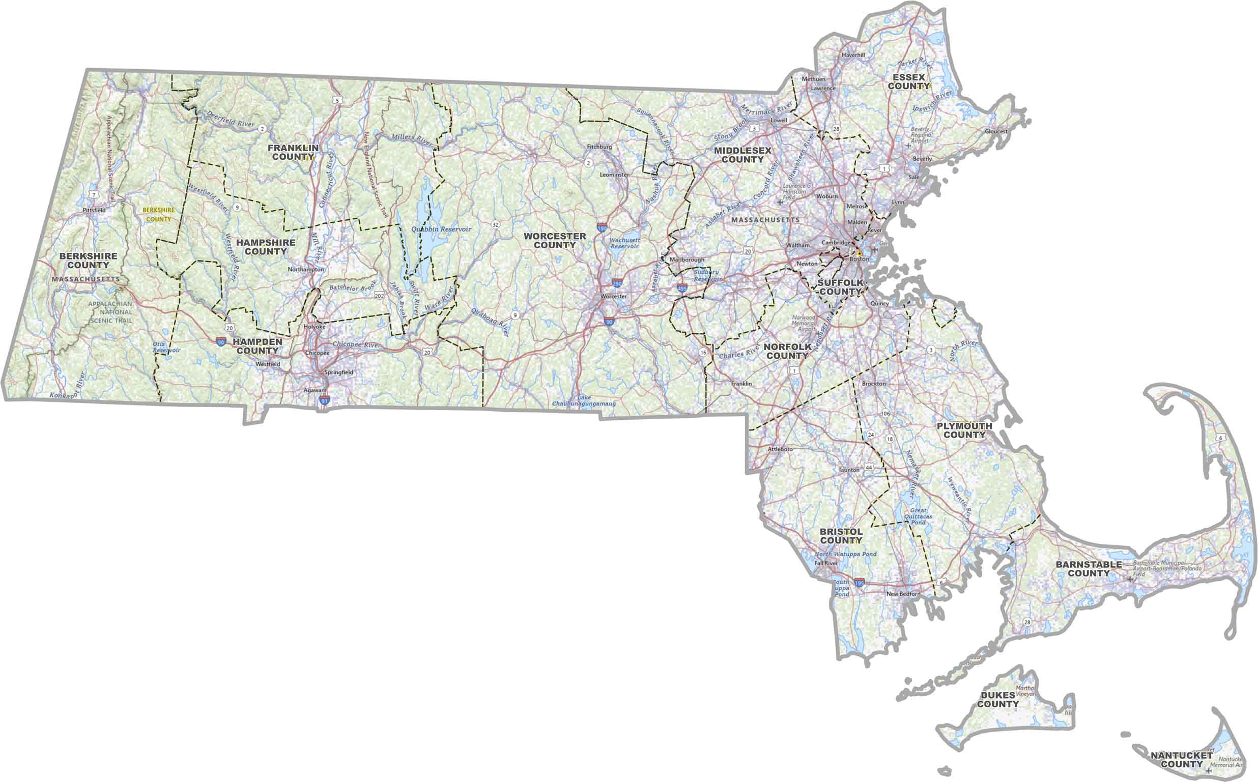
PHYSICAL MAP
Massachusetts Topographic County Map
Our toographic map gives you a clear picture of Massachusetts counties. You’ll also see its highways, rivers, reservoirs and cities.
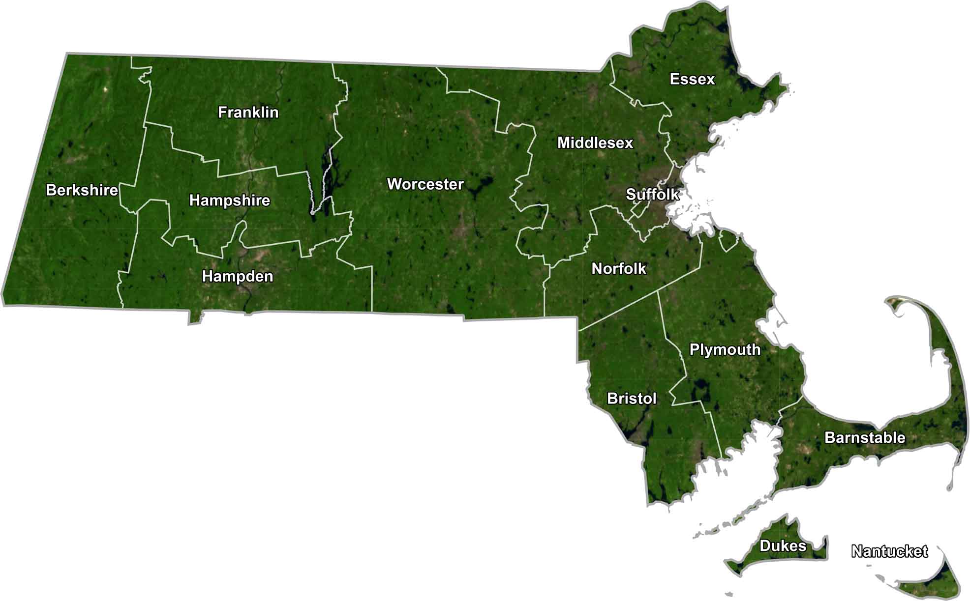
SATELLITE IMAGERY
Massachusetts Satellite County Map
Massachusetts from above shows off its green. You’ll see a lot of nature including its forests, lakes, and coastline. Our satellite map captures all that detail and with county borders.
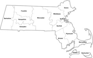
OUTLINE MAP
Massachusetts Simple County Map
Need a quick look at Massachusetts by county? This clean map shows each one clearly. Easy to print off and see how the state’s laid out.

Massachusetts Counties
Middlesex County takes the top spot as the most populous county in Massachusetts. It’s not surprising when you consider it includes Cambridge and parts of the Greater Boston area. Whereas Nantucket County is the least populous because it’s basically an island.
Most Populous: Middlesex County
Least Populous: Nantucket County

Sizewise, Worcester County is the biggest, spanning across central Massachusetts. It has cities, suburbs, and plenty of rural areas too. The smallest? If you just use landmass, that’d be Nantucket again. It might be tiny, but it’s big on coastal beauty.
Largest Area: Worcester County
Smallest Area: Nantucket County
Massachusetts counties have some cool history behind them. For instance, Suffolk County used to be much larger, but other counties split off from it over time. Now it’s basically just Boston and a few nearby towns. Or Franklin County, named after Benjamin Franklin.
The first counties in Massachusetts were set up back in 1643, with Essex, Middlesex, and Suffolk being among the original ones. Even though some counties don’t have functioning governments anymore, they’re still important for things like judicial districts and statistical areas.
Massachusetts County List
Here’s a complete list of counties in Massachusetts showing important details of each one:
| FIPS Code | Name | Land % | Water % | Total Area (sq mi) |
|---|---|---|---|---|
| 25-001 | Barnstable County | 30.2 | 69.8 | 1,305.5 |
| 25-003 | Berkshire County | 97.9 | 2.1 | 946.5 |
| 25-005 | Bristol County | 80.0 | 20.0 | 691.1 |
| 25-007 | Dukes County | 21.0 | 79.0 | 491.0 |
| 25-009 | Essex County | 59.4 | 40.6 | 828.5 |
| 25-011 | Franklin County | 96.5 | 3.5 | 724.5 |
| 25-013 | Hampden County | 97.3 | 2.7 | 634.1 |
| 25-015 | Hampshire County | 96.7 | 3.3 | 545.3 |
| 25-017 | Middlesex County | 96.6 | 3.4 | 846.9 |
| 25-019 | Nantucket County | 15.2 | 84.8 | 303.7 |
| 25-021 | Norfolk County | 89.1 | 10.9 | 444.3 |
| 25-023 | Plymouth County | 60.3 | 39.7 | 1,093.3 |
| 25-025 | Suffolk County | 48.4 | 51.6 | 120.2 |
| 25-027 | Worcester County | 95.7 | 4.3 | 1,579.2 |
Source: United States Census Bureau