Missouri County Map

Missouri County Map Collection
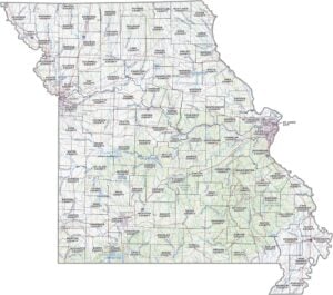

We allow you to use our Missouri County map. Attribution is required.
Missouri County Maps
Missouri’s split into 114 counties, plus the independent city of St. Louis. Click on one of our customized maps below.


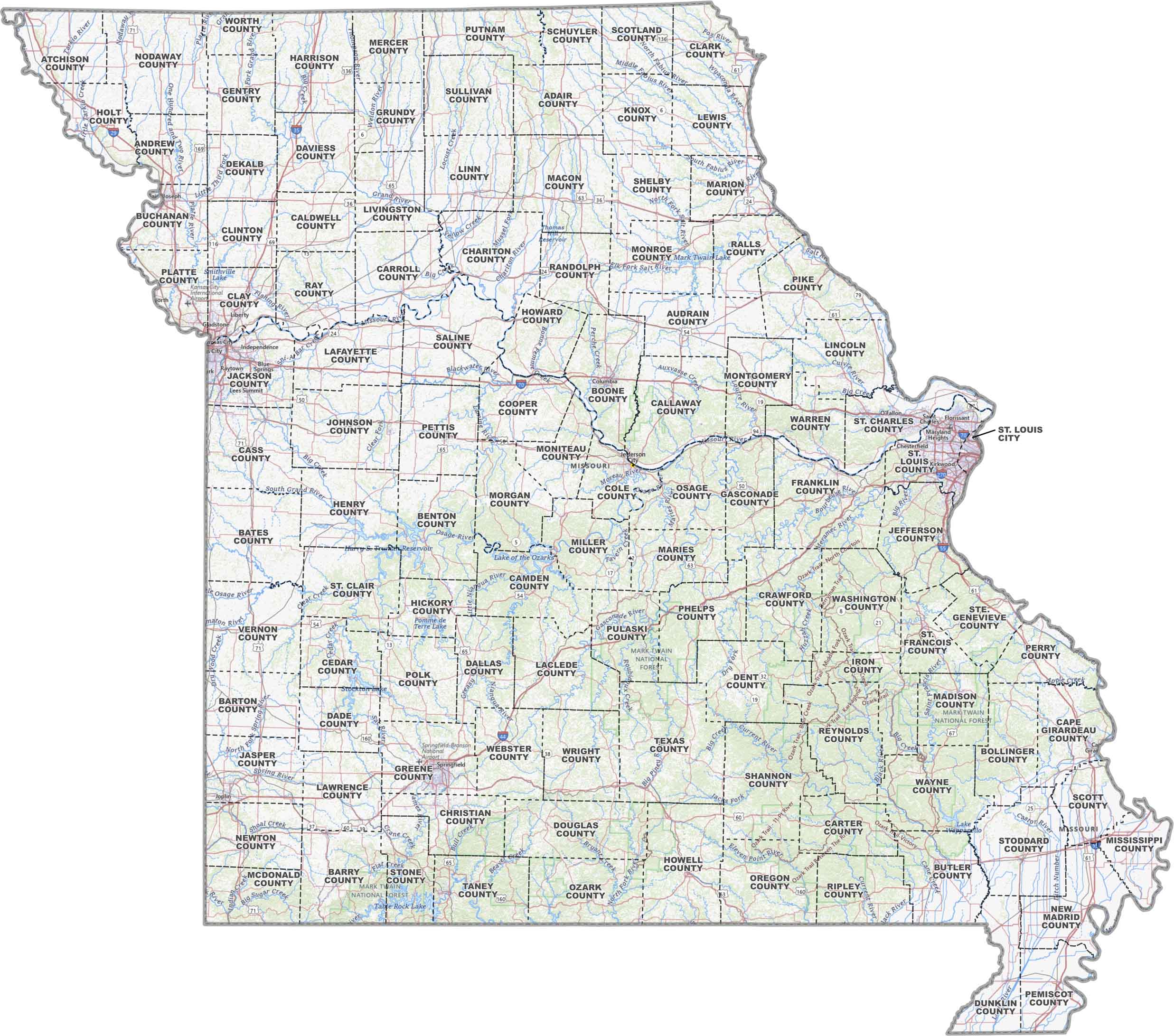
PHYSICAL MAP
Missouri Topographic County Map
Need a clear view of Missouri? This map lays out all the counties, major highways, airports, cities, rivers, lakes and more. It’s all right here in our Missouri topographic county map.
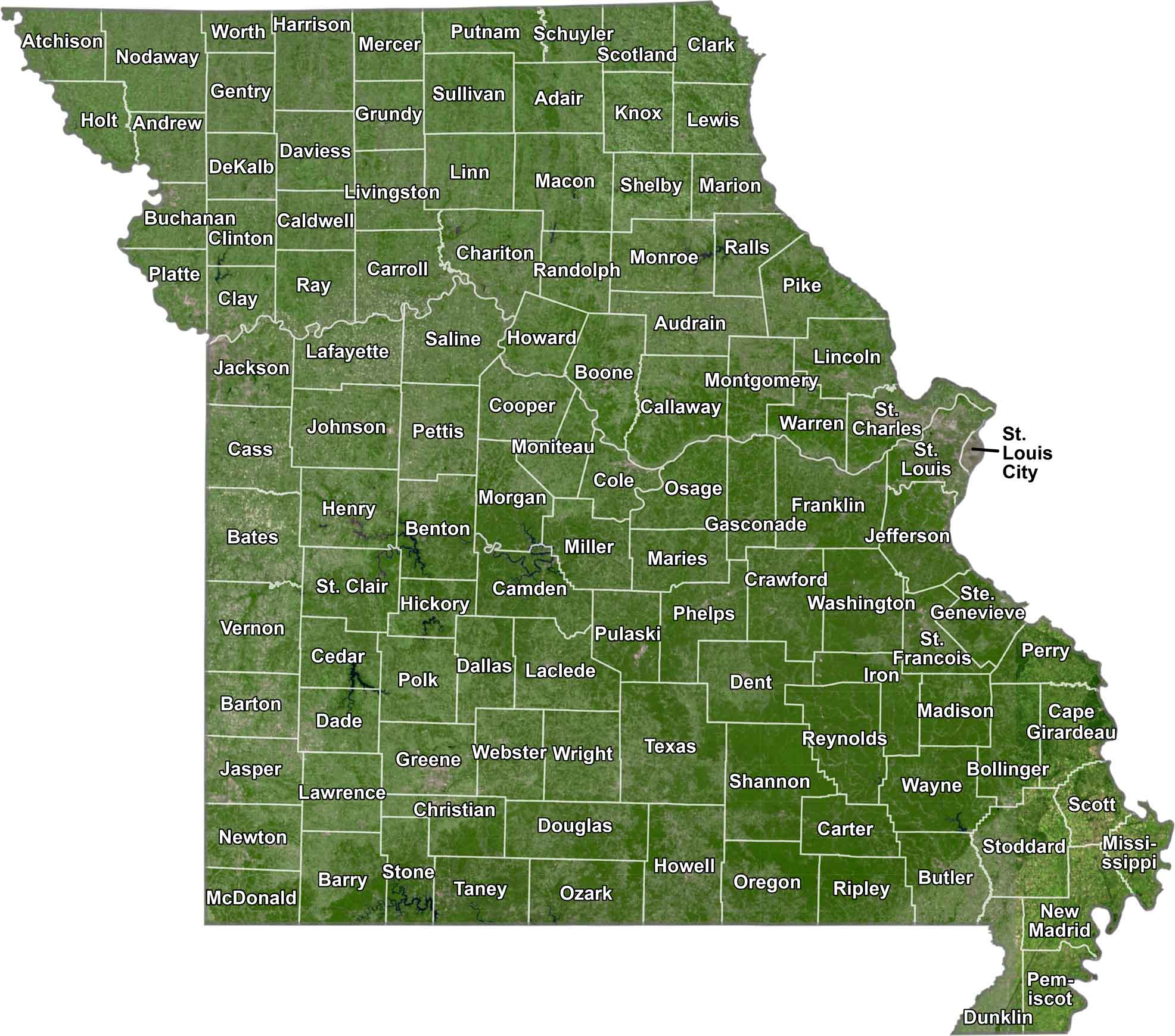
SATELLITE IMAGERY
Missouri Satellite County Map
From above, Missouri shows a bit of everything. It has rolling hills, farmland, cities, and rivers. Our satellite map captures that mix, with county lines on top of everything.
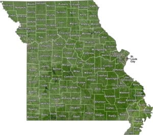
OUTLINE MAP
Missouri Simple County Map
We’re getting back to the basics with this one. Our simple Missouri map shows each county with clean lines and easy-to-read labels.

Missouri Counties
When it comes to population, St. Louis County takes the cake. It wraps around the city of St. Louis like a horseshoe, packed with suburbs and bounded by the City of St. Louis. On the flip side, there’s Worth County up north. It’s the least populous, with fewer people than some high schools have students. Why? It’s mostly farmland, and let’s face it, not everyone’s cut out for that rural life.
Most Populous: St. Louis County
Least Populous: Worth County

In terms of size, Texas County is the largest county Missouri. Ironically, it’s right in the middle of the state, not anywhere near Texas. The smallest county is Worth County with 266.8 square miles worth of area. It might be small, but it has some of the richest farmland in the state.
Largest Area: Texas County
Smallest Area: Worth County
Missouri started divvying up into counties back in 1812, right after it became a territory. Missouri’s counties have some stories to tell. How about Pulaski County? It’s named after a Polish count who fought in the American Revolution.
Missouri County List
Learn about all of Missouri’s counties with our table below.
| FIPS Code | Name | Land % | Water % | Total Area (sq mi) |
|---|---|---|---|---|
| 29-001 | Adair County | 99.6 | 0.4 | 569.4 |
| 29-003 | Andrew County | 99.1 | 0.9 | 436.4 |
| 29-005 | Atchison County | 99.5 | 0.5 | 550.1 |
| 29-007 | Audrain County | 99.3 | 0.7 | 696.8 |
| 29-009 | Barry County | 98.4 | 1.6 | 791.0 |
| 29-011 | Barton County | 99.2 | 0.8 | 596.7 |
| 29-013 | Bates County | 98.3 | 1.7 | 851.4 |
| 29-015 | Benton County | 93.6 | 6.4 | 752.5 |
| 29-017 | Bollinger County | 99.5 | 0.5 | 621.2 |
| 29-019 | Boone County | 99.2 | 0.8 | 691.0 |
| 29-021 | Buchanan County | 98.3 | 1.7 | 415.2 |
| 29-023 | Butler County | 99.4 | 0.6 | 699.0 |
| 29-025 | Caldwell County | 99.2 | 0.8 | 429.6 |
| 29-027 | Callaway County | 98.5 | 1.5 | 847.4 |
| 29-029 | Camden County | 92.6 | 7.4 | 708.7 |
| 29-031 | Cape Girardeau County | 98.7 | 1.3 | 586.3 |
| 29-033 | Carroll County | 99.0 | 1.0 | 701.4 |
| 29-035 | Carter County | 99.7 | 0.3 | 509.0 |
| 29-037 | Cass County | 99.2 | 0.8 | 702.4 |
| 29-039 | Cedar County | 95.2 | 4.8 | 498.7 |
| 29-041 | Chariton County | 98.0 | 2.0 | 766.8 |
| 29-043 | Christian County | 99.8 | 0.2 | 563.8 |
| 29-045 | Clark County | 98.6 | 1.4 | 511.8 |
| 29-047 | Clay County | 97.3 | 2.7 | 408.7 |
| 29-049 | Clinton County | 98.9 | 1.1 | 423.5 |
| 29-051 | Cole County | 98.1 | 1.9 | 398.9 |
| 29-053 | Cooper County | 99.2 | 0.8 | 569.2 |
| 29-055 | Crawford County | 99.8 | 0.2 | 743.7 |
| 29-057 | Dade County | 96.8 | 3.2 | 506.3 |
| 29-059 | Dallas County | 99.7 | 0.3 | 542.8 |
| 29-061 | Daviess County | 99.0 | 1.0 | 569.0 |
| 29-063 | DeKalb County | 99.0 | 1.0 | 425.8 |
| 29-065 | Dent County | 99.8 | 0.2 | 754.5 |
| 29-067 | Douglas County | 99.9 | 0.1 | 814.6 |
| 29-069 | Dunklin County | 98.9 | 1.1 | 547.2 |
| 29-071 | Franklin County | 99.1 | 0.9 | 930.7 |
| 29-073 | Gasconade County | 98.7 | 1.3 | 526.0 |
| 29-075 | Gentry County | 99.9 | 0.1 | 491.7 |
| 29-077 | Greene County | 99.6 | 0.4 | 677.9 |
| 29-079 | Grundy County | 99.4 | 0.6 | 438.0 |
| 29-081 | Harrison County | 99.5 | 0.5 | 726.4 |
| 29-083 | Henry County | 95.2 | 4.8 | 732.3 |
| 29-085 | Hickory County | 96.9 | 3.1 | 411.7 |
| 29-087 | Holt County | 98.4 | 1.6 | 470.4 |
| 29-089 | Howard County | 98.4 | 1.6 | 471.5 |
| 29-091 | Howell County | 99.9 | 0.1 | 928.4 |
| 29-093 | Iron County | 99.7 | 0.3 | 552.1 |
| 29-095 | Jackson County | 98.1 | 1.9 | 616.3 |
| 29-097 | Jasper County | 99.6 | 0.4 | 641.3 |
| 29-099 | Jefferson County | 98.8 | 1.2 | 664.3 |
| 29-101 | Johnson County | 99.5 | 0.5 | 833.2 |
| 29-103 | Knox County | 99.4 | 0.6 | 506.8 |
| 29-105 | Laclede County | 99.6 | 0.4 | 768.0 |
| 29-107 | Lafayette County | 98.4 | 1.6 | 638.9 |
| 29-109 | Lawrence County | 99.7 | 0.3 | 613.4 |
| 29-111 | Lewis County | 98.9 | 1.1 | 510.8 |
| 29-113 | Lincoln County | 97.8 | 2.2 | 640.5 |
| 29-115 | Linn County | 99.1 | 0.9 | 621.4 |
| 29-117 | Livingston County | 98.8 | 1.2 | 538.5 |
| 29-119 | McDonald County | 100.0 | 0.0 | 539.7 |
| 29-121 | Macon County | 98.6 | 1.4 | 812.4 |
| 29-123 | Madison County | 99.4 | 0.6 | 497.6 |
| 29-125 | Maries County | 99.4 | 0.6 | 529.9 |
| 29-127 | Marion County | 98.3 | 1.7 | 444.3 |
| 29-129 | Mercer County | 99.7 | 0.3 | 455.1 |
| 29-131 | Miller County | 98.8 | 1.2 | 600.0 |
| 29-133 | Mississippi County | 96.0 | 4.0 | 428.8 |
| 29-135 | Moniteau County | 99.1 | 0.9 | 418.9 |
| 29-137 | Monroe County | 96.6 | 3.4 | 670.2 |
| 29-139 | Montgomery County | 99.0 | 1.0 | 540.5 |
| 29-141 | Morgan County | 97.3 | 2.7 | 614.0 |
| 29-143 | New Madrid County | 96.9 | 3.1 | 696.6 |
| 29-145 | Newton County | 99.7 | 0.3 | 626.6 |
| 29-147 | Nodaway County | 99.9 | 0.1 | 877.9 |
| 29-149 | Oregon County | 99.8 | 0.2 | 791.5 |
| 29-151 | Osage County | 98.9 | 1.1 | 613.4 |
| 29-153 | Ozark County | 98.6 | 1.4 | 755.2 |
| 29-155 | Pemiscot County | 95.9 | 4.1 | 513.4 |
| 29-157 | Perry County | 98.0 | 2.0 | 484.2 |
| 29-159 | Pettis County | 99.4 | 0.6 | 686.3 |
| 29-161 | Phelps County | 99.6 | 0.4 | 674.3 |
| 29-163 | Pike County | 97.9 | 2.1 | 684.7 |
| 29-165 | Platte County | 98.5 | 1.5 | 426.3 |
| 29-167 | Polk County | 98.9 | 1.1 | 642.4 |
| 29-169 | Pulaski County | 99.2 | 0.8 | 551.5 |
| 29-171 | Putnam County | 99.6 | 0.4 | 519.6 |
| 29-173 | Ralls County | 97.1 | 2.9 | 483.8 |
| 29-175 | Randolph County | 99.0 | 1.0 | 487.8 |
| 29-177 | Ray County | 99.1 | 0.9 | 573.9 |
| 29-179 | Reynolds County | 99.3 | 0.7 | 814.4 |
| 29-181 | Ripley County | 99.7 | 0.3 | 631.6 |
| 29-183 | St. Charles County | 94.6 | 5.4 | 592.7 |
| 29-185 | St. Clair County | 96.1 | 3.9 | 702.1 |
| 29-186 | Ste. Genevieve County | 98.5 | 1.5 | 506.8 |
| 29-187 | St. Francois County | 99.4 | 0.6 | 454.7 |
| 29-189 | St. Louis County | 97.0 | 3.0 | 522.9 |
| 29-195 | Saline County | 98.5 | 1.5 | 766.9 |
| 29-197 | Schuyler County | 99.7 | 0.3 | 308.2 |
| 29-199 | Scotland County | 99.4 | 0.6 | 439.3 |
| 29-201 | Scott County | 98.6 | 1.4 | 425.9 |
| 29-203 | Shannon County | 100.0 | 0.0 | 1,004.0 |
| 29-205 | Shelby County | 99.7 | 0.3 | 502.3 |
| 29-207 | Stoddard County | 99.3 | 0.7 | 829.0 |
| 29-209 | Stone County | 90.8 | 9.2 | 510.8 |
| 29-211 | Sullivan County | 99.5 | 0.5 | 651.5 |
| 29-213 | Taney County | 97.0 | 3.0 | 651.6 |
| 29-215 | Texas County | 99.8 | 0.2 | 1,179.2 |
| 29-217 | Vernon County | 98.8 | 1.2 | 836.8 |
| 29-219 | Warren County | 97.9 | 2.1 | 437.8 |
| 29-221 | Washington County | 99.7 | 0.3 | 762.5 |
| 29-223 | Wayne County | 98.1 | 1.9 | 774.1 |
| 29-225 | Webster County | 99.8 | 0.2 | 593.8 |
| 29-227 | Worth County | 99.9 | 0.1 | 266.8 |
| 29-229 | Wright County | 99.8 | 0.2 | 683.1 |
| 29-510 | St. Louis City | 93.4 | 6.6 | 66.1 |
Source: United States Census Bureau