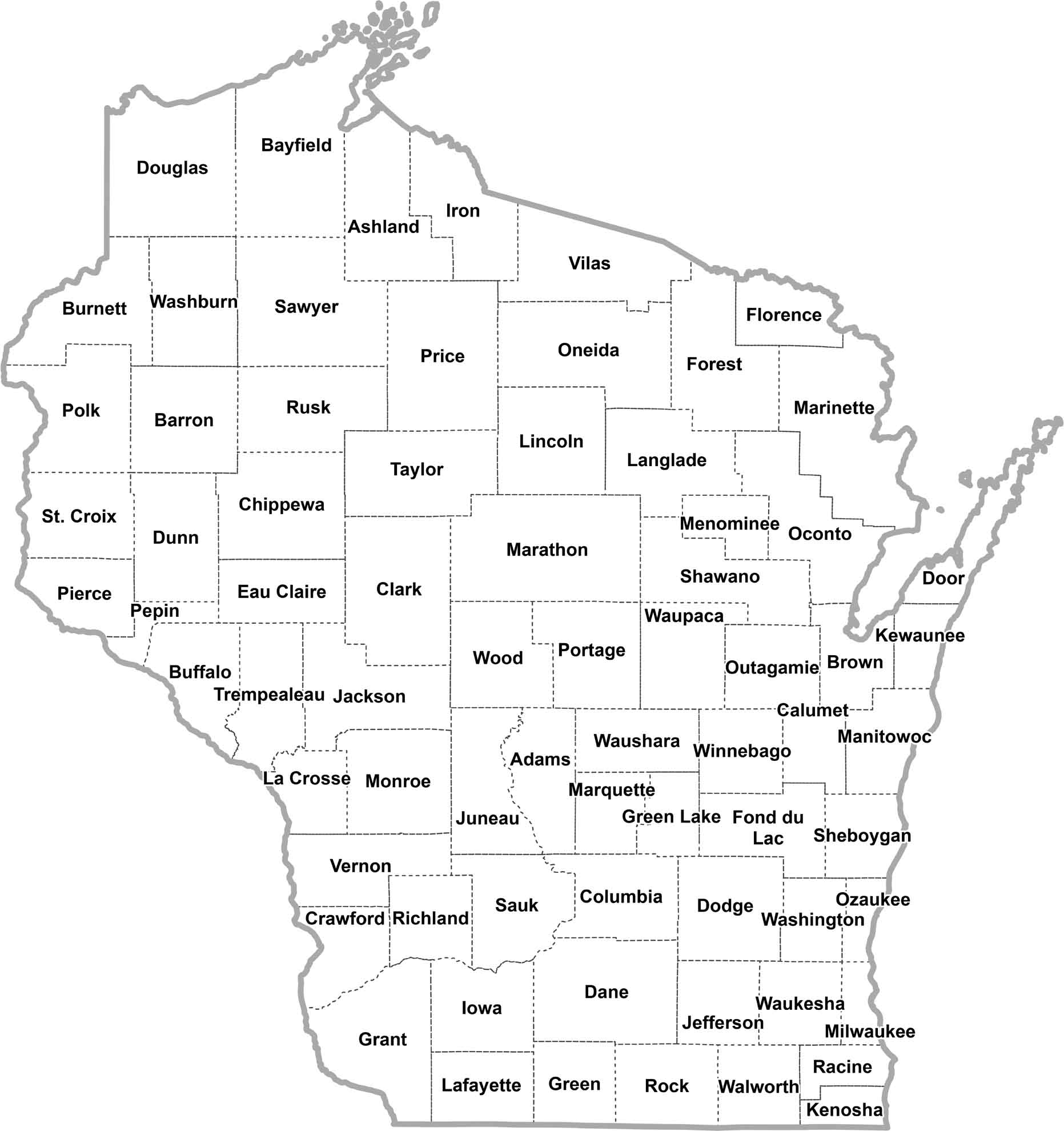
Wisconsin County Map

Wisconsin County Map Collection
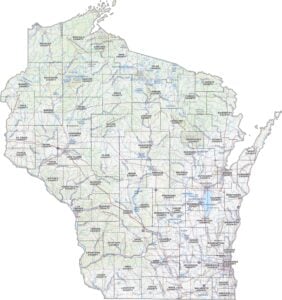

We allow you to use our Wisconsin County map. Attribution is required.
Wisconsin County Maps
There are 72 counties in America’s Dairyland, which is a pretty good number for a state its size.


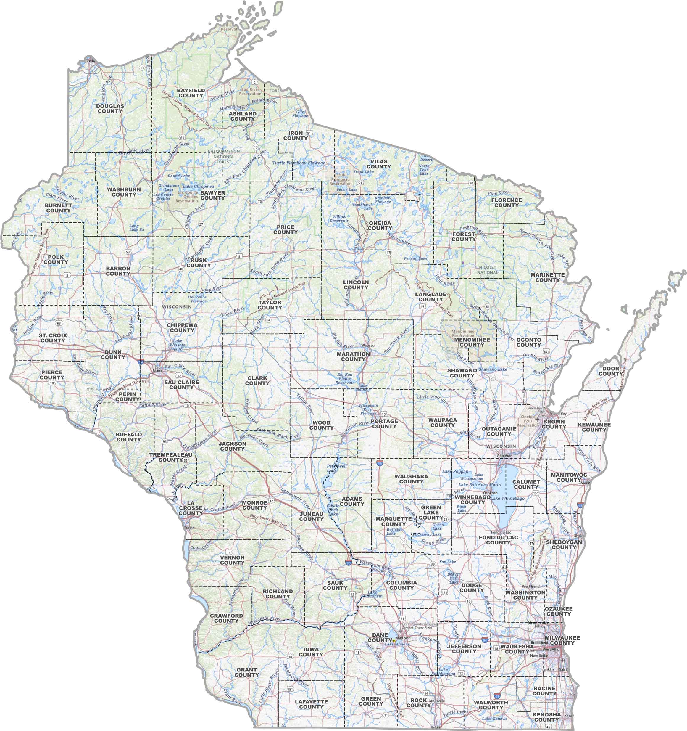
PHYSICAL MAP
Wisconsin Topographic County Map
Our map brings all of Wisconsin into focus. From highways cutting through dairy country to cities like Madison and Milwaukee, this county map makes it easy to see how everything fits together.
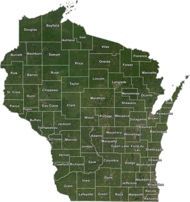
SATELLITE IMAGERY
Wisconsin Satellite County Map
Wisconsin’s a mix of forests, fields, water, and towns. Our satellite map captures that real-life imagery, while county borders add just enough structure to show how the landscape is organized.
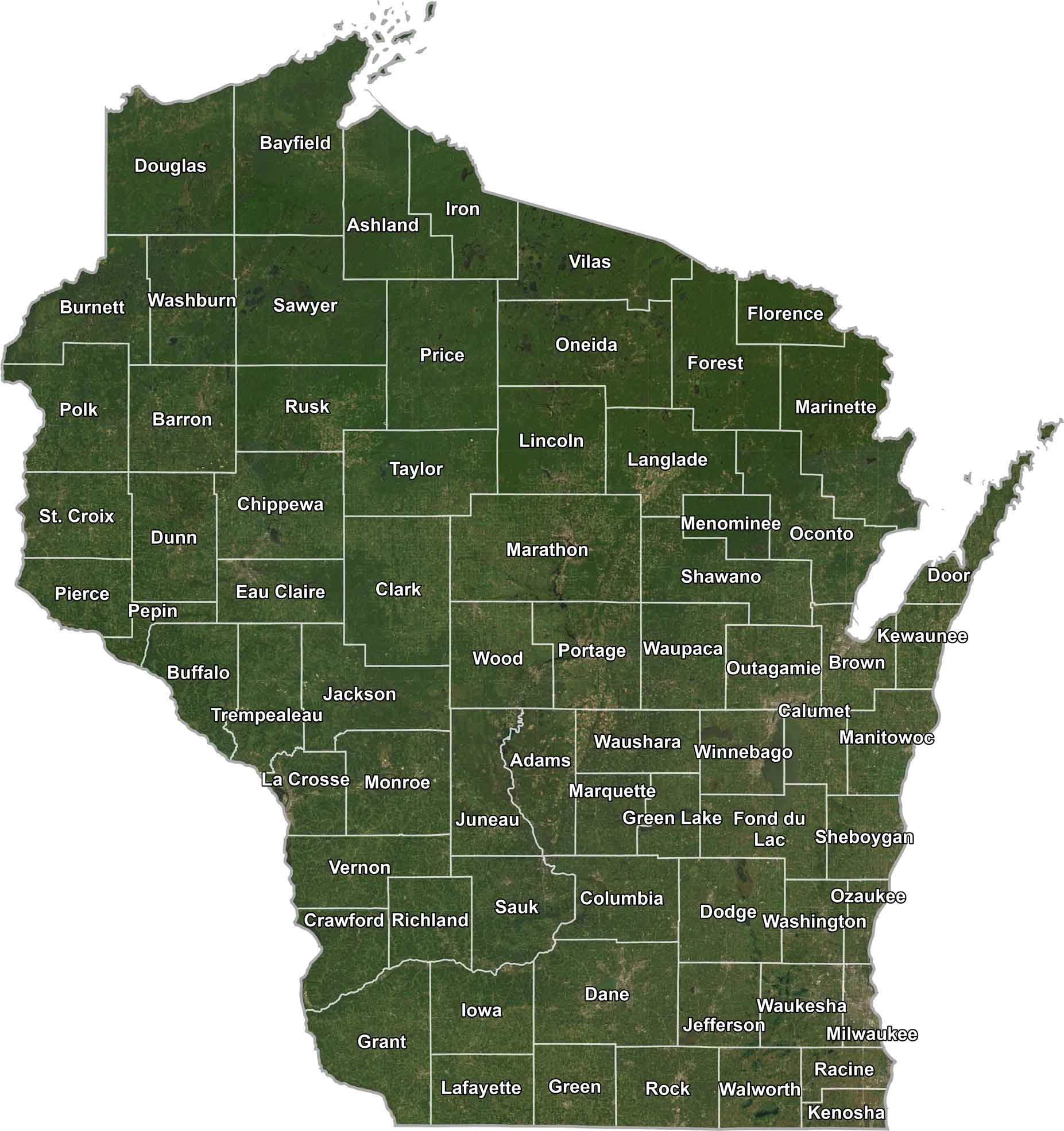
OUTLINE MAP
Wisconsin Simple County Map
Nothing fancy here. This is just Wisconsin divided into counties. Clean lines, readable labels, and a no-nonsense layout that makes finding your spot quick and easy.
Wisconsin Counties
Wisconsin’s landscape is more diverse than you might think. Sure, there are plenty of dairy farms, but you’ve also got forests up north, bluffs along the Mississippi, and sandy beaches on the Great Lakes. Each county has its own blend of these features.

Milwaukee County is the big cheese when it comes to population. It’s home to Milwaukee, the state’s largest city. People are drawn there for jobs, culture, and beer. Lots of beer. On the flip side, there’s Menominee County. It’s the least populated and happens to be entirely within the Menominee Indian Reservation.
Most Populous: Milwaukee County
Least Populous: Menominee County
Marathon County is the largest, covering about 1,545 square miles. It’s right in the middle of the state and known for ginseng farming of all things. The smallest county is Pepin County, along the Mississippi River. It’s only about 232 square miles but claims to be the birthplace of Laura Ingalls Wilder. So there’s that.
Largest Area: Marathon County
Smallest Area: Pepin County
Wisconsin’s counties have some quirks. Like how Door County got its name from a treacherous strait that Native Americans called “Death’s Door.” Or how Outagamie County is named after a Native American word meaning “dwellers on the other side of the stream”.
Wisconsin County List
Here’s a complete list of counties in Wisconsin:
| FIPS Code | Name | Land % | Water % | Total Area (sq mi) |
|---|---|---|---|---|
| 55-001 | Adams County | 93.9 | 6.1 | 687.5 |
| 55-003 | Ashland County | 45.6 | 54.4 | 2,292.3 |
| 55-005 | Barron County | 97.0 | 3.0 | 889.8 |
| 55-007 | Bayfield County | 72.4 | 27.6 | 2,041.7 |
| 55-009 | Brown County | 86.1 | 13.9 | 615.7 |
| 55-011 | Buffalo County | 95.2 | 4.8 | 709.6 |
| 55-013 | Burnett County | 93.3 | 6.7 | 880.2 |
| 55-015 | Calumet County | 80.2 | 19.8 | 397.1 |
| 55-017 | Chippewa County | 96.8 | 3.2 | 1,041.3 |
| 55-019 | Clark County | 99.3 | 0.7 | 1,218.7 |
| 55-021 | Columbia County | 96.2 | 3.8 | 796.0 |
| 55-023 | Crawford County | 95.2 | 4.8 | 599.2 |
| 55-025 | Dane County | 96.7 | 3.3 | 1,237.5 |
| 55-027 | Dodge County | 96.5 | 3.5 | 907.1 |
| 55-029 | Door County | 20.3 | 79.7 | 2,370.2 |
| 55-031 | Douglas County | 88.1 | 11.9 | 1,479.7 |
| 55-033 | Dunn County | 98.4 | 1.6 | 863.9 |
| 55-035 | Eau Claire County | 98.9 | 1.1 | 645.2 |
| 55-037 | Florence County | 98.1 | 1.9 | 497.4 |
| 55-039 | Fond du Lac County | 94.0 | 6.0 | 765.8 |
| 55-041 | Forest County | 96.9 | 3.1 | 1,046.5 |
| 55-043 | Grant County | 96.9 | 3.1 | 1,183.4 |
| 55-045 | Green County | 99.9 | 0.1 | 584.5 |
| 55-047 | Green Lake County | 92.0 | 8.0 | 380.1 |
| 55-049 | Iowa County | 99.3 | 0.7 | 768.0 |
| 55-051 | Iron County | 82.5 | 17.5 | 919.2 |
| 55-053 | Jackson County | 98.7 | 1.3 | 1,000.5 |
| 55-055 | Jefferson County | 95.5 | 4.5 | 582.7 |
| 55-057 | Juneau County | 95.3 | 4.7 | 805.2 |
| 55-059 | Kenosha County | 36.1 | 63.9 | 754.0 |
| 55-061 | Kewaunee County | 31.6 | 68.4 | 1,084.3 |
| 55-063 | La Crosse County | 94.1 | 5.9 | 480.0 |
| 55-065 | Lafayette County | 99.8 | 0.2 | 634.6 |
| 55-067 | Langlade County | 98.1 | 1.9 | 887.8 |
| 55-069 | Lincoln County | 96.9 | 3.1 | 906.8 |
| 55-071 | Manitowoc County | 39.4 | 60.6 | 1,494.1 |
| 55-073 | Marathon County | 98.0 | 2.0 | 1,576.3 |
| 55-075 | Marinette County | 90.3 | 9.7 | 1,550.0 |
| 55-077 | Marquette County | 98.1 | 1.9 | 464.5 |
| 55-078 | Menominee County | 98.0 | 2.0 | 365.0 |
| 55-079 | Milwaukee County | 20.3 | 79.7 | 1,189.5 |
| 55-081 | Monroe County | 99.2 | 0.8 | 908.1 |
| 55-083 | Oconto County | 86.8 | 13.2 | 1,148.8 |
| 55-085 | Oneida County | 90.1 | 9.9 | 1,236.6 |
| 55-087 | Outagamie County | 98.9 | 1.1 | 644.6 |
| 55-089 | Ozaukee County | 20.9 | 79.1 | 1,116.2 |
| 55-091 | Pepin County | 93.3 | 6.7 | 248.7 |
| 55-093 | Pierce County | 97.0 | 3.0 | 591.9 |
| 55-095 | Polk County | 95.6 | 4.4 | 956.4 |
| 55-097 | Portage County | 97.3 | 2.7 | 822.8 |
| 55-099 | Price County | 98.1 | 1.9 | 1,278.0 |
| 55-101 | Racine County | 42.0 | 58.0 | 792.1 |
| 55-103 | Richland County | 99.5 | 0.5 | 589.3 |
| 55-105 | Rock County | 98.9 | 1.1 | 726.1 |
| 55-107 | Rusk County | 98.1 | 1.9 | 930.9 |
| 55-109 | St. Croix County | 98.2 | 1.8 | 735.7 |
| 55-111 | Sauk County | 97.9 | 2.1 | 849.2 |
| 55-113 | Sawyer County | 93.1 | 6.9 | 1,350.2 |
| 55-115 | Shawano County | 98.2 | 1.8 | 909.4 |
| 55-117 | Sheboygan County | 40.2 | 59.8 | 1,271.2 |
| 55-119 | Taylor County | 99.0 | 1.0 | 984.6 |
| 55-121 | Trempealeau County | 98.8 | 1.2 | 742.0 |
| 55-123 | Vernon County | 97.0 | 3.0 | 816.4 |
| 55-125 | Vilas County | 84.3 | 15.7 | 1,017.7 |
| 55-127 | Walworth County | 96.3 | 3.7 | 576.6 |
| 55-129 | Washburn County | 93.4 | 6.6 | 853.3 |
| 55-131 | Washington County | 98.8 | 1.2 | 435.7 |
| 55-133 | Waukesha County | 94.7 | 5.3 | 580.5 |
| 55-135 | Waupaca County | 97.7 | 2.3 | 765.2 |
| 55-137 | Waushara County | 98.2 | 1.8 | 637.4 |
| 55-139 | Winnebago County | 75.1 | 24.9 | 578.6 |
| 55-141 | Wood County | 98.0 | 2.0 | 809.2 |
Source: United States Census Bureau