Florida County Map

Florida County Map Collection

We allow you to use our Florida County map. Attribution is required.
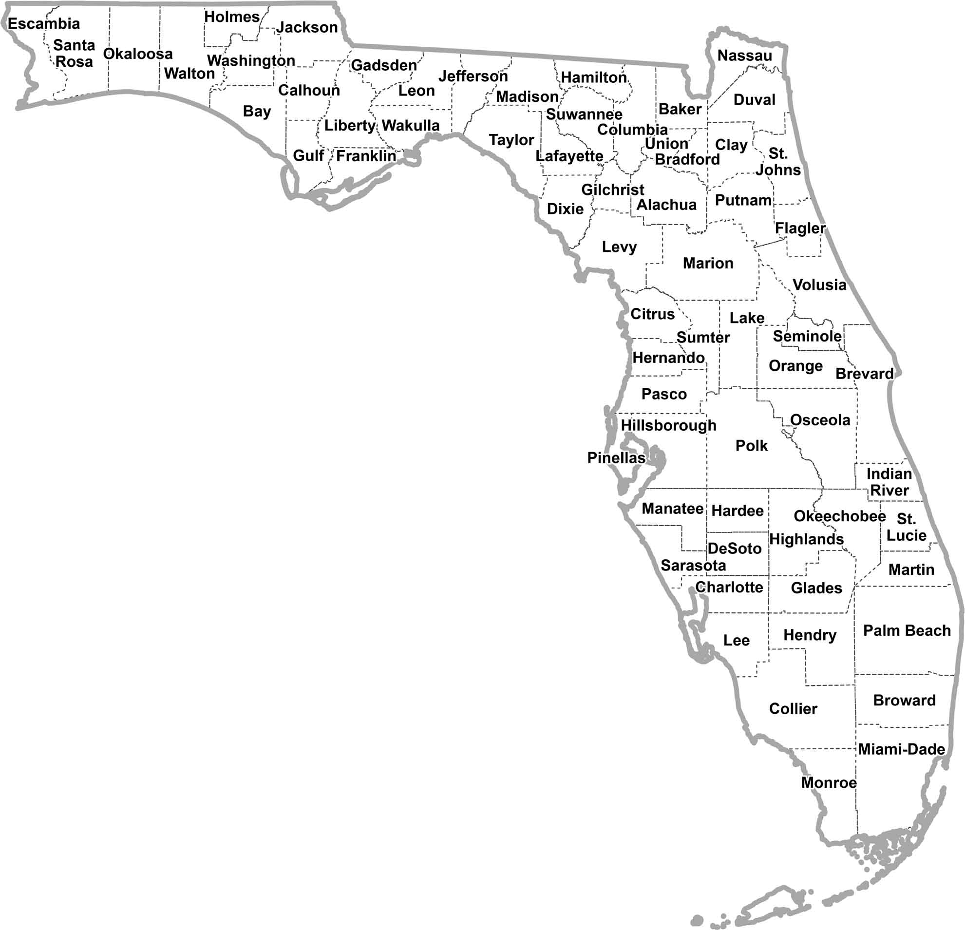
Florida County Maps
The Sunshine State has 67 counties in total. From the Panhandle to the Keys, these counties serve up a smorgasbord of landscapes. Click one of them below to see up close.


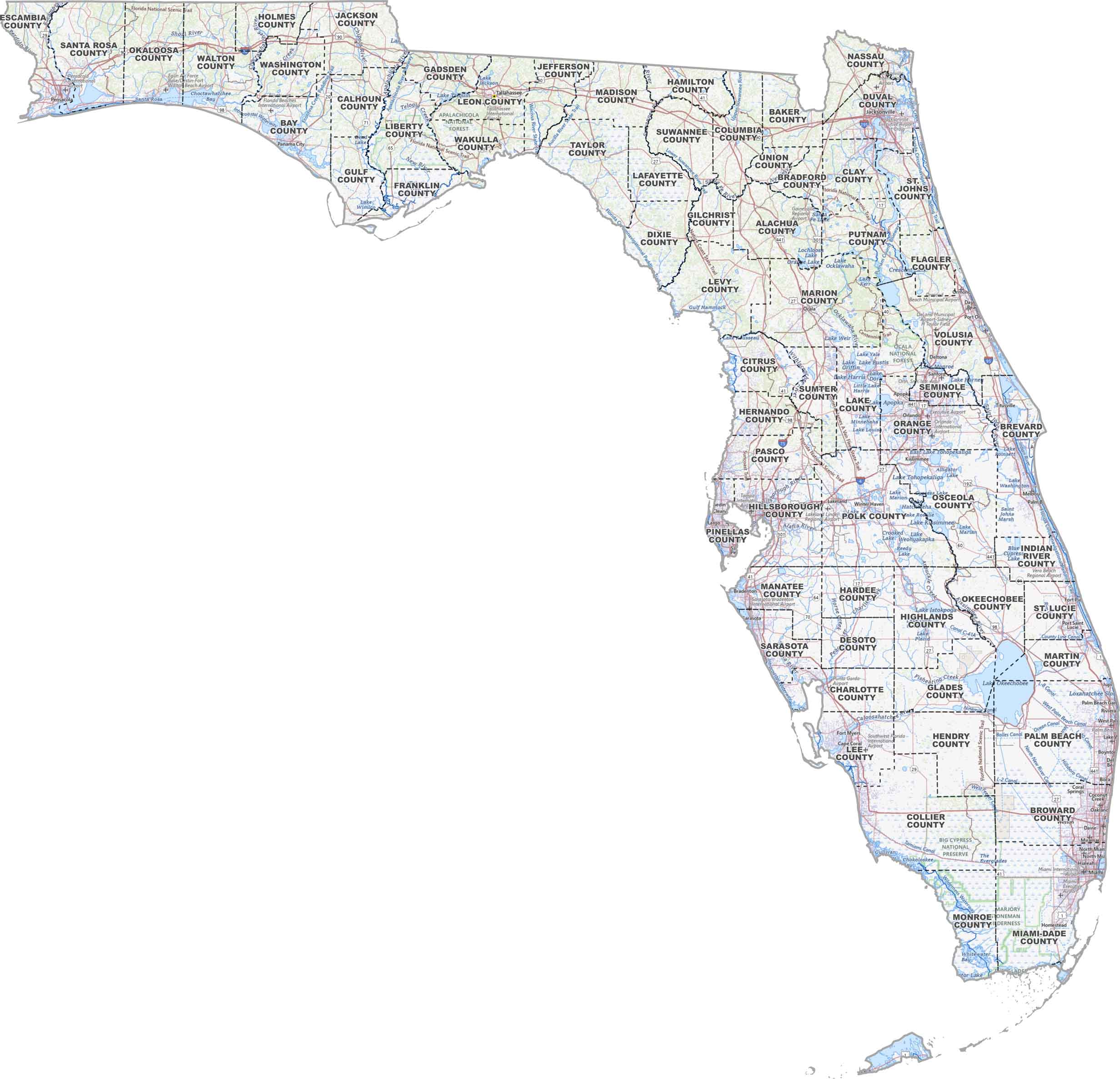
PHYSICAL MAP
Florida Topographic County Map
Our topographic map includes roads, lakes, rivers, and airports while showing Florida’s counties. Try out our new zoom tool below to look around in detail.
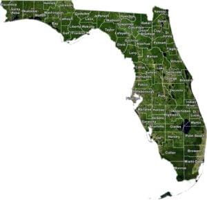
SATELLITE IMAGERY
Florida Satellite County Map
As you can see in our satellite map below, Florida is a blend of green forests, blue lakes, and cities. The satellite view captures everything from the Everglades to the beaches. Each county’s unique mix of land and water really stands out.

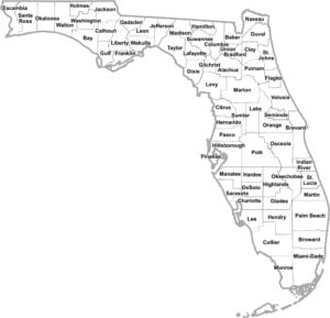
OUTLINE MAP
Florida Simple County Map
This simple map breaks Florida down by county with clean lines and clear labels. It’s just an easy view of how the state is divided.
Florida Counties
Miami-Dade County takes the population crown, and boy, does it wear it with style. Yep, one-third of Miami-Dade County is located in Everglades National Park. Now, zip across the state to Liberty County in the Panhandle. It’s Florida’s least populous county, where the biggest traffic jams are caused by tractors on country roads.
Most Populous: Miami-Dade County
Least Populous: Liberty County

For size, Collier County stretches out as the largest county. This long strip of Gulf coastline is situated in the southern part of the state. On the flip side, there’s Union County, which is Florida’s smallest county in size.
Largest Area: Collier County
Smallest Area: Union County
Florida’s counties are like a crash course in American history and geography. There’s Leon County, named after the Spanish explorer Ponce de León, still chasing that fountain of youth. Or Seminole County, a nod to the Native American tribe that gave the state so much of its early history. The oldest county? St. Johns County, established way back in 1821 when Florida was still a territory.
Florida’s counties each bring their own flavor to the table. You’ve got Orange County with its theme parks. While Monroe County stretches through the Keys, Hillsborough County is where Cuban sandwiches are serious business.
Florida County List
Here’s a complete list of Florida’s counties and statistics for each:
| FIPS Code | Name | Land % | Water % | Total Area (sq mi) |
|---|---|---|---|---|
| 12-001 | Alachua County | 90.3 | 9.7 | 968.8 |
| 12-003 | Baker County | 99.4 | 0.6 | 589.0 |
| 12-005 | Bay County | 73.4 | 26.6 | 1,033.1 |
| 12-007 | Bradford County | 97.8 | 2.2 | 300.5 |
| 12-009 | Brevard County | 65.2 | 34.8 | 1,557.0 |
| 12-011 | Broward County | 91.0 | 9.0 | 1,322.8 |
| 12-013 | Calhoun County | 98.8 | 1.2 | 574.3 |
| 12-015 | Charlotte County | 79.4 | 20.6 | 858.2 |
| 12-017 | Citrus County | 75.3 | 24.7 | 773.2 |
| 12-019 | Clay County | 94.0 | 6.0 | 643.5 |
| 12-021 | Collier County | 86.6 | 13.4 | 2,305.0 |
| 12-023 | Columbia County | 99.5 | 0.5 | 801.3 |
| 12-027 | DeSoto County | 99.6 | 0.4 | 639.1 |
| 12-029 | Dixie County | 81.6 | 18.4 | 863.6 |
| 12-031 | Duval County | 83.1 | 16.9 | 918.5 |
| 12-033 | Escambia County | 75.1 | 24.9 | 874.7 |
| 12-035 | Flagler County | 85.0 | 15.0 | 570.8 |
| 12-037 | Franklin County | 52.5 | 47.5 | 1,037.6 |
| 12-039 | Gadsden County | 97.7 | 2.3 | 528.5 |
| 12-041 | Gilchrist County | 98.4 | 1.6 | 355.2 |
| 12-043 | Glades County | 81.7 | 18.3 | 986.8 |
| 12-045 | Gulf County | 74.3 | 25.7 | 744.4 |
| 12-047 | Hamilton County | 99.0 | 1.0 | 519.1 |
| 12-049 | Hardee County | 99.9 | 0.1 | 638.1 |
| 12-051 | Hendry County | 97.2 | 2.8 | 1,189.8 |
| 12-053 | Hernando County | 80.3 | 19.7 | 589.0 |
| 12-055 | Highlands County | 91.9 | 8.1 | 1,106.7 |
| 12-057 | Hillsborough County | 80.7 | 19.3 | 1,265.7 |
| 12-059 | Holmes County | 97.9 | 2.1 | 489.0 |
| 12-061 | Indian River County | 81.5 | 18.5 | 616.9 |
| 12-063 | Jackson County | 96.2 | 3.8 | 954.6 |
| 12-065 | Jefferson County | 94.0 | 6.0 | 636.5 |
| 12-067 | Lafayette County | 99.2 | 0.8 | 547.9 |
| 12-069 | Lake County | 82.2 | 17.8 | 1,156.9 |
| 12-071 | Lee County | 64.5 | 35.5 | 1,212.4 |
| 12-073 | Leon County | 95.0 | 5.0 | 701.8 |
| 12-075 | Levy County | 79.2 | 20.8 | 1,412.8 |
| 12-077 | Liberty County | 99.1 | 0.9 | 843.1 |
| 12-079 | Madison County | 97.3 | 2.7 | 715.7 |
| 12-081 | Manatee County | 83.2 | 16.8 | 892.7 |
| 12-083 | Marion County | 95.5 | 4.5 | 1,662.7 |
| 12-085 | Martin County | 72.2 | 27.8 | 753.1 |
| 12-086 | Miami-Dade County | 78.1 | 21.9 | 2,431.2 |
| 12-087 | Monroe County | 26.3 | 73.7 | 3,737.2 |
| 12-089 | Nassau County | 89.4 | 10.6 | 725.9 |
| 12-091 | Okaloosa County | 86.0 | 14.0 | 1,082.1 |
| 12-093 | Okeechobee County | 86.2 | 13.8 | 891.9 |
| 12-095 | Orange County | 90.0 | 10.0 | 1,003.2 |
| 12-097 | Osceola County | 88.2 | 11.8 | 1,506.0 |
| 12-099 | Palm Beach County | 82.5 | 17.5 | 2,383.2 |
| 12-101 | Pasco County | 86.0 | 14.0 | 868.4 |
| 12-103 | Pinellas County | 45.0 | 55.0 | 608.1 |
| 12-105 | Polk County | 89.4 | 10.6 | 2,010.4 |
| 12-107 | Putnam County | 88.0 | 12.0 | 826.9 |
| 12-109 | St. Johns County | 73.1 | 26.9 | 821.5 |
| 12-111 | St. Lucie County | 83.1 | 16.9 | 687.8 |
| 12-113 | Santa Rosa County | 86.2 | 13.8 | 1,173.8 |
| 12-115 | Sarasota County | 76.8 | 23.2 | 725.3 |
| 12-117 | Seminole County | 89.6 | 10.4 | 345.3 |
| 12-119 | Sumter County | 96.1 | 3.9 | 579.8 |
| 12-121 | Suwannee County | 99.5 | 0.5 | 692.3 |
| 12-123 | Taylor County | 84.7 | 15.3 | 1,232.2 |
| 12-125 | Union County | 97.5 | 2.5 | 249.8 |
| 12-127 | Volusia County | 76.9 | 23.1 | 1,432.4 |
| 12-129 | Wakulla County | 82.4 | 17.6 | 735.7 |
| 12-131 | Walton County | 83.7 | 16.3 | 1,239.6 |
| 12-133 | Washington County | 94.9 | 5.1 | 616.0 |
Source: United States Census Bureau