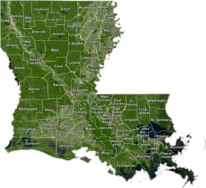
Louisiana Parish Map

Louisiana Parish Map Collection

We allow you to use our Louisiana Parish map. Attribution is required.
Louisiana Parish Maps
Louisiana doesn’t actually have counties. Instead, it’s divided into 64 parishes. This unique system sets Louisiana apart from most other states in the U.S. Click on a map below.


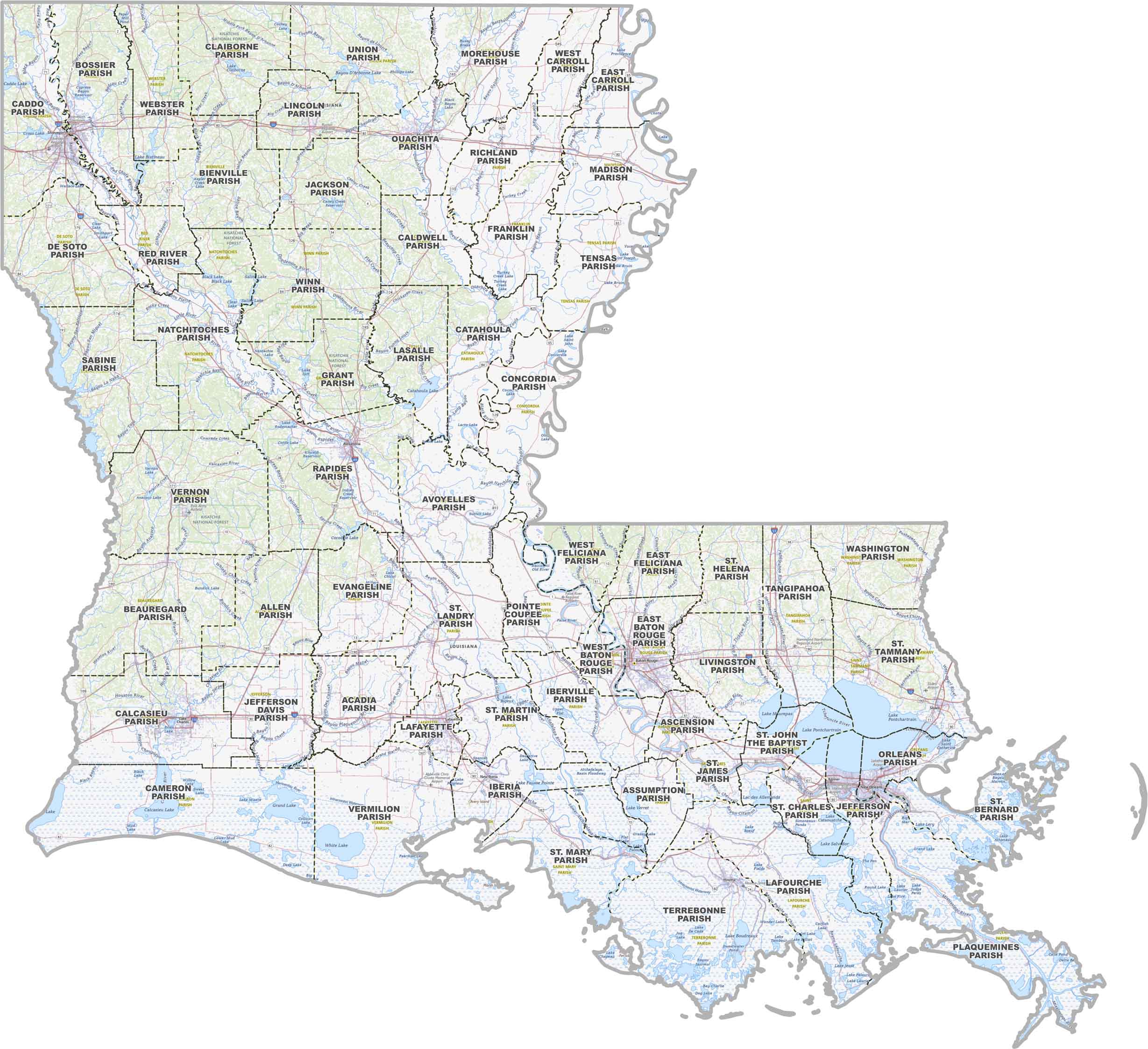
PHYSICAL MAP
Louisiana Topographic Parish Map
Want to get a sense of where everything is in Louisiana? This map lays it all out with parishes, highways, and topographic features like bayous and parks.
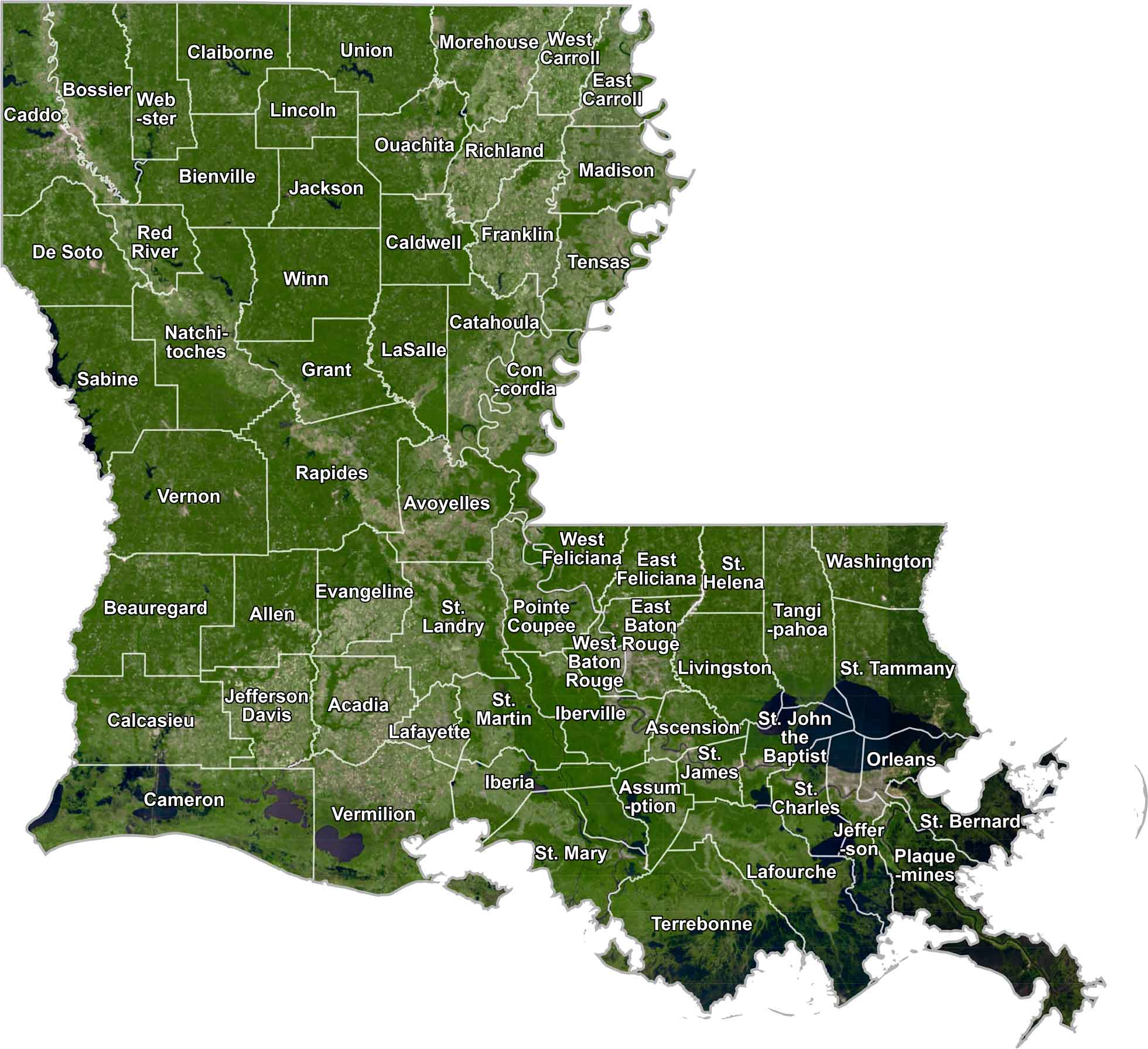
SATELLITE IMAGERY
Louisiana Satellite Parish Map
When you look at Louisiana from above, you’ll notice a lot of green, a ton of water, and some busy city spots. Our satellite map shows all of that, plus it outlines each parish so you can see how the state’s split up.
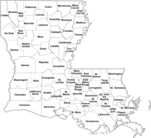
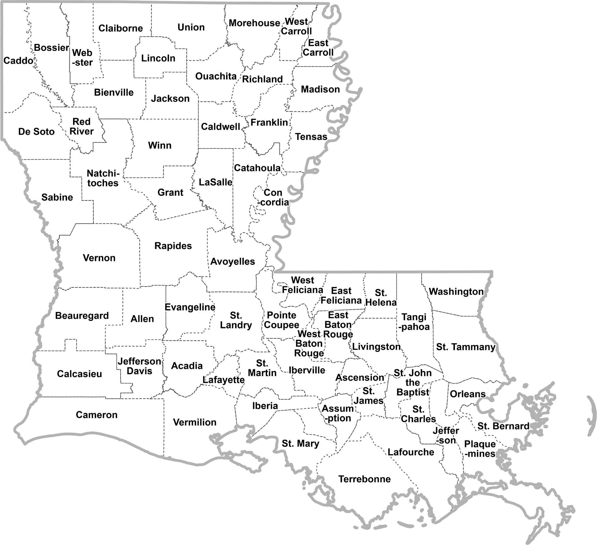
OUTLINE MAP
Louisiana Simple Parish Map
This is a plain map of Louisiana with each parish labeled. No extras. It’s just a clear view of how everything’s divided up.
Louisiana Parishes
East Baton Rouge Parish is the most populated parish in Louisiana. It’s home to Baton Rouge, the state capital. This parish brings in people with its government jobs, universities, and industrial opportunities. On the other hand, Tensas Parish is the least populous. It’s a rural area and has unfortunately had a steady decline in population over the years.
Most Populous: East Baton Rouge Parish
Least Populous: Tensas Parish

When it comes to size, a lot of people say Cameron Parish is the largest. But according to the U.S. Census Bureau data, Vernon Parish has the most landmass. See our table below to verify and calculate total area * land %. Wikipedia is wrong. At the other end of the spectrum, we have Orleans Parish, the smallest at just 169 square miles, home of New Orleans.
Largest Area: Vernon Parish
Smallest Area: Orleans Parish
The word “parish” has its roots in the state’s French and Spanish colonial history. It originally referred to church parishes, which were used as administrative units. Interestingly, the first parishes were established way back in 1807, just a few years after the Louisiana Purchase.
Louisiana’s geography is diverse, with swamps, marshes, and coastal plains in the south, and rolling hills in the north. Its parish system is just one of the many things that make this state stand out. From the Mardi Gras streets of New Orleans to the quiet bayous of the coast, each parish contributes to Louisiana life.
Louisiana Parishes List
Check out our table below of Louisiana parishes with key statistics for each:
| FIPS Code | Name | Land % | Water % | Total Area (sq mi) |
|---|---|---|---|---|
| 22-001 | Acadia Parish | 99.7 | 0.3 | 657.5 |
| 22-003 | Allen Parish | 99.5 | 0.5 | 765.9 |
| 22-005 | Ascension Parish | 95.8 | 4.2 | 302.8 |
| 22-007 | Assumption Parish | 92.9 | 7.1 | 364.5 |
| 22-009 | Avoyelles Parish | 96.1 | 3.9 | 865.7 |
| 22-011 | Beauregard Parish | 99.3 | 0.7 | 1,165.8 |
| 22-013 | Bienville Parish | 98.7 | 1.3 | 822.1 |
| 22-015 | Bossier Parish | 96.9 | 3.1 | 867.4 |
| 22-017 | Caddo Parish | 93.8 | 6.2 | 936.6 |
| 22-019 | Calcasieu Parish | 97.3 | 2.7 | 1,094.3 |
| 22-021 | Caldwell Parish | 97.9 | 2.1 | 540.7 |
| 22-023 | Cameron Parish | 66.3 | 33.7 | 1,936.7 |
| 22-025 | Catahoula Parish | 95.8 | 4.2 | 739.4 |
| 22-027 | Claiborne Parish | 98.4 | 1.6 | 767.4 |
| 22-029 | Concordia Parish | 93.3 | 6.7 | 747.3 |
| 22-031 | De Soto Parish | 98.0 | 2.0 | 894.6 |
| 22-033 | East Baton Rouge Parish | 96.8 | 3.2 | 470.2 |
| 22-035 | East Carroll Parish | 95.1 | 4.9 | 442.4 |
| 22-037 | East Feliciana Parish | 99.5 | 0.5 | 455.8 |
| 22-039 | Evangeline Parish | 97.5 | 2.5 | 679.6 |
| 22-041 | Franklin Parish | 98.3 | 1.7 | 635.4 |
| 22-043 | Grant Parish | 96.7 | 3.3 | 664.6 |
| 22-045 | Iberia Parish | 55.7 | 44.3 | 1,030.5 |
| 22-047 | Iberville Parish | 94.8 | 5.2 | 652.9 |
| 22-049 | Jackson Parish | 98.1 | 1.9 | 580.3 |
| 22-051 | Jefferson Parish | 46.1 | 53.9 | 642.0 |
| 22-053 | Jefferson Davis Parish | 98.9 | 1.1 | 658.6 |
| 22-055 | Lafayette Parish | 99.8 | 0.2 | 269.2 |
| 22-057 | Lafourche Parish | 72.7 | 27.3 | 1,468.9 |
| 22-059 | LaSalle Parish | 94.3 | 5.7 | 662.4 |
| 22-061 | Lincoln Parish | 99.8 | 0.2 | 472.5 |
| 22-063 | Livingston Parish | 93.7 | 6.3 | 691.5 |
| 22-065 | Madison Parish | 95.9 | 4.1 | 650.9 |
| 22-067 | Morehouse Parish | 98.6 | 1.4 | 806.1 |
| 22-069 | Natchitoches Parish | 96.4 | 3.6 | 1,299.0 |
| 22-071 | Orleans Parish | 48.4 | 51.6 | 349.8 |
| 22-073 | Ouachita Parish | 96.6 | 3.4 | 631.7 |
| 22-075 | Plaquemines Parish | 30.4 | 69.6 | 2,567.2 |
| 22-077 | Pointe Coupee Parish | 94.3 | 5.7 | 590.7 |
| 22-079 | Rapides Parish | 97.0 | 3.0 | 1,361.6 |
| 22-081 | Red River Parish | 96.7 | 3.3 | 402.3 |
| 22-083 | Richland Parish | 98.4 | 1.6 | 564.5 |
| 22-085 | Sabine Parish | 85.7 | 14.3 | 1,011.6 |
| 22-087 | St. Bernard Parish | 17.5 | 82.5 | 2,155.2 |
| 22-089 | St. Charles Parish | 70.0 | 30.0 | 396.9 |
| 22-091 | St. Helena Parish | 99.7 | 0.3 | 409.5 |
| 22-093 | St. James Parish | 93.7 | 6.3 | 257.8 |
| 22-095 | St. John the Baptist Parish | 52.3 | 47.7 | 409.9 |
| 22-097 | St. Landry Parish | 98.4 | 1.6 | 939.0 |
| 22-099 | St. Martin Parish | 90.3 | 9.7 | 816.5 |
| 22-101 | St. Mary Parish | 49.6 | 50.4 | 1,119.4 |
| 22-103 | St. Tammany Parish | 77.2 | 22.8 | 1,095.6 |
| 22-105 | Tangipahoa Parish | 93.7 | 6.3 | 844.1 |
| 22-107 | Tensas Parish | 94.0 | 6.0 | 641.2 |
| 22-109 | Terrebonne Parish | 59.1 | 40.9 | 2,082.0 |
| 22-111 | Union Parish | 96.9 | 3.1 | 905.4 |
| 22-113 | Vermilion Parish | 76.1 | 23.9 | 1,542.1 |
| 22-115 | Vernon Parish | 99.0 | 1.0 | 1,341.5 |
| 22-117 | Washington Parish | 99.1 | 0.9 | 675.9 |
| 22-119 | Webster Parish | 96.5 | 3.5 | 614.8 |
| 22-121 | West Baton Rouge Parish | 94.4 | 5.6 | 203.8 |
| 22-123 | West Carroll Parish | 99.7 | 0.3 | 360.6 |
| 22-125 | West Feliciana Parish | 94.7 | 5.3 | 426.0 |
| 22-127 | Winn Parish | 99.3 | 0.7 | 956.8 |
Source: United States Census Bureau