Dukes County Map, Massachusetts

Dukes County Map Collection


We allow you to use our Dukes County map. Attribution is required.
Dukes County, Massachusetts

Dukes County lies off the southern coast of Massachusetts as a cluster of islands. Martha’s Vineyard is the star of the show here. The island has long been a favorite summer getaway for the rich and famous.
But there’s more to Dukes County than just celebrity spotting. Pristine beaches stretch for miles along the coast. Fishing villages are all across the landscape. Their weathered shingles tell stories of generations past.
The Aquinnah Cliffs are a must-see natural wonder. Bike paths crisscross the islands and are a perfect way to explore. Dukes County isn’t just for tourists though. Year-round residents take pride in their communities.
| Category | Details |
|---|---|
| County name | Dukes County |
| County seat | Edgartown |
| Population | Approximately 21,000 |
| Cities, towns, and communities | Aquinnah, Chilmark, Edgartown, Gosnold, Oak Bluffs, Tisbury, West Tisbury |
| Interstates and highways | No interstates; Massachusetts Route 28 and Massachusetts Route 30 |
| FIPS code | 25-007 |
| Total area (land and water) | 491 square miles (104 square miles land, 387 square miles water) |
| Adjacent counties (and direction) | Bristol County (Northwest), Plymouth County (North), Barnstable County (Northeast), Nantucket County (East) |
| Time zone | Eastern Time Zone (ET) |
| State | Massachusetts |
| Coordinates | 41.4030° N, 70.6693° W |
| Etymology | Named after the title of the Duke of York |
| Major landmarks | Martha’s Vineyard, Gay Head Cliffs, Polly Hill Arboretum, Oak Bluffs Campground, Edgartown Lighthouse |
| Website | Dukes County Website |
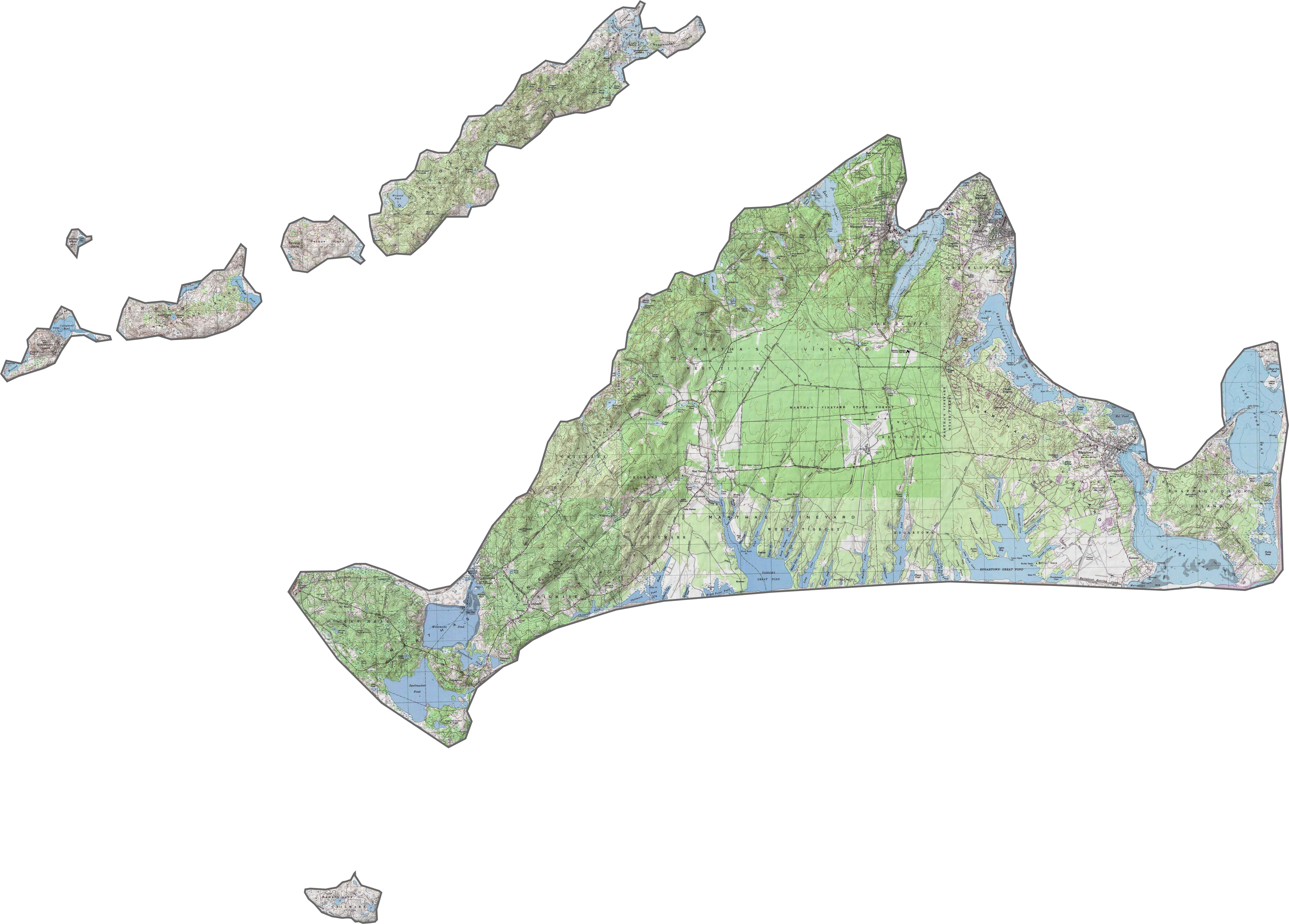
PHYSICAL MAP
Dukes County Topographic Map
It’s mostly flat here. Some bluffs and small hills rise inland, but nothing too crazy. Shorelines and ponds are more noticeable than elevation changes. You can zoom in on every contour using our topo map below
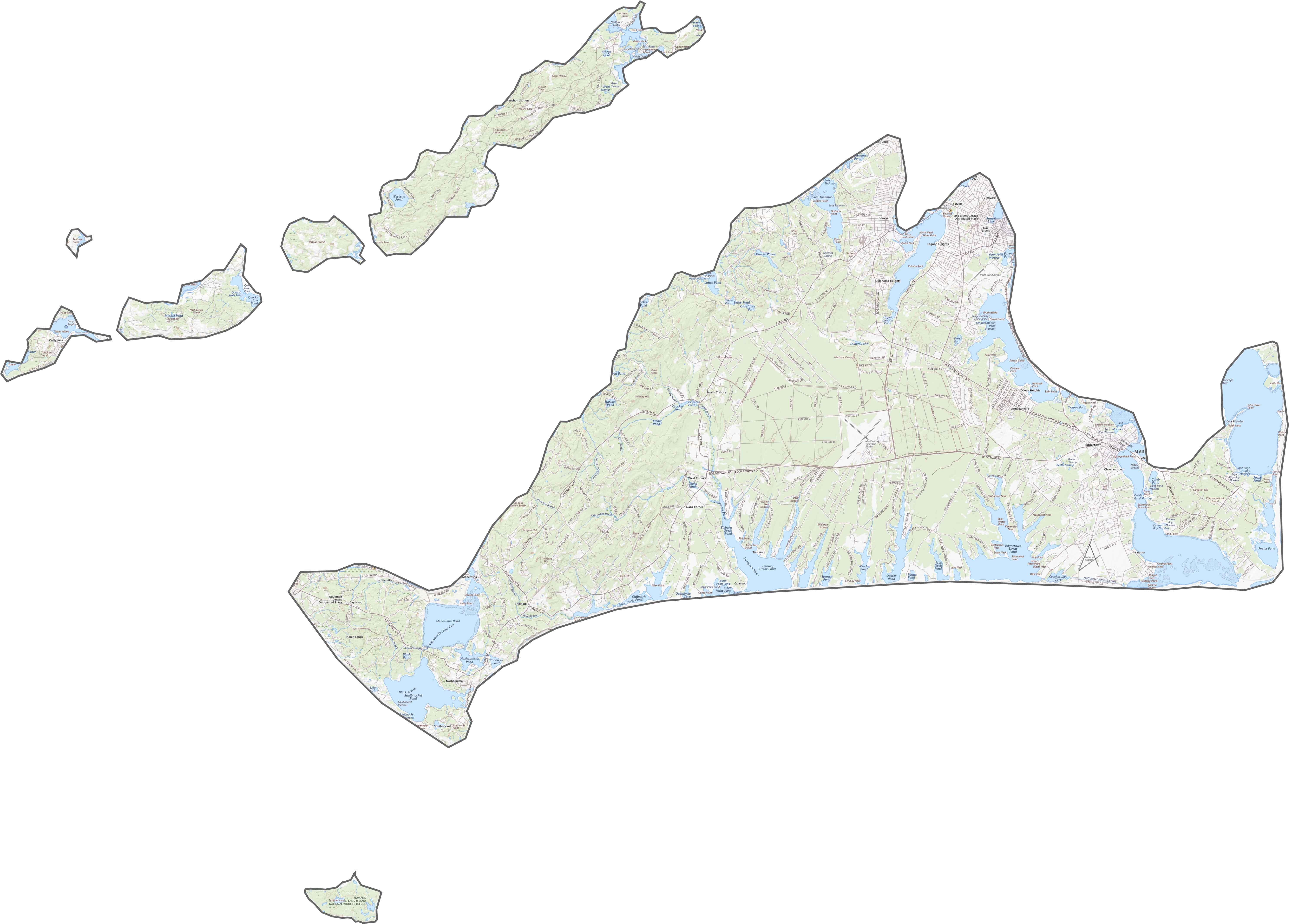
TRANSPORTATION MAP
Dukes County Road Map
Roads in Dukes County are confined to the islands, especially Martha’s Vineyard. There are no interstates here, and no bridges to the mainland either. Although the road network is limited, it’s easy to travel. Most of the traffic stays local. Buses run, but cars often arrive by ferry.
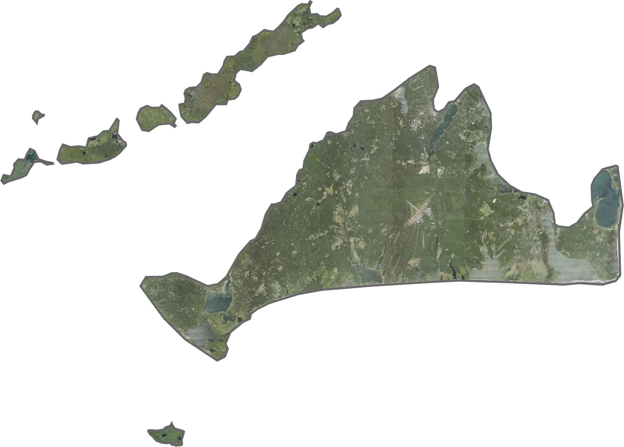
SATELLITE IMAGERY
Dukes County Satellite Map
In our satellite map of Dukes County, the island’s beaches pop right away. Large ponds and inlets cut into the land, especially along the southern edge. Woods cover much of the island, though open fields still appear inland. Even Martha’s Vineyard Airport stands out from above.
OUTLINE MAP
Dukes County Blank Map
Dukes County is made up of islands. It doesn’t border another state, but it’s surrounded by the Atlantic Ocean. Martha’s Vineyard is the largest piece, though smaller islands like Chappaquiddick and Cuttyhunk are also included. The shape is irregular, with many bays, coves, and jagged coastlines.

Neighboring Counties
Here are the 4 neighboring counties of Dukes County:


Massachusetts County Map

Small state, big personality. Boston’s skyline shouts history. The Cape serves up beach days and lobster rolls. Massachusetts history, culture, and coastline is packed into its 14 counties.