Ector County Map, Texas

Ector County Map Collection


We allow you to use our Ector County map. Attribution is required.
Ector County, Texas

Ector County is out in West Texas, where the Permian Basin stretches wide. Odessa is the heart of it all. It’s an oil county with pump jacks across the landscape. They’re like mechanical praying mantises.
It’s boom or bust here, always has been. The county has grit. These are tough folks who know how to weather the storms. And I’m not just talking dust storms, though those can be fierce.
Football is religion in these parts. Permian High’s legacy looms large. It’s not all oil, though. There’s ranching too and a growing medical sector. The sunsets? Spectacular. It’s a place that gets in your blood.
| Category | Details |
|---|---|
| County Name | Ector County |
| County Seat | Odessa |
| Population | Approximately 170,000 |
| Cities, Towns, and Communities | Odessa, Goldsmith, West Odessa |
| Interstates and Highways | Interstate 20, U.S. Highway 385, State Highway 302 |
| FIPS Code | 48-135 |
| Total Area (Land and Water) | 902 square miles (898 sq mi land, 4 sq mi water) |
| Adjacent Counties (and Direction) | Andrews County (North), Midland County (East), Upton County (Southeast), Crane County (South), Ward County (Southwest), Winkler County (West) |
| Time Zone | Central Time Zone (CST) |
| State | Texas |
| Coordinates | 31°52’N, 102°31’W |
| Etymology | Named after Matthew Ector, a Confederate general during the Civil War |
| Major Landmarks | Permian Basin Petroleum Museum, Odessa Meteor Crater, Stonehenge Replica at University of Texas Permian Basin |
| Website | Ector County Website |
TRANSPORTATION MAP
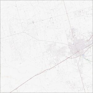
Ector County Road Map
This is West Texas, so roads go long and straight. I-20 slices through the flat terrain with purpose. Most routes focus on Odessa. Loops and bypasses ring the city, but the rest is open space.

SATELLITE IMAGERY
Ector County Satellite Map
From above, you’ll see Odessa in the right of the map. Oil fields leave a pattern in perfect rows. Outside the city, it’s hard to find trees. Roads and pump jacks are the dominant shapes.

OUTLINE MAP
Ector County Blank Map
Ector County is shaped like a square. It borders several other counties but no other states. The lines are straight, drawn without regard for rivers or hills… that’s because there aren’t many. It’s classic West Texas county geometry.

Neighboring Counties
Here are the 6 neighboring counties of Ector County:


Texas County Map

254 legendary Texas county maps. From the Panhandle to the Rio Grande, we’ve got the Lone Star State mapped. That means more rodeos, honky-tonk, and Texas BBQ.