Elkhart County Map, Indiana

Elkhart County Map Collection

We allow you to use our Elkhart County map. Attribution is required.
Elkhart County, Indiana

When you think of Elkhart County, think RVs and music. This northern Indiana county is the RV Capital of the World, churning out most of America’s recreational vehicles. It’s also home to instrument makers like Conn-Selmer.
Elkhart is the largest city. It has a gritty, industrial vibe, while Goshen, the county seat, is more laid-back with a growing arts scene. The Amish community here adds another layer to the cultural mix.
Summers are perfect for exploring the Pumpkinvine Nature Trail. The Elkhart Jazz Festival brings in crowds every June. Overall, Elkhart County brings together a mix of industry, natural beauty, and Amish culture.
| Category | Details |
|---|---|
| County Name | Elkhart County |
| County Seat | Goshen |
| Population | 211,000 (estimated) |
| Cities, Towns, and Communities | Elkhart, Goshen, Nappanee, Middlebury, Bristol, Millersburg, Wakarusa, New Paris, Simonton Lake |
| Interstates and Highways | I-80, I-90 (Indiana Toll Road), US-6, US-20, IN-13, IN-15, IN-19, IN-119, IN-120 |
| FIPS Code | 18-039 |
| Total Area (Land and Water) | 467 square miles (Land: 463 sq mi, Water: 4 sq mi) |
| Adjacent Counties (and Direction) | Cass County, Michigan (Northwest), St. Joseph County, Michigan (Northeast), LaGrange County (East), Noble County (Southeast), Kosciusko County (South), Marshall County (Southwest), St. Joseph County (West) |
| Time Zone | Eastern Time Zone (ET) |
| State | Indiana |
| Coordinates | 41.5934° N, 85.8486° W |
| Etymology | Named after the Elkhart Native American people |
| Major Landmarks | RV/MH Hall of Fame, Amish Acres, Wellfield Botanic Gardens, Bonneyville Mill County Park |
| Website | Elkhart County Website |
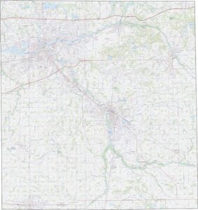
TRANSPORTATION MAP
Elkhart County Road Map
Elkhart County’s land is mostly flat with gentle slopes near the Elkhart and St. Joseph Rivers. While much of the county remains farmland, there are growing urban areas around Elkhart and Goshen. The rivers create slight valleys in the otherwise level terrain.

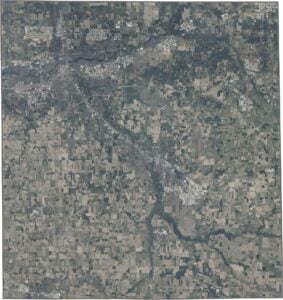
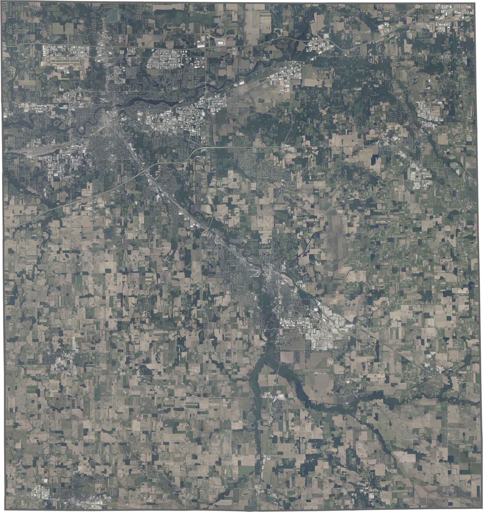
SATELLITE IMAGERY
Elkhart County Satellite Map
In our Elkhart County map, cities appear as dense gray patches surrounded by open farmland. The two main rivers form dark, winding lines across the landscape, joining near the county’s center. There are numerous small lakes scattered throughout.
OUTLINE MAP
Elkhart County Blank Map
The county has a rectangular shape. No major rivers define the other boundaries.

Neighboring Counties
Here are the 7 neighboring counties of Elkhart County:


Indiana County Map

Explore the Hoosier State. 92 counties worth of backroads, skyline views, and small-town magic. This is your glovebox passport to diner pies, covered bridges, and Lake Michigan sunsets.