Essex County Map, Massachusetts

Essex County Map Collection

We allow you to use our Essex County map. Attribution is required.
Essex County, Massachusetts

The North Shore of Massachusetts is home to Essex County. As the third-most populous county in the state, it stretches from the Atlantic coast inland.
It’s a place steeped in history and natural beauty. Salem is famous for its witch trials and draws tourists year-round. But there’s more to Essex than witches.
Plum Island’s beaches are a haven for both birds and beachgoers. Gloucester’s fishing heritage runs deep, immortalized in “The Perfect Storm”. You’ll find quaint towns with cobblestone streets and modern cities buzzing with life. Plus, the county’s fall foliage is spectacular.
| Category | Details |
|---|---|
| County name | Essex County |
| County seat | Salem and Lawrence (Co-seats) |
| Population | Approximately 820,000 |
| Cities, towns, and communities | Amesbury, Andover, Beverly, Boxford, Danvers, Essex, Georgetown, Gloucester, Groveland, Hamilton, Haverhill, Ipswich, Lawrence, Lynn, Lynnfield, Manchester-by-the-Sea, Marblehead, Merrimac, Methuen, Middleton, Nahant, Newbury, Newburyport, North Andover, Peabody, Rockport, Rowley, Salem, Salisbury, Saugus, Swampscott, Topsfield, Wenham, West Newbury |
| Interstates and highways | Interstate 95, Interstate 495, U.S. Route 1, U.S. Route 1A, Massachusetts Route 114, Massachusetts Route 128, Massachusetts Route 133 |
| FIPS code | 25-009 |
| Total area (land and water) | 828 square miles (498 square miles land, 330 square miles water) |
| Adjacent counties (and direction) | Rockingham County, New Hampshire (North), Middlesex County (West), Suffolk County (South) |
| Time zone | Eastern Time Zone (ET) |
| State | Massachusetts |
| Coordinates | 42.6334° N, 70.7829° W |
| Etymology | Named after Essex, England |
| Major landmarks | Salem Witch Museum, Essex Shipbuilding Museum, Crane Beach, Hammond Castle, Parker River National Wildlife Refuge |
| Website | Essex County Website |
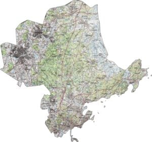
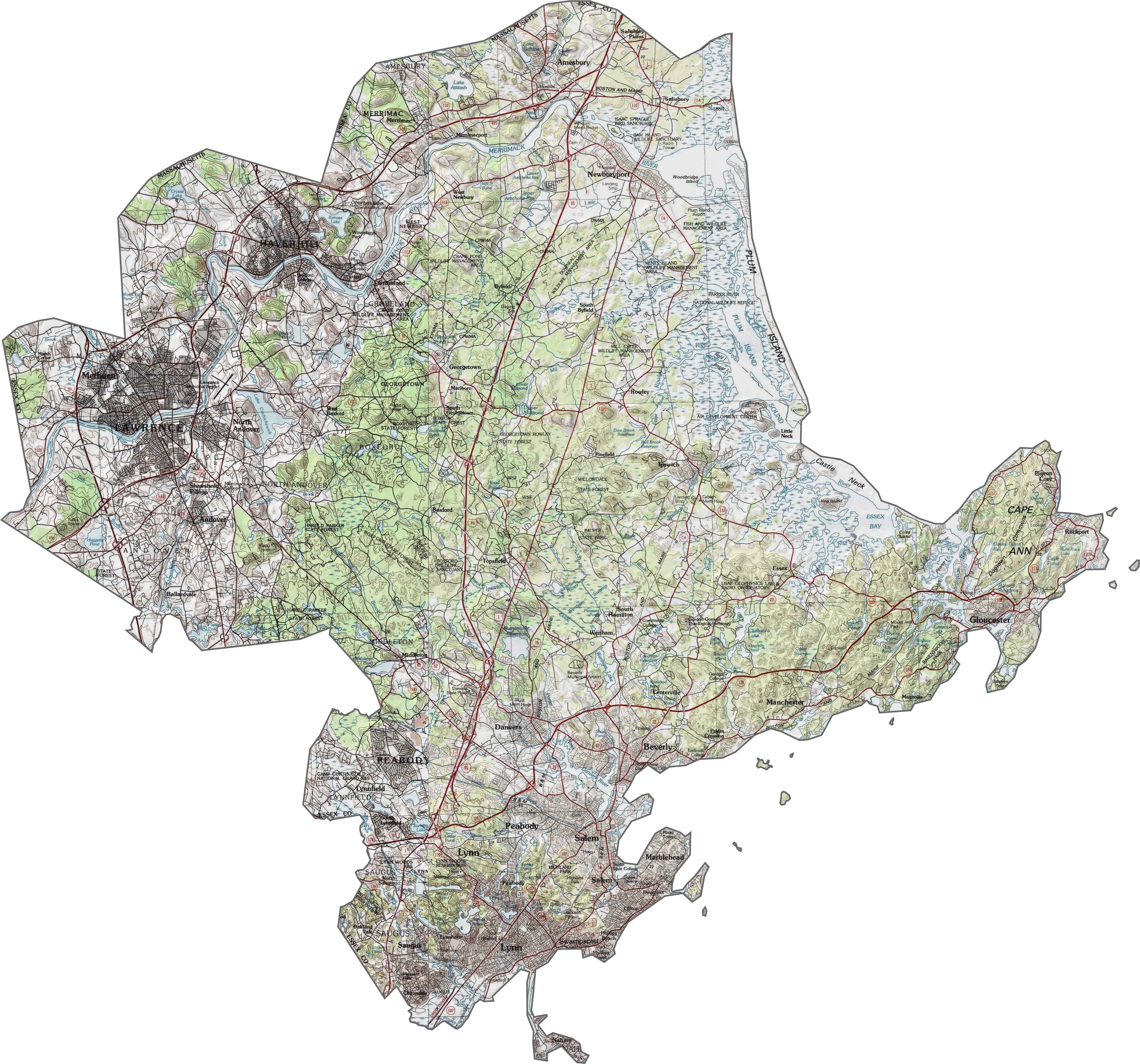
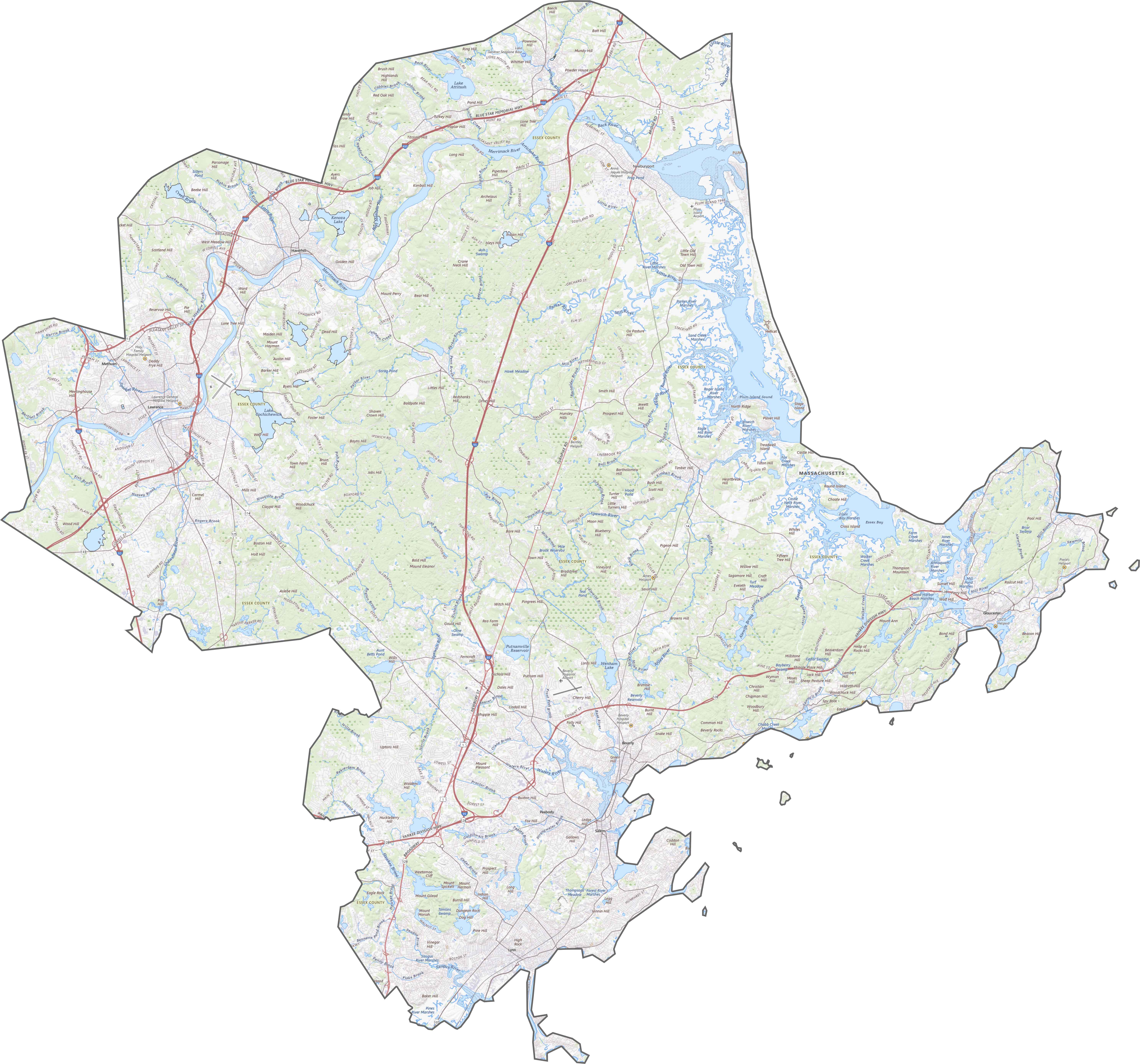
PHYSICAL MAP
Essex County Topographic Map
Essex County is mostly lowland, with rolling terrain near the interior. Though not mountainous, the elevation shifts just enough to show up clearly on our topo map. Our zoom tool below to see all the details of Essex County.
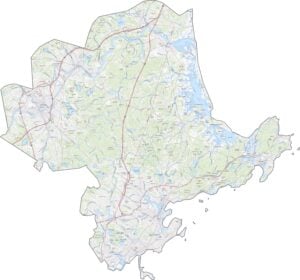
TRANSPORTATION MAP
Essex County Road Map
Essex County is well connected by roads and rail. I-95 and I-495 form a rough loop around it, but traffic still clogs near Salem and Lynn. Route 1 adds another north-south route, though it’s not always the fastest. Though some areas feel suburban, others are more coastal and compact.
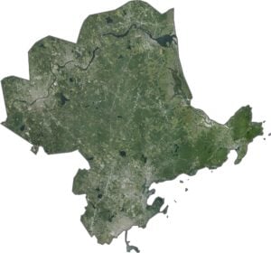
SATELLITE IMAGERY
Essex County Satellite Map
In our satellite map, you’ll see dense neighborhoods near the coast, but forests and rivers fill the inland areas. Salt marshes and estuaries stand out along the Atlantic edge. Although cities like Lawrence and Beverly are easy to spot, much of the county is still green from above.

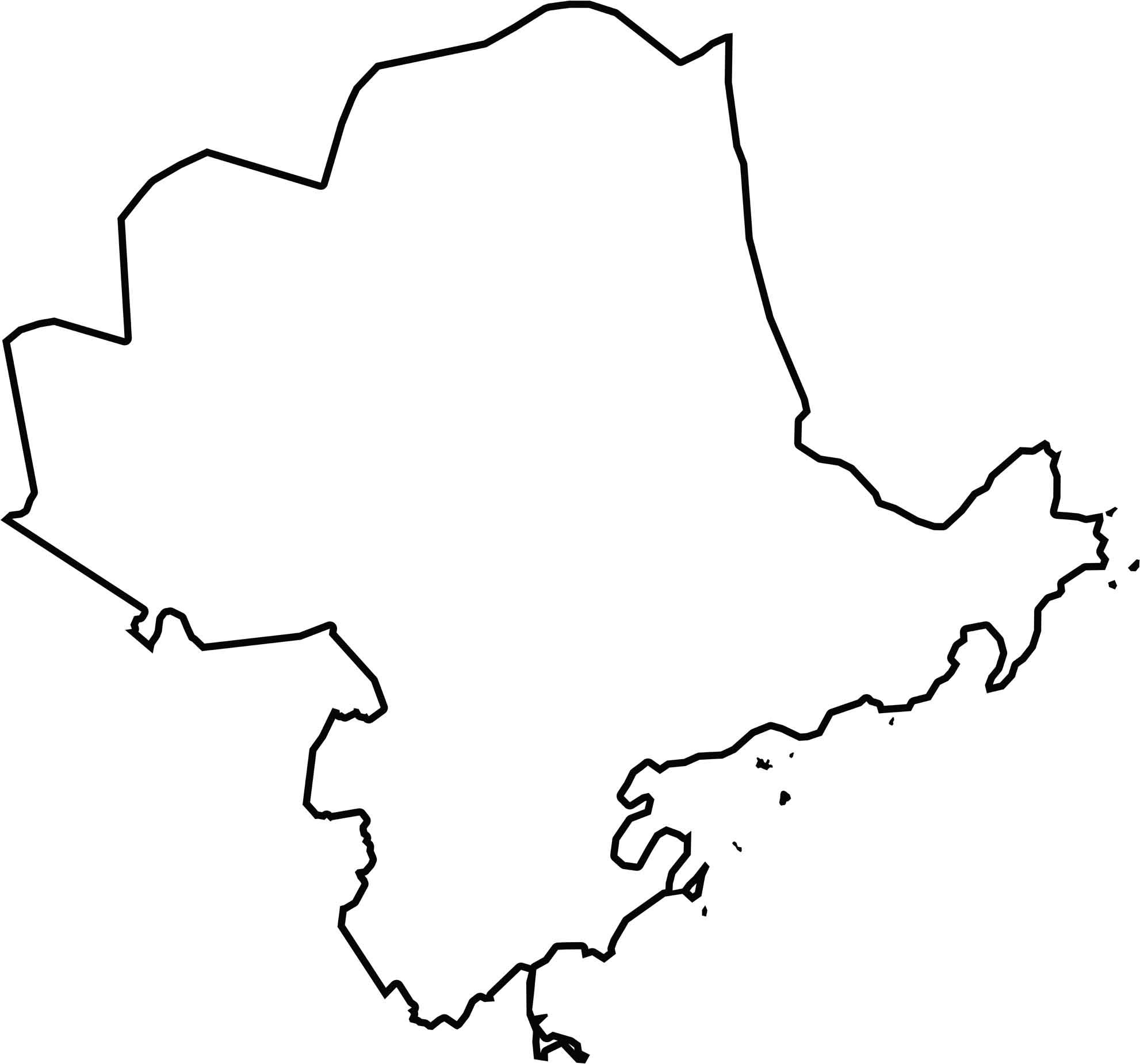
OUTLINE MAP
Essex County Blank Map
The county hugs the northeastern corner of Massachusetts. It borders the Atlantic Ocean and shares a short boundary with New Hampshire. Its coastline is jagged, with points, bays, and river mouths. The Merrimack River forms part of the northern edge near the state line.
Neighboring Counties
Here are the 3 neighboring counties of Essex County:


Massachusetts County Map

Small state, big personality. Boston’s skyline shouts history. The Cape serves up beach days and lobster rolls. Massachusetts history, culture, and coastline is packed into its 14 counties.