Oxford County Map, Maine

Oxford County Map Collection
We allow you to use our Oxford County map. Attribution is required.
Oxford County, Maine

Bordering New Hampshire to the west, Oxford County sprawls across western Maine. Here, you’ll find the White Mountains, dense forests and sparkling lakes.
Locals love the area’s natural beauty and outdoor adventures. Hiking, fishing, and skiing are big draws here. Bethel is a hotspot for tourists, especially in winter.
Rumford’s known for its paper industry. The Appalachian Trail cuts through, bringing hikers from far and wide. Paris is the county seat.
| Category | Details |
|---|---|
| County Name | Oxford County |
| County Seat | Paris |
| Population | Approximately 58,000 |
| Cities, Towns, and Communities | Norway, Paris, Rumford, Oxford, Fryeburg, Bethel, Mexico, Dixfield, Buckfield, Hiram, Lovell, Woodstock, Waterford |
| Interstates and Highways | US-2, ME-5, ME-26, ME-35, ME-117 |
| FIPS Code | 23-017 |
| Total Area (Land and Water) | 2,176 square miles (2,077 sq mi land, 99 sq mi water) |
| Adjacent Counties (and Direction) | Franklin County (Northeast), Androscoggin County (East), Cumberland County (Southeast), York County (South), Carroll County, New Hampshire (Southwest), Coös County, New Hampshire (West) |
| Time Zone | Eastern Time Zone (ET) |
| State | Maine |
| Coordinates | 44.3202° N, 70.9760° W |
| Etymology | Named after Oxford, Massachusetts, which in turn was named after Oxford, England |
| Major Landmarks | White Mountain National Forest, Sunday River Resort, Grafton Notch State Park, Mt. Abram Ski Area, Oxford Casino, Fryeburg Fairgrounds |
| Website | Oxford County Website |
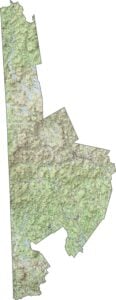
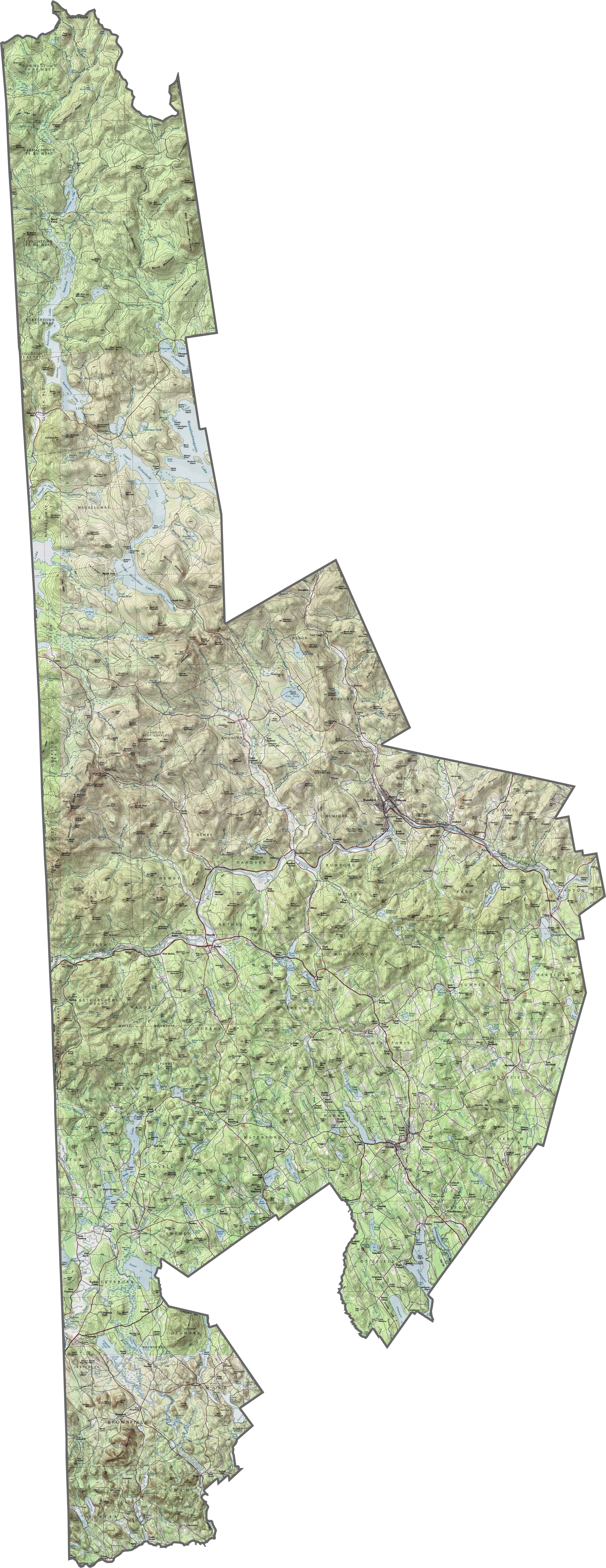
PHYSICAL MAP
Oxford County Topographic Map
Oxford County contains rolling farmlands in the east give way to rugged mountains in the west. The hills rise sharply in places, especially near the New Hampshire border. Get to know Oxford County with our interactive zoom tool.
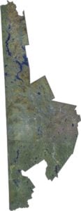
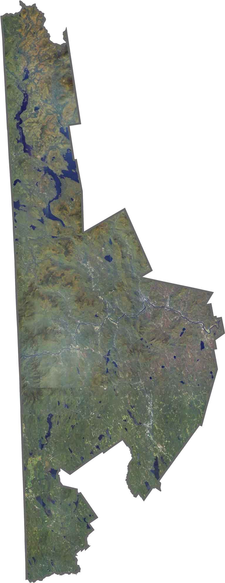
SATELLITE IMAGERY
Oxford County Satellite Map
Our satellite map of Oxford County shows the high number of lakes. It immediately catches the eye like Upper Richardson and Mooselookmeguntic. The Androscoggin River carves a winding path through the county.
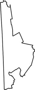
OUTLINE MAP
Oxford County Blank Map
Oxford County has a rough rectangular shape, stretching wide along the Maine-New Hampshire border. It also touches Franklin, Cumberland, and York Counties.

Neighboring Counties
Here are the 6 neighboring counties of Oxford County:


Maine County Map

Life moves at the pace of the tides here. One day is spent hiking forest trails, the next watching fog roll over quiet harbors. See what makes each county special with our Maine county maps.