Steuben County Map, New York

Steuben County Map Collection


We allow you to use our Steuben County map. Attribution is required.
Steuben County, New York

Steuben County is down in New York’s Southern Tier. It’s a big place in terms of size. It’s actually one one of the state’s largest counties by area. The landscape is a mix of steep hills and river valleys.
The Cohocton and Canisteo rivers snake through it. Corning is the county seat, which is famous for its glassmaking. That’s why the Corning Museum of Glass is a must-see. It’s got everything from ancient Egyptian artifacts to modern art installations.
But it’s also wine country here too. The hills around Keuka Lake are covered in vineyards. Visitors love it here, with hiking, fishing, and hunting being big draws. The fall foliage is spectacular. Pinnacle State Park is also a popular destination.
| Category | Details |
|---|---|
| County Name | Steuben County |
| County Seat | Bath |
| Population | Approximately 90,000 |
| Cities, Towns, and Communities | Bath, Corning, Hornell, Canisteo, Wayland |
| Interstates and Highways | Interstate 86, U.S. Route 15, New York State Route 36, New York State Route 54 |
| FIPS Code | 36-101 |
| Total Area (Land and Water) | 1,408 square miles (1,394 sq mi land, 14 sq mi water) |
| Adjacent Counties (and Direction) | Ontario County (North), Yates County (Northeast), Schuyler County (East), Chemung County (East), Tioga County, Pennsylvania (South), Potter County, Pennsylvania (Southwest), Allegany County (West), Livingston County (Northwest) |
| Time Zone | Eastern Time Zone (ET) |
| State | New York |
| Coordinates | 42.3333° N, 77.6836° W |
| Etymology | Named after Friedrich Wilhelm von Steuben |
| Major Landmarks | Corning Museum of Glass, Letchworth State Park, Keuka Lake |
| Website | Steuben County Website |
PHYSICAL MAP
Steuben County Topographic Map
This is hill country. No question about it. Steuben County’s landscape is full of deep valleys and forested ridges. The Canisteo and Cohocton rivers cut through the hills. Elevation rolls from one slope to the next. There’s barely a flat spot in sight.

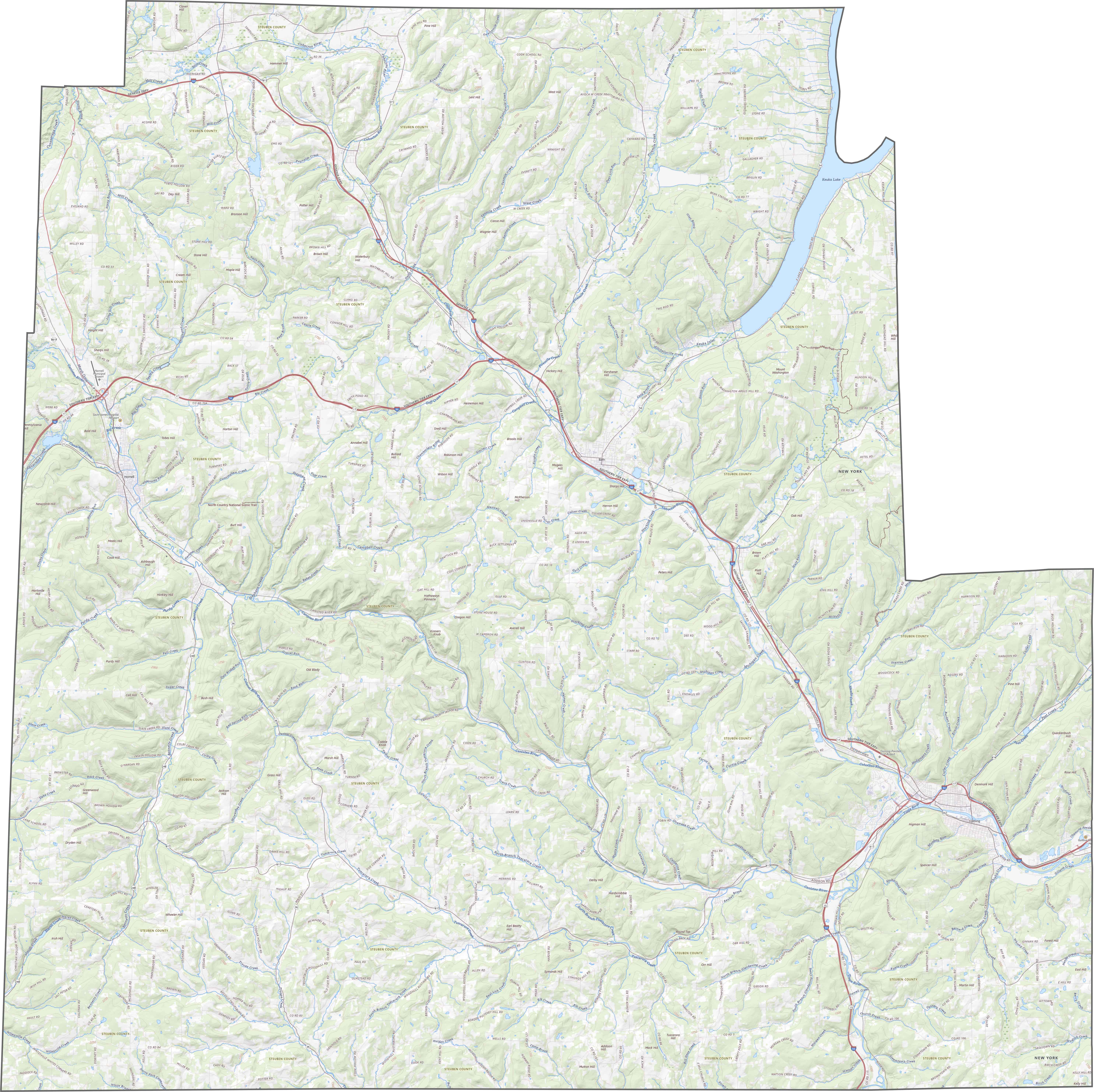
TRANSPORTATION MAP
Steuben County Road Map
I-86 (Southern Tier Expressway) runs east–west across the county. Then, US Route 15 dips in from the south near Corning. Although major highways serve it well, many roads still follow the land’s twists. Hills and valleys decide the path. Zoom in to follow every ridge-hugging route.
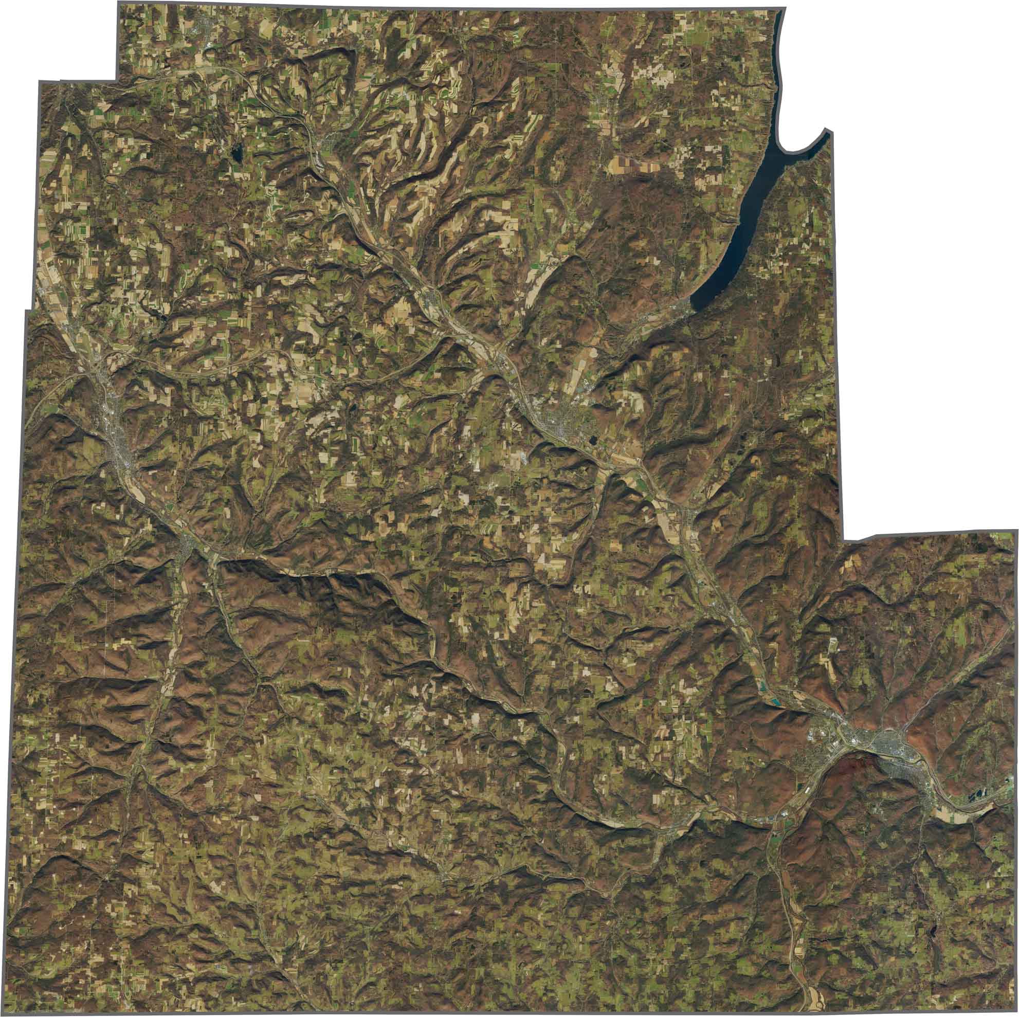
SATELLITE IMAGERY
Steuben County Satellite Map
Corning and Hornell stand out as urban areas. But forests fill most of the space between. And that’s a lot of forests. Roads wind around through the hills. Some valleys hold long stretches of farmland. The terrain’s rhythm shows clearly from above. Green ridges, cleared fields, and narrow towns.
OUTLINE MAP
Steuben County Blank Map
Steuben County has a jagged, uneven outline. It borders Pennsylvania to the south. Other than that, it’s only next to NY counties.

Neighboring Counties
Here are the 8 neighboring counties of Steuben County:


New York County Map

New York has 62 counties. Each with their own attitude. Manhattan’s chaos to the Adirondacks’ silence… and how about those Buffalo wings? Explore our NY counties maps.