Whitfield County Map, Georgia

Whitfield County Map Collection
We allow you to use our Whitfield County map. Attribution is required.
Whitfield County, Georgia

Whitfield County sits in northwest Georgia, right up against the Tennessee line. Dalton is the county seat and is known as the “Carpet Capital of the World”. You can’t talk about Whitfield without mentioning carpet because it’s everywhere. The county’s economy revolves around it.
There’s also a lot of nature here. The Conasauga River forms the eastern border, and there’s also Fort Mountain State Park nearby. The Tunnel Hill Heritage Center tells the area’s Civil War story.
Whitfield County has a growing Hispanic population, adding new flavors to local culture. Whitfield County brings together a lot of history and industry, keeping things interesting in this corner of Georgia.
| Category | Details |
|---|---|
| County Name | Whitfield County |
| County Seat | Dalton |
| Population | Approximately 110,000 |
| Cities, Towns, and Communities | Dalton (county seat), Varnell, Tunnel Hill, and several unincorporated communities |
| Interstates and Highways | Interstate 75, U.S. Route 41, U.S. Route 76, State Route 2 |
| FIPS Code | 13-313 |
| Total Area (Land and Water) | 289 square miles (land: 287 sq mi, water: 2 sq mi) |
| Adjacent Counties (and Direction) | Bradley County, Tennessee (North), Murray County (East), Gordon County (South), Walker County (Southwest), Catoosa County (Northwest), Hamilton County, Tennessee (Northwest) |
| Time Zone | Eastern Time Zone (ET) |
| State | Georgia |
| Coordinates | 34.7680° N, 84.9730° W |
| Etymology | Named after George Whitfield, an early settler and influential figure in the region |
| Major Landmarks | Dalton Depot, Northwest Georgia Trade and Convention Center, Chickamauga Battlefield |
| Website | Whitfield County Website |
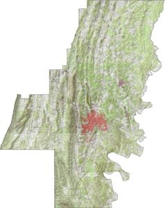
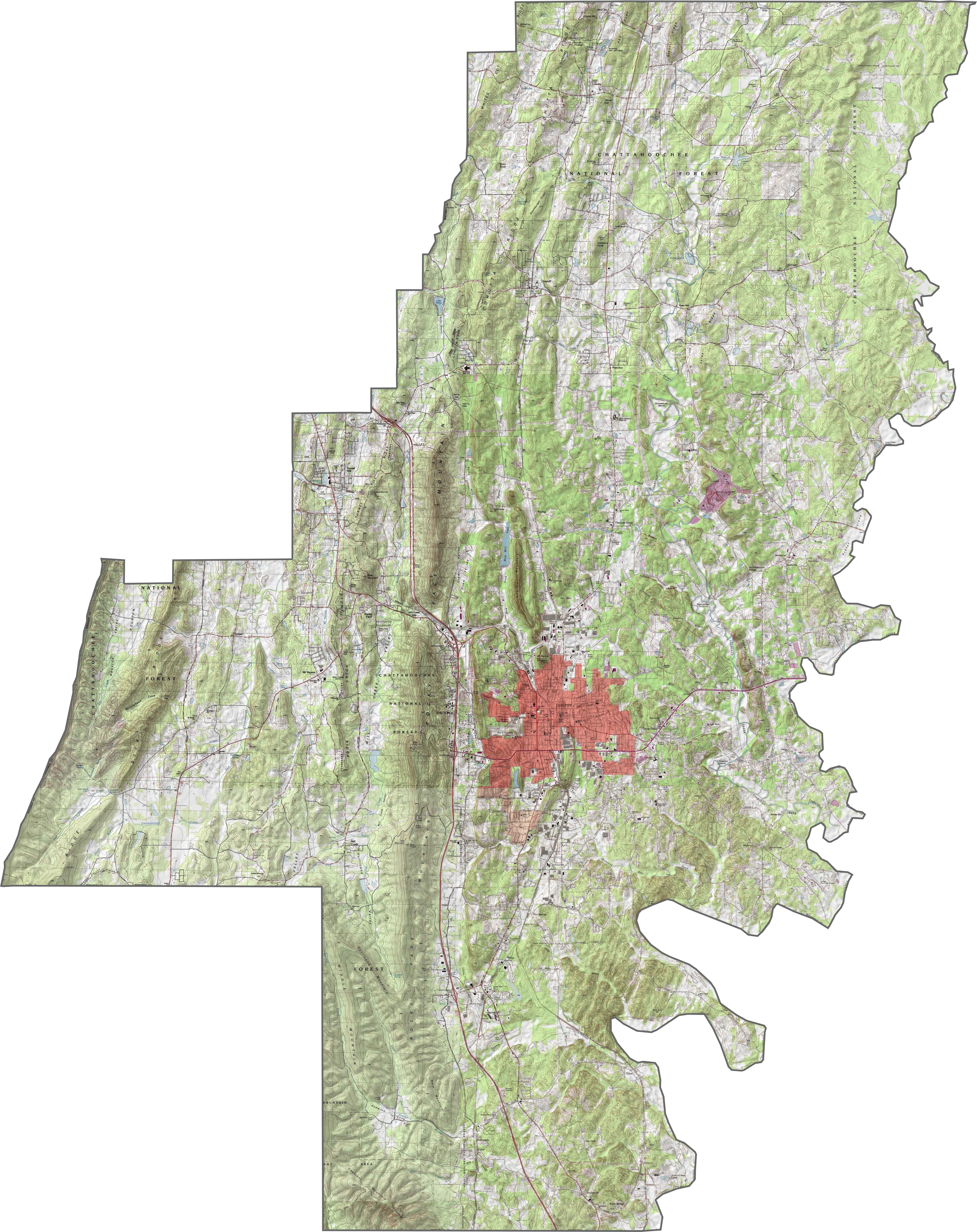
PHYSICAL MAP
Whitfield County Topographic Map
Our topographic map of Whitfield County shows its ridge and valley terrain typical of northwest Georgia. You’ll find Dalton, the county seat, in the center of the county. The Chattahoochee National Forest covers most of the southwest region of the county.
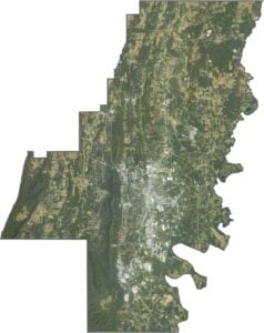
SATELLITE IMAGERY
Whitfield County Satellite Map
Whitfield County sits in the Ridge and Valley region, which means the land has long, rolling ridges and wide valleys. To the north, Tunnel Hill is a small town with Civil War history. In the west, Rocky Face has scenic ridges and outdoor trails. The eastern side of the county has more forests and farmland, with small communities spread throughout.

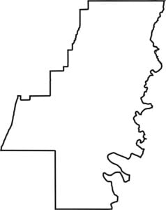
OUTLINE MAP
Whitfield County Blank Map
Whitfield County has an irregular shape following natural terrain features. Its western border follows the crest of Taylor’s Ridge. The Conasauga River influences the eastern border where it flows into Tennessee.

Neighboring Counties
Here are the 6 neighboring counties of Whitfield County:


Georgia County Map

Just launched! Our Georgia county map shows all 159 counties in stunning detail. It’s the perfect resource you’ve been waiting for. Don’t miss out on the Peach State.