Anne Arundel County Map, Maryland

Anne Arundel County Map Collection


We allow you to use our Anne Arundel County map. Attribution is required.
Anne Arundel County, Maryland

Just south of Baltimore lies Anne Arundel County, a place with more than its fair share of history. It’s home to Annapolis, Maryland’s capital city.
Summers are hot and humid, perfect for days at Sandy Point State Park’s beaches. The area’s known for its blue crabs, so don’t leave without trying a local crab feast.
The Chesapeake Bay hugs the county’s eastern edge with endless opportunities for sailing, fishing, and waterfront dining. Visitors also go to the U.S. Naval Academy, while nature lovers explore the scenic trails of Patapsco Valley State Park.
| Category | Details |
|---|---|
| County Name | Anne Arundel County |
| County Seat | Annapolis |
| Population | 600,000 |
| Cities, Towns, and Communities | Annapolis (county seat), Glen Burnie, Laurel, Pasadena, and various unincorporated communities |
| Interstates and Highways | I-95, I-97, I-295, U.S. Highway 50, U.S. Highway 301 |
| FIPS Code | 24-003 |
| Total Area (Land and Water) | 588 square miles (land: 415 sq mi, water: 173 sq mi) |
| Adjacent Counties (and Direction) | Baltimore County (North), Baltimore City (North), Calvert County (South), Kent County (Northeast), Howard County (Northwest), Prince George’s County (Southwest), Queen Anne’s County (East), Talbot County (Southeast) |
| Time Zone | Eastern Time Zone (EST) |
| State | Maryland |
| Coordinates | 38.92°N, 76.54°W |
| Etymology | Named after Anne Arundel, the wife of Cecil Calvert, 2nd Baron Baltimore, the founder of Maryland. |
| Major Landmarks | United States Naval Academy, Maryland State House, Sandy Point State Park, Broadneck Park |
| Website | Anne Arundel County Website |
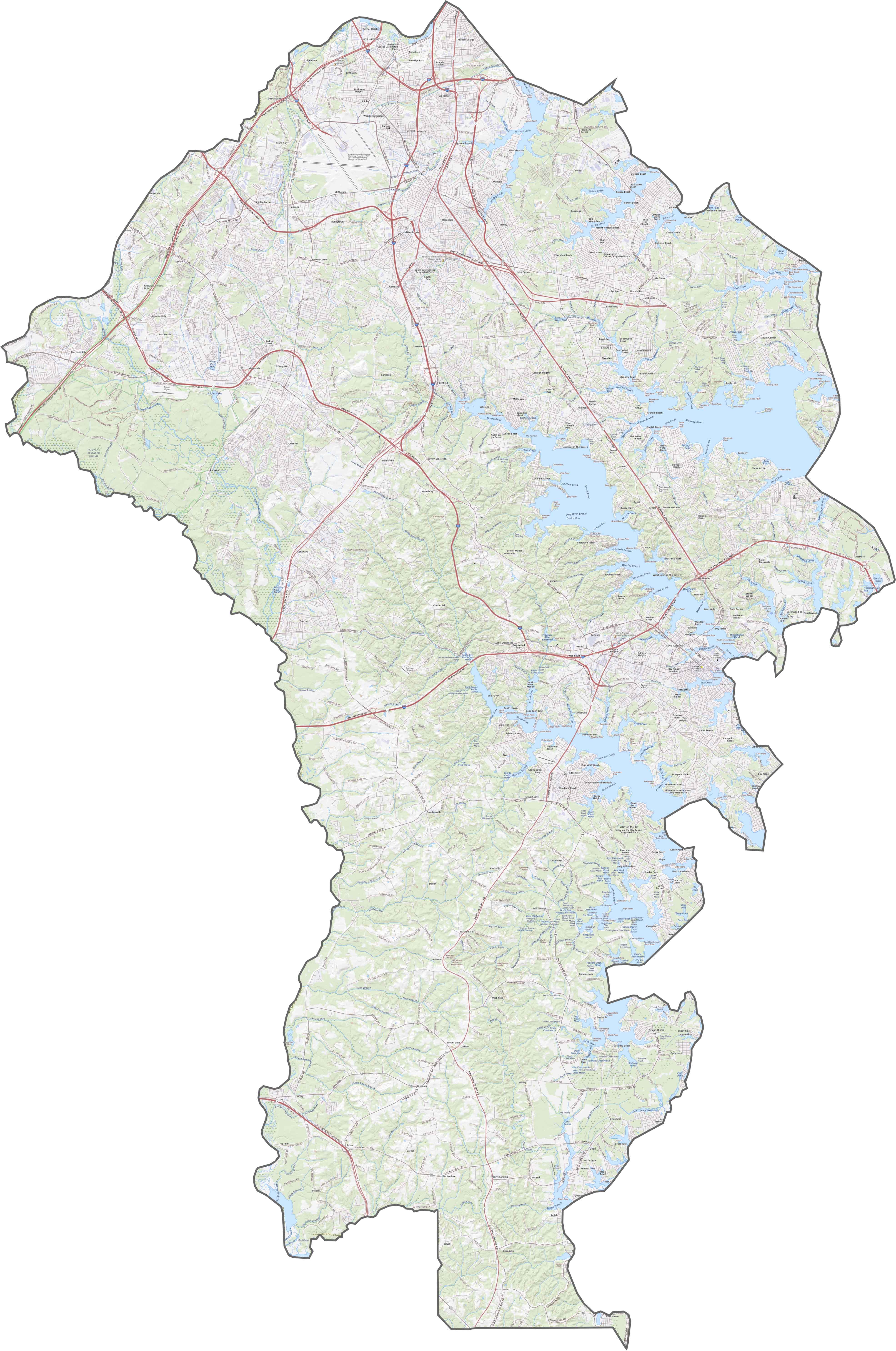
TRANSPORTATION MAP
Anne Arundel County Road Map
Anne Arundel is well-connected by major roads like I-97 and US-50. However, traffic can get heavy near Annapolis. Despite the congestion, routes like MD-2 provide scenic drives along the coast. Check out the details with our zoom tool for a closer look.
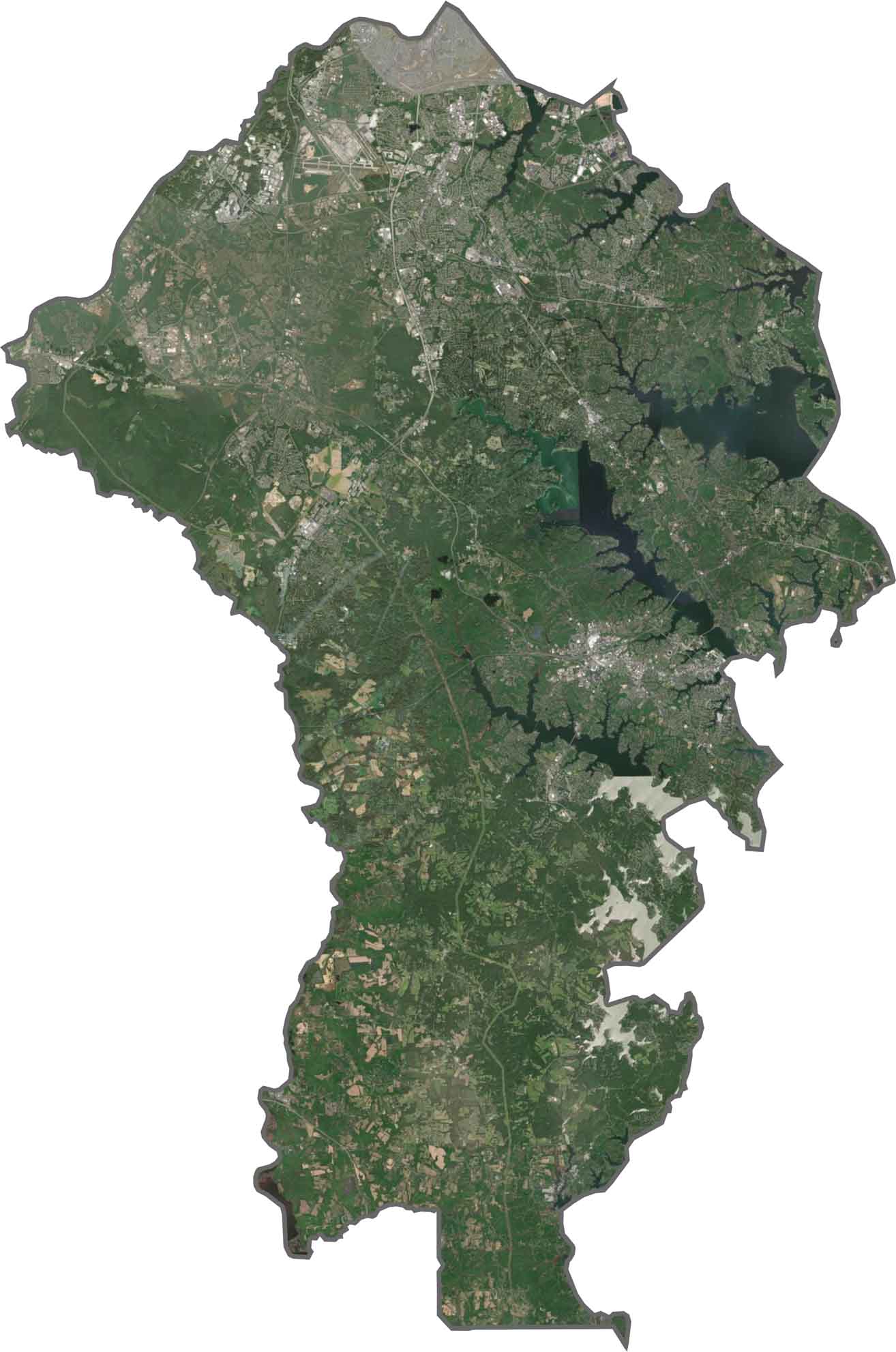
SATELLITE IMAGERY
Anne Arundel County Satellite Map
The Chesapeake Bay occupies the eastern side, with water inlets cutting into the land. Urban areas cluster near Annapolis, while patches of farmland and forests fill the interior. Use our zoom tool to explore detailed features in the satellite imagery below.
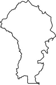
OUTLINE MAP
Anne Arundel County Blank Map
Anne Arundel County curves along the western shore of the Chesapeake Bay. Its jagged edges follow rivers like the Patuxent on the western edge. It borders Prince George’s, Howard, and Calvert counties but doesn’t touch another state.

Neighboring Counties
Here are the 8 neighboring counties of Anne Arundel County:


Maryland County Map

With 23 counties and Baltimore City, Maryland gives you a distinct experience in every corner. City life, small towns, and outdoor adventures all come together. Learn more in our Maryland county maps.