Berkeley County Map, South Carolina

Berkeley County Map Collection
We allow you to use our Berkeley County map. Attribution is required.
Berkeley County, South Carolina

Berkeley County sits in the southeastern part of South Carolina, just north of Charleston. The county’s got a bit of everything – forests, swamps, and suburban sprawl. Moncks Corner is the county seat.
It’s mostly rural here. But new developments are popping up all over. The county’s growing fast, attracting folks from all over. It’s close enough to Charleston for an easy commute. But it’s far enough away to have its own identity.
The Cooper River runs through it so it has great spots for kayaking. The eastern half is Francis Marion National Forest. But the highlight is the massive man-made Lake Moultrie. History’s everywhere you look. Old plantations dot the landscape. Berkeley County’s a place in transition, balancing growth with its rural roots.
| Category | Details |
|---|---|
| County Name | Berkeley County |
| County Seat | Moncks Corner |
| Population | Approximately 248,000 |
| Cities, Towns, and Communities | Goose Creek, Moncks Corner, Hanahan, St. Stephen, Bonneau |
| Interstates and Highways | Interstate 26, U.S. Highway 176, U.S. Highway 52, State Highway 6 |
| FIPS Code | 45-015 |
| Total Area (Land and Water) | 1,229 square miles (1,099 sq mi land, 130 sq mi water) |
| Adjacent Counties (and Direction) | Georgetown County (East), Williamsburg County (Northeast), Clarendon County (North), Orangeburg County (Northwest), Dorchester County (West), Charleston County (South) |
| Time Zone | Eastern Time Zone (EST) |
| State | South Carolina |
| Coordinates | 33°11’N, 80°01’W |
| Etymology | Named after William Berkeley, colonial proprietary governor and landowner |
| Major Landmarks | Cypress Gardens, Old Santee Canal Park, Mepkin Abbey |
| Website | Berkeley County Website |
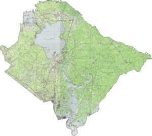
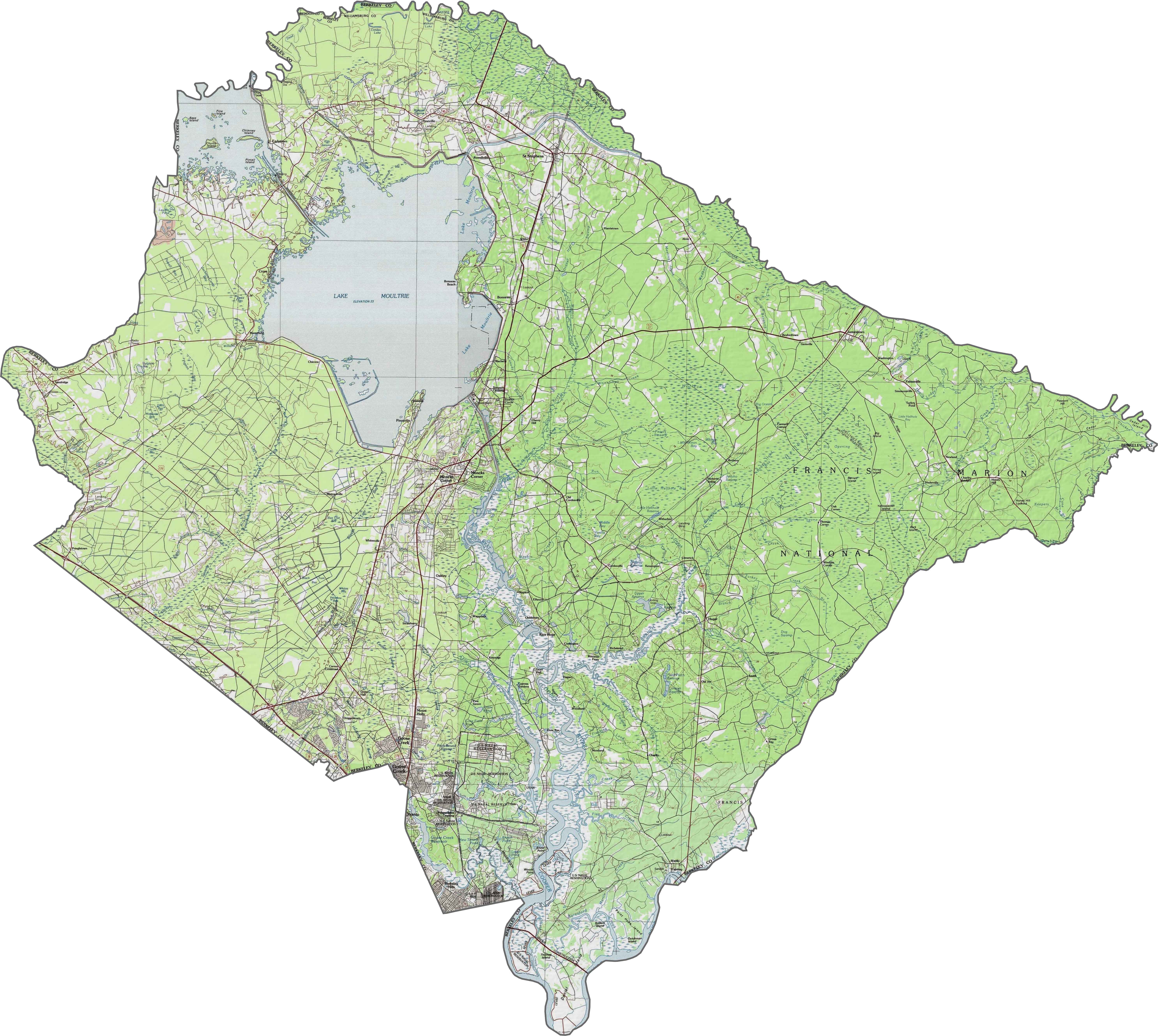
PHYSICAL MAP
Berkeley County Topographic Map
Flatness dominates here, but it’s not featureless. Wetlands and low ridges interrupt the plain, especially near lakes and old riverbeds. The western side has more elevation change. You can explore all the elevation changes using our zoom tool.
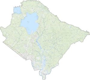
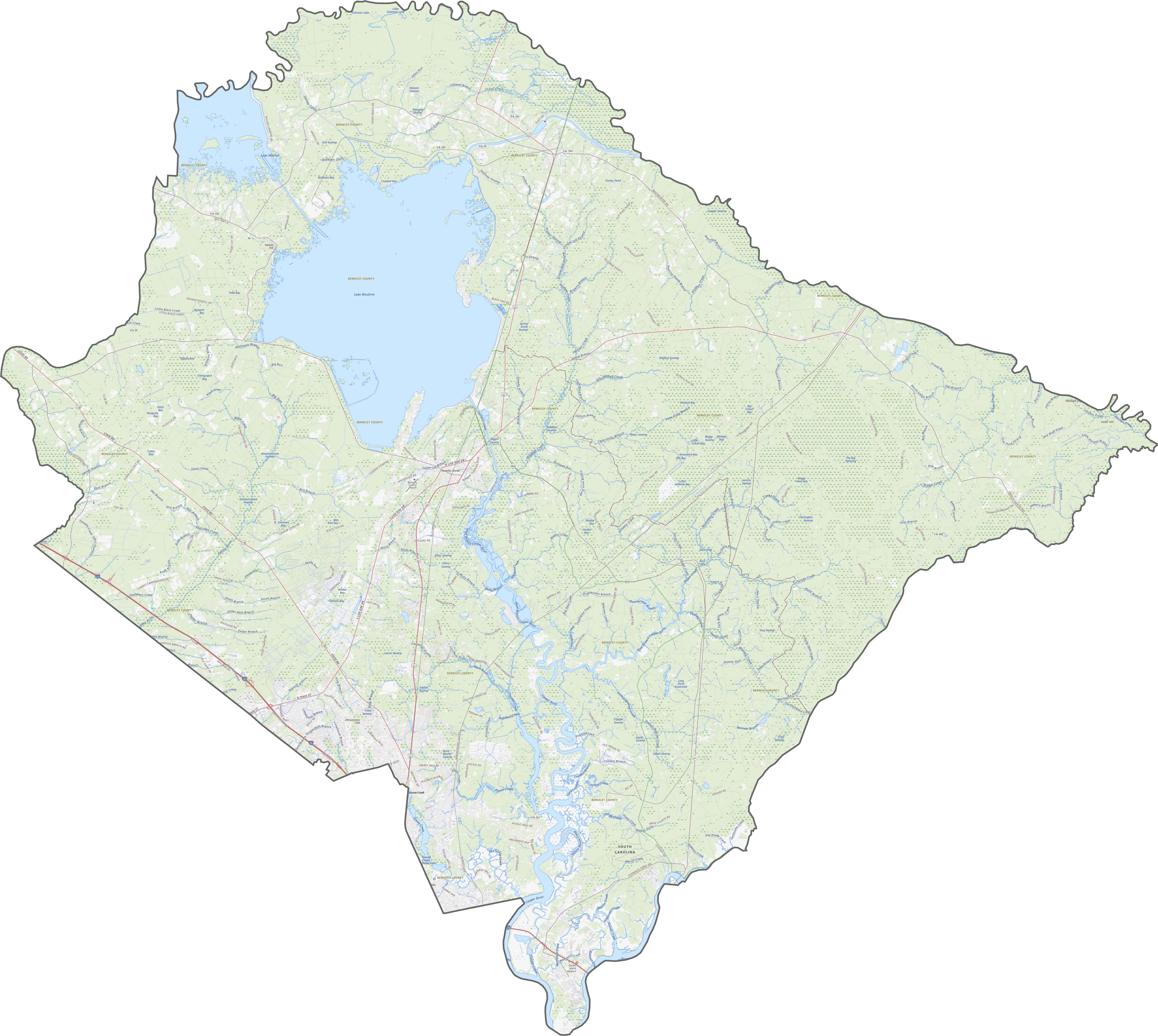
TRANSPORTATION MAP
Berkeley County Road Map
Berkeley County’s road system is shaped by water. Routes bend and branch to avoid swamps, lakes, and rivers. I-26, U.S. Highway 176 and 52 are the main highways that tie the county together.
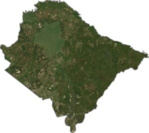
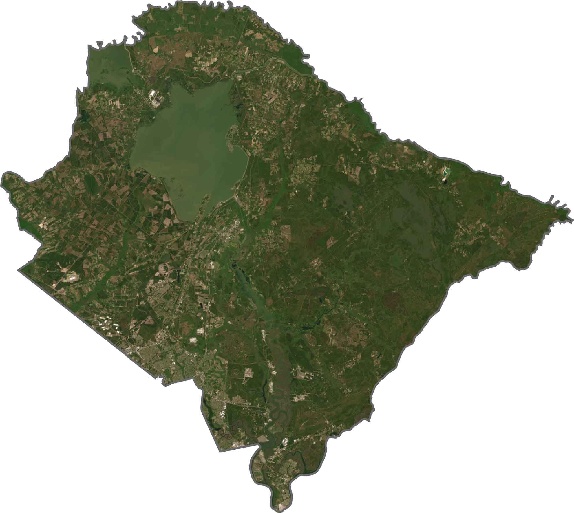
SATELLITE IMAGERY
Berkeley County Satellite Map
Lake Moultrie steals the spotlight in the north. Its size and shape are hard to miss. Elsewhere, forests fill in the blanks, interrupted by small towns and power corridors. Marshland creeps along the southern edge. Though suburban growth has spread northward, nature still covers most of the land.
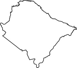
OUTLINE MAP
Berkeley County Blank Map
It’s a rough diamond stretched north to south. While the Santee River forms the eastern border, the Wando River flows along the southern boundary.

Neighboring Counties
Here are the 6 neighboring counties of Berkeley County:


South Carolina County Map

South Carolina’s 46 counties keep things interesting. Some swing to beach tunes, others hum with history. You’ll find gators, grits, and gospel… sometimes all in the same afternoon.