Bucks County Map, Pennsylvania

Bucks County Map Collection


We allow you to use our Bucks County map. Attribution is required.
Bucks County, Pennsylvania

Bucks County is just north of Philadelphia and has a bit of everything. There are quaint river towns like New Hope, known for its friendly atmosphere. You’ve got sprawling farms and covered bridges in the northern parts.
Washington Crossing Historic Park marks the spot where George Washington and his troops crossed the Delaware during the Revolutionary War. It’s a big deal.
Doylestown is the county seat. It’s home to some quirky museums housed in concrete castles. It’s crisscrossed by the Delaware River, which forms its eastern border with New Jersey. This is a place where history and charm collide.
| Category | Details |
|---|---|
| County Name | Bucks County |
| County Seat | Doylestown |
| Population | Approximately 640,000 |
| Cities, Towns, and Communities | Doylestown, Quakertown, Newtown, Perkasie, Levittown, Bristol, Warminster, Bensalem |
| Interstates and Highways | Interstate 95, Interstate 276, U.S. Highway 1, U.S. Highway 13, State Highway 611 |
| FIPS Code | 42-017 |
| Total Area (Land and Water) | 622 square miles (604 sq mi land, 18 sq mi water) |
| Adjacent Counties (and Direction) | Lehigh County (Northwest), Northampton County (North), Warren County, New Jersey (Northeast), Hunterdon County, New Jersey (Northeast), Mercer County, New Jersey (East), Burlington County, New Jersey (Southeast), Philadelphia County (South), Montgomery County (West) |
| Time Zone | Eastern Time Zone (EST) |
| State | Pennsylvania |
| Coordinates | 40°20’N, 75°05’W |
| Etymology | Named after Buckinghamshire in England |
| Major Landmarks | Washington Crossing Historic Park, Sesame Place, Peddler’s Village, Tyler State Park |
| Website | Bucks County Website |
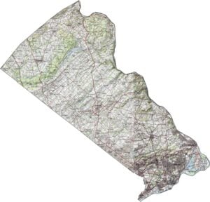
PHYSICAL MAP
Bucks County Topographic Map
Bucks shifts gradually from urban to rural as you move north. The southern portion is flatter, with broad, open areas. But farther north, gentle hills roll into view. The landscape becomes more wooded and uneven, especially near the Delaware River valley.
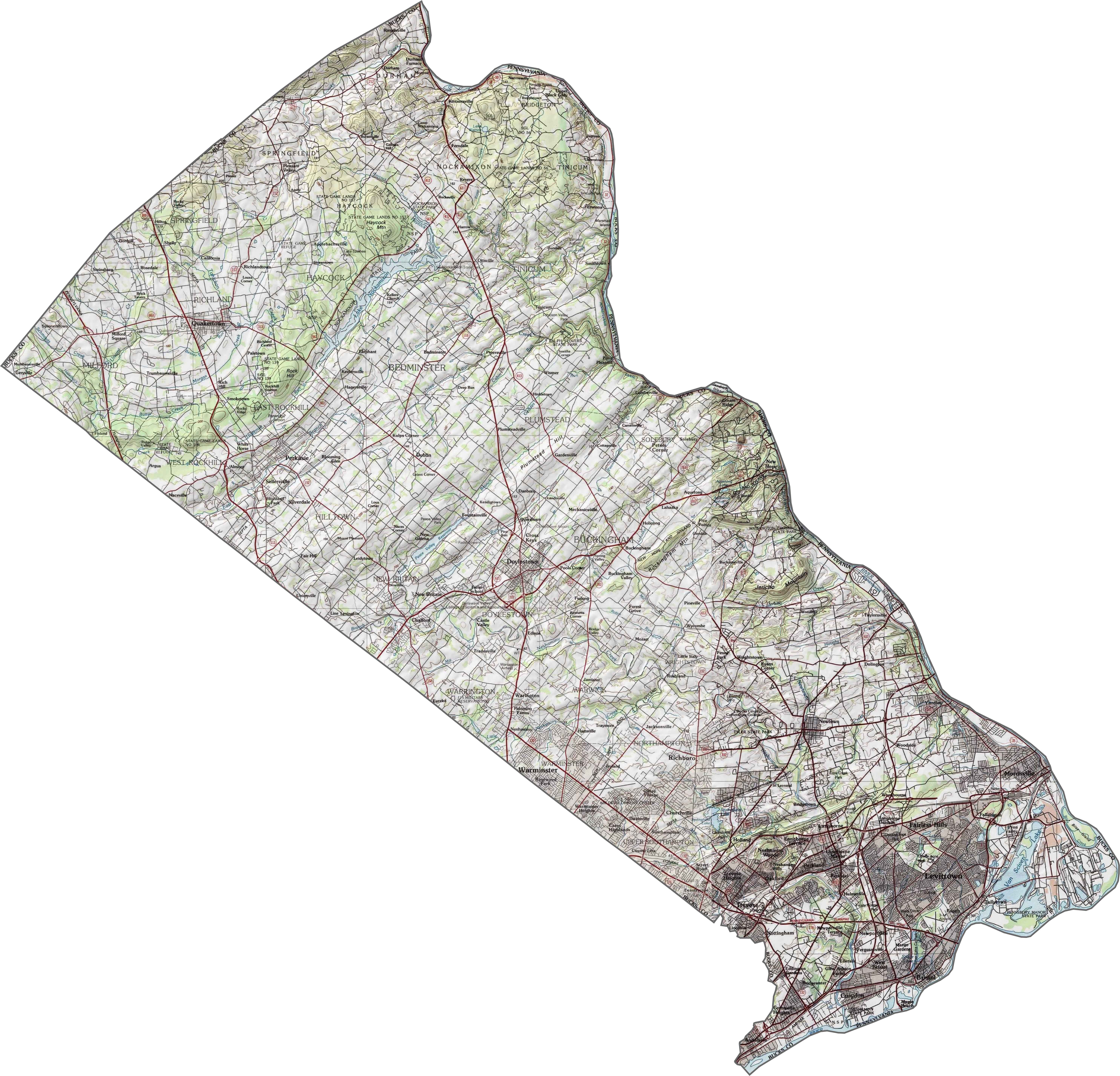
TRANSPORTATION MAP
Bucks County Road Map
Roads in Buck County cross the county in all directions, linking towns, suburbs, and farmland. Traffic is generally heavier toward the southern end, but quieter in the north. Still, you won’t have trouble navigating.
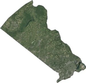
SATELLITE IMAGERY
Bucks County Satellite Map
In our satellite map, you’ll notice how green the upper half is. Forests and farmland cover a big stretch of the county. But the southern portion is packed with development.

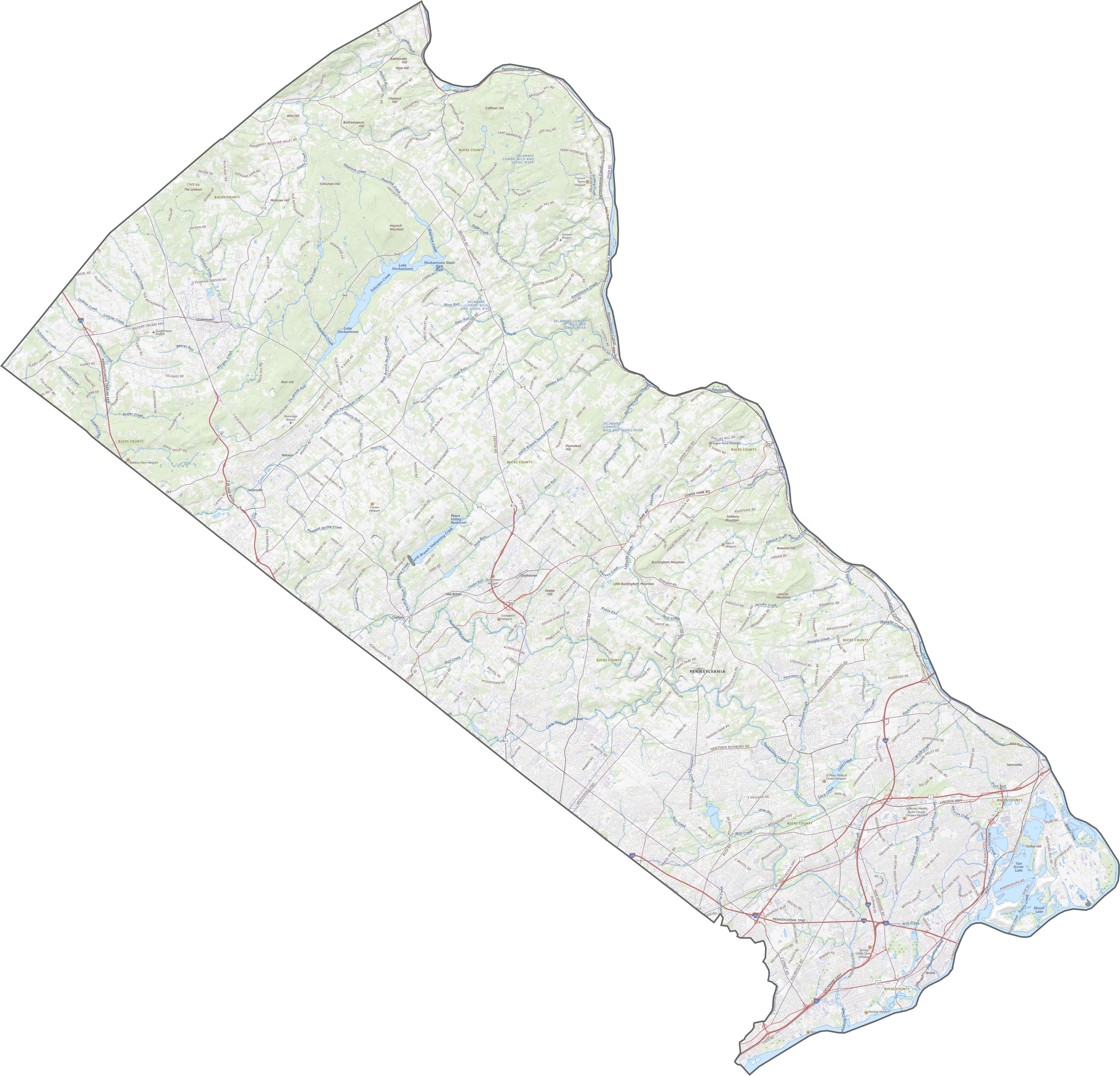
OUTLINE MAP
Bucks County Blank Map
The shape of Bucks County is long and pointed, tipped sideways. Its eastern border follows the Delaware River, which separates it from New Jersey. The rest of the boundary cuts cleanly across land, with just a few curves and dips.

Neighboring Counties
Here are the 8 neighboring counties of Bucks County:


Pennsylvania County Map

Pennsylvania’s 67 counties contains steel city lights, Amish country backroads, and Pocono mountain escapes. Mileage may vary, but the stories won’t.