Carroll County Map, New Hampshire
Carroll County Map Collection


We allow you to use our Carroll County map. Attribution is required.
Carroll County, New Hampshire
Carroll County is in the eastern part of New Hampshire, bordering Maine. It’s a place where the White Mountains meet pristine lakes. Conway serves as the commercial hub. But don’t let that fool you because most of the county is rural and wild.
Tourists come here for the scenery. Mount Washington, the highest peak in the Northeast, looms large on the horizon. Skiing is huge in winter. Summer brings hikers, campers, and folks just looking to cool off in Lake Winnipesaukee.
The Kancamagus Highway cuts through with some of the best fall foliage views you’ll ever see. Carroll County’s got a bit of everything. It has quaint villages, covered bridges, and yeah, even a few moose.
| Category | Details |
|---|---|
| County Name | Carroll County |
| County Seat | Ossipee |
| Population | Approximately 50,000 |
| Cities, Towns, and Communities | Conway, Ossipee, Wolfeboro, Moultonborough, Wakefield, Tamworth, Bartlett, Freedom |
| Interstates and Highways | U.S. Route 302, New Hampshire Route 16, New Hampshire Route 25, New Hampshire Route 109 |
| FIPS Code | 33-003 |
| Total Area (Land and Water) | 992 square miles (931 sq mi land, 61 sq mi water) |
| Adjacent Counties (and Direction) | Coos County (North), Oxford County, Maine (Northeast), York County, Maine (Southeast), Strafford County (South), Belknap County (Southwest), Grafton County (West) |
| Time Zone | Eastern Time Zone (ET) |
| State | New Hampshire |
| Coordinates | 43.8673° N, 71.1828° W |
| Etymology | Named after Charles Carroll, a signer of the Declaration of Independence |
| Major Landmarks | Mount Washington Valley, White Mountain National Forest, Castle in the Clouds, Lake Winnipesaukee |
| Website | Carroll County Website |
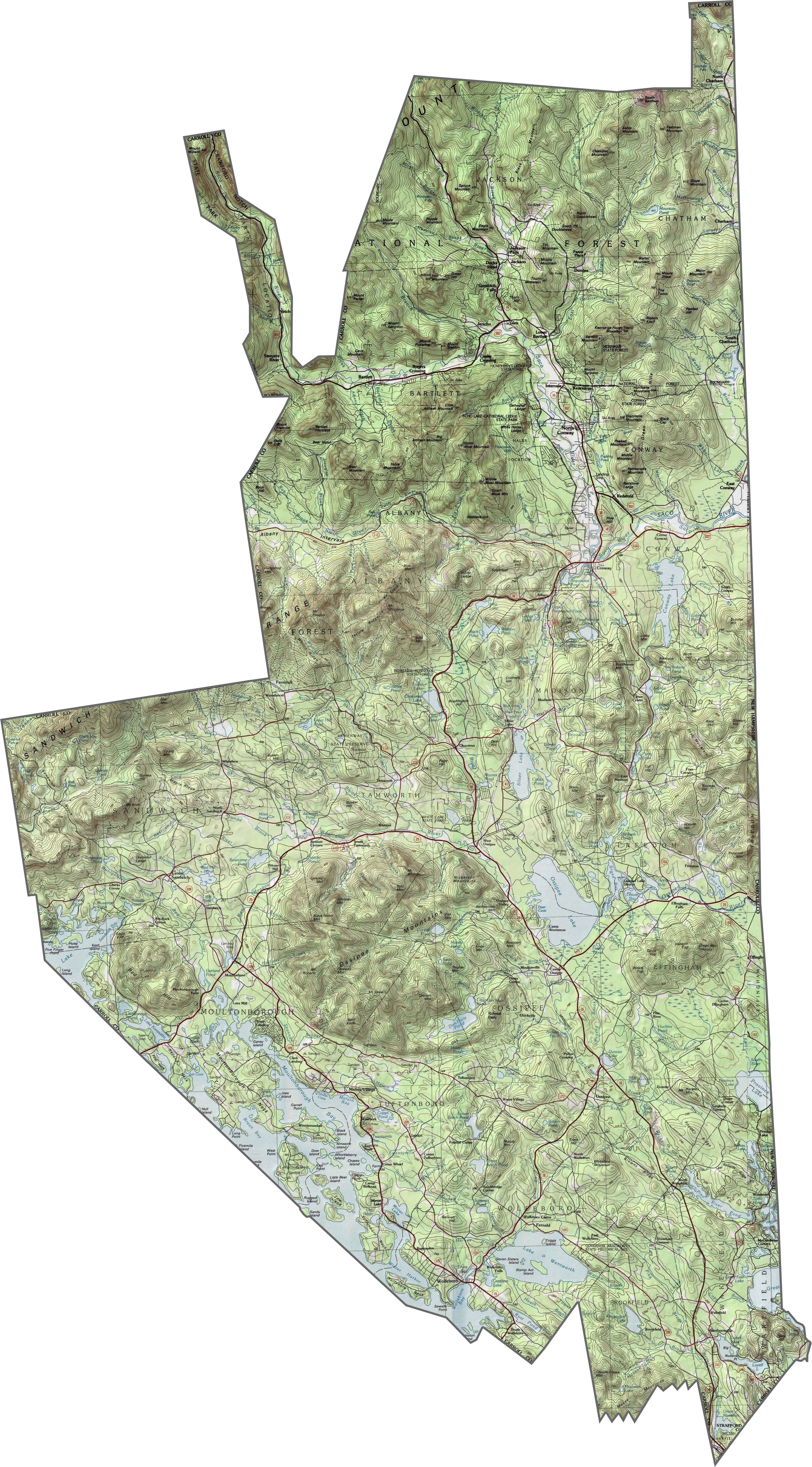
PHYSICAL MAP
Carroll County Topographic Map
Mountains take center stage in Carroll County. The eastern edge of the White Mountains fills much of the county. Peaks rise quickly, especially in the north. Flat land is rare. But valleys do break things up with Conway situated in one. Use our zoom tool in the topographic map below to really explore Carroll County.
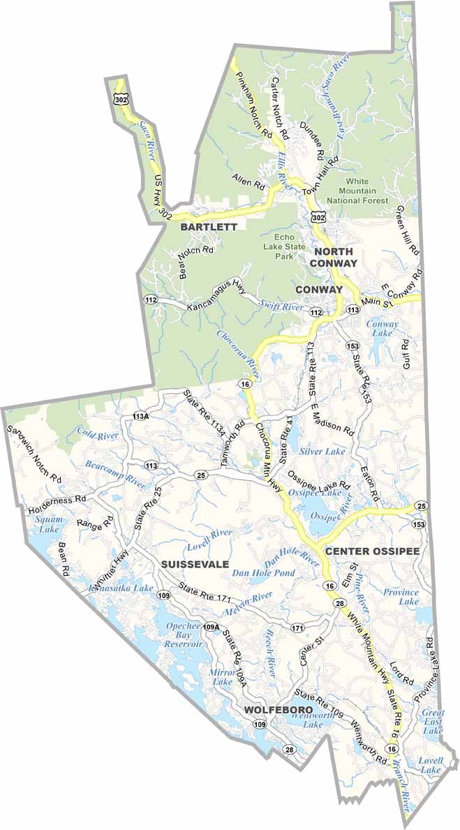
TRANSPORTATION MAP
Carroll County Road Map
Carroll County lacks interstates too, but major routes still cut through. NH Route 16 is the backbone, running north to south. Traffic is light except near resort towns. Even with limited routes, you can get around. Try our zoom tool below to follow major routes.

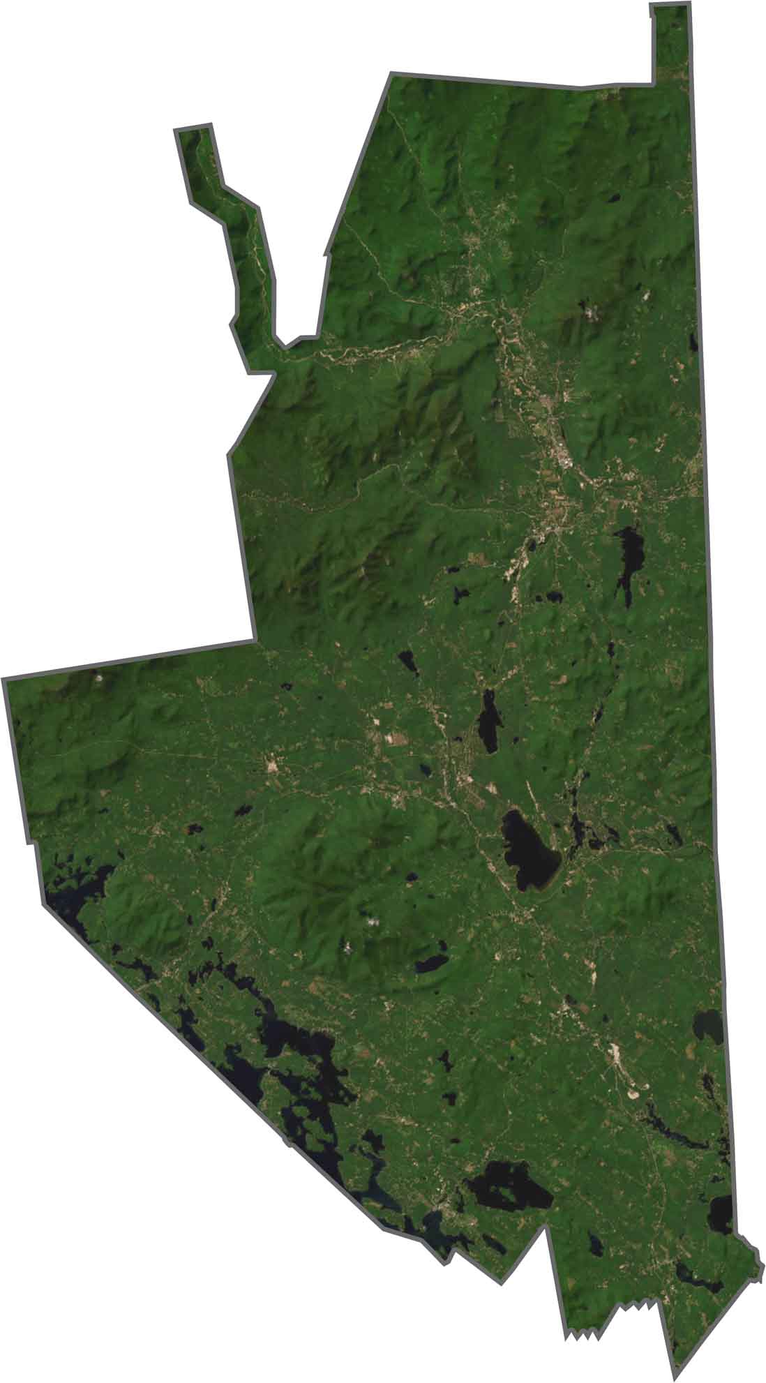
SATELLITE IMAGERY
Carroll County Satellite Map
Forests stretch across most of the county. Mountains pop out clearly from above. Even though there are towns, they’re scattered. The Saco River winds across the eastern part. Lakes like Ossipee and Squam stand out too.
OUTLINE MAP
Carroll County Blank Map
Carroll County has a strange shape. It’s narrow at the top and wider at the bottom. The eastern edge forms part of the border with Maine. Jagged lines mark much of the boundary. It doesn’t follow a clean pattern, except on the eastern boundary.

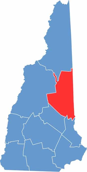
Neighboring Counties
Here are the 6 neighboring counties of Carroll County:


New Hampshire County Map

Explore the Granite State. 10 counties packed with mountain switchbacks, colonial villages, and Atlantic winds. Enjoy maple syrup mornings, moose crossings, and so much more.