Cecil County Map, Maryland

Cecil County Map Collection

We allow you to use our Cecil County map. Attribution is required.
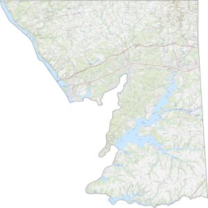
Cecil County, Maryland

Cecil County sits in the northeast corner of Maryland, bordering Pennsylvania and Delaware. It’s a mix of rural landscapes and waterfront towns, with plenty to explore.
The Chesapeake Bay laps at its southern shores, while rolling hills and farmland stretch across the north. You’ll find quaint towns like Elkton and Rising Sun scattered throughout.
Visitors go to spots like Elk Neck State Park for hiking, fishing, and killer views. The Susquehanna River forms its western border. It’s not the flashiest place, but Cecil County is definitely down-to-earth.
| Category | Details |
|---|---|
| County Name | Cecil County |
| County Seat | Elkton |
| Population | 115,000 |
| Cities, Towns, and Communities | Elkton, North East, Rising Sun, Perryville, Charlestown, Port Deposit, Chesapeake City |
| Interstates and Highways | I-95, MD Route 40, MD Route 213 |
| FIPS Code | 24-015 |
| Total Area (Land and Water) | 419.3 square miles (land: 407.8 sq mi, water: 11.5 sq mi) |
| Adjacent Counties (and Direction) | Chester County, Pennsylvania (North), Lancaster County, Pennsylvania (Northwest), New Castle County, Delaware (East), Harford County (West), Kent County (South) |
| Time Zone | Eastern Time Zone (EST) |
| State | Maryland |
| Coordinates | 39.60°N, 75.93°W |
| Etymology | Named after Cecil Calvert, 2nd Baron Baltimore, the founder of the Maryland colony. |
| Major Landmarks | Elk Neck State Park, Chesapeake City Canal Museum, Perryville Historic District, Iron Hill Park |
| Website | Cecil County Website |
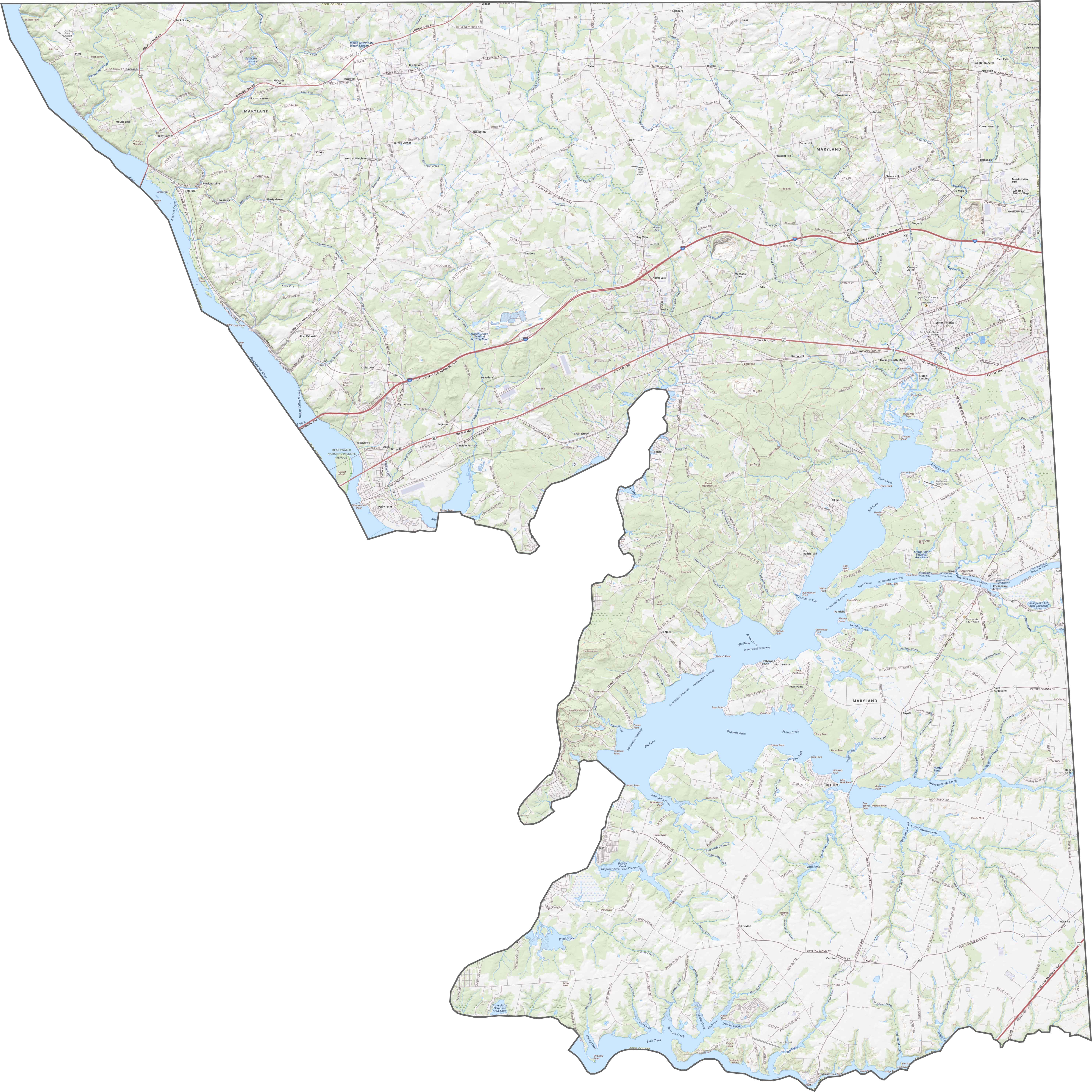
TRANSPORTATION MAP
Cecil County Road Map
Interstate 95 runs east-west through Cecil County, connecting Baltimore to Philadelphia.. Another major east-west routes include Route 40, which serve local communities. The county has several bridges crossing the Susquehanna River, including the Hatem Memorial Bridge. Zoom in our map below for a more detailed view.
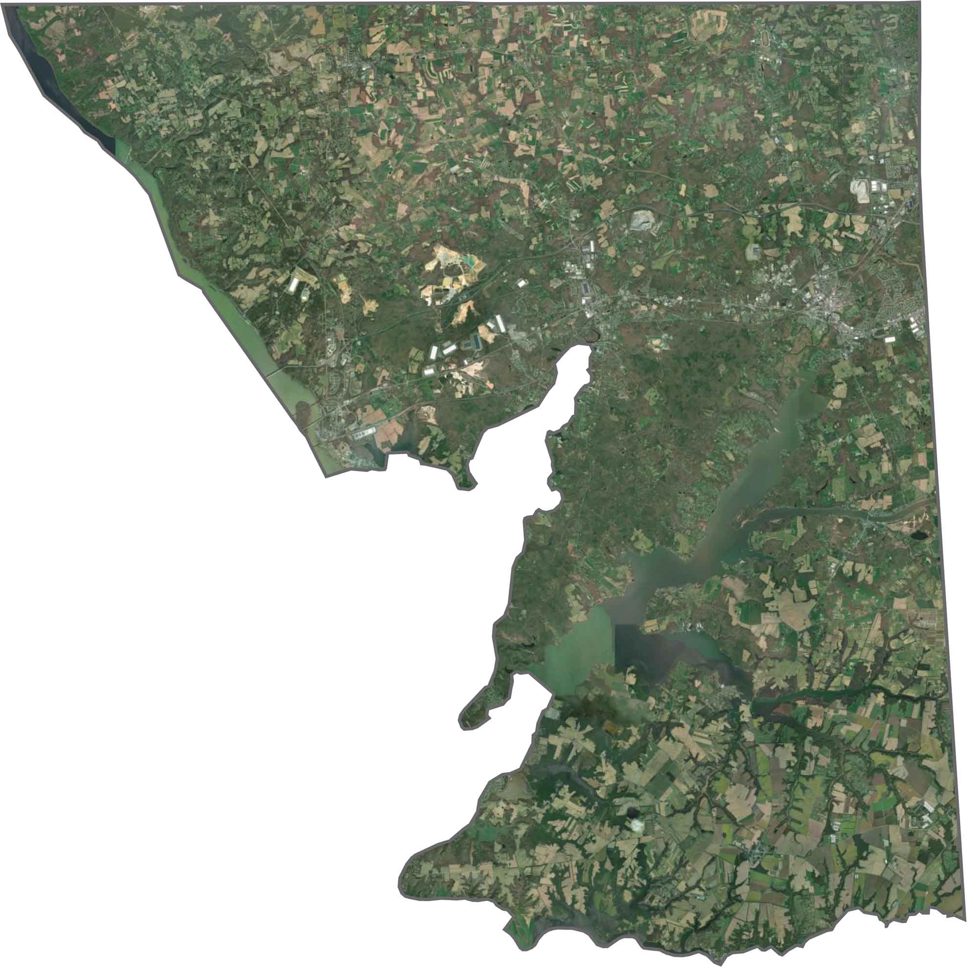
SATELLITE IMAGERY
Cecil County Satellite Map
From above, Cecil County shows a mix of agricultural fields, forested areas, and developed corridors along major highways. The Conowingo Dam is clearly visible on the Susquehanna River, with its large reservoir stretching northward. Finally, the coastal areas display wetlands along the bay shoreline.
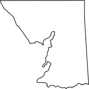
OUTLINE MAP
Cecil County Blank Map
Cecil County occupies Maryland’s northeastern corner, bordering both Pennsylvania and Delaware. The Susquehanna River and Chesapeake Bay forms the entire western boundary. Its irregular shape includes several peninsulas extending into the Chesapeake Bay.

Neighboring Counties
Here are the 5 neighboring counties of Cecil County:


Maryland County Map

With 23 counties and Baltimore City, Maryland gives you a distinct experience in every corner. City life, small towns, and outdoor adventures all come together. Learn more in our Maryland county maps.