Lancaster County Map, Pennsylvania

Lancaster County Map Collection

We allow you to use our Lancaster County map. Attribution is required.
Lancaster County, Pennsylvania

Lancaster County sits right in the heart of southeastern Pennsylvania. You’ve probably heard of Amish country. Well, that’s Lancaster County for you. America’s oldest Amish settlement is here.
But don’t think it’s all old-fashioned because Lancaster city has a hip food scene that’ll surprise you. Visitors love this place too. The area played a big role in the Revolutionary War.
Oh, and did I mention the covered bridges? There are 25 of ’em. People come from all over to see the Pennsylvania Dutch Country. It’s a unique piece of America you won’t find anywhere else.
| Category | Details |
|---|---|
| County Name | Lancaster County |
| County Seat | Lancaster |
| Population | Approximately 560,000 |
| Cities, Towns, and Communities | Lancaster, Ephrata, Lititz, Manheim, Mount Joy, Elizabethtown, New Holland, Columbia |
| Interstates and Highways | U.S. Highway 30, U.S. Highway 222, U.S. Highway 322, State Highway 283 |
| FIPS Code | 42-071 |
| Total Area (Land and Water) | 984 square miles (944 sq mi land, 40 sq mi water) |
| Adjacent Counties (and Direction) | Lebanon County (North), Berks County (Northeast), Dauphin County (Northwest), Cecil County, Maryland (South), Harford County, Maryland (Southwest), Chester County (East), York County (West) |
| Time Zone | Eastern Time Zone (EST) |
| State | Pennsylvania |
| Coordinates | 40°03’N, 76°18’W |
| Etymology | Named after Lancaster, England |
| Major Landmarks | Amish Country, Long’s Park, Dutch Wonderland, Landis Valley Village & Farm Museum, Strasburg Railroad |
| Website | Lancaster County Website |
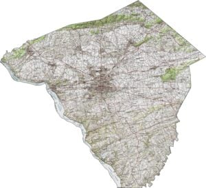
PHYSICAL MAP
Lancaster County Topographic Map
The land in Lancaster County is mostly gentle and rolling. Elevation changes are minor, but they shape the flow of streams and farmland. It’s fertile ground with long valleys, soft hills, and open views. The southern half becomes hillier but stays navigable.
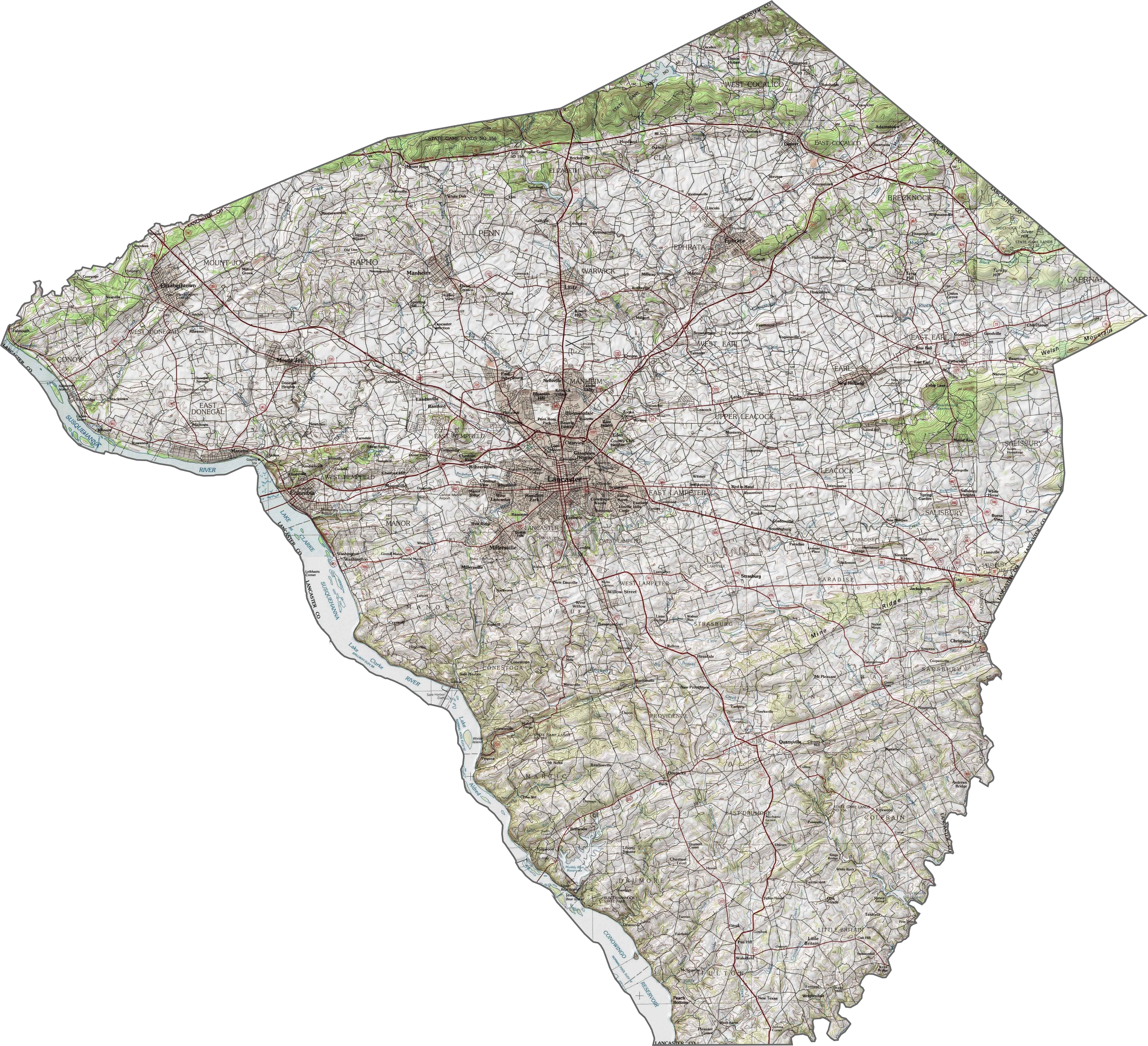
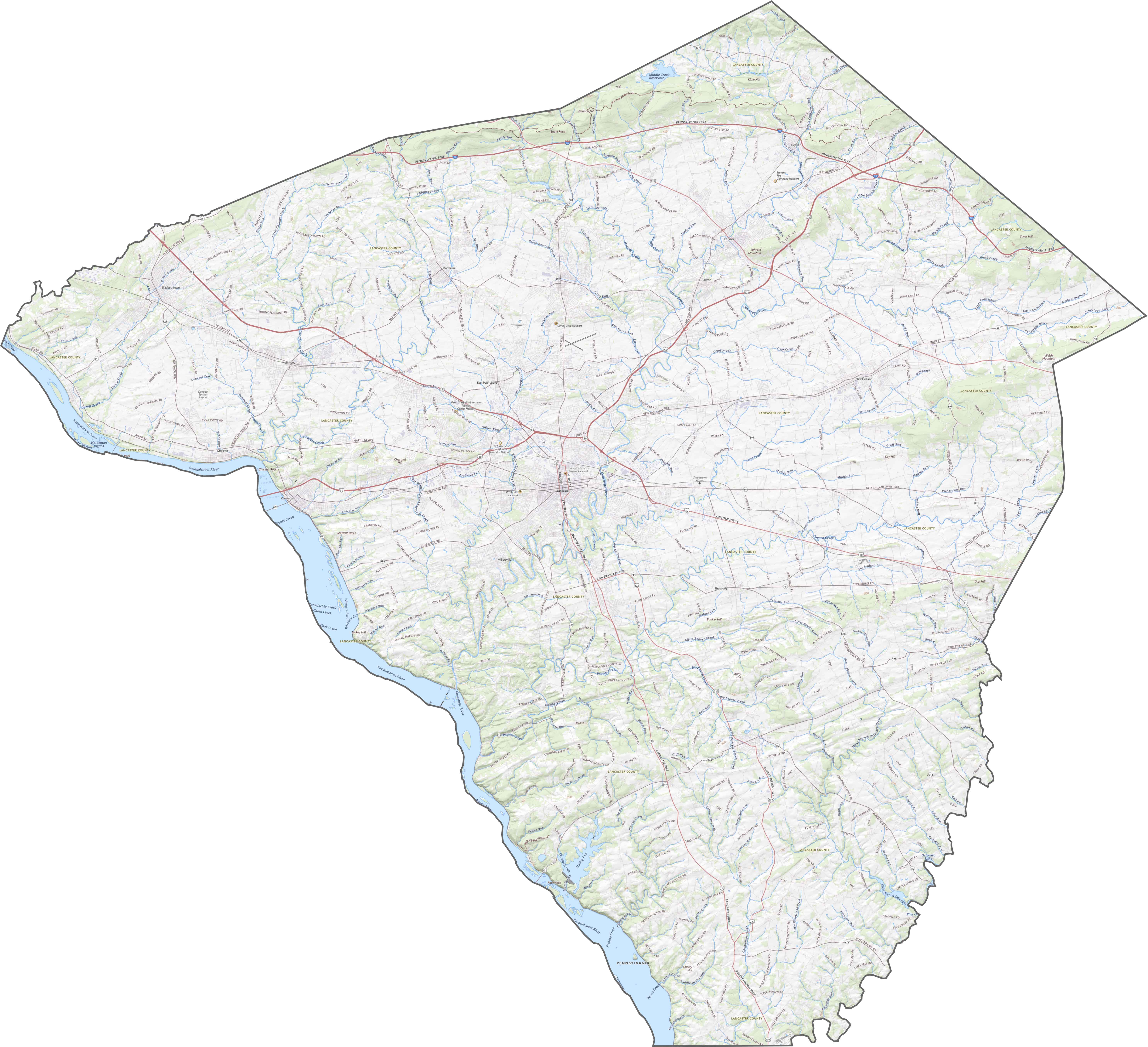
TRANSPORTATION MAP
Lancaster County Road Map
Lancaster County has an orderly, well-traveled highway grid. Major roads like I-76 and U.S. 222 crisscross farm country and Lancaster. Some routes are wide and fast. But others meander between silos and pastures.
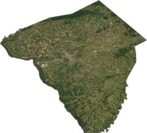
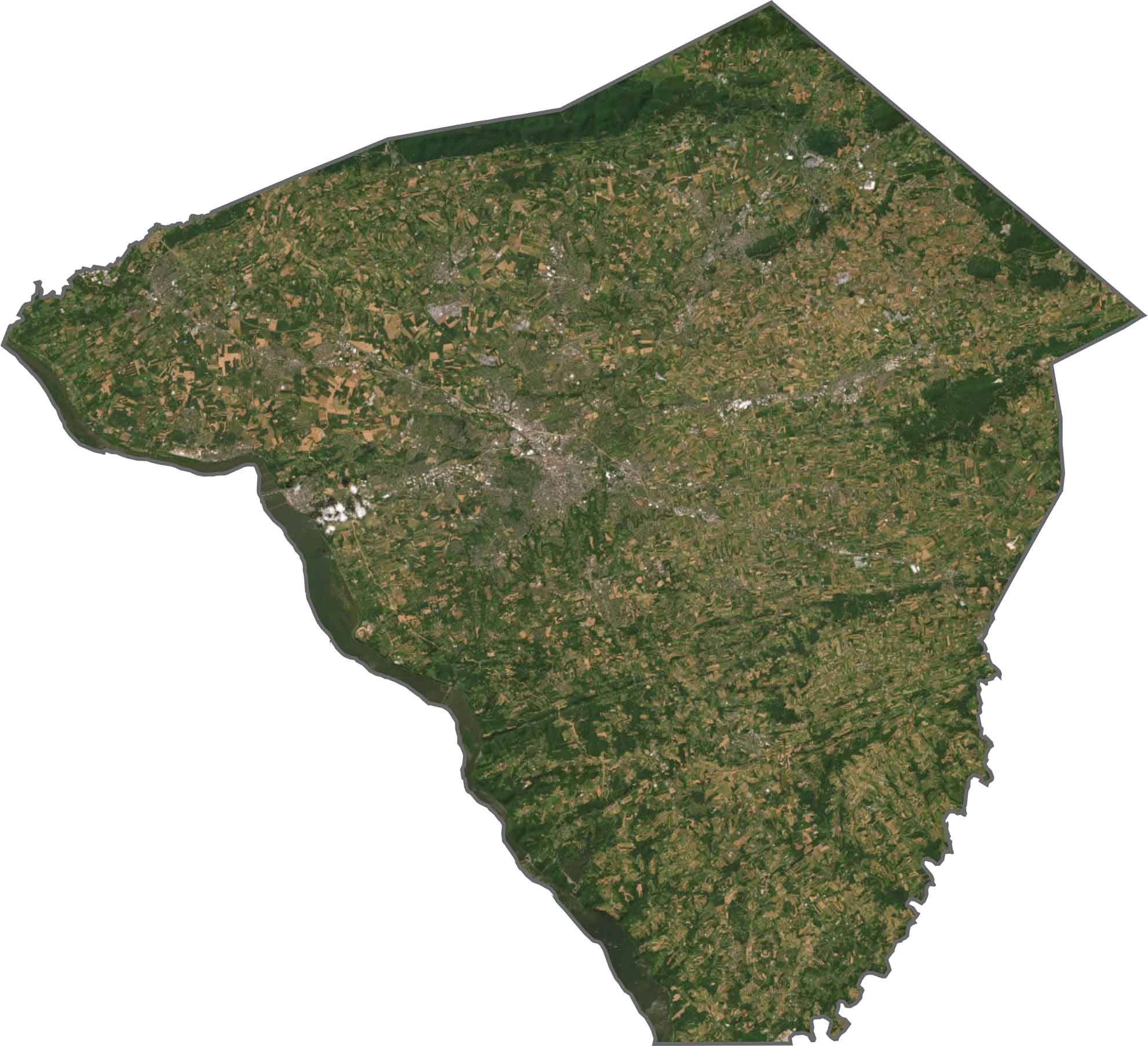
SATELLITE IMAGERY
Lancaster County Satellite Map
Lancaster County has plenty of green and tan because of its farm fields. Lancaster city shows up clearly in the center. Scattered barns and winding creeks cover the countryside. Susquehanna River forms the western boundary.
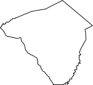
OUTLINE MAP
Lancaster County Blank Map
Lancaster’s shape is wide at the top and narrows toward the bottom. The western border follows the curve of the Susquehanna River. To the south, it touches Maryland.

Neighboring Counties
Here are the 7 neighboring counties of Lancaster County:


Pennsylvania County Map

Pennsylvania’s 67 counties contains steel city lights, Amish country backroads, and Pocono mountain escapes. Mileage may vary, but the stories won’t.