Clarke County Map, Georgia

Clarke County Map Collection


We allow you to use our Clarke County map. Attribution is required.
Clarke County, Georgia

Clarke County is a different breed of Georgia county. It’s small, urban, and proud of it. Athens dominates the landscape, a college town with a world-class music scene. The University of Georgia calls it home, giving the whole place a youthful energy.
The county is named after Elijah Clarke, a Revolutionary War hero. Unlike most Georgia counties, you won’t find much farmland here. It’s all about education, healthcare, and that famous Athens nightlife.
The Oconee River cuts through town, offering a bit of nature in the urban sprawl. Clarke County has a quirky vibe all its own. You’ve got your college students, your townies, and your professors all mixing it up.
| Category | Details |
|---|---|
| County Name | Clarke County |
| County Seat | Athens |
| Population | Approximately 130,000 |
| Cities, Towns, and Communities | Athens (the only city), Winterville, and several unincorporated areas |
| Interstates and Highways | US 78, US 129, State Route 10, State Route 15 |
| FIPS Code | 13-059 |
| Total Area (Land and Water) | 121 square miles (land: 114 sq mi, water: 7 sq mi) |
| Adjacent Counties (and Direction) | Madison County (Northeast), Oglethorpe County (East), Oconee County (Southwest), Barrow County (West), Jackson County (Northwest) |
| Time Zone | Eastern Time Zone (ET) |
| State | Georgia |
| Coordinates | 33.9495° N, 83.3576° W |
| Etymology | Named after Elijah Clarke, a Revolutionary War hero |
| Major Landmarks | University of Georgia, Sanford Stadium, and the Georgia Museum of Art |
| Website | Clarke County Website |
PHYSICAL MAP
Clarke County Topographic Map
This topographic map shows Clarke County’s moderate hills with several creek valleys. Athens sits between the North and Middle Oconee Rivers on hilly terrain. Use our zoom tool to view Sandy Creek Park and the entire Clarke County.

SATELLITE IMAGERY
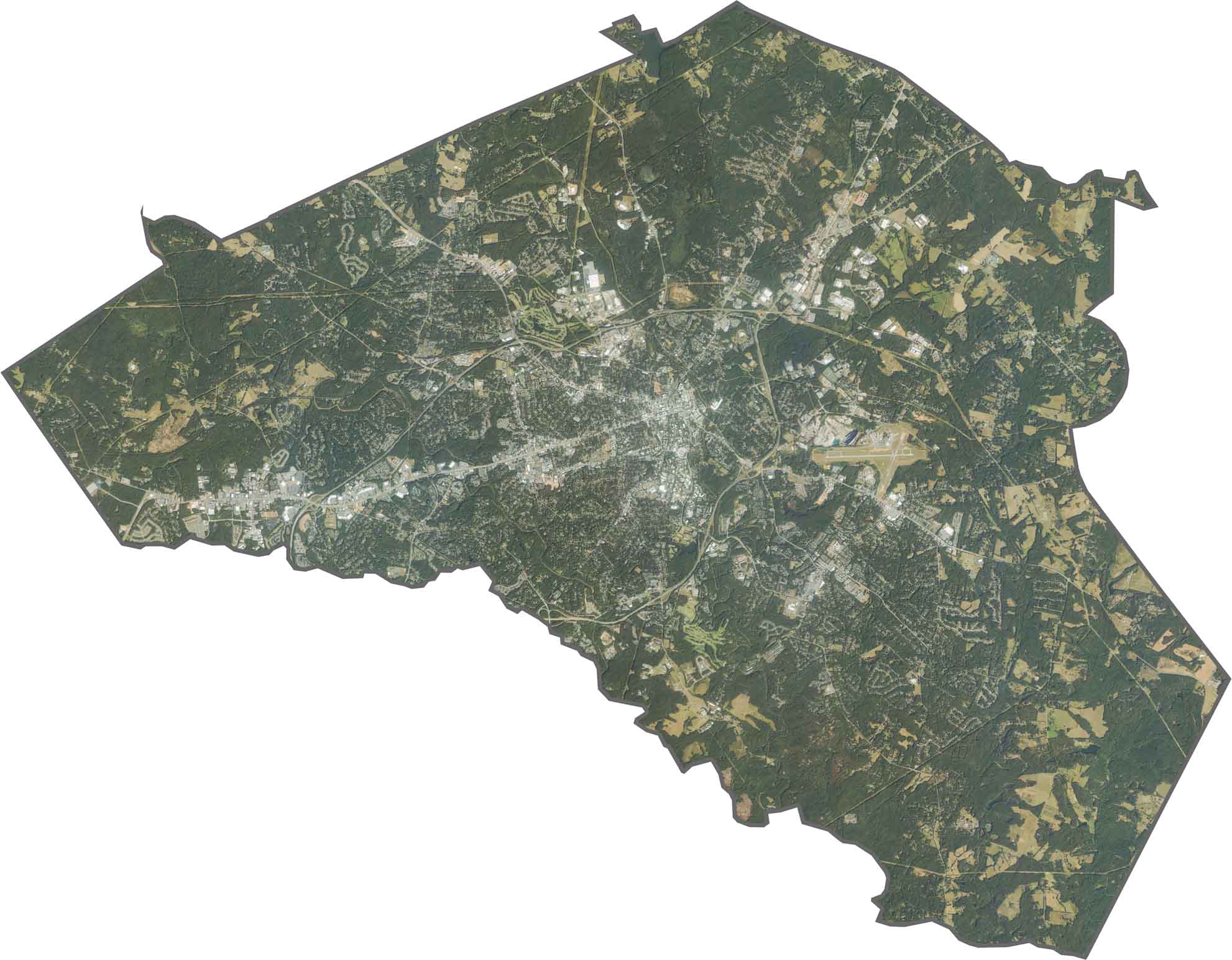
Clarke County Satellite Map
This satellite map reveals Clarke’s compact urban core surrounded by green spaces. The western section of this map shows more residential areas. Whereas the State Botanical Garden creates a green buffer.
OUTLINE MAP
Clarke County Blank Map
Clarke County has a small, roughly triangular shape. The Middle Oconee River forms the western edge, separating it from Oconee County.

Neighboring Counties
Here are the 5 neighboring counties of Clarke County:


Georgia County Map

Just launched! Our Georgia county map shows all 159 counties in stunning detail. It’s the perfect resource you’ve been waiting for. Don’t miss out on the Peach State.