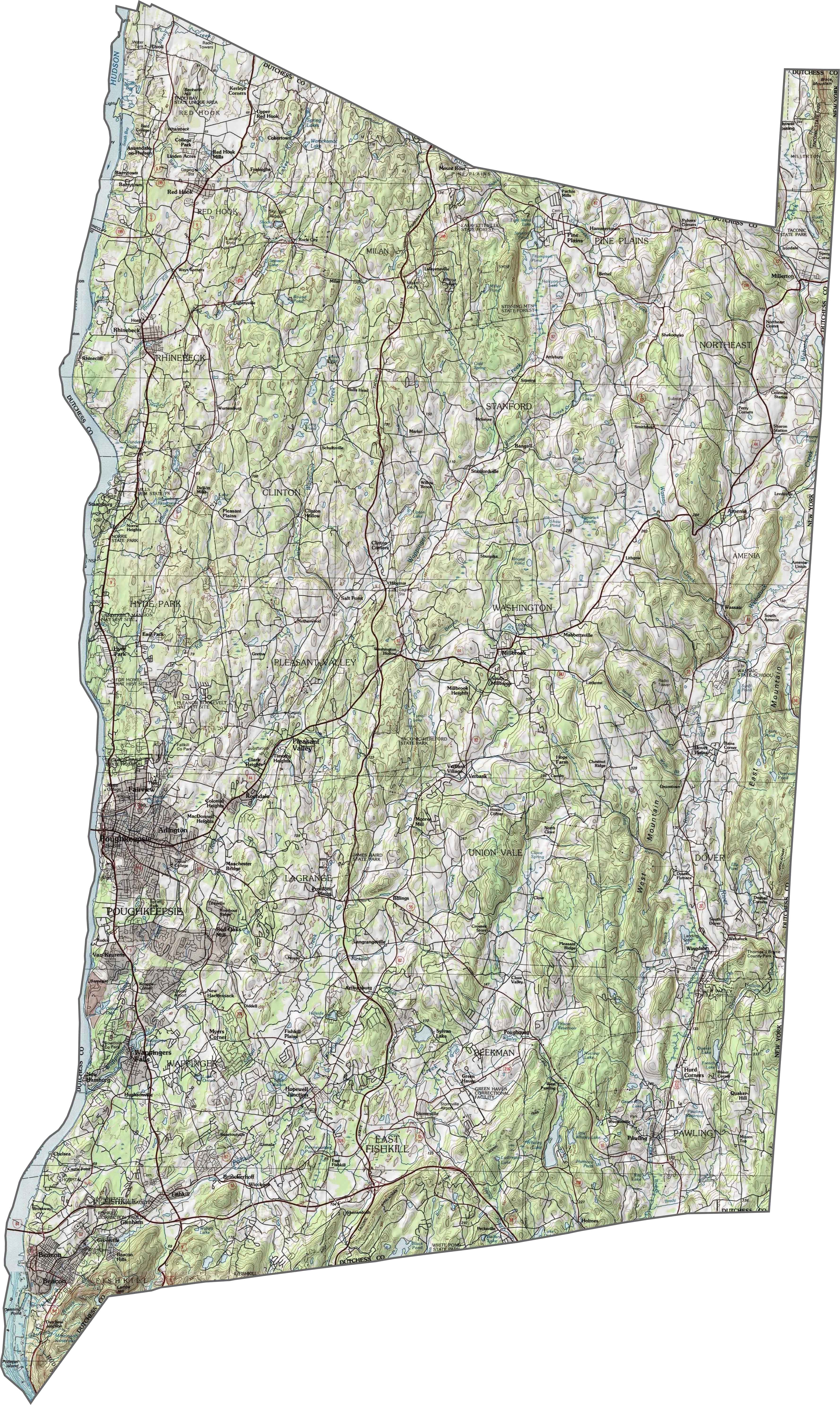
Dutchess County Map, New York

Dutchess County Map Collection

We allow you to use our Dutchess County map. Attribution is required.
Dutchess County, New York

Dutchess County stretches along the eastern bank of the Hudson River, about halfway between New York City and Albany. It’s a place where history and hipster culture collide. Poughkeepsie is the county seat. It’s home to the Walkway Over the Hudson, the world’s longest elevated pedestrian bridge.
You can’t talk about Dutchess without mentioning the Culinary Institute of America in Hyde Park. The area has deep roots in America’s story, with FDR’s home and presidential library. Beacon has transformed from an old factory town into an art lover’s paradise.
The county boasts some of the oldest wineries in the country. Rhinebeck brings in visitors with its upscale boutiques and farm-to-table restaurants. Visitors also love exploring the Appalachian Trail as it winds through the eastern part of the county.
| Category | Details |
|---|---|
| County Name | Dutchess County |
| County Seat | Poughkeepsie |
| Population | Approximately 308,000 |
| Cities, Towns, and Communities | Poughkeepsie, Beacon, Hyde Park, Fishkill, Wappingers Falls, Rhinebeck |
| Interstates and Highways | Interstate 84, U.S. Route 9, New York State Route 22, Taconic State Parkway |
| FIPS Code | 36-027 |
| Total Area (Land and Water) | 825 square miles (796 sq mi land, 29 sq mi water) |
| Adjacent Counties (and Direction) | Columbia County (North), Berkshire County, Massachusetts (Northeast), Litchfield County, Connecticut (East), Fairfield County, Connecticut (Southeast), Putnam County (South), Orange County (Southwest), Ulster County (West) |
| Time Zone | Eastern Time Zone (ET) |
| State | New York |
| Coordinates | 41.7856° N, 73.7380° W |
| Etymology | Named after Mary of Modena, Duchess of York, wife of James II of England |
| Major Landmarks | FDR Home National Historic Site, Walkway Over the Hudson, Vanderbilt Mansion National Historic Site |
| Website | Dutchess County Website |
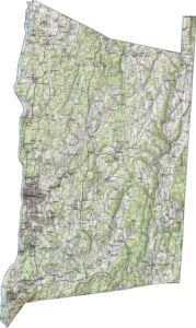
PHYSICAL MAP
Dutchess County Topographic Map
In Dutchess County, the west is low and flat near the river. But elevation rises quickly to the east. The eastern half is full of ridges and valleys. Though not massive, the hills shape where towns and roads go. Check it all out in our topographic map below.
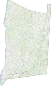
TRANSPORTATION MAP
Dutchess County Road Map
Dutchess County is well-connected for its transportation system. U.S. Route 9, I-84, and NY-22 are some of the key highways here. The terrain makes road layouts curvy in places. Try out our zoom tool in our road map below.

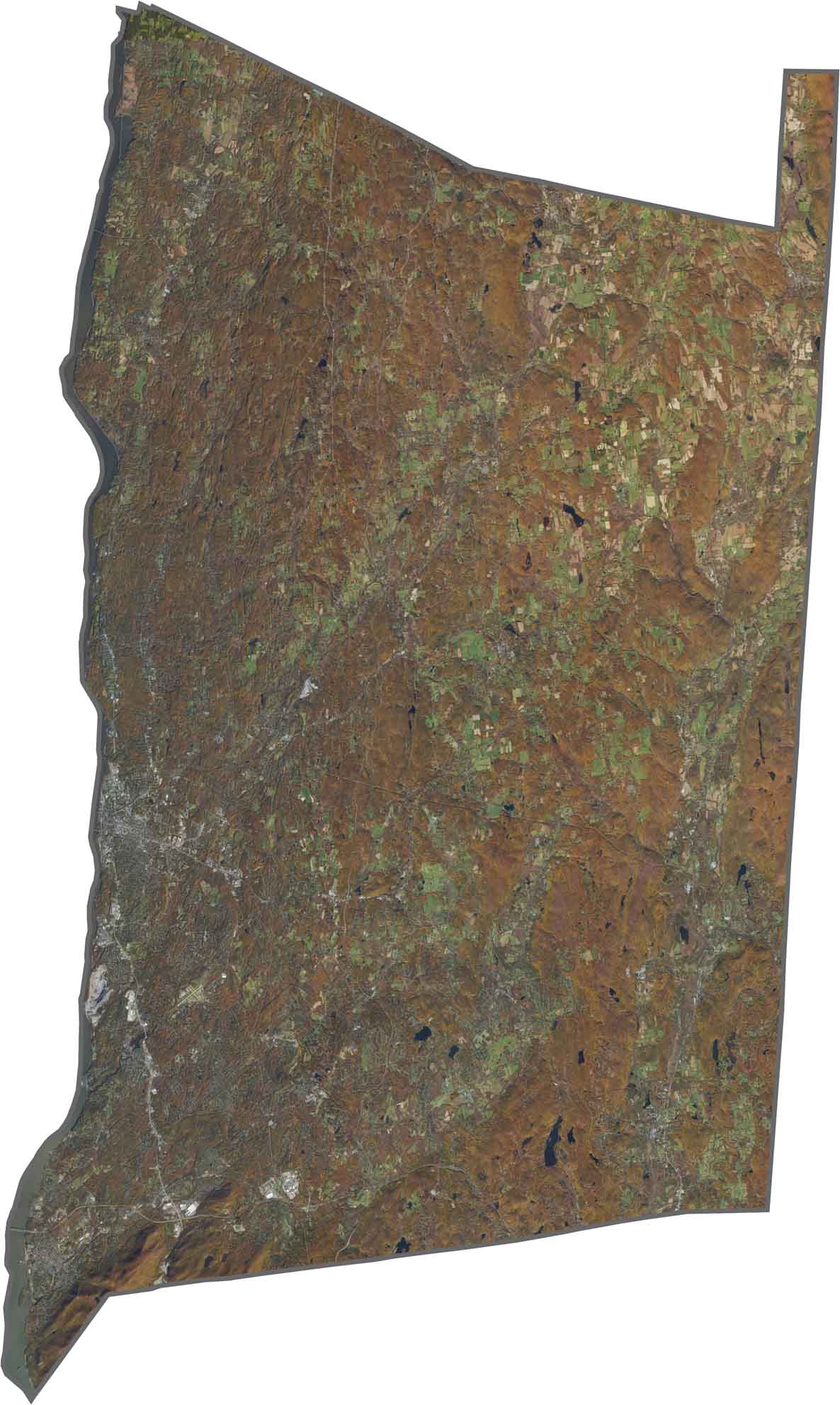
SATELLITE IMAGERY
Dutchess County Satellite Map
Green and browns cover the view, especially east of Poughkeepsie. Forests and farmland fill most of the space outside towns. The Hudson River fills along the western edge. Though Poughkeepsie stands out, much of the county looks rural from above.
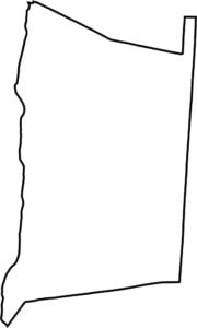
OUTLINE MAP
Dutchess County Blank Map
Dutchess County has a long, narrow shape stretching north–south. Its entire western border is the Hudson River. To the east, it borders Connecticut.

Neighboring Counties
Here are the 7 neighboring counties of Dutchess County:


New York County Map

New York has 62 counties. Each with their own attitude. Manhattan’s chaos to the Adirondacks’ silence… and how about those Buffalo wings? Explore our NY counties maps.