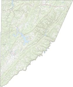
Garrett County Map, Maryland

Garrett County Map Collection


We allow you to use our Garrett County map. Attribution is required.
Garrett County, Maryland

Maryland’s westernmost corner is home to Garrett County, a place where nature lovers can find their paradise. It’s a land of rolling hills, dense forests, and sparkling lakes.
The county boasts some of the state’s highest elevations, including Hoye-Crest, which sits atop Backbone Mountain.
Summers are mild and ideal for hiking, fishing, and camping. Deep Creek Lake is the largest inland body of water in Maryland. People love to come here and hang out by the water.
| Category | Details |
|---|---|
| County Name | Garrett County |
| County Seat | Oakland |
| Population | 30,000 |
| Cities, Towns, and Communities | Oakland, Mountain Lake Park, Friendsville, Accident, McHenry, Deer Park, and several unincorporated communities |
| Interstates and Highways | U.S. Route 40, U.S. Route 219, Maryland Route 135, Maryland Route 495 |
| FIPS Code | 24-023 |
| Total Area (Land and Water) | 655.2 square miles (land: 647.8 sq mi, water: 7.4 sq mi) |
| Adjacent Counties (and Direction) | Fayette County, Pennsylvania (Northwest), Somerset County, Pennsylvania (North), Allegany County, Maryland (East), Grant County, West Virginia (South), Mineral County, West Virginia (Southeast), Preston County, West Virginia (West) |
| Time Zone | Eastern Time Zone (EST) |
| State | Maryland |
| Coordinates | 39.55°N, 79.40°W |
| Etymology | Named after John Work Garrett, president of the Baltimore and Ohio Railroad |
| Major Landmarks | Deep Creek Lake, Wisp Resort, Swallow Falls State Park, Casselman River Bridge State Park |
| Website | Garrett County Website |
TRANSPORTATION MAP
Garrett County Road Map
Focus in on specific features with our detailed zoom tool and Garrett County road map. You’ll find highways like I-68 that climbs stubbornly over the mountains amongst many others.

SATELLITE IMAGERY
Garrett County Satellite Map
Garrett County is covered with forest interrupted only by Deep Creek Lake’s jagged blue hole. Tiny towns cling to valleys, their straight roads contrasting with the natural chaos.

OUTLINE MAP
Garrett County Blank Map
West Virginia chews into the county’s western side with crooked teeth. The Mason-Dixon Line slices the north, while the Potomac River starts as a trickle along the southern edge.

Neighboring Counties
Here are the 6 neighboring counties of Garrett County:


Maryland County Map

With 23 counties and Baltimore City, Maryland gives you a distinct experience in every corner. City life, small towns, and outdoor adventures all come together. Learn more in our Maryland county maps.