Gaston County Map, North Carolina

Gaston County Map Collection
We allow you to use our Gaston County map. Attribution is required.
Gaston County, North Carolina

Gaston County is in west North Carolina, bordering South Carolina. The Catawba River forms the eastern border of Gaston County. The whole county is just west of Charlotte. Gastonia is the county seat and biggest city with a revitalized downtown.
Crowders Mountain State Park is a rock climber’s paradise. You can see the Charlotte skyline from the top on a clear day. The Daniel Stowe Botanical Garden is a stunner, especially during the holidays. The Schiele Museum of Natural History is way cooler than you’d expect.
This place has serious textile roots. Old mill towns have found new purpose, becoming trendy spots for living and playing. Belmont Abbey College adds some collegiate flavor. Craft breweries and farm-to-table restaurants are popping up all over.
| Category | Details |
|---|---|
| County Name | Gaston County |
| County Seat | Gastonia |
| Population | Approximately 240,000 |
| Cities, Towns, and Communities | Gastonia, Belmont, Mount Holly, Bessemer City |
| Interstates and Highways | Interstate 85, U.S. Route 74, U.S. Route 321 |
| FIPS Code | 37-071 |
| Total Area | 368 square miles (land and water) |
| Adjacent Counties | Lincoln County (North), Mecklenburg County (East), York County, South Carolina (South), Cleveland County (West) |
| Time Zone | Eastern Time Zone |
| State | North Carolina |
| Coordinates | 35.2865° N, 81.1871° W |
| Etymology | Named after William Gaston, a United States Congressman |
| Major Landmarks | Daniel Stowe Botanical Garden, Schiele Museum of Natural History |
| Website | Gaston County Website |
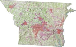
PHYSICAL MAP
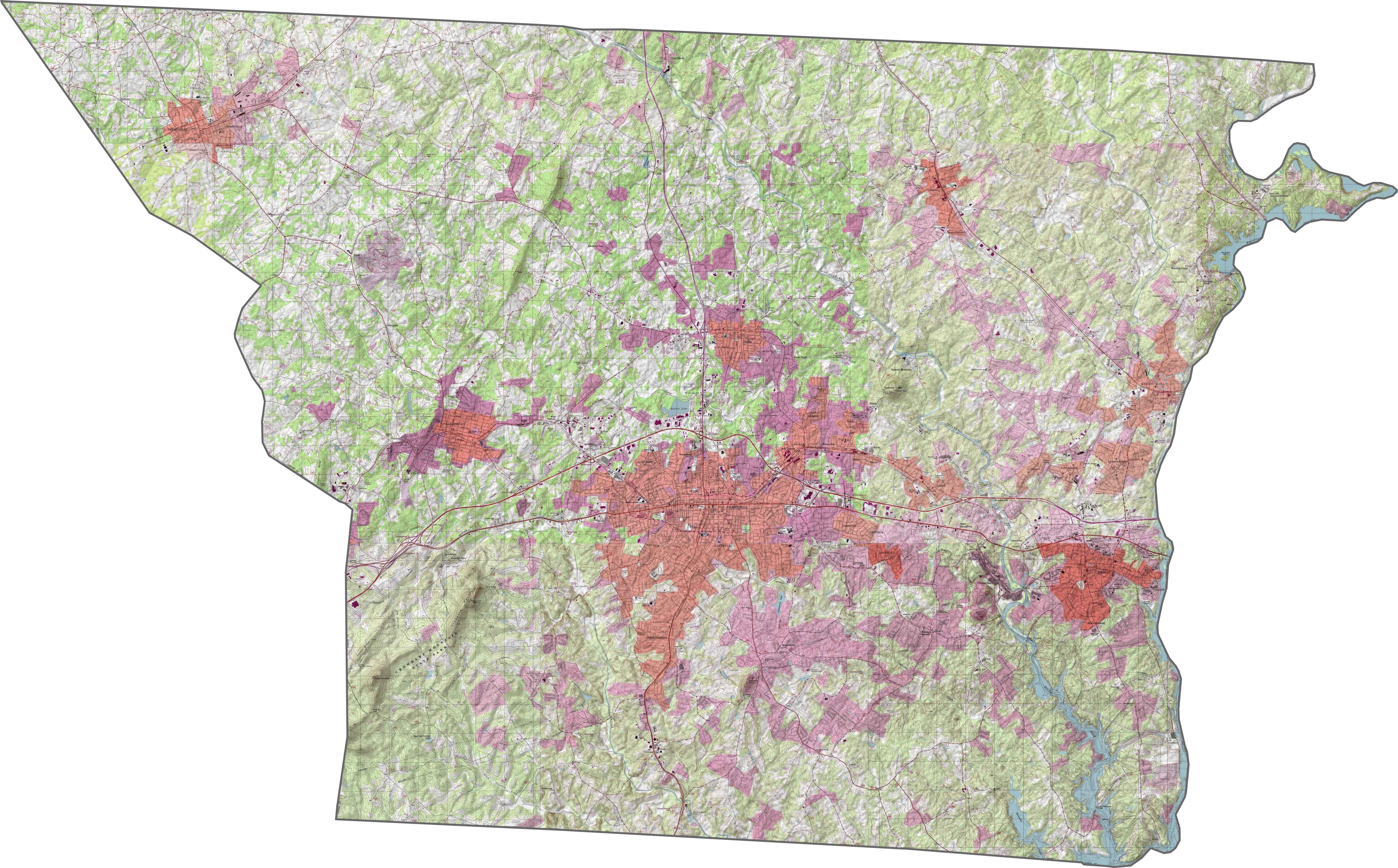
Gaston County Topographic Map
Gaston County is definitely not flat. It lies in the Piedmont with hints of the foothills. Crowders Mountain rises in the west, breaking the pattern. Elsewhere, low ridges and rolling ground fill the scene. Our zoomable map shows the full elevation contours.
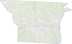
TRANSPORTATION MAP
Gaston County Road Map
In our road map, you’ll see how roads run between riverbanks, mills, and bedroom communities. I-85 slices right through Gaston from east to west. But U.S. Route 321 cuts north-south. Even though some roads curve around lakes and hills, most are fast-moving.

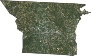
SATELLITE IMAGERY
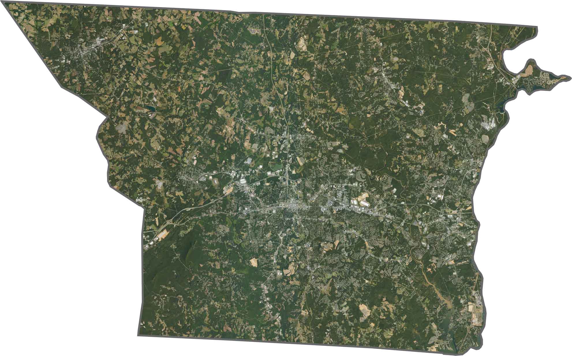
Gaston County Satellite Map
From above, Gastonia dominates the center. But Crowders Mountain and Kings Mountain parks stand out in dark green. The Catawba River hugs the eastern edge. Suburbs stretch outward, but there’s still a decent balance between gray and green.
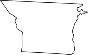
OUTLINE MAP
Gaston County Blank Map
Gaston County borders South Carolina along its southern edge. The Catawba River defines most of the eastern line. Its shape is long and low, stretching west to east with a few notches. State lines and rivers help draw the border.

Neighboring Counties
Here are the 4 neighboring counties of Gaston County:


North Carolina County Map

North Carolina’s 100 counties don’t all play by the same rules. Some lean into beach life, others into barbecue or bluegrass. Sometimes all three. You’ll find waterfalls, farmland, and NASCAR.