Kenton County Map, Kentucky

Kenton County Map Collection
We allow you to use our Kenton County map. Attribution is required.
Kenton County, Kentucky

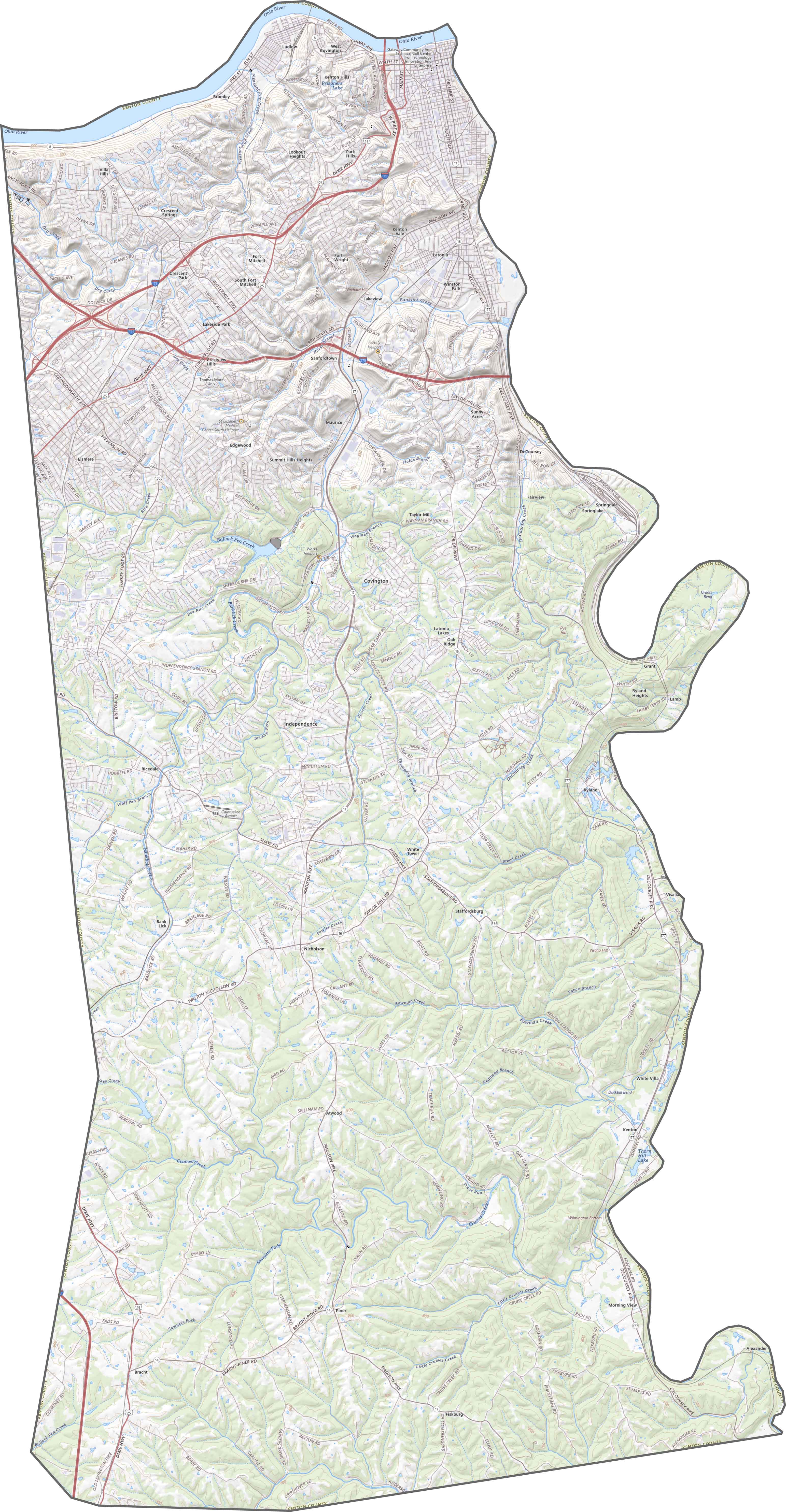
Kenton County is located in northern Kentucky. It’s part of the Greater Cincinnati metropolitan area. Covington and Independence are both county seats here.
Kenton County has a population of about 170,000 people. The county is easily accessible via I-75 and I-71, making it a key connection between Kentucky and Ohio.
Covington is known for having a riverfront area and historic neighborhoods. The Roebling Suspension Bridge, an iconic structure connecting Covington to Cincinnati.
| Category | Details |
|---|---|
| County Name | Kenton County |
| County Seat | Covington and Independence |
| Population | Approximately 170,000 |
| Cities, Towns, and Communities | Covington, Independence, Erlanger, Fort Mitchell, Edgewood |
| Interstates and Highways | I-71, I-75, I-275, US-25, KY-17 |
| FIPS Code | 21-117 |
| Total Area (Land and Water) | 164 sq mi (Land: 160 sq mi; Water: 4 sq mi) |
| Adjacent Counties (and Direction) | Hamilton County, Ohio (North), Campbell County (East), Pendleton County (Southeast), Grant County (Southwest), Boone County (West) |
| Time Zone | Eastern Time Zone (ET) |
| State | Kentucky |
| Coordinates | 38.9369° N, 84.6009° W |
| Etymology | Named after Simon Kenton, a frontiersman in Kentucky |
| Major Landmarks | Devou Park, MainStrasse Village, Kenton County Public Library |
| Website | Kenton County Website |
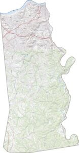
TRANSPORTATION MAP
Kenton County Road Map
Kenton County’s roads include highways like I-75 and I-71, which speed traffic toward Cincinnati. On the other hand, older roads like US 25 twist through Covington’s historic streets. Explore them all with our zoom tool and map below.
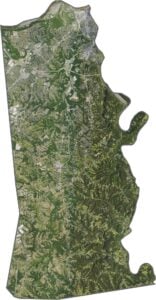
SATELLITE IMAGERY
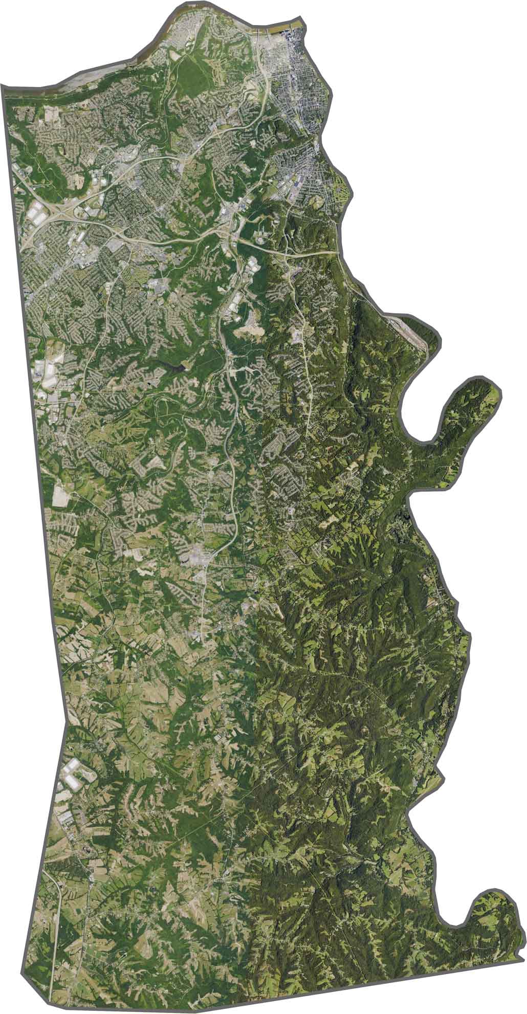
Kenton County Satellite Map
In our satellite map, you’ll see that north is developed. Whereas the south is less developed with wooded hills. The Ohio River forms the northern border with Cincinnati. Covington and Newport’s tight urban grids are pressed against its banks.
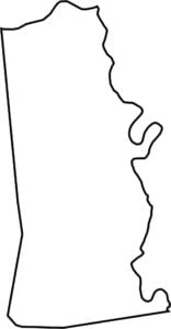
OUTLINE MAP
Kenton County Blank Map
Kenton County is elongated in the north-south directions and squeezed between the Ohio and Licking Rivers. The Ohio forms its northern border with Ohio, while the Licking separates it from Campbell County.

Neighboring Counties
Here are the 5 neighboring counties of Kenton County:


Kentucky County Map

Kentucky isn’t just bluegrass and bourbon. It’s a land where the trees grow tall and the stories grow taller. Find your path with one of our Kentucky county maps.