Lancaster County Map, South Carolina

Lancaster County Map Collection


We allow you to use our Lancaster County map. Attribution is required.
Lancaster County, South Carolina

Lancaster County is just a short distance away from Charlotte. It’s where South Carolina’s Piedmont region shows off its glory. This place is steeped in history, from its Revolutionary War sites to its gold rush past.
The county seat, Lancaster, is a classic Southern small town with quite the arts scene. You’ll find red clay hills and rolling farmland here, dotted with peach orchards and cattle ranches.
People who love the outdoors enjoy Andrew Jackson State Park. Speaking of which… The county’s got a quirky claim to fame: it’s the birthplace of Andrew Jackson, the seventh U.S. president.
| Category | Details |
|---|---|
| County Name | Lancaster County |
| County Seat | Lancaster |
| Population | Approximately 109,000 |
| Cities, Towns, and Communities | Lancaster, Kershaw, Heath Springs, Indian Land |
| Interstates and Highways | U.S. Highway 521, U.S. Highway 21 |
| FIPS Code | 45-057 |
| Total Area (Land and Water) | 555 square miles (549 sq mi land, 6 sq mi water) |
| Adjacent Counties (and Direction) | Union County, North Carolina (Northeast), Chesterfield County (East), Kershaw County (South), Fairfield County (Southwest), York County (West), Chester County (West), Mecklenburg County, North Carolina (North) |
| Time Zone | Eastern Time Zone (EST) |
| State | South Carolina |
| Coordinates | 34°42’N, 80°46’W |
| Etymology | Named after the English city of Lancaster |
| Major Landmarks | Andrew Jackson State Park, Landsford Canal State Park, Buford’s Massacre Battlefield |
| Website | Lancaster County Website |
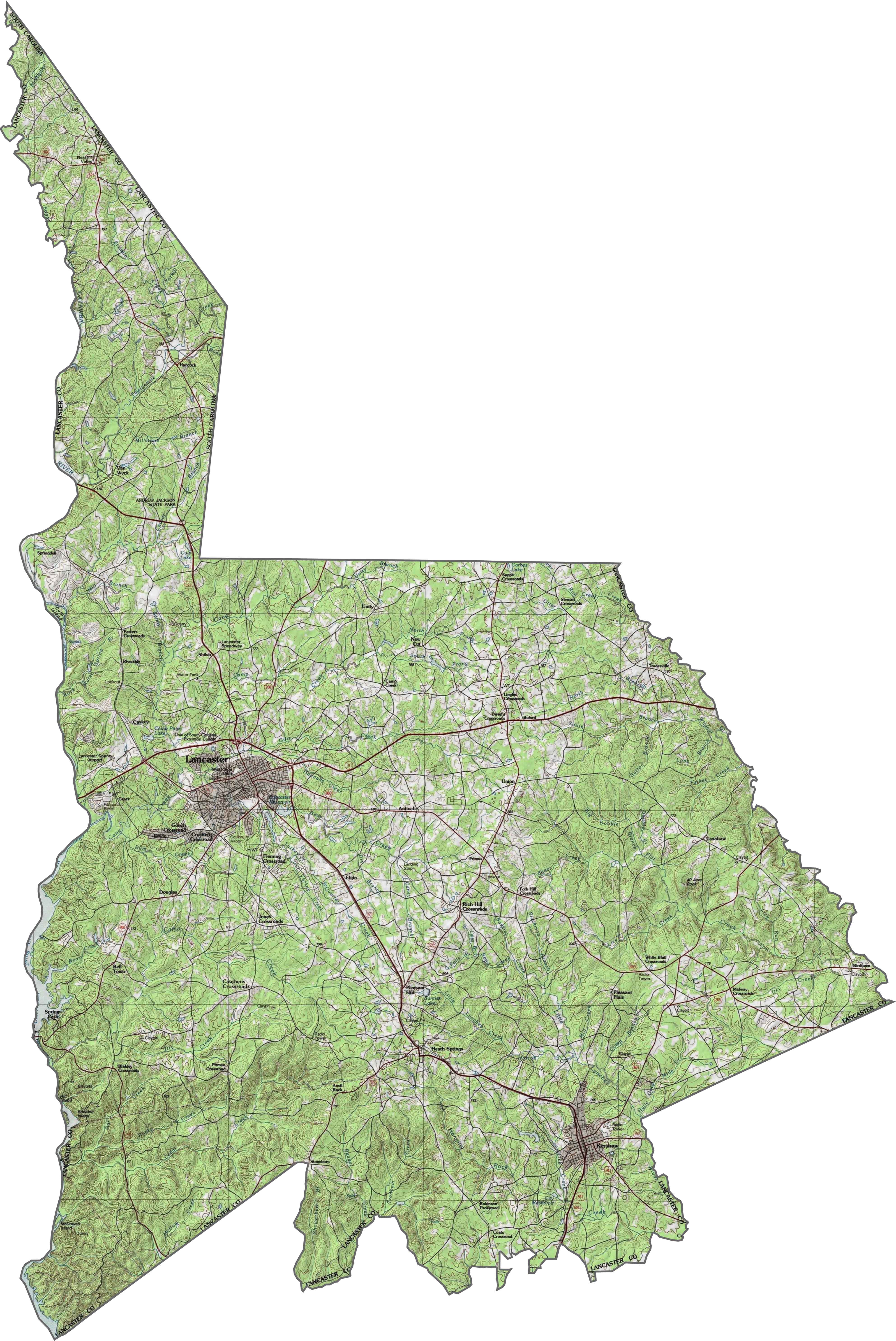
PHYSICAL MAP
Lancaster County Topographic Map
Lancaster County rises and falls across the Piedmont. It’s not mountainous, but you’ll find some real elevation swings. You can zoom in on our map to follow all of the terrain.
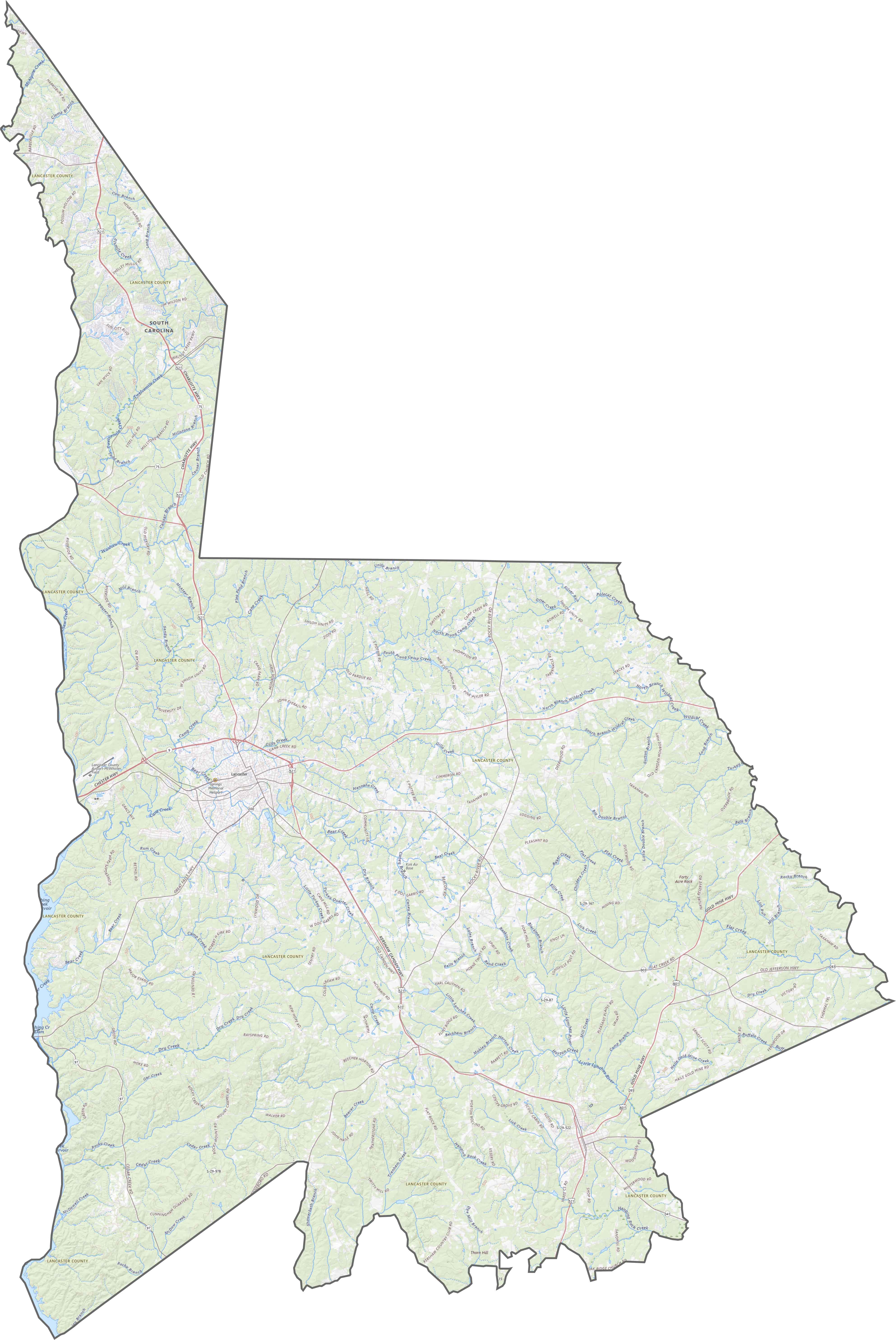
TRANSPORTATION MAP
Lancaster County Road Map
Lancaster County’s road system stretches out in long lines. Closer to the city of Lancaster, you’ll find plenty of intersections and local connectors. Everything ties together eventually though.
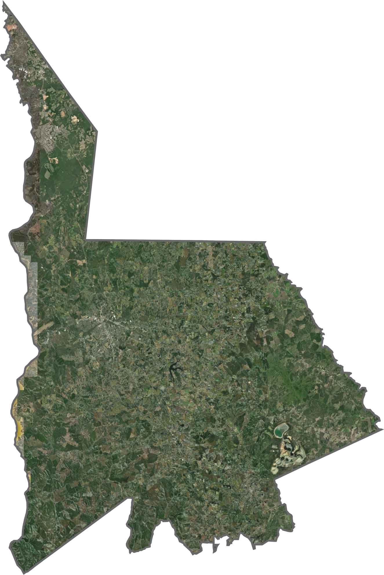
SATELLITE IMAGERY
Lancaster County Satellite Map
From above, Lancaster County is a mix of forest, farmland, and urban areas. Suburban growth has crept in from the south. The northern part appears greener, while the southern section shows more cleared land.
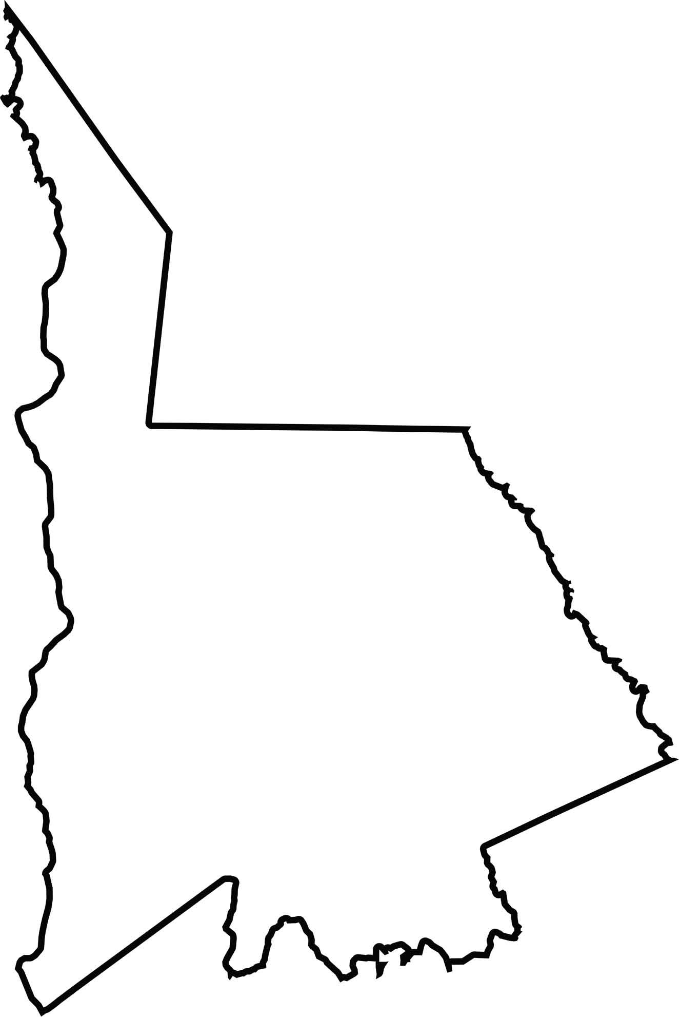
OUTLINE MAP
Lancaster County Blank Map
Lancaster has a stretched-out shape, running north to south. The northern border touches North Carolina. Curves and slight notches break up the edges. The Catawba River forms the western boundary.
Neighboring Counties
Here are the 7 neighboring counties of Lancaster County:


South Carolina County Map

South Carolina’s 46 counties keep things interesting. Some swing to beach tunes, others hum with history. You’ll find gators, grits, and gospel… sometimes all in the same afternoon.