Lorain County Map, Ohio

Lorain County Map Collection


We allow you to use our Lorain County map. Attribution is required.
Lorain County, Ohio

Lorain County sits along Lake Erie’s southern shore. It’s a place of diversity. Industrial cities rub shoulders with rural farmland. The county’s seen its share of ups and downs. Steel mills once dominated the landscape.
Now, new industries are taking their place. It’s also home to Oberlin College, a school with a rich history of social justice. The county’s got natural beauty too. Miles of Lake Erie shoreline. Lush metro parks.
Lorain County is also known for its cultural scene. Art galleries in Oberlin. Festivals in Elyria. The county’s a melting pot of cultures. You’ll find influences from all over the world here. From Polish pierogies to Puerto Rican mofongo. Lorain County is full of surprises.
| Category | Details |
|---|---|
| County Name | Lorain County |
| County Seat | Elyria |
| Population | Approximately 320,000 |
| Cities, Towns, and Communities | Elyria, Lorain, Amherst, North Ridgeville |
| Interstates and Highways | Interstate 90, U.S. Highway 20, State Route 2 |
| FIPS Code | 39-093 |
| Total Area | 491 square miles (land and water) |
| Adjacent Counties | Cuyahoga County (East), Medina County (Southeast), Ashland County (South), Huron County (Southwest), Erie County (Northwest) |
| Time Zone | Eastern Time Zone |
| State | Ohio |
| Coordinates | 41.4183° N, 82.1278° W |
| Etymology | Named after Lorraine, France |
| Major Landmarks | Lakeview Park, Black River Historical Society |
| Website | Lorain County Website |
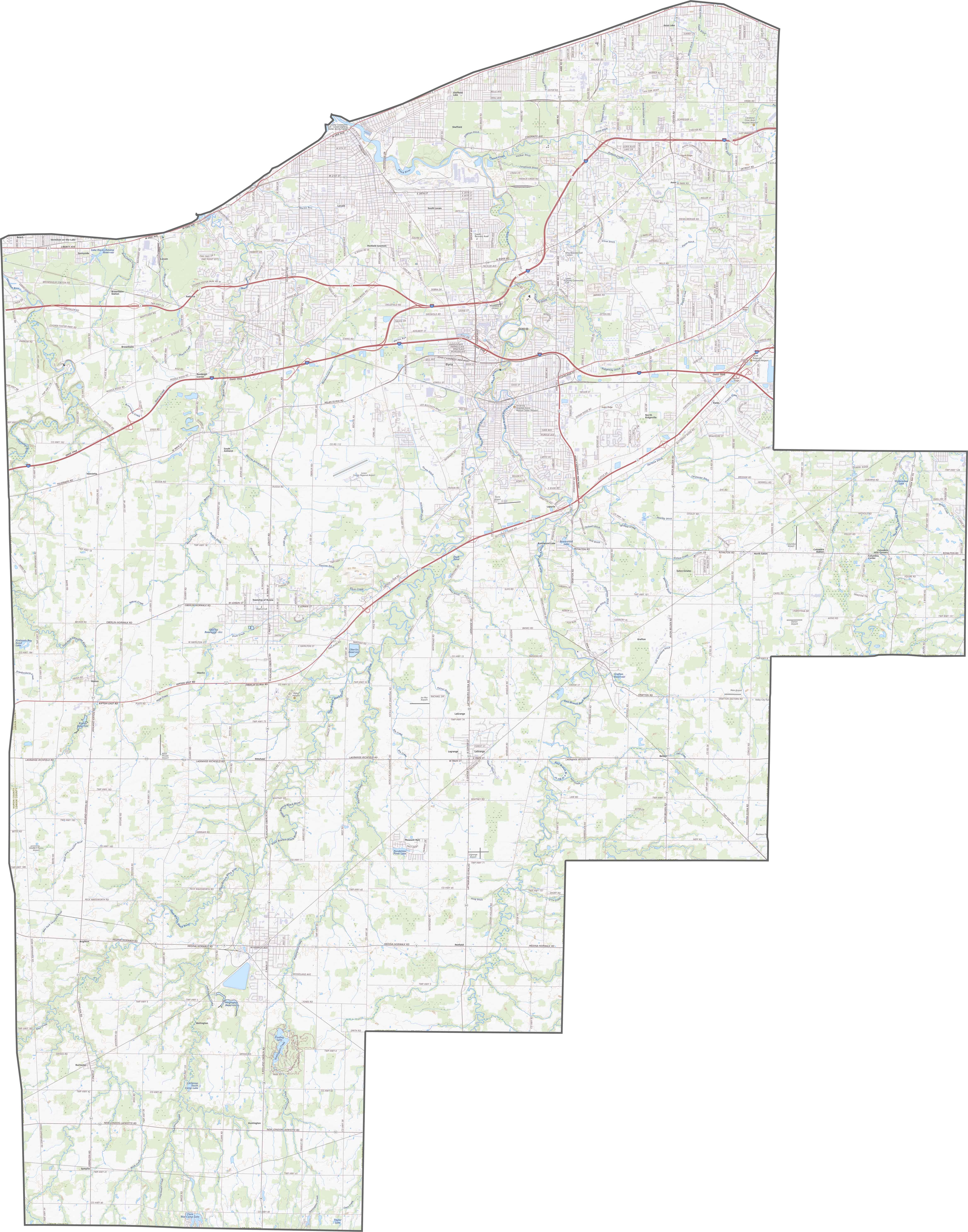
TRANSPORTATION MAP
Lorain County Road Map
Lorain County is well linked by major corridors. Interstate 90 spans the county, with U.S. Route 20 and various state routes complementing it. Although dense urban cores experience heavy traffic, less busy roads open up the rural regions.
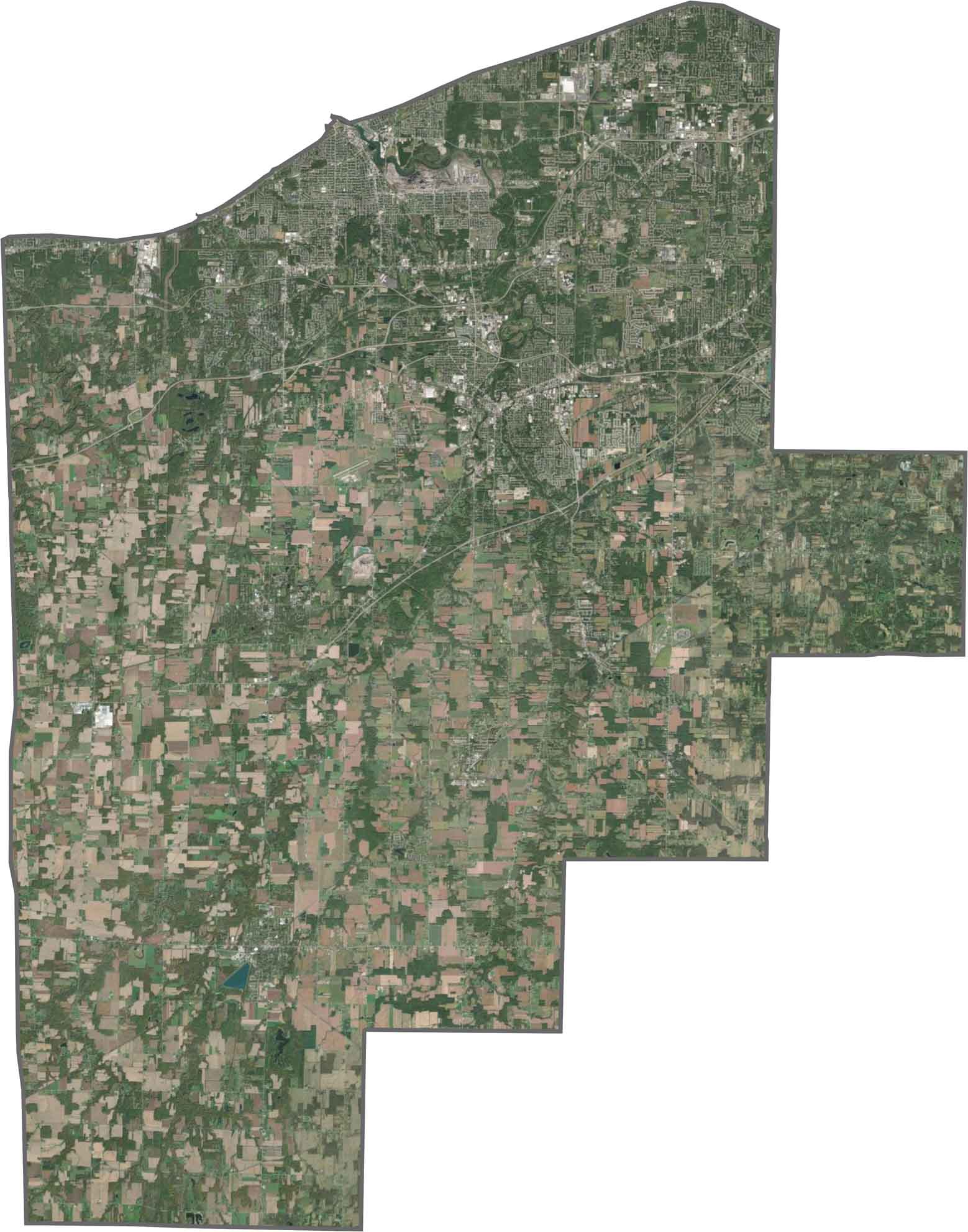
SATELLITE IMAGERY
Lorain County Satellite Map
From the sky, distinct features become clear. Urban centers like Elyria and Lorain form urban clusters. There are also quite a bit of open fields and forests.
OUTLINE MAP
Lorain County Blank Map
Lorain County’s boundary carries a notable lakeside curve. Its northern edge follows Lake Erie, which naturally softens the otherwise angular borders. Although most sides are marked by straight survey lines, the lake edge gives it a distinctive boundary.

Neighboring Counties
Here are the 5 neighboring counties of Lorain County:


Ohio County Map

Forget the coast. Ohio’s 88 counties are where real America hums. No pretense, no postcard perfection, just hard-working towns and quiet backroads that get under your skin. This is the Midwest without the filter.