Macomb County Map, Michigan

Macomb County Map Collection


We allow you to use our Macomb County map. Attribution is required.
Macomb County, Michigan

Macomb County is located just northeast of Detroit. It’s actually a part of Metro Detroit, but don’t let that fool you. This county’s got its own unique vibe.
Warren is the largest city and is a hub for tech and defense industries. You can catch a concert at Freedom Hill Amphitheatre or explore the Clinton River Trail.
The county’s eastern border hugs Lake St. Clair, offering boating and fishing galore. The diversity here is incredible with something for everyone.
| Category | Details |
|---|---|
| County Name | Macomb County |
| County Seat | Mount Clemens |
| Population | Approximately 889,000 |
| Cities, Towns, and Communities | Warren, Sterling Heights, St. Clair Shores, Roseville, Eastpointe, Clinton Township, Shelby Township, Romeo |
| Interstates and Highways | I-94, I-696, M-53, M-59 |
| FIPS Code | 26-099 |
| Total Area (Land and Water) | 570 square miles (Land: 479 sq mi, Water: 91 sq mi) |
| Adjacent Counties (and Direction) | St. Clair County (Northeast), Lapeer County (Northwest), Oakland County (West), Wayne County (South) |
| Time Zone | Eastern Time Zone (ET) |
| State | Michigan |
| Coordinates | 42.7165° N, 82.9372° W |
| Etymology | Named after General Alexander Macomb, a hero of the War of 1812 |
| Major Landmarks | Lake St. Clair Metropark, Stony Creek Metropark, Freedom Hill Amphitheatre, Michigan Transit Museum |
| Website | Macomb County Website |
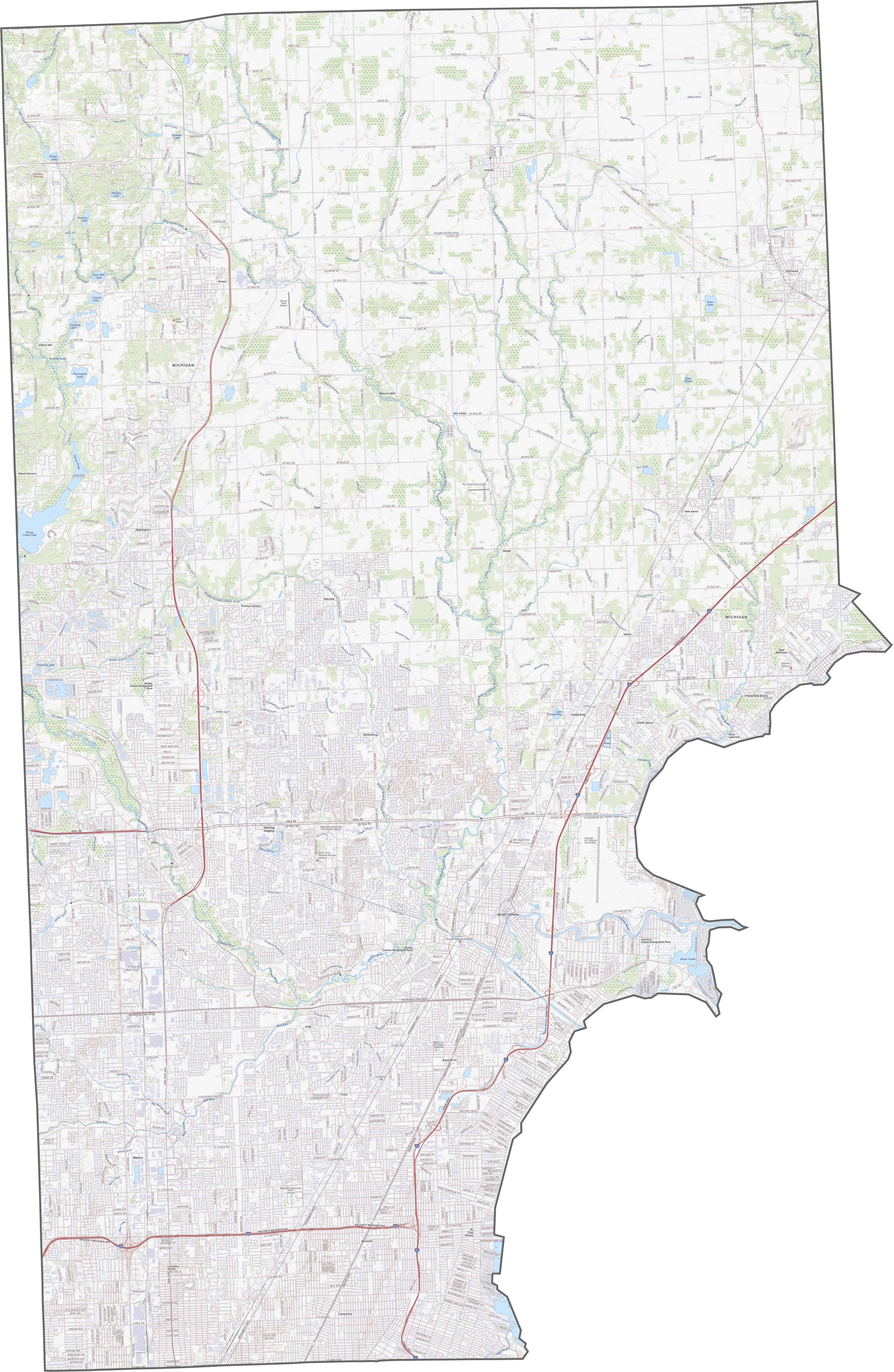
TRANSPORTATION MAP
Macomb County Road Map
Macomb County has a tightly packed highway system. I-94 runs northeast along the lake, while M-53 heads north to south across the county’s center. You can zoom in on our interactive map to follow every street and highway.
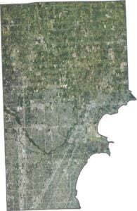
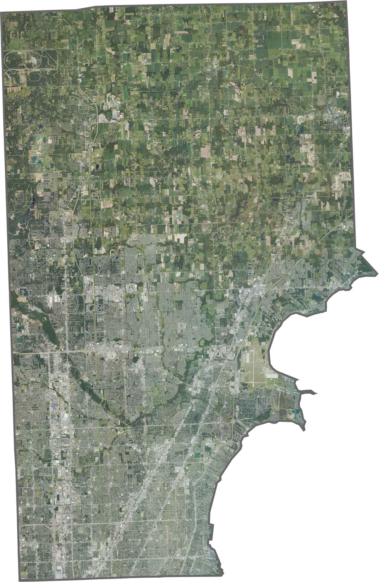
SATELLITE IMAGERY
Macomb County Satellite Map
Urban sprawl covers most of Macomb County. Though patches of farmland still survive up north, the closer you get to Detroit, the more dense the landscape looks. The Clinton River cuts through, breaking up the urban area.
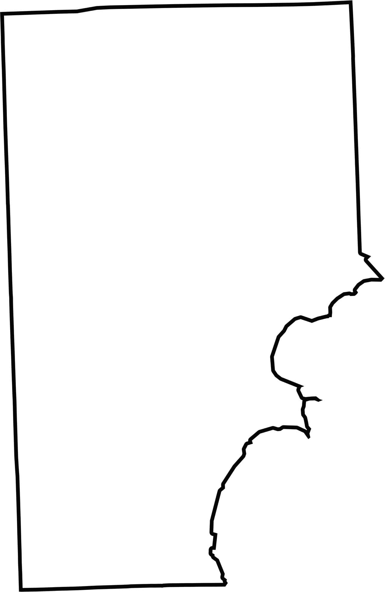
OUTLINE MAP
Macomb County Blank Map
Macomb County’s eastern edge hugs Lake St. Clair, curving slightly along the water. Although most borders are straight, the lakeshore gives it a jagged look. It doesn’t border another state, but Canada isn’t far across the lake.
Neighboring Counties
Here are the 4 neighboring counties of Macomb County:


Michigan County Map

From Motown to moose sightings, Michigan’s 83 counties deliver. Detroit roars with Motown. Ann Arbor fuels college-town cool. The Mitten serves up pure Great Lakes glory.