Merrimack County Map, New Hampshire

Merrimack County Map Collection
We allow you to use our Merrimack County map. Attribution is required.
Merrimack County, New Hampshire

Merrimack County sits right in the heart of New Hampshire, stretching from the capital city of Concord to the Lakes Region. The State House dome dominates Concord’s skyline, but drive a few miles and you’re in farm country.
Locals take pride in their maple syrup and apple orchards. The Merrimack River winds its way through with great spots for kayaking and fishing. You’ll find some of the state’s best hiking in the Bear Brook State Park.
Canterbury Shaker Village highlights its simpler past. It’s not all rural though. Towns like Hooksett are growing fast. Finally, the New Hampshire Motor Speedway brings NASCAR fans from all over.
| Category | Details |
|---|---|
| County Name | Merrimack County |
| County Seat | Concord |
| Population | Approximately 160,000 |
| Cities, Towns, and Communities | Concord, Hooksett, Bow, Franklin, Pembroke, Warner, Loudon, Andover, Henniker |
| Interstates and Highways | Interstate 93, Interstate 89, U.S. Route 3, New Hampshire Route 9, New Hampshire Route 101 |
| FIPS Code | 33-013 |
| Total Area (Land and Water) | 956 square miles (934 sq mi land, 22 sq mi water) |
| Adjacent Counties (and Direction) | Belknap County (Northeast), Strafford County (East), Rockingham County (Southeast), Hillsborough County (South), Sullivan County (West), Grafton County (Northwest) |
| Time Zone | Eastern Time Zone (ET) |
| State | New Hampshire |
| Coordinates | 43.2845° N, 71.6673° W |
| Etymology | Named after the Merrimack River, which runs through the county |
| Major Landmarks | New Hampshire State House, Canterbury Shaker Village, Mount Kearsarge, Carter Hill Orchard |
| Website | Merrimack County Website |
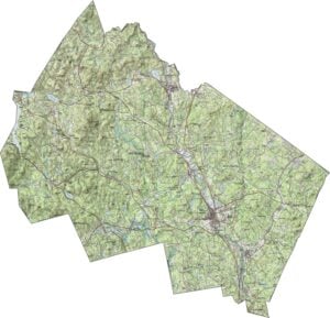
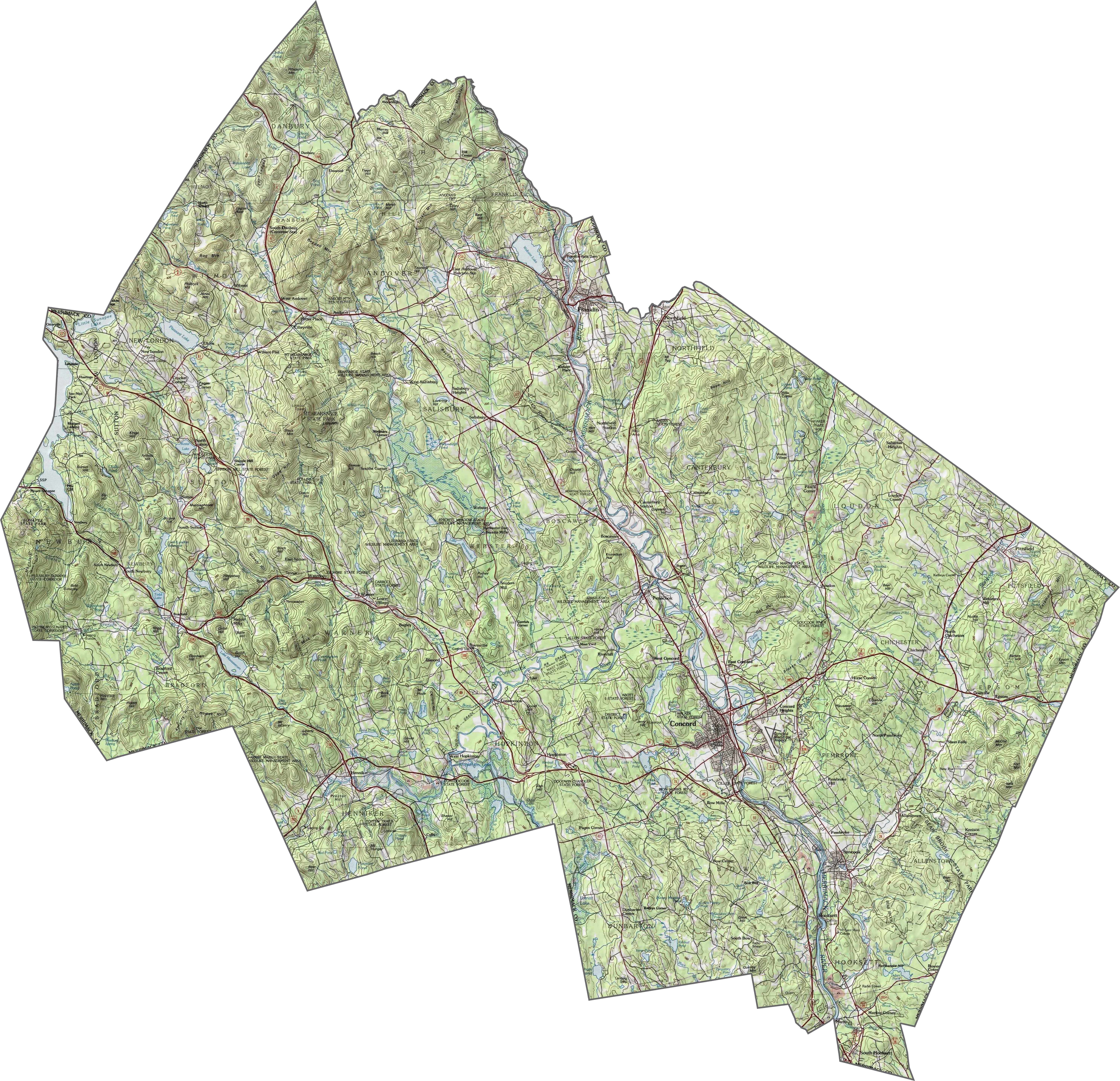
PHYSICAL MAP
Merrimack County Topographic Map
Merrimack County is a blend of low hills cover and a few higher ridges. The Merrimack River runs right down the middle. Elevation stays moderate, but it’s not flat. Concord sits in a wide valley. Forests and small peaks fill the space between towns. Use our zoom tool to explore Merrimack County.
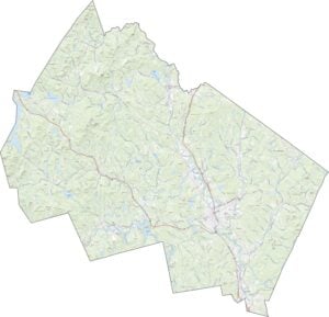
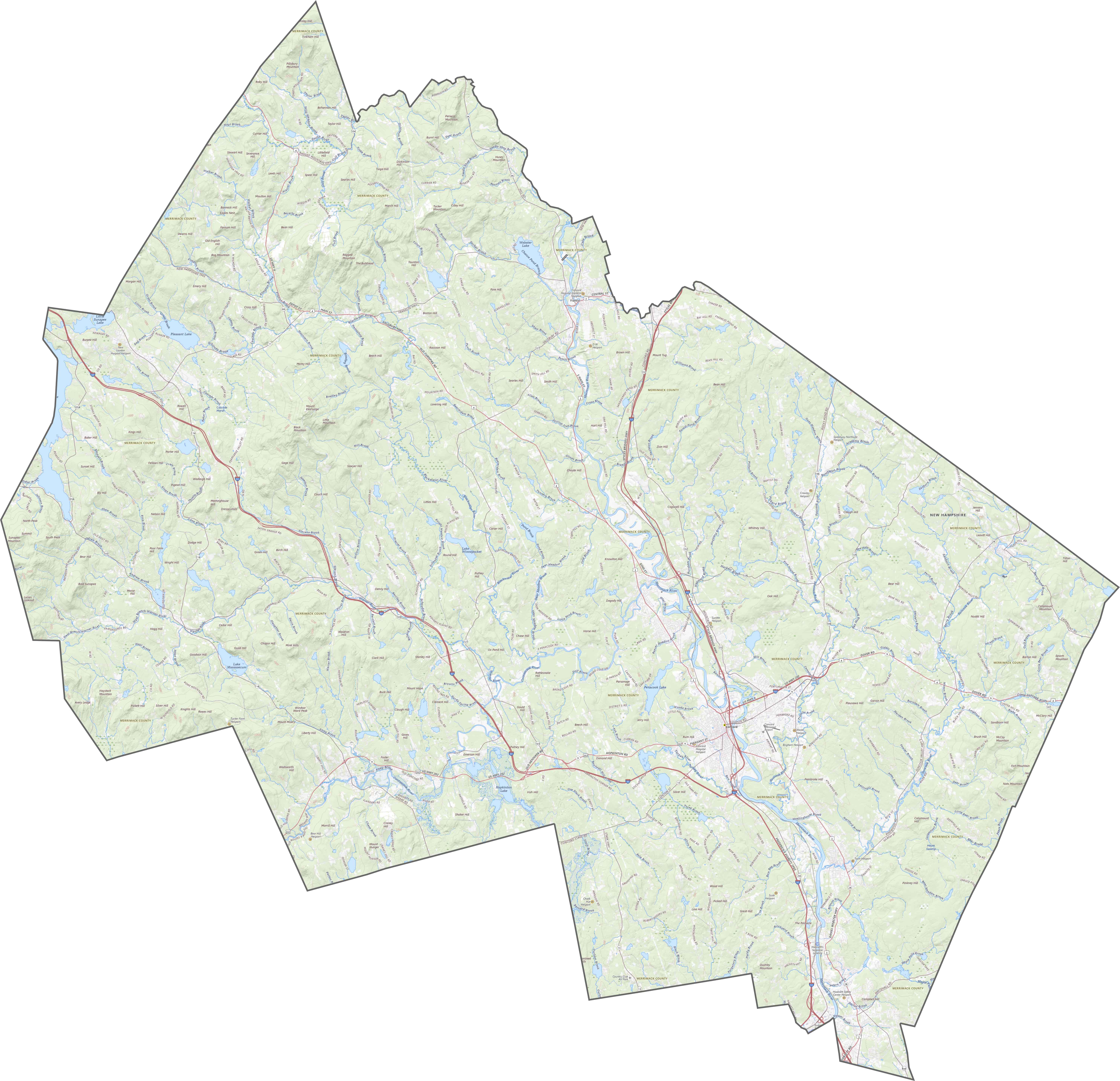
TRANSPORTATION MAP
Merrimack County Road Map
Merrimack has a healthy mix of roads. Interstate 93 runs straight through, north to south while Route 4 cuts across from east to west. Backroads spread out from the cities, connecting rural corners. Use our zoom tool to see just how connected it is.
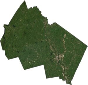
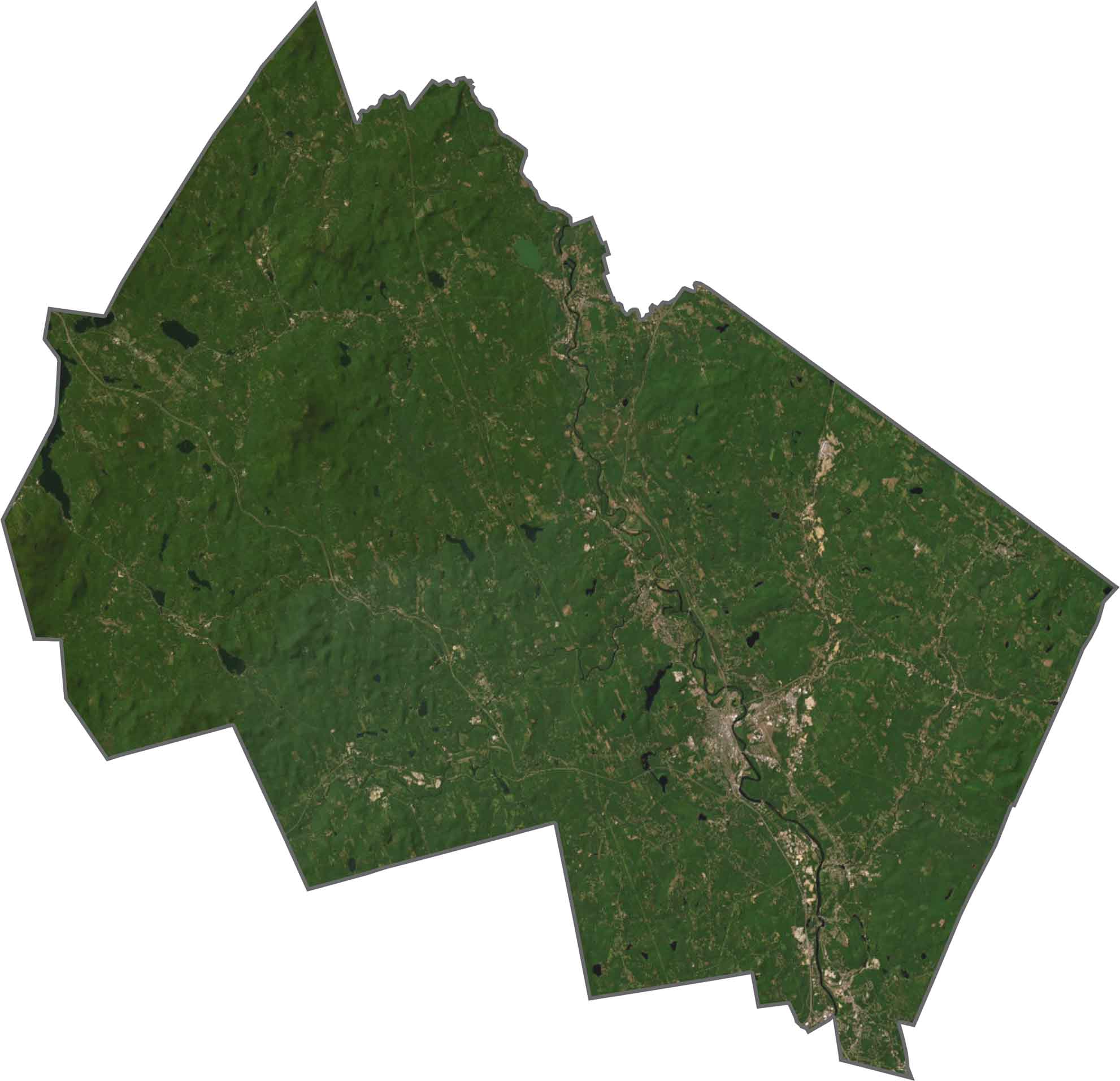
SATELLITE IMAGERY
Merrimack County Satellite Map
Concord stands out as the urban center. But just outside the city, it turns green quickly. Forests, fields, and small lakes fill the view. The Merrimack River is long and clear, slicing down the middle. You’ll spot development along the river, then woods beyond it.
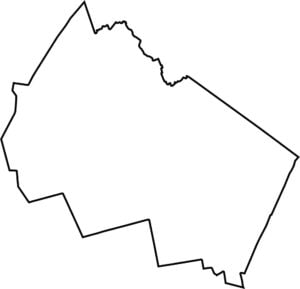
OUTLINE MAP
Merrimack County Blank Map
Merrimack is shaped like a tilted rectangle with a few bites taken out. It’s surrounded by other New Hampshire counties and no other states border it.

Neighboring Counties
Here are the 6 neighboring counties of Merrimack County:


New Hampshire County Map

Explore the Granite State. 10 counties packed with mountain switchbacks, colonial villages, and Atlantic winds. Enjoy maple syrup mornings, moose crossings, and so much more.