Middlesex County Map, New Jersey

Middlesex County Map Collection
We allow you to use our Middlesex County map. Attribution is required.
Middlesex County, New Jersey

Central Jersey has a heartbeat, and it’s called Middlesex County. This area sits between New York City and Philadelphia. It soaks up influence from both. New Brunswick is home to Rutgers University, known for its cutting-edge research.
You’ll find a real melting pot here. Edison has one of the largest Asian communities in the state. The food scene reflects this diversity. From Korean barbecue to Portuguese seafood, your taste buds won’t get bored.
Visitors can explore sites like the Proprietary House in Perth Amboy. Middlesex isn’t all urban sprawl though. The county has its share of parks and nature preserves. You can kayak on the Raritan River or hike in Cheesequake State Park.
| Category | Details |
|---|---|
| County Name | Middlesex County |
| County Seat | New Brunswick |
| Population | Approximately 870,000 |
| Cities, Towns, and Communities | Edison, New Brunswick, Piscataway, East Brunswick, Old Bridge, Woodbridge, Perth Amboy, South Brunswick |
| Interstates and Highways | Interstate 95 (New Jersey Turnpike), Interstate 287, U.S. Route 1, U.S. Route 9, Garden State Parkway |
| FIPS Code | 34-023 |
| Total Area (Land and Water) | 322 square miles (308 sq mi land, 14 sq mi water) |
| Adjacent Counties (and Direction) | Somerset County (Northwest), Union County (North), Hudson County (Northeast), Monmouth County (Southeast), Mercer County (Southwest) |
| Time Zone | Eastern Time Zone (ET) |
| State | New Jersey |
| Coordinates | 40.4117° N, 74.3587° W |
| Etymology | Named after the historic English county of Middlesex |
| Major Landmarks | Rutgers University, Thomas Edison Center at Menlo Park, Rutgers Gardens, Roosevelt Park |
| Website | Middlesex County Website |
TRANSPORTATION MAP
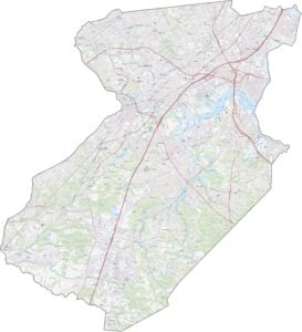
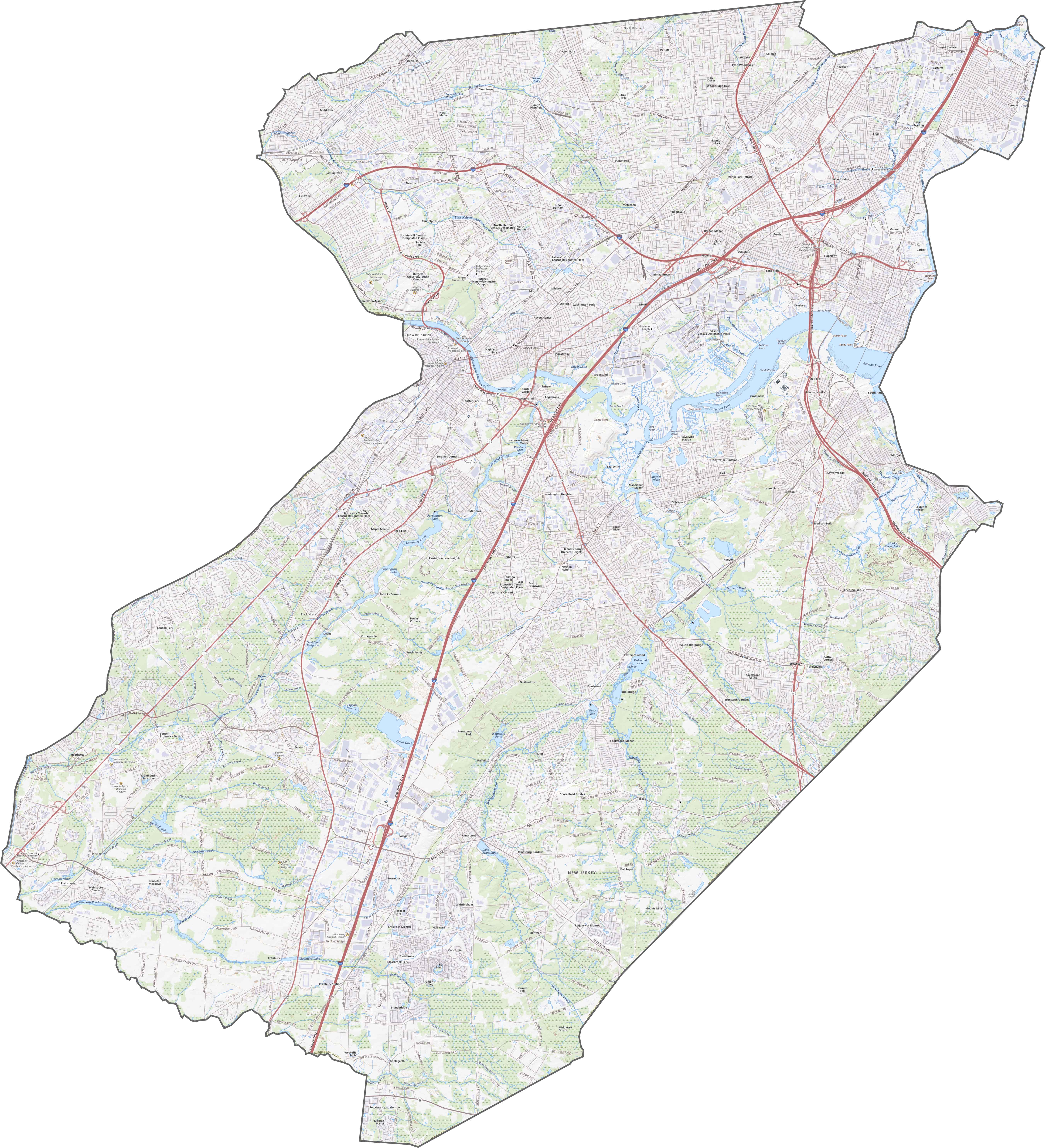
Middlesex County Road Map
Middlesex County is a place of many crossroads. The New Jersey Turnpike and Garden State Parkway both cut through. I-287 swings around the north like a wide arc. Even though there are plenty of local roads, the highways carry the weight. Try our zoom tool below to see the entire road network.
SATELLITE IMAGERY
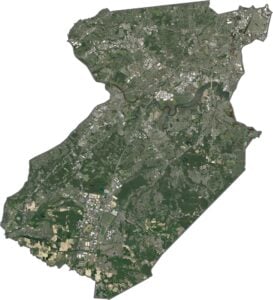
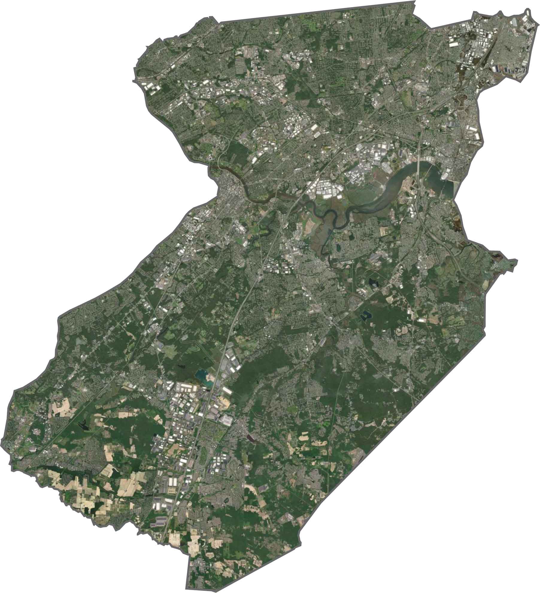
Middlesex County Satellite Map
Dense in the east, greener toward the west. You’ll see highways and neighborhoods packed in tight, especially near Edison and New Brunswick. But it opens up the farther you move from the river. The Raritan River snakes through the middle, and the bay in the northeast adds a flash of blue.
OUTLINE MAP
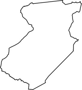
Middlesex County Blank Map
Middlesex County is shaped like a box someone kicked. It’s slightly crooked with a bite taken out of the northwest. Though it doesn’t touch another state, water still defines many of its borders.

Neighboring Counties
Here are the 5 neighboring counties of Middlesex County:


New Jersey County Map

New Jersey packs a lot into 21 counties – beach towns, pine forests and farmland. Trace the colonial history in Hunterdon or walk the boardwalk in Ocean County. There’s more here than meets the Turnpike.