Porter County Map, Indiana

Porter County Map Collection


We allow you to use our Porter County map. Attribution is required.
Porter County, Indiana

Porter County is located in northwest Indiana, along the shores of Lake Michigan. The Indiana Dunes National Park is the county’s jewel. People love to climb the massive sand dunes.
The county also features a mix of small towns, like Valparaiso, which is home to Valparaiso University and a lively downtown area. But head north to Portage or Chesterton, and you’re in pure suburbia.
It’s a place of stark contrasts, where steel mills share the lakefront with pristine beaches. Porter County’s not all lakefront though. Most of the southern part is pure Indiana farmland.
| Category | Details |
|---|---|
| County Name | Porter County |
| County Seat | Valparaiso |
| Population | 175,000 (estimated) |
| Cities, Towns, and Communities | Valparaiso, Portage, Chesterton, Hebron, Burns Harbor, Ogden Dunes, Kouts, Dune Acres, Beverly Shores |
| Interstates and Highways | I-80, I-90 (Indiana Toll Road), I-94, US-6, US-12, US-20, IN-2, IN-49, IN-130 |
| FIPS Code | 18-127 |
| Total Area (Land and Water) | 521 square miles (Land: 418 sq mi, Water: 103 sq mi) |
| Adjacent Counties (and Direction) | LaPorte County (East), Starke County (Southeast), Jasper County (South), Lake County (West), Cook County, Illinois (Northwest), Berrien County, Michigan (Northeast) |
| Time Zone | Central Time Zone (CT) |
| State | Indiana |
| Coordinates | 41.5200° N, 87.0548° W |
| Etymology | Named after Commodore David Porter, a naval hero of the War of 1812 |
| Major Landmarks | Indiana Dunes National Park, Indiana Dunes State Park, Taltree Arboretum and Gardens, Porter County Courthouse |
| Website | Porter County Website |
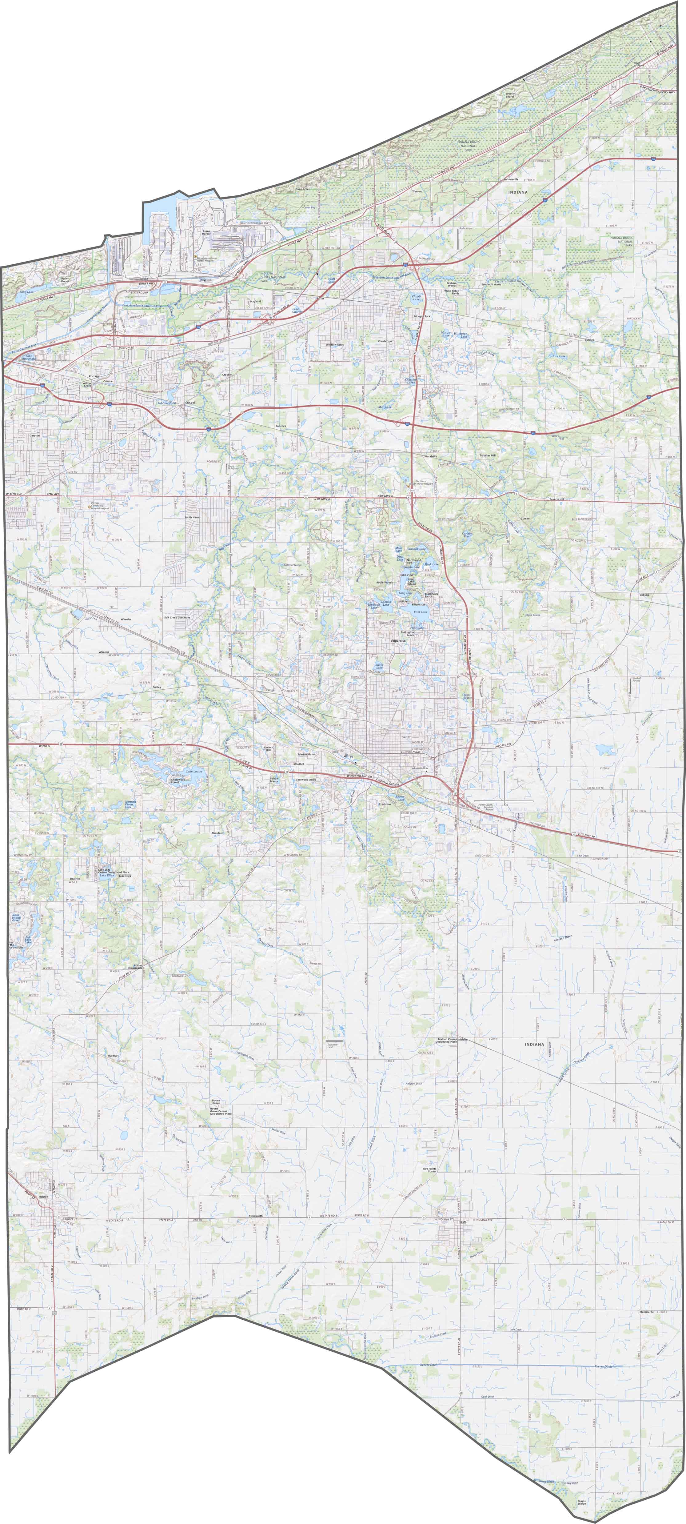
TRANSPORTATION MAP
Porter County Road Map
Flat plains cover much of the county, but there are sand dunes along Lake Michigan. While the southern areas are uniformly level, the northern lakeshore features rolling dunes and wetlands. I-80 and I-94 are the main highways in Porter County.
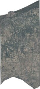
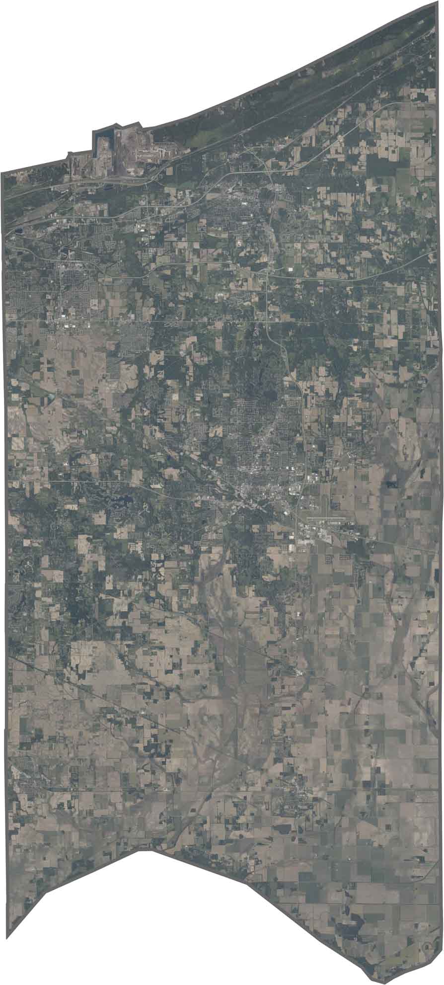
SATELLITE IMAGERY
Porter County Satellite Map
The Indiana Dunes stand out as light-colored sandy areas along the blue lake. Further south, there are scattered towns surrounded by farmland. The intersecting highways create straight lines across the landscape.
OUTLINE MAP
Porter County Blank Map
The county has an irregular shape that narrows toward the south. Lake Michigan forms its entire northern border, while Kankakee River define its southern edge. It touches no other states but it’s close to Illinois to the west.

Neighboring Counties
Here are the 6 neighboring counties of Porter County:


Indiana County Map

Explore the Hoosier State. 92 counties worth of backroads, skyline views, and small-town magic. This is your glovebox passport to diner pies, covered bridges, and Lake Michigan sunsets.