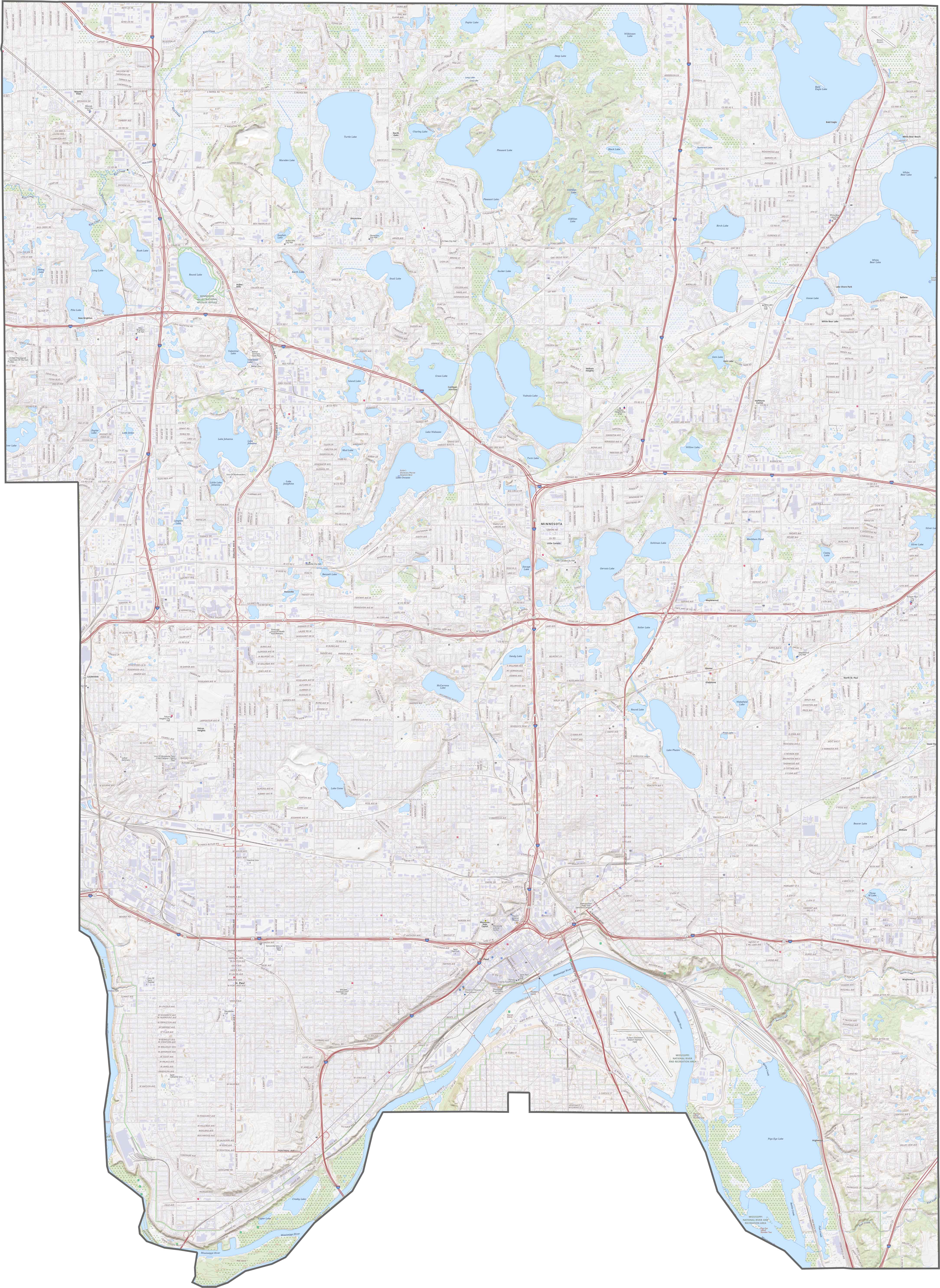
Ramsey County Map, Minnesota

Ramsey County Map Collection
We allow you to use our Ramsey County map. Attribution is required.
Ramsey County, Minnesota

The Twin Cities metro area wouldn’t be complete without Ramsey County. It’s the smallest county in Minnesota by area, but don’t let that fool you. St. Paul, the state capital, calls this place home.
You’ll find Ramsey County in the east-central part of Minnesota, right next to Minneapolis. It’s got a bit of everything… Urban buzz, quiet suburbs, and even some lakes (because, well, it’s Minnesota!).
The Mississippi River flows through here. Nature lovers can hit up parks like Battle Creek Regional Park for a dose of green. How about the food scene? Top-notch.
| Category | Details |
|---|---|
| County Name | Ramsey County |
| County Seat | St. Paul |
| Population | Approximately 560,000 |
| Cities, Towns, and Communities | St. Paul, Maplewood, Roseville, Shoreview, Arden Hills, White Bear Lake, Mounds View, Little Canada, North St. Paul |
| Interstates and Highways | I-35E, I-94, I-694, US 10, MN 36, MN 51 |
| FIPS Code | 27-123 |
| Total Area (Land and Water) | 170 square miles (Land: 152 sq mi, Water: 18 sq mi) |
| Adjacent Counties (and Direction) | Anoka County (North), Washington County (East), Dakota County (South), Hennepin County (West) |
| Time Zone | Central Time Zone (CT) |
| State | Minnesota |
| Coordinates | 44.9537° N, 93.0895° W |
| Etymology | Named after Alexander Ramsey, the first governor of the Minnesota Territory |
| Major Landmarks | Minnesota State Capitol, Como Park Zoo and Conservatory, Science Museum of Minnesota, Cathedral of Saint Paul |
| Website | Ramsey County Website |
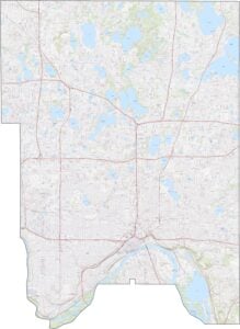
TRANSPORTATION MAP
Ramsey County Road Map
Ramsey County packs a lot of highways into a small space. Interstate 35E cuts north to south while I-94 runs east-west through St. Paul. Highway 36 circles across the north. Though it’s busy, getting around is quick. You can zoom in on our map to see every turn.
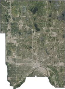
SATELLITE IMAGERY
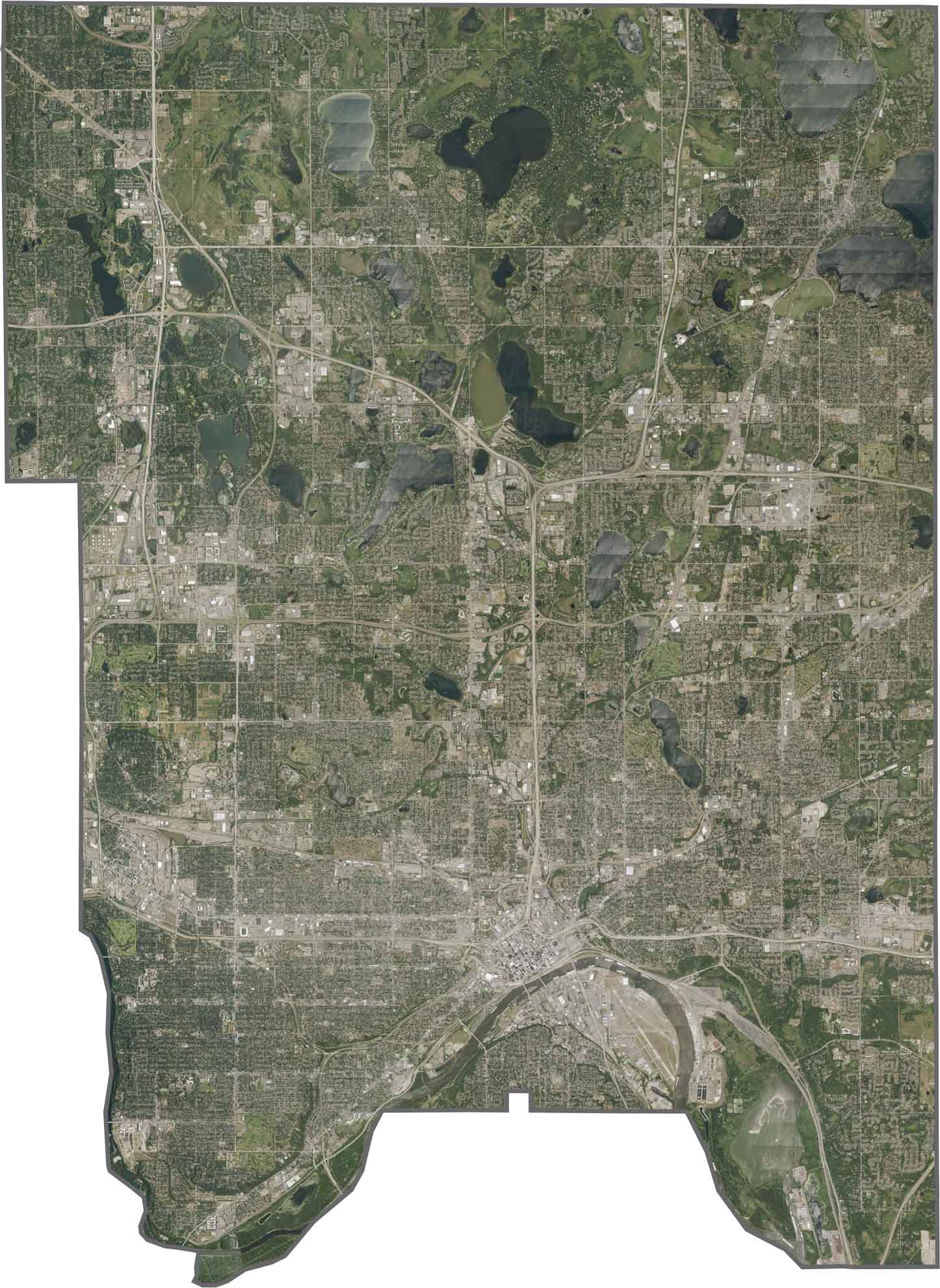
Ramsey County Satellite Map
From above, Ramsey County looks packed with city streets. St. Paul covers most of the space in the south. But lakes and parks are scattered everywhere because water is a big part of the landscape. The Mississippi River curves through the south side.
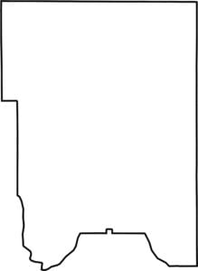
OUTLINE MAP
Ramsey County Blank Map
Ramsey County has a compact shape. It’s round at the south end, but square in the north. The county sits fully inside Minnesota without touching another state.

Neighboring Counties
Here are the 4 neighboring counties of Ramsey County:


Minnesota County Map

Land of 10,000 Lakes? How about the land of 87 counties to explore? Say hello to Hennepin County (Minneapolis) or the shores of Lake Superior. Get to know all the counties of Minnesota right here.