Rockland County Map, New York

Rockland County Map Collection
We allow you to use our Rockland County map. Attribution is required.
Rockland County, New York

Rockland County lies just north of the Big Apple. It’s really just a quick trip up the Hudson from NYC. You’ve got the Hudson River on one side, mountains on the other. It’s actually a pretty sweet setup.
The county has some serious Revolutionary War history. Outdoorsy types love it here with hiking, biking, and more. Small towns and burbs cover the county.
It’s diverse too, with a big Hasidic community in New Square. Nyack is a funky little arts hub worth checking out. Rockland’s vibe? Think suburban chill with a dash of Hudson Valley cool.
| Category | Details |
|---|---|
| County Name | Rockland County |
| County Seat | New City |
| Population | Approximately 350,000 |
| Cities, Towns, and Communities | New City, Spring Valley, Suffern, Clarkstown, Orangetown |
| Interstates and Highways | Interstate 87, Interstate 287, U.S. Route 9W, New York State Route 59 |
| FIPS Code | 36-087 |
| Total Area (Land and Water) | 199 square miles (174 sq mi land, 25 sq mi water) |
| Adjacent Counties (and Direction) | Orange County (Northwest), Putnam County (Northeast), Westchester County (East), Passaic County, New Jersey (West), Bergen County, New Jersey (South) |
| Time Zone | Eastern Time Zone (ET) |
| State | New York |
| Coordinates | 41.1380° N, 73.9922° W |
| Etymology | Named for the large number of rocks and boulders in the region |
| Major Landmarks | Bear Mountain State Park, Rockland Lake State Park, Palisades Center |
| Website | Rockland County Website |
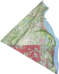
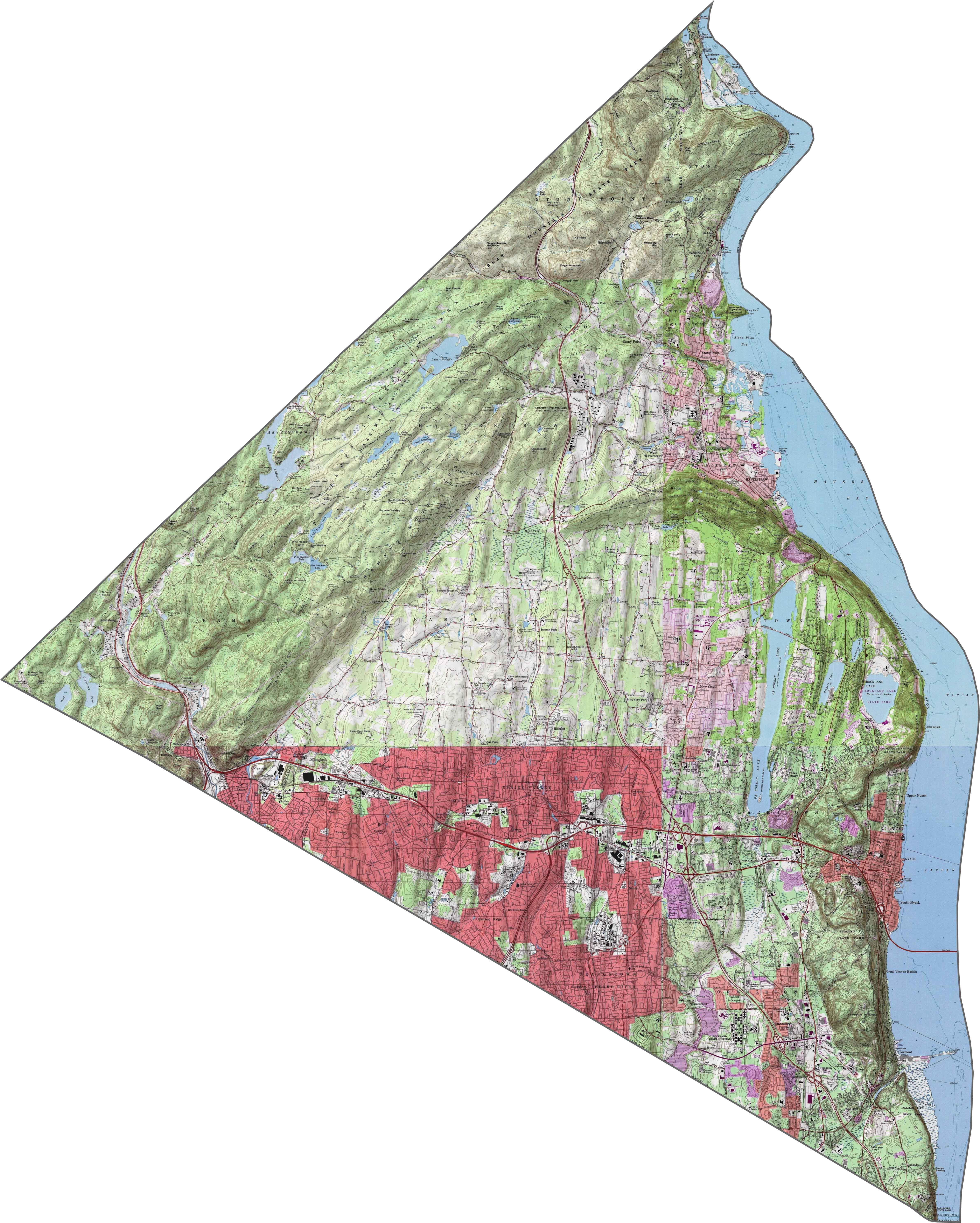
PHYSICAL MAP
Rockland County Topographic Map
The terrain in Rockland County packs in more drama than you’d expect. Steep slopes rise near the Hudson, especially along the Palisades. The western half is hilly too, part of the Ramapo Mountains. Valleys in between are narrow and deep. You get both height and density in a small space.
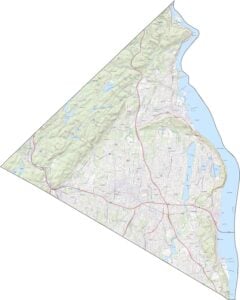
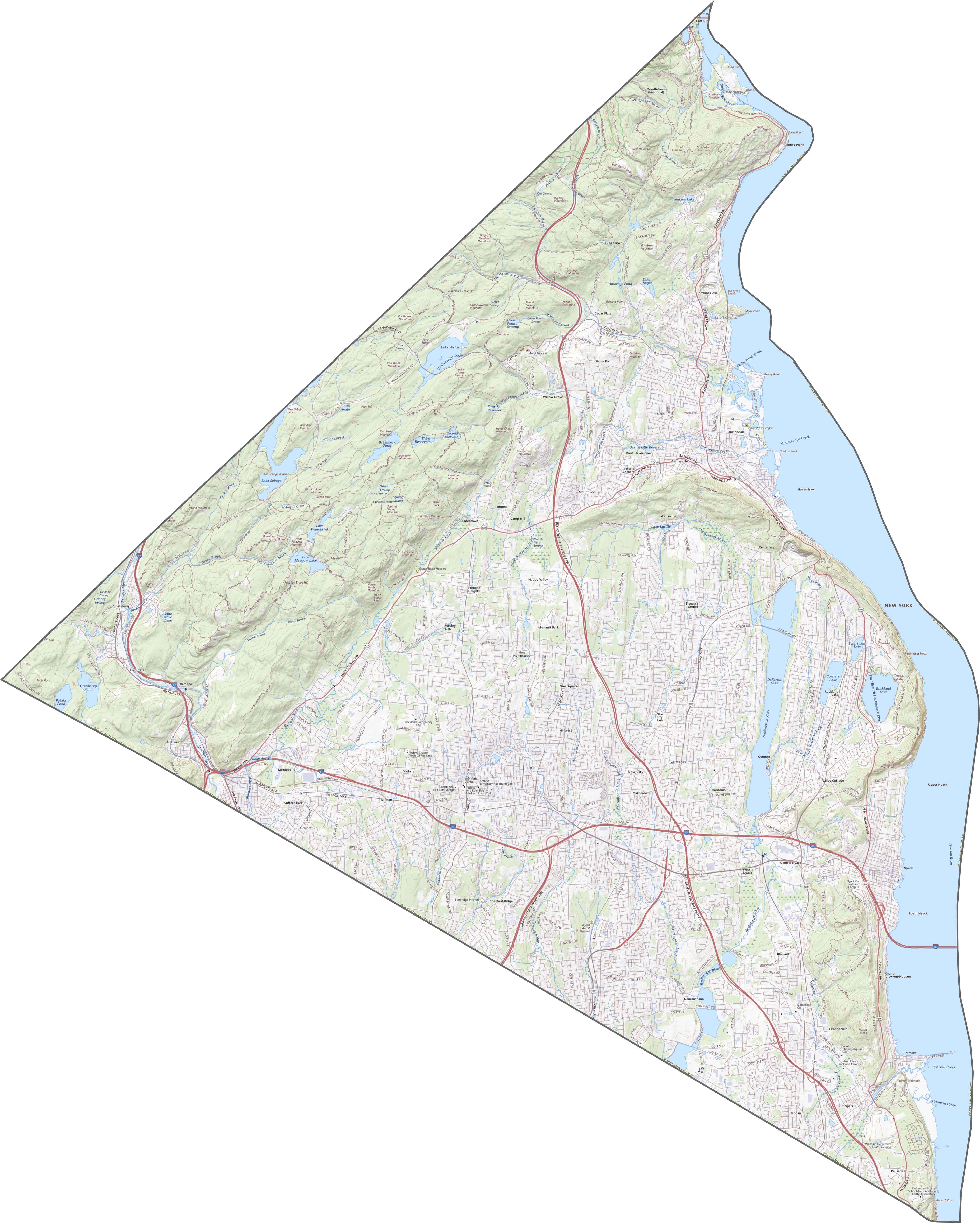
TRANSPORTATION MAP
Rockland County Road Map
Despite its size, Rockland is crossed by all sorts of major roads. I-87 and I-287 run together just west of the Hudson. The Palisades Parkway and US-9W follow a more scenic path north–south. Though the traffic can stack up in some spots, backroads through the hills stay quiet.
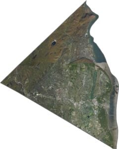
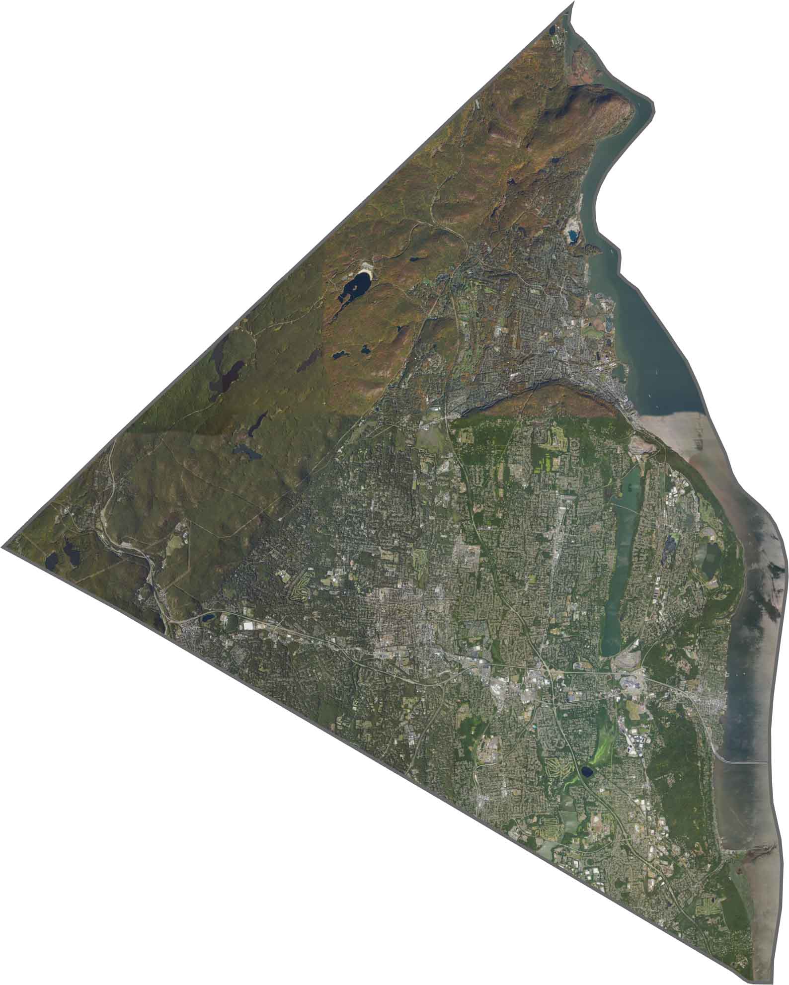
SATELLITE IMAGERY
Rockland County Satellite Map
The Hudson River flows along the eastern edge. Dense suburbs sprawl through the center, but forested hills creep in from the west. Harriman State Park takes up a large chunk in the northwest. Yep, it’s the dark, textured patch from above. Towns cluster along rivers and highways, with nature wedged in between.
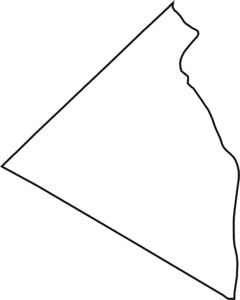
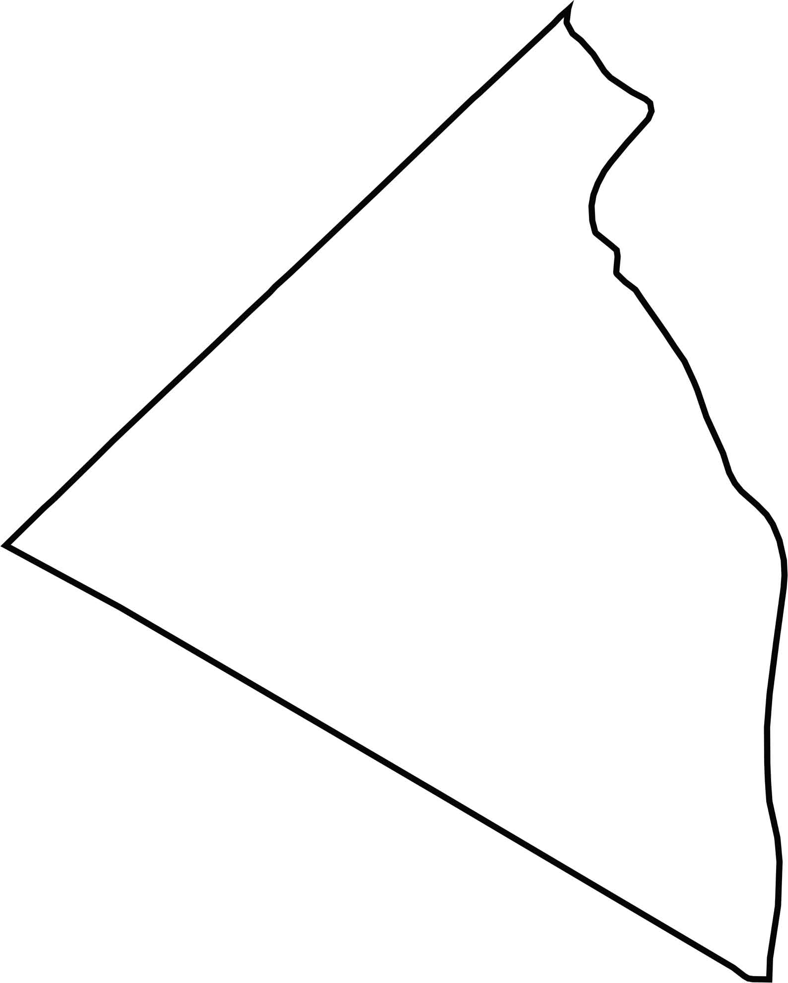
OUTLINE MAP
Rockland County Blank Map
Rockland’s shape looks like a short, lopsided triangle. The Hudson River defines its entire eastern border. To the south and west, it meets New Jersey. The lines are tight and slightly angled.
Neighboring Counties
Here are the 5 neighboring counties of Rockland County:


New York County Map

New York has 62 counties. Each with their own attitude. Manhattan’s chaos to the Adirondacks’ silence… and how about those Buffalo wings? Explore our NY counties maps.