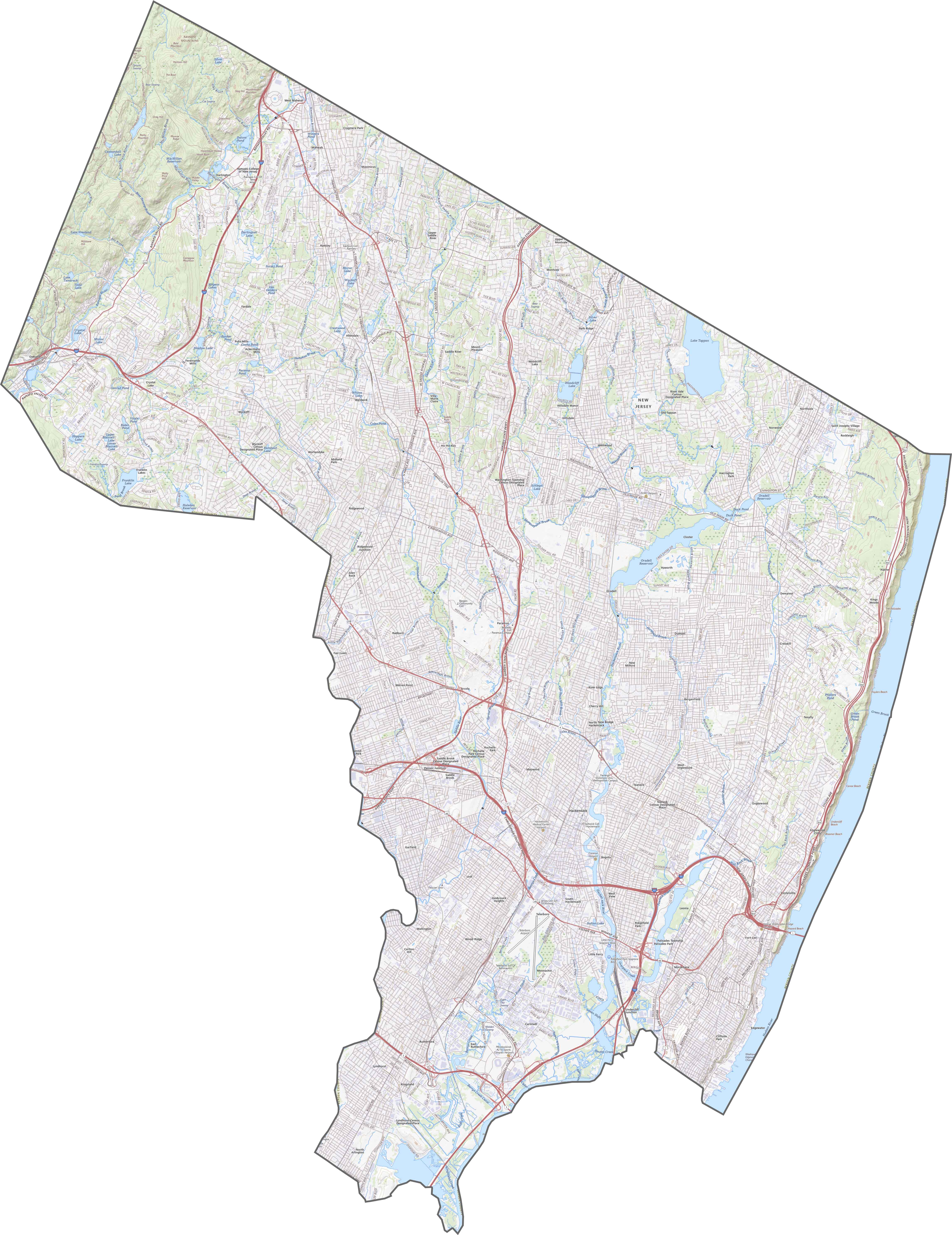
Bergen County Map, New Jersey

Bergen County Map Collection
We allow you to use our Bergen County map. Attribution is required.
Bergen County, New Jersey

Bergen County sits in northeast New Jersey, just across the Hudson from New York City. It’s the most populous county in New Jersey, and for good reason. The place has a bit of everything. Bustling downtowns, quiet suburbs, and even some nature spots.
Bergen has a long history, dating back to before the American Revolution. You can still see some of that history today in places like Historic New Bridge Landing. You’ll also find high-end restaurants and local delis so you definitely won’t go hungry.
The county is known for its shopping, with mega-malls like Westfield Garden State Plaza. It’s not all urban though. The Palisades offer great hiking trails and river views. Bergen County has both city and nature with something different around every corner.
| Category | Details |
|---|---|
| County Name | Bergen County |
| County Seat | Hackensack |
| Population | Approximately 950,000 |
| Cities, Towns, and Communities | Hackensack, Fort Lee, Paramus, Teaneck, Englewood, Fair Lawn, Ridgewood, Mahwah, Garfield |
| Interstates and Highways | Interstate 80, Interstate 95 (New Jersey Turnpike), Garden State Parkway, U.S. Route 46, New Jersey Route 4 |
| FIPS Code | 34-003 |
| Total Area (Land and Water) | 246 square miles (233 sq mi land, 13 sq mi water) |
| Adjacent Counties (and Direction) | Rockland County, New York (North), Passaic County (West), Westchester County, New York (Northeast), Bronx County, New York (East), New York County, New York (East), Essex County (South), Hudson County (South) |
| Time Zone | Eastern Time Zone (ET) |
| State | New Jersey |
| Coordinates | 40.9606° N, 74.0730° W |
| Etymology | Named after East Jersey Bergen, New Netherland settlement |
| Major Landmarks | George Washington Bridge, Meadowlands Sports Complex, Palisades Interstate Park |
| Website | Bergen County Website |
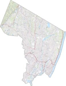
TRANSPORTATION MAP
Bergen County Road Map
Bergen County has more highways than most counties in New Jersey. I-80 runs east-west through its middle. But I-95 is the real heavyweight, which cuts down from the George Washington Bridge. Route 4 is busy too, though it’s not an interstate. You can explore all these routes with our map zoom tool below.
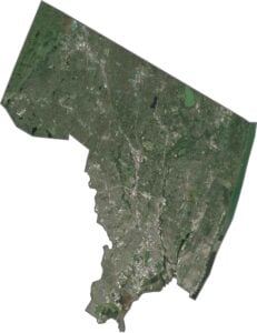
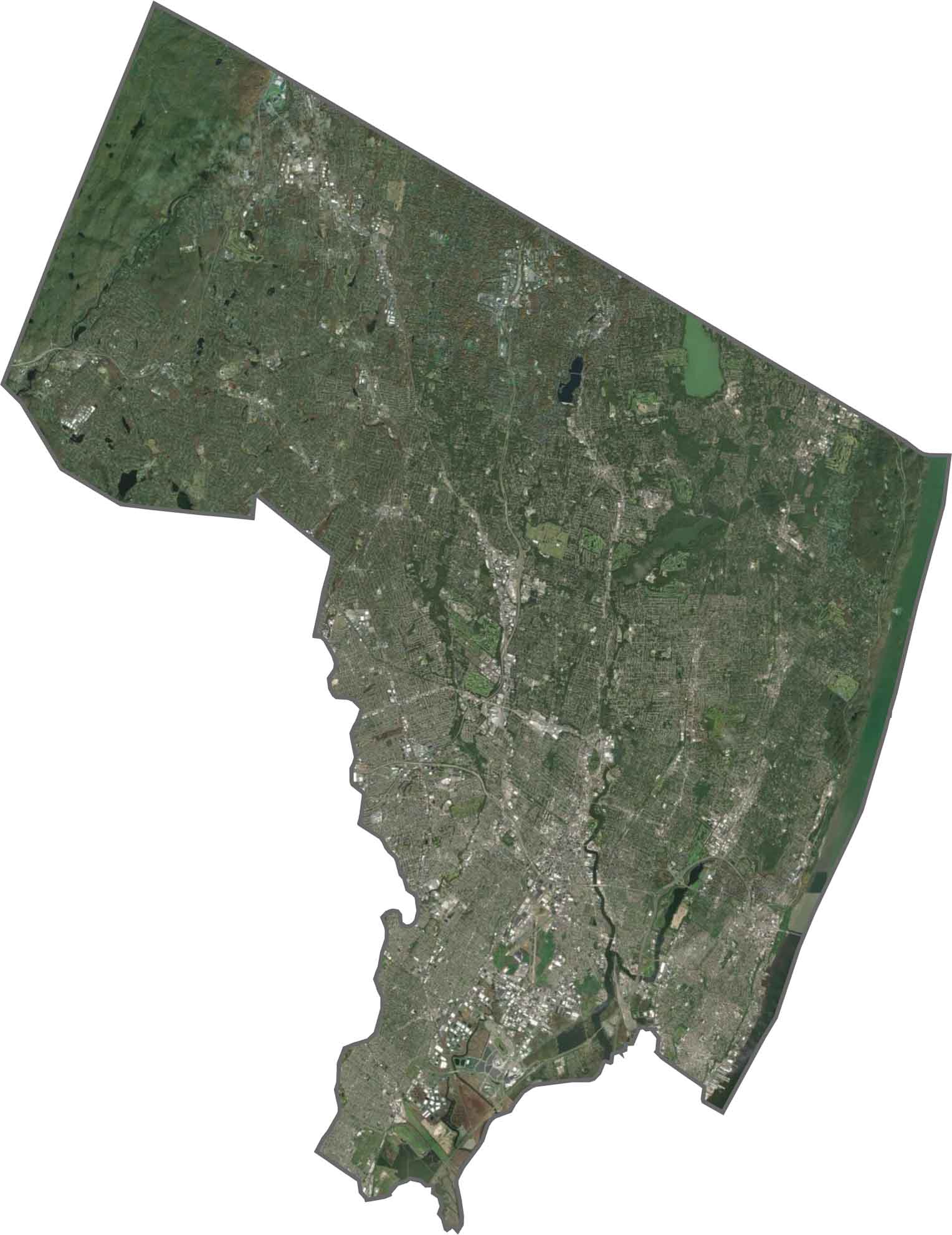
SATELLITE IMAGERY
Bergen County Satellite Map
Bergen looks crowded in our satellite map. Dense development fills most of the area. But there are still areas that appear green from above. Though roads crisscross tightly, parks and green spaces break it up. The Hudson River makes up east border of Bergen County.
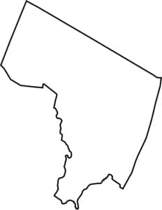
OUTLINE MAP
Bergen County Blank Map
Bergen County hugs the northeastern tip of New Jersey. Though the rest of the border winds a bit, it’s fairly compact. Its eastern border is the Hudson River, separating it from New York. So yes, it touches New York State directly.

Neighboring Counties
Here are the 7 neighboring counties of Bergen County:


New Jersey County Map

New Jersey packs a lot into 21 counties – beach towns, pine forests and farmland. Trace the colonial history in Hunterdon or walk the boardwalk in Ocean County. There’s more here than meets the Turnpike.