St. Lawrence County Map, New York

St. Lawrence County Map Collection

We allow you to use our St. Lawrence County map. Attribution is required.
St. Lawrence County, New York

St. Lawrence County is up in the North Country. It’s huge. In fact, it’s the biggest county in New York State outside of NYC. The mighty St. Lawrence River forms its northwest border with Canada.
This place is a nature lover’s paradise. Think rolling farmland, dense forests, and the stunning Adirondacks. Winters are no joke here. Locals embrace the snow with gusto. Summers are all about river life and hiking.
It’s home to several colleges, including Clarkson University. The county’s full of attractions like the Frederic Remington Art Museum. Agriculture’s big business, especially dairy. St. Lawrence County is where New York State gets wild.
| Category | Details |
|---|---|
| County Name | St. Lawrence County |
| County Seat | Canton |
| Population | Approximately 110,000 |
| Cities, Towns, and Communities | Canton, Potsdam, Ogdensburg, Massena, Gouverneur |
| Interstates and Highways | U.S. Route 11, U.S. Route 62, New York State Route 37, New York State Route 68 |
| FIPS Code | 36-089 |
| Total Area (Land and Water) | 2,821 square miles (2,682 sq mi land, 139 sq mi water) |
| Adjacent Counties (and Direction) | Franklin County (East), Herkimer County (South), Hamilton County (South), Lewis County (Southwest), Jefferson County (West) |
| Time Zone | Eastern Time Zone (ET) |
| State | New York |
| Coordinates | 44.4664° N, 75.2295° W |
| Etymology | Named after the St. Lawrence River, which forms the county’s northern border |
| Major Landmarks | St. Lawrence River, Adirondack Park, Clarkson University |
| Website | St. Lawrence County Website |
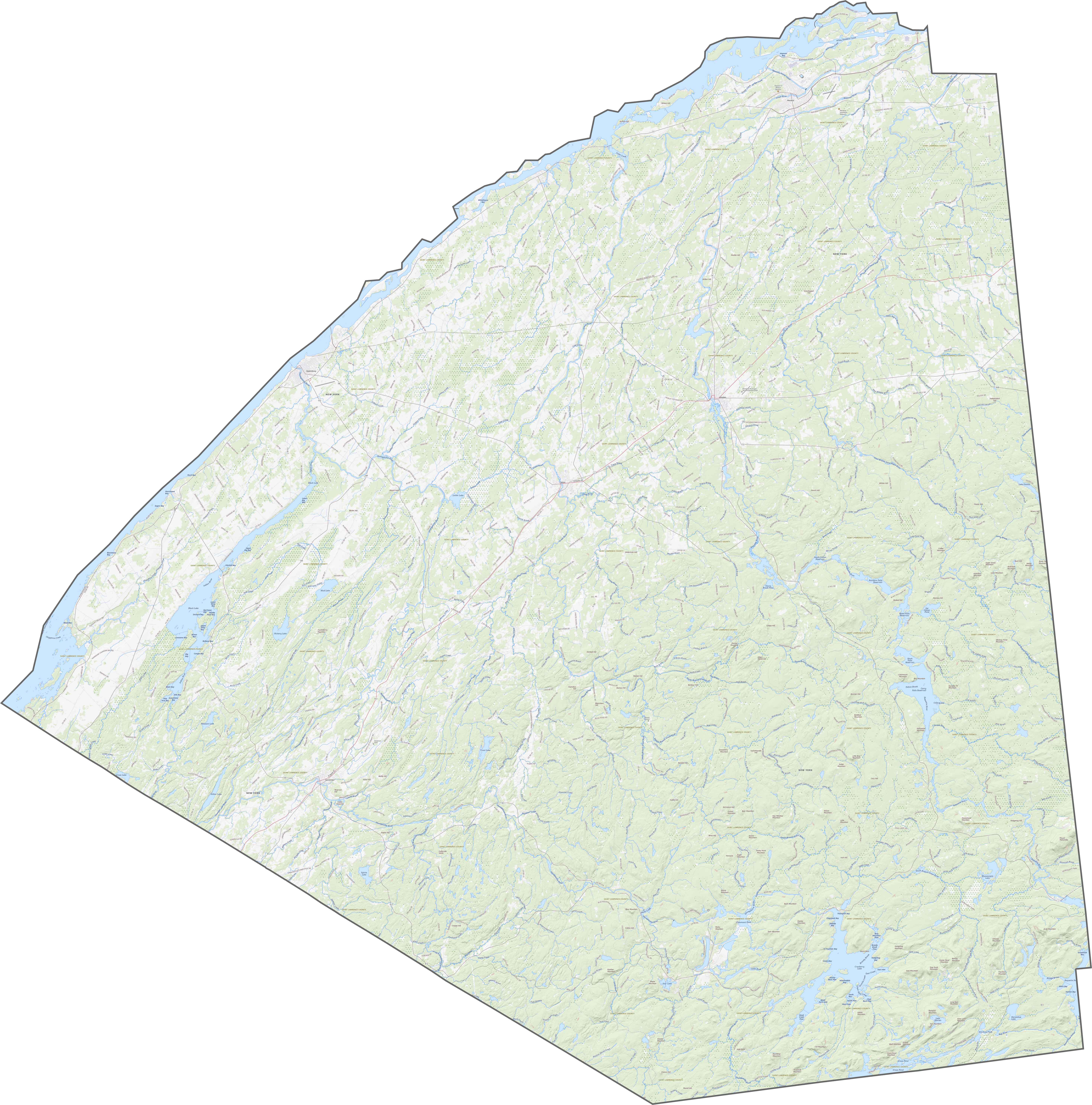
TRANSPORTATION MAP
St. Lawrence County Road Map
Although it’s the largest county in New York, highways here are surprisingly spaced out. US-11 cuts across from east to west. NY-37 runs near the Canadian border, shadowing the St. Lawrence River. Southbound routes like NY-3 twist through forests and farmland. It’s big, so our zoom tool below comes in handy.
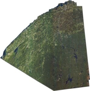
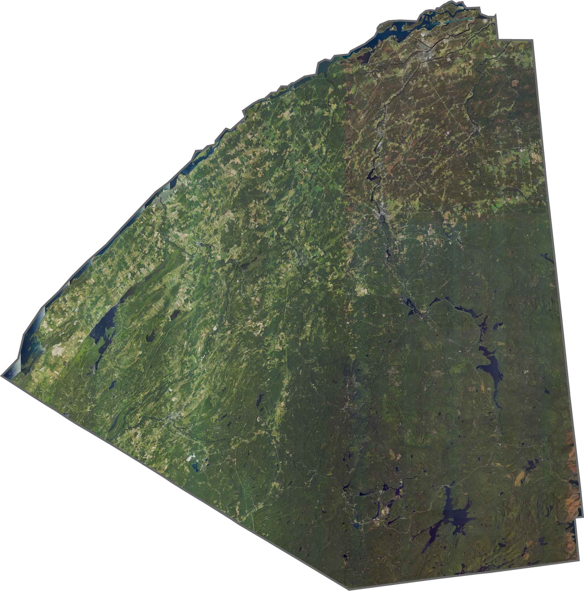
SATELLITE IMAGERY
St. Lawrence County Satellite Map
From above, the county looks mostly green. Forests dominate the southern half, especially near the Adirondacks. The river and its lakes catch the eye in the north. Small towns are scattered across the farmland. Overall, nature wins the view.
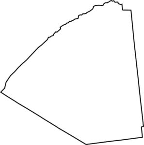
OUTLINE MAP
St. Lawrence County Blank Map
St. Lawrence County is a huge wedge stretching from the Adirondacks to the Canadian border. It actually looks a bit like one of those hand fans with its wing spread out. The St. Lawrence River forms the entire northern edge. It borders Ontario across the water. It’s close to Vermont just to the east (but doesn’t border it).

Neighboring Counties
Here are the 5 neighboring counties of St. Lawrence County:


New York County Map

New York has 62 counties. Each with their own attitude. Manhattan’s chaos to the Adirondacks’ silence… and how about those Buffalo wings? Explore our NY counties maps.