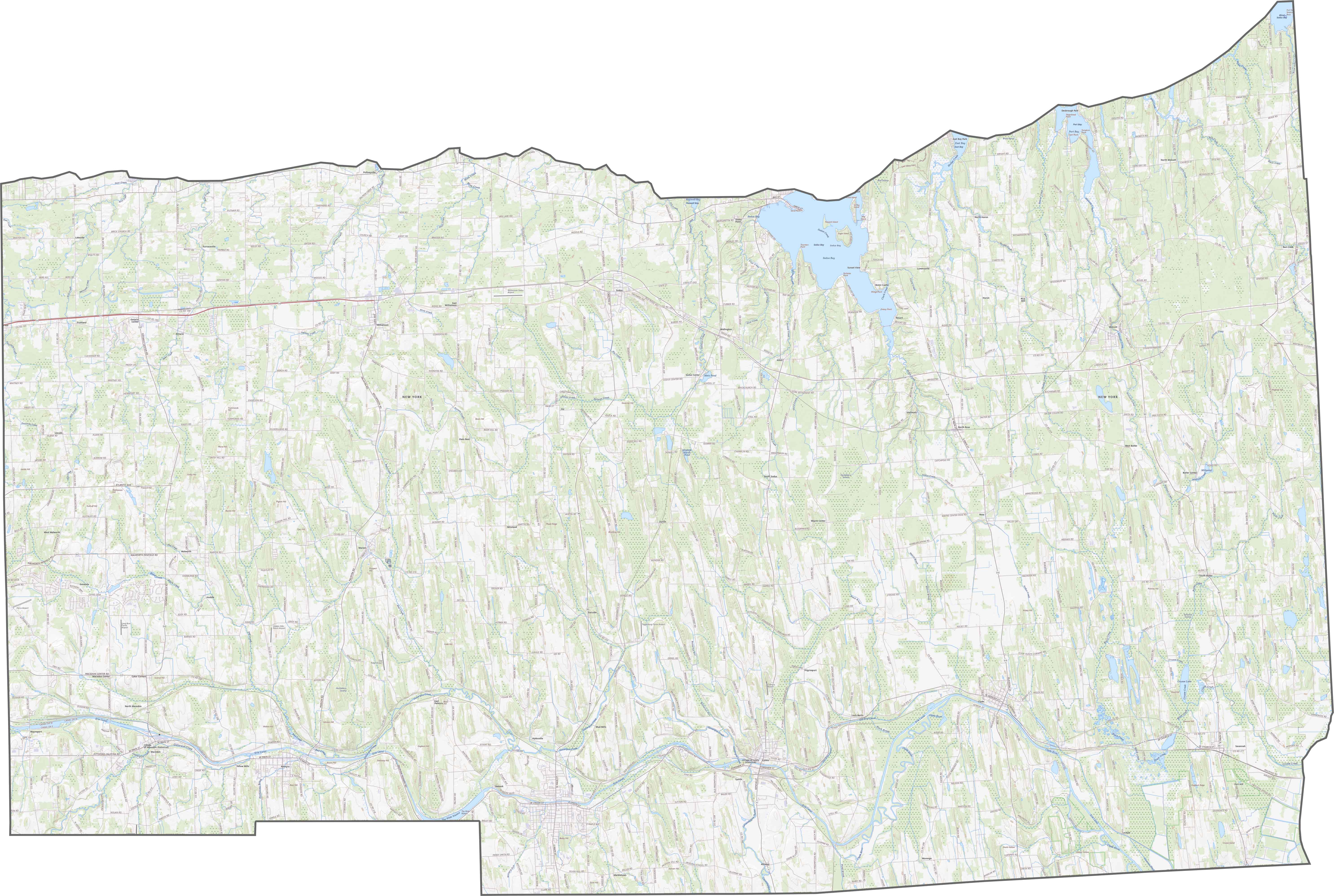
Wayne County Map, New York

Wayne County Map Collection

We allow you to use our Wayne County map. Attribution is required.
Wayne County, New York

Wayne County is up in the Finger Lakes region. It’s sandwiched between Rochester and Syracuse, right on Lake Ontario’s southern shore. Small towns with cute main streets are the norm.
Apple orchards are everywhere. Seriously, they’re famous for it. In fall, the whole place smells like cider. Fishing’s big here too. The Erie Canal runs through, adding some historical flair.
It’s laid-back and unpretentious. People here work hard and play harder. If you’re into quiet country living with a dash of lake life, Wayne County’s your spot.
| Category | Details |
|---|---|
| County Name | Wayne County |
| County Seat | Lyons |
| Population | Approximately 90,000 |
| Cities, Towns, and Communities | Lyons, Newark, Wolcott, Clyde, Sodus |
| Interstates and Highways | Interstate 490, U.S. Route 31, New York State Route 14, New York State Route 104 |
| FIPS Code | 36-117 |
| Total Area (Land and Water) | 1,315 square miles (1,293 sq mi land, 22 sq mi water) |
| Adjacent Counties (and Direction) | Cayuga County (East), Seneca County (Southeast), Ontario County (South), Monroe County (West) |
| Time Zone | Eastern Time Zone (ET) |
| State | New York |
| Coordinates | 43.1006° N, 77.0469° W |
| Etymology | Named after General Anthony Wayne, the American Revolutionary War general |
| Major Landmarks | Sodus Point Lighthouse, Wayne County Fairgrounds, Lake Ontario |
| Website | Wayne County Website |
TRANSPORTATION MAP
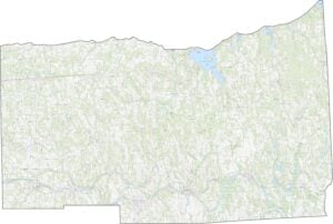
Wayne County Road Map
Although there’s no interstate here, state routes keep everything moving. NY-104 runs just south of Lake Ontario, crossing nearly the entire county. NY-31 cuts through the southern part, linking up smaller towns. Learn about the transportation with our road map of Wayne County below.
SATELLITE IMAGERY
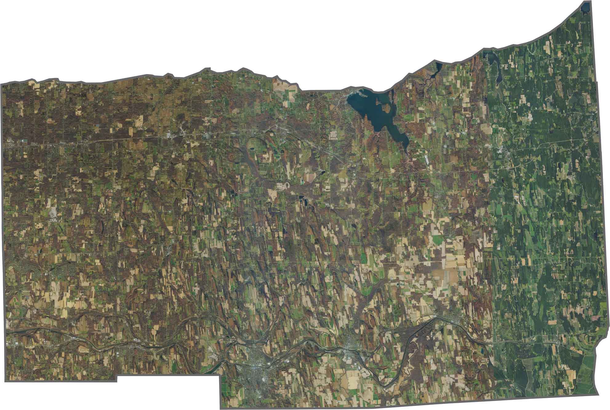
Wayne County Satellite Map
From above, this county is a mix of fields, orchards, and water. You’ll see big patches of green and tan. There is lots of agriculture. The Erie Canal winds through the middle, cutting through towns and woods. Lake Ontario forms the top border.
OUTLINE MAP
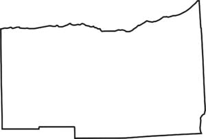
Wayne County Blank Map
Wayne County has a long, horizontal shape. Lake Ontario defines the entire northern edge. The southern border is more jagged.

Neighboring Counties
Here are the 4 neighboring counties of Wayne County:


New York County Map

New York has 62 counties. Each with their own attitude. Manhattan’s chaos to the Adirondacks’ silence… and how about those Buffalo wings? Explore our NY counties maps.