Wilson County Map, Tennessee

Wilson County Map Collection


We allow you to use our Wilson County map. Attribution is required.
Wilson County, Tennessee

Wilson County is right on Nashville’s doorstep, but it has its own thing going on. The county has a mix of old and new. There’s farmland, sure, but also some high-tech industry.
Lebanon’s the county seat. No, not that Lebanon – this one’s pronounced “Leb-nun”. It’s known as the “Antiques Capital of Tennessee.” Old stuff everywhere. Ever heard of Cracker Barrel? Yeah, it started right here in Lebanon.
Cedars of Lebanon State Park is a local favorite. Great hiking, fishing, all that good stuff. Wilson County has some quirky claims to fame. The county fair is a big deal too and is one of the oldest in the state. Oh, and if you’re into cars, they’ve got this awesome classic car show every year.
| Category | Details |
|---|---|
| County Name | Wilson County |
| County Seat | Lebanon |
| Population | Approximately 162,000 |
| Cities, Towns, and Communities | Lebanon, Mt. Juliet, Watertown, Gladeville |
| Interstates and Highways | Interstate 40, Interstate 840, U.S. Highway 70 |
| FIPS Code | 47-189 |
| Total Area (Land and Water) | 583 square miles (571 sq mi land, 12 sq mi water) |
| Adjacent Counties (and Direction) | Trousdale County (North), Smith County (Northeast), DeKalb County (East), Cannon County (Southeast), Rutherford County (South), Davidson County (West), Sumner County (Northwest) |
| Time Zone | Central Time Zone (CST) |
| State | Tennessee |
| Coordinates | 36°09’N, 86°16’W |
| Etymology | Named after Major David Wilson, a Revolutionary War officer |
| Major Landmarks | Cedars of Lebanon State Park, Wilson County Fairgrounds, Fiddlers Grove Historic Village |
| Website | Wilson County Website |
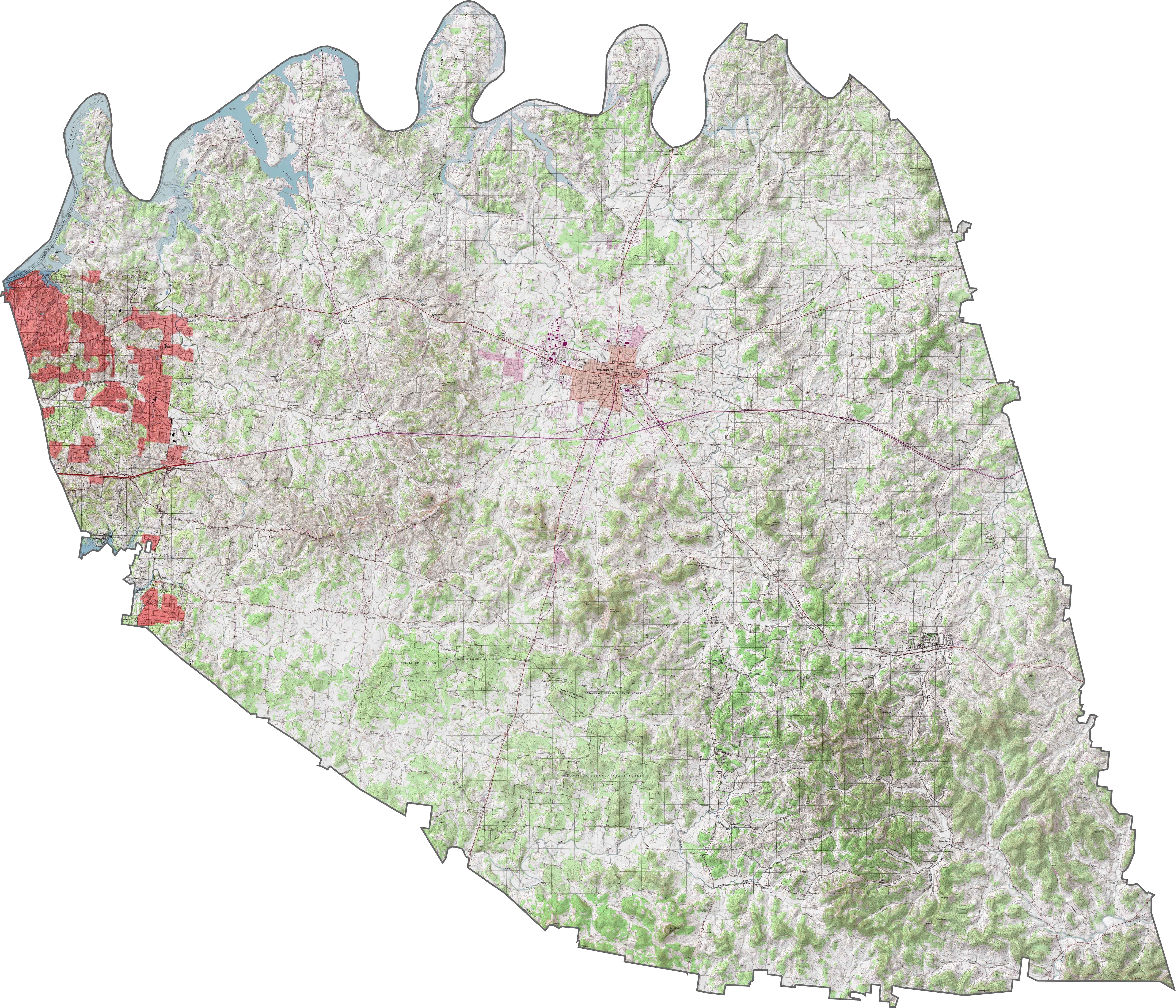
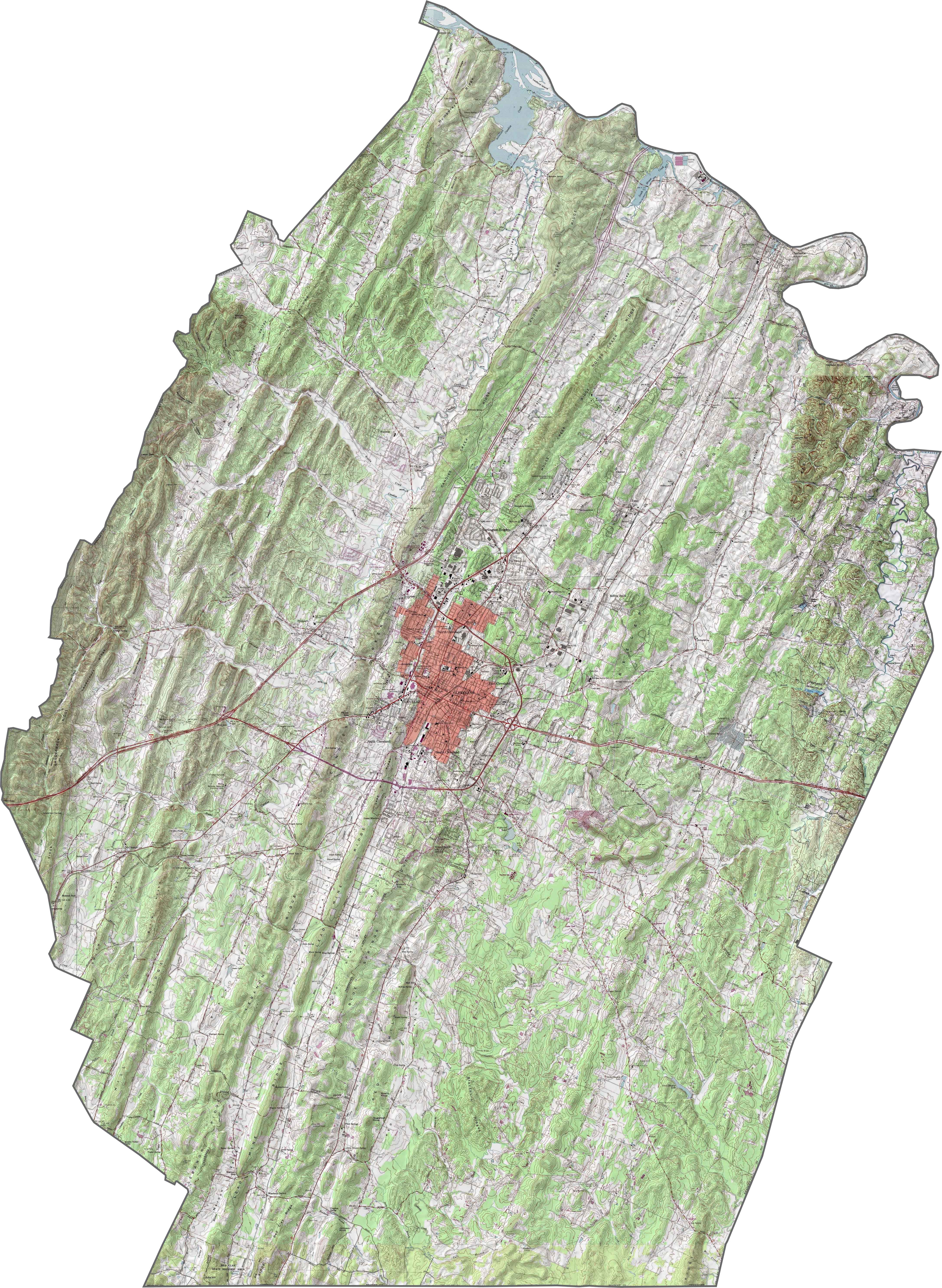
PHYSICAL MAP
Wilson County Topographic Map
Wilson County is balanced. Not too flat, not too rugged. Gentle hills rise across the landscape, especially in the south and east. But the most defining feature? Cedars. Cedars of Lebanon State Forest sits squarely in the county. It’s a landscape that holds its own.
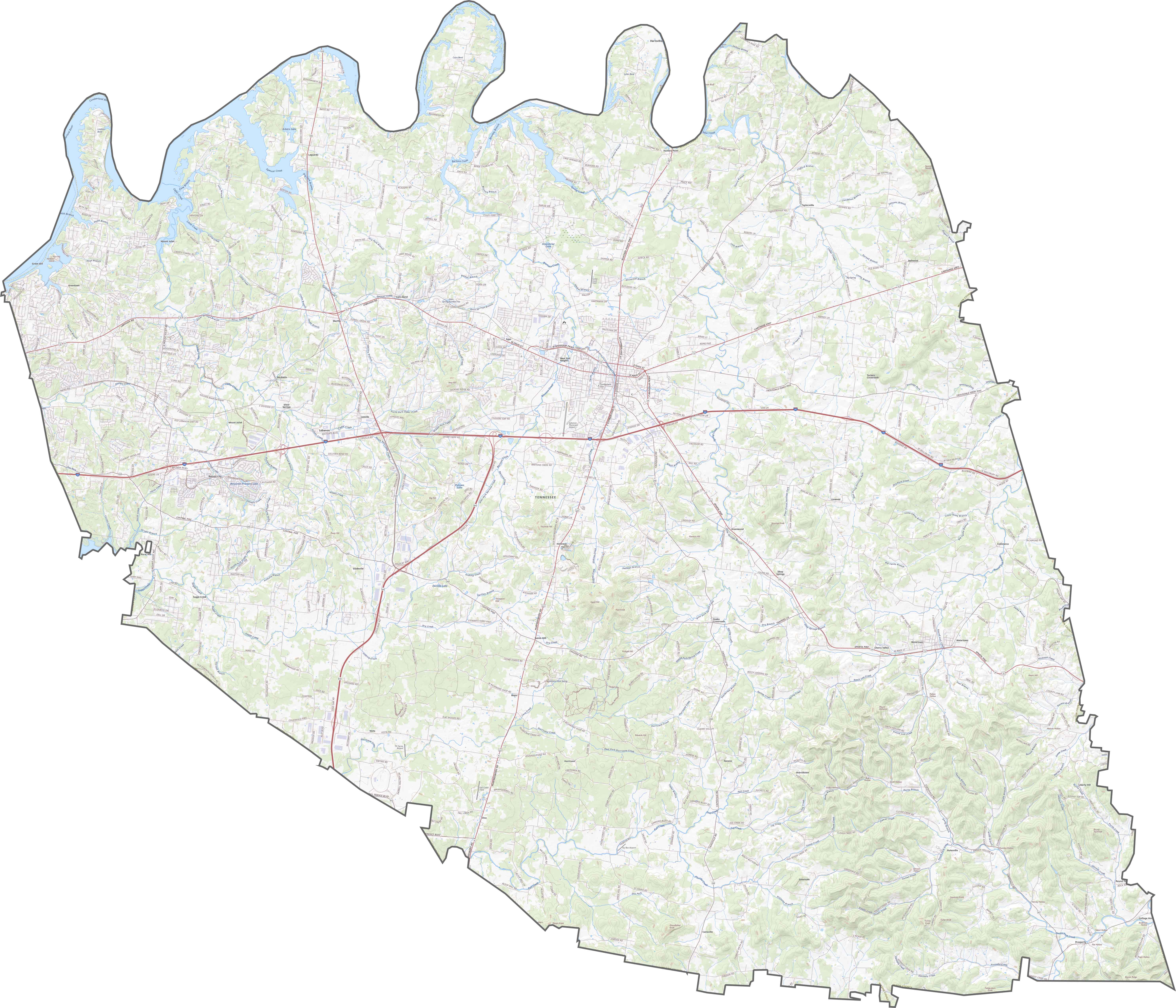
TRANSPORTATION MAP
Wilson County Road Map
Wilson County sits at a crossroads, literally. I-40 cuts straight through it, east to west, making it a major connection point for middle Tennessee. Lebanon stands at the heart. Traffic’s not too bad most days, though growth has tightened things up near Mount Juliet. Use our zoom tool for the full view of the road network.
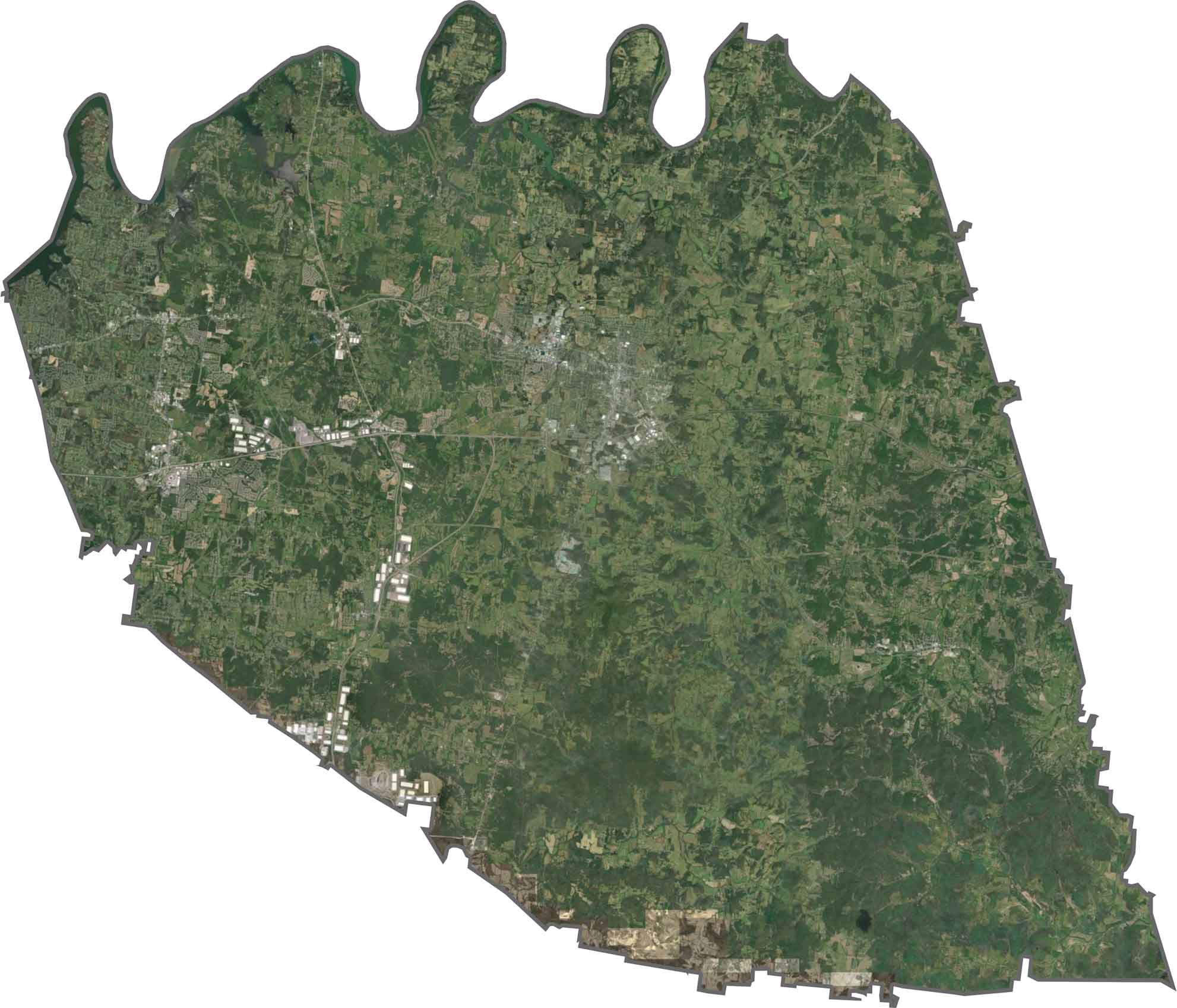
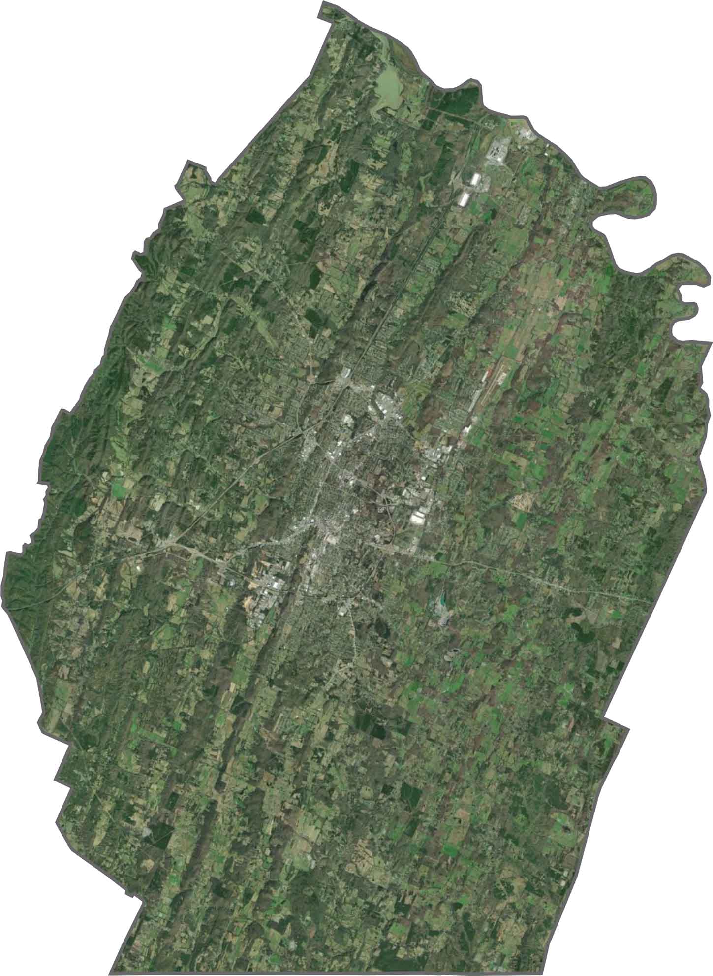
SATELLITE IMAGERY
Wilson County Satellite Map
Lebanon and Mount Juliet show up quickly on the map. They are the two bright clusters. But the in-between is a collection of farmland and wooded tracts. Cedar forests darken the map in places. I-40 cuts a line across it all. Streams flow through, but forests steal the show.
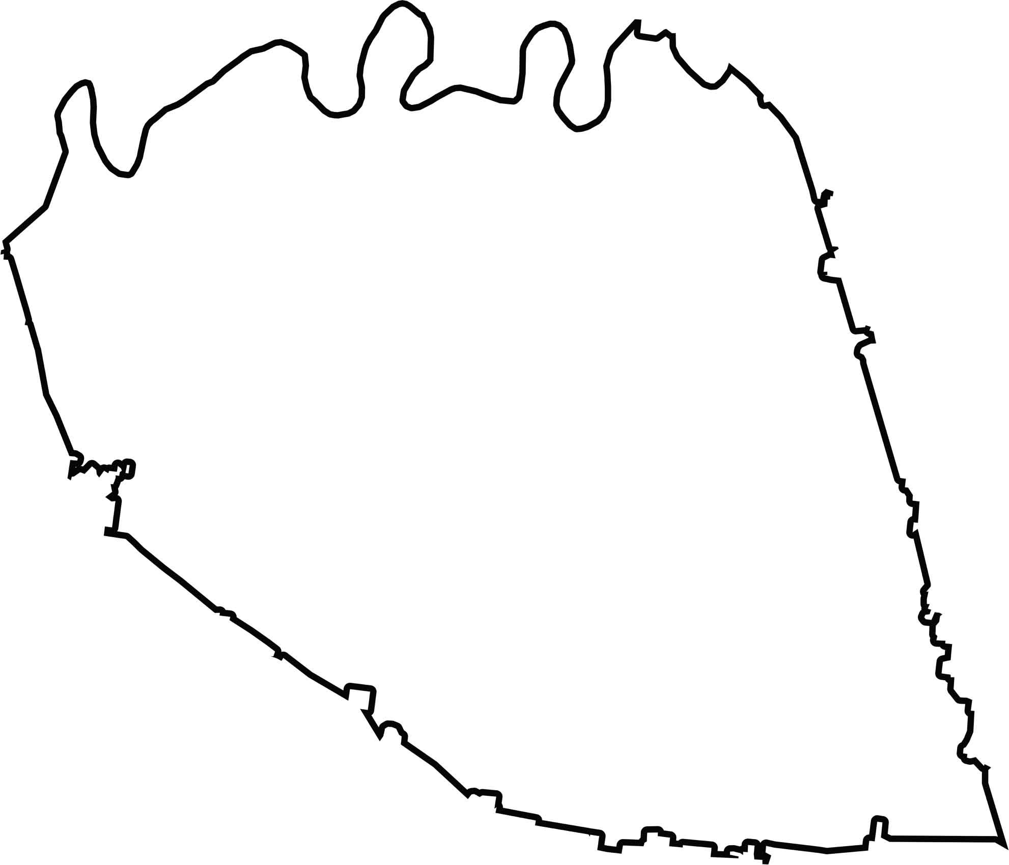
OUTLINE MAP
Wilson County Blank Map
The shape is roundish with a few firm bumps. It doesn’t border another state. Most of the outline is smooth with the Cumberland River forming the northern boundary.
Neighboring Counties
Here are the 7 neighboring counties of Wilson County:


Tennessee County Map

There’s no such thing as a boring county in Tennessee. Some stretch through the Smokies, others roll out into Delta flatlands. Every county’s shaped by the land and it shows.