Erie County Map, Pennsylvania

Erie County Map Collection
We allow you to use our Erie County map. Attribution is required.
Erie County, Pennsylvania

Erie County is the only part of Pennsylvania that touches one of the Great Lakes. Lake Erie, to be specific. It’s up in the northwest corner of the state.
Erie is the county seat and is Pennsylvania’s fifth-largest city. Presque Isle State Park is the crown jewel here. Miles of beaches, right on the lake. It’s a summer hotspot.
The county has a rich maritime history. Check out the Erie Maritime Museum if that’s your thing. Gannon University and Penn State Behrend keep the area young and lively. Waldameer & Water World is a hit with families.
| Category | Details |
|---|---|
| County Name | Erie County |
| County Seat | Erie |
| Population | Approximately 264,000 |
| Cities, Towns, and Communities | Erie, Edinboro, North East, Fairview, Girard, Harborcreek |
| Interstates and Highways | Interstate 79, Interstate 90, U.S. Highway 20, U.S. Highway 19 |
| FIPS Code | 42-049 |
| Total Area (Land and Water) | 1,558 square miles (799 sq mi land, 759 sq mi water) |
| Adjacent Counties (and Direction) | Chautauqua County, New York (Northeast), Warren County (Southeast), Crawford County (South), Ashtabula County, Ohio (Southwest) |
| Time Zone | Eastern Time Zone (EST) |
| State | Pennsylvania |
| Coordinates | 42°07’N, 80°05’W |
| Etymology | Named after Lake Erie |
| Major Landmarks | Presque Isle State Park, Erie Maritime Museum, Waldameer Park, Tom Ridge Environmental Center |
| Website | Erie County Website |
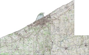
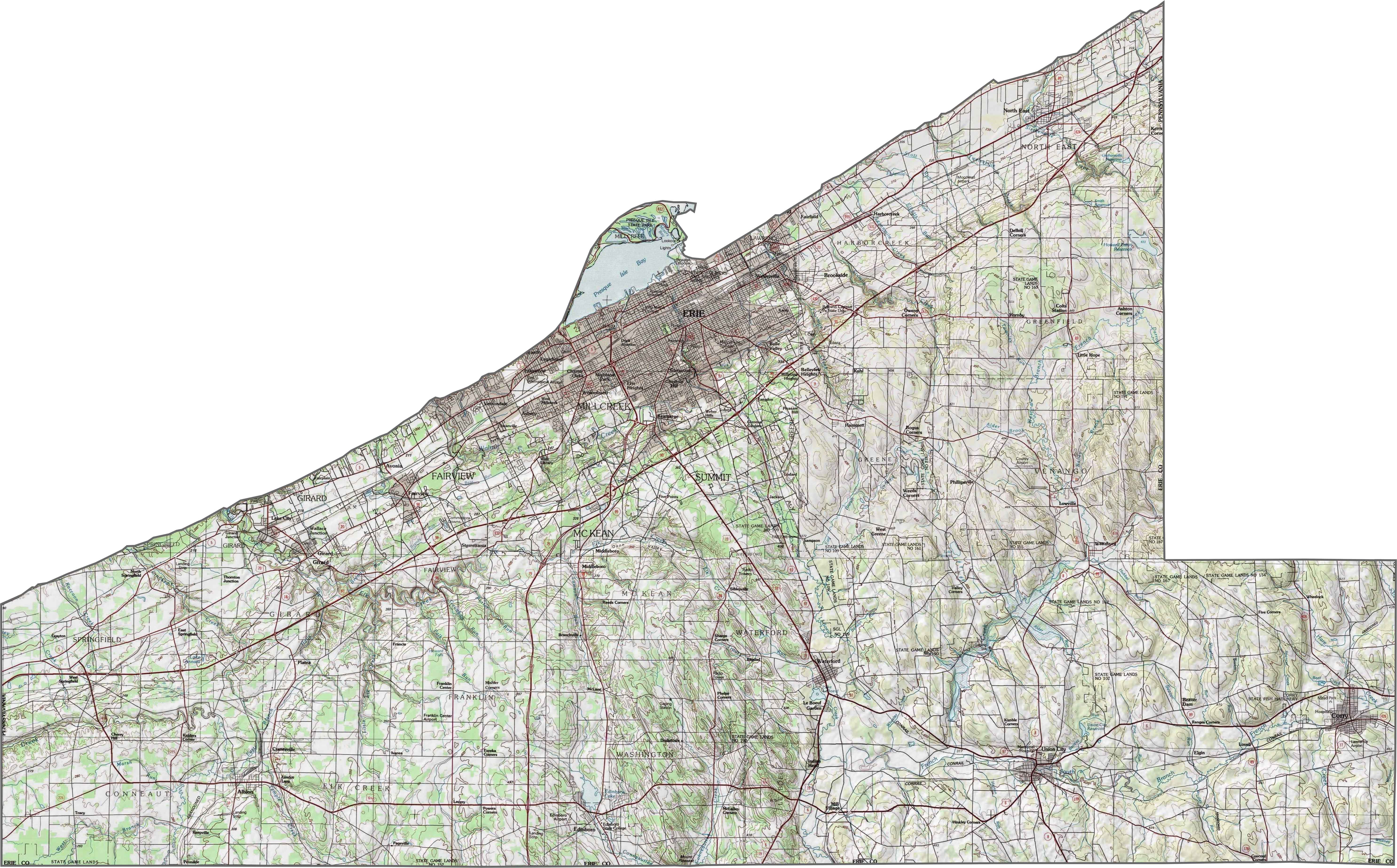
PHYSICAL MAP
Erie County Topographic Map
Erie County slopes gently northward toward Lake Erie. Most of the land is flat to rolling, but elevation rises in the south. Ridges and hills become more common farther inland, though they’re rarely steep.
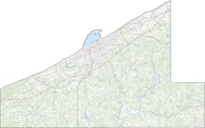
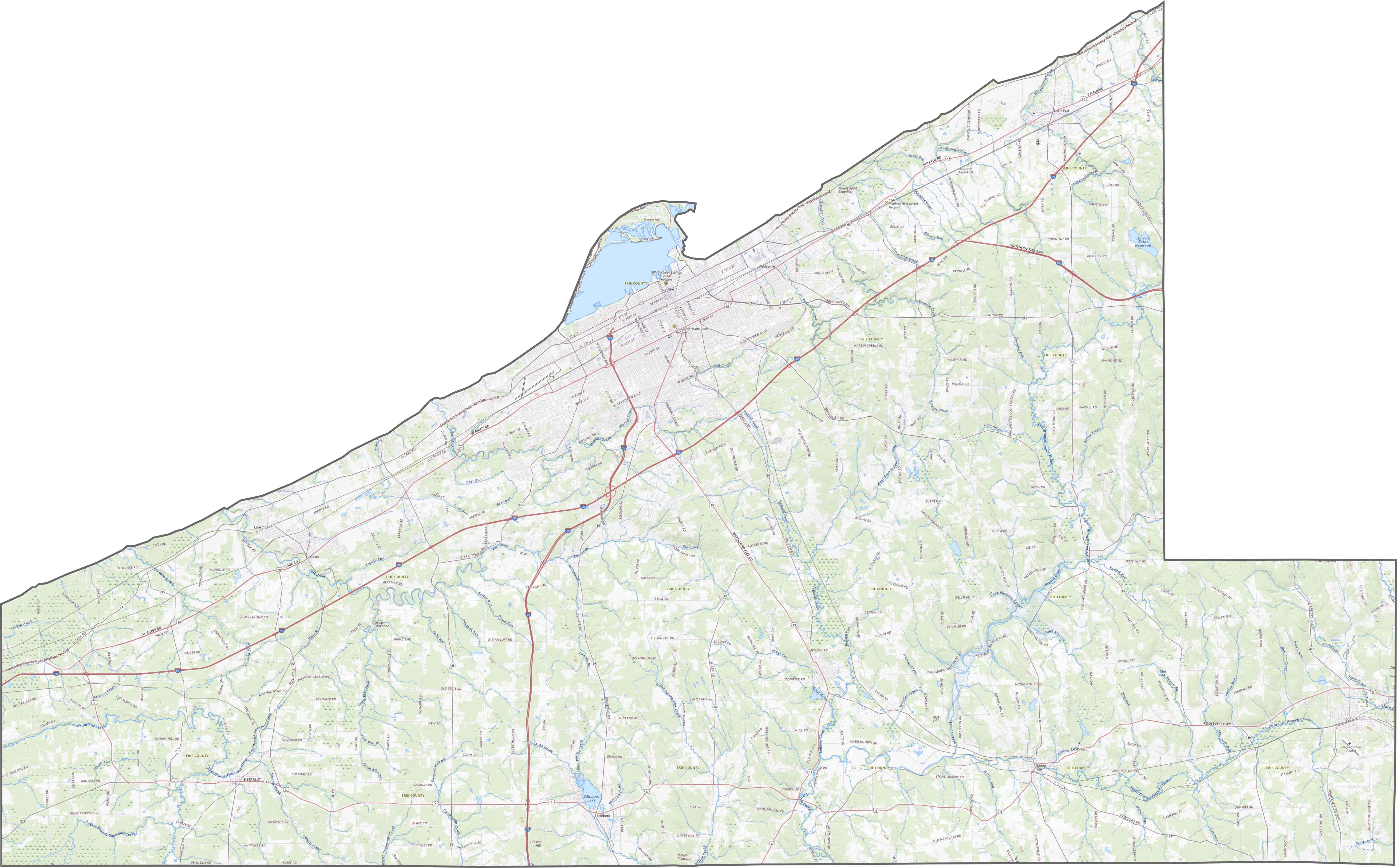
TRANSPORTATION MAP
Erie County Road Map
Erie County’s roads stretch north to the lake and south through farmland. There’s a strong east-west network along the shoreline with I-90. However, inland routes tend to wander more. You can explore them all using our zoom feature below.
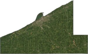
SATELLITE IMAGERY
Erie County Satellite Map
The city of Erie appears as a tight, gray cluster near the shore. Forests and farmland share the rest of the map, with long green stretches and open fields across the southern half.

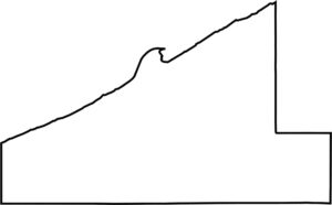
OUTLINE MAP
Erie County Blank Map
Erie County has a boxy southern border. But the northern border takes its shape from Lake Erie. To the west, it borders Ohio. The lakefront gives the county its defining shape, which is a curvy edge in the north.

Neighboring Counties
Here are the 4 neighboring counties of Erie County:


Pennsylvania County Map

Pennsylvania’s 67 counties contains steel city lights, Amish country backroads, and Pocono mountain escapes. Mileage may vary, but the stories won’t.