Pierce County Map, Washington

Pierce County Map Collection
We allow you to use our Pierce County map. Attribution is required.
Pierce County, Washington

Pierce County lies just south of Seattle, a diverse area with a mix of urban and rural landscapes. It’s home to Tacoma, Washington’s third-largest city.
Mount Rainier looms large here, literally. The massive volcano dominates the skyline and draws hikers and nature lovers from all over. Pierce County isn’t just about the mountain though.
There’s plenty of history too. Check out the restored 1800s buildings at Fort Nisqually. Like cars? The LeMay Car Museum will blow your mind. The county has great parks. Don’t miss the glass art scene either because it’s world-class. Pierce County has a little bit of everything.
| Category | Details |
|---|---|
| County Name | Pierce County |
| County Seat | Tacoma |
| Population | Approximately 945,000 |
| Cities, Towns, and Communities | Tacoma, Puyallup, Lakewood, Sumner, Gig Harbor, Bonney Lake, University Place, Steilacoom |
| Interstates and Highways | I-5, I-705, WA-16, WA-167, WA-512 |
| FIPS Code | 53-053 |
| Total Area (Land and Water) | 1,806 sq mi (Land: 1,670 sq mi; Water: 136 sq mi) |
| Adjacent Counties (and Direction) | King County (North), Yakima County (East), Lewis County (South), Thurston County (West), Mason County (Northwest), Kitsap County (Northwest) |
| Time Zone | Pacific Time Zone (PT) |
| State | Washington |
| Coordinates | 47.0676° N, 122.1295° W |
| Etymology | Named after President Franklin Pierce, the 14th President of the United States |
| Major Landmarks | Mount Rainier National Park, Point Defiance Park, LeMay – America’s Car Museum |
| Website | Pierce County Website |
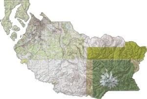
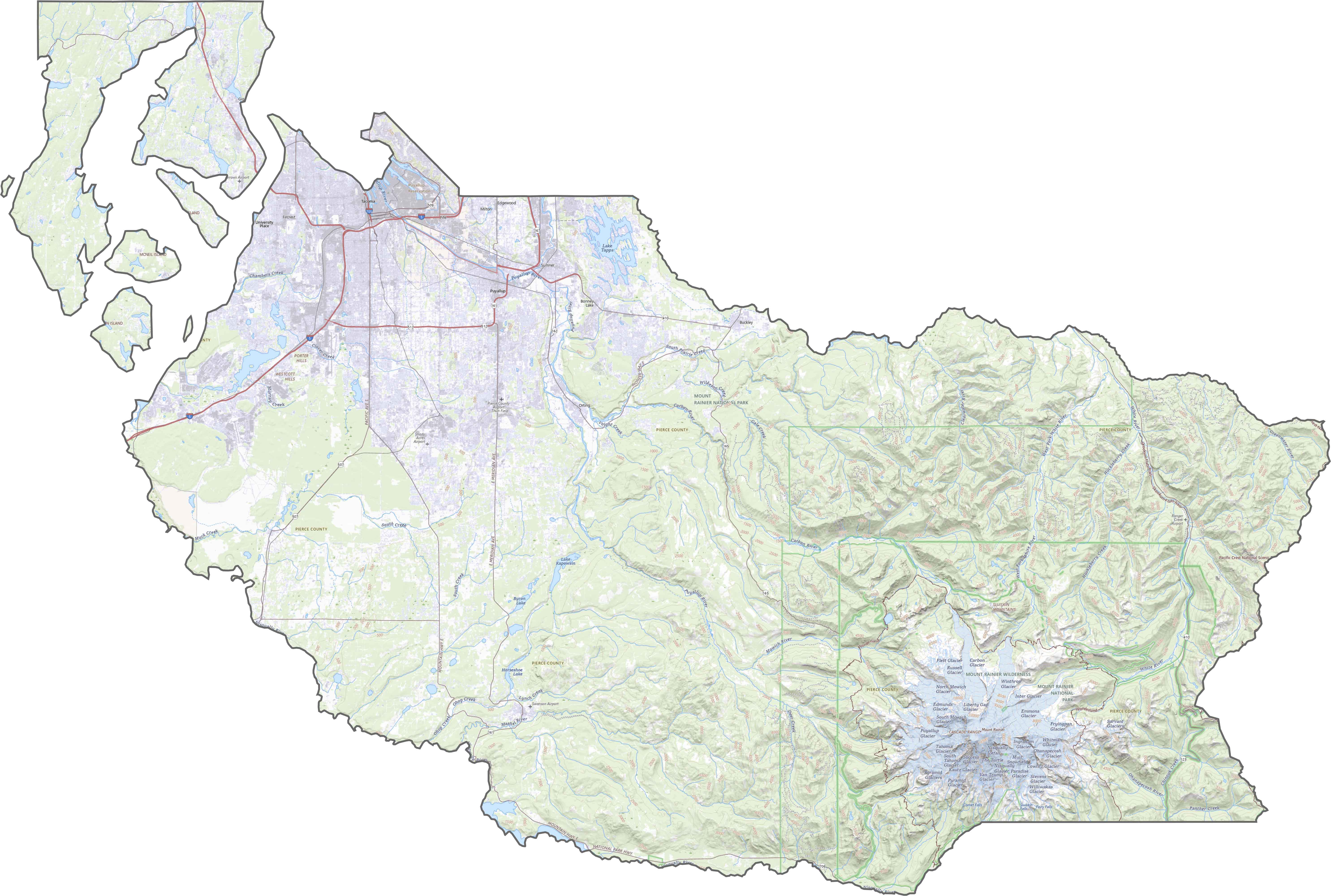
PHYSICAL MAP
Pierce County Topographic Map
Mount Rainier steals the show in Pierce County, towering at over 14,000 feet. The southeast is alpine terrain, all glaciers and ridgelines. But head west, and the land drops into river valleys and rolling hills. You also have the tidal flats near Puget Sound.

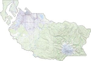
TRANSPORTATION MAP
Pierce County Road Map
Interstate 5 cuts through the western half, threading Tacoma to Olympia and Seattle. Though I-705 and State Route 512 offer extra access, traffic can get dense. But out east, the roads thin out fast. Our zoom tool shows the transition from freeway grids to winding mountain routes.
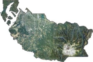
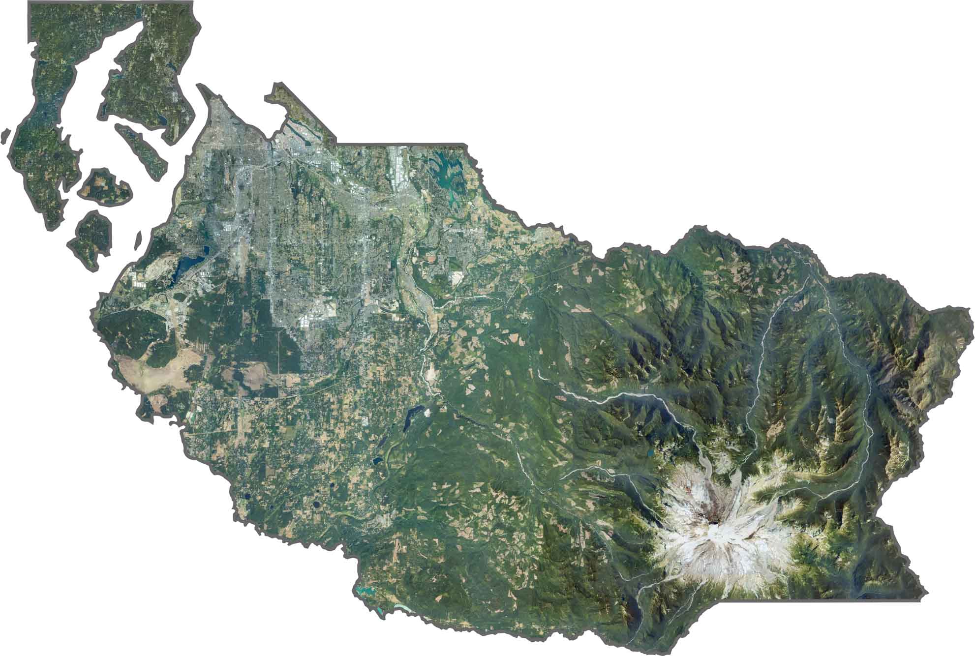
SATELLITE IMAGERY
Pierce County Satellite Map
From above, urban density hugs the coastline. That’s right. Tacoma’s grid is clear and sprawling. But the farther inland you go, the greener it gets. Rainier’s snowy peak is hard to miss, even from space.
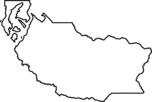
OUTLINE MAP
Pierce County Blank Map
Pierce County is broad on the west and narrows into the Cascades. The Greenwater and Nisqually Rivers shape parts of the border. Though it doesn’t touch another state, it runs from Puget Sound to the wilderness of Mount Rainier National Park.

Neighboring Counties
Here are the 6 neighboring counties of Pierce County:


Washington County Map

Seattle takes the spotlight, but the rest of Washington is where the wild still wins. From coast to mountains, Washington’s 39 counties are full of surprises. Find your favorite spot.