Benton County Map, Washington

Benton County Map Collection


We allow you to use our Benton County map. Attribution is required.
Benton County, Washington

Benton County is right in the south-central part of Washington. The Tri-Cities area includes Kennewick, Pasco, and Richland. These places form the heart of the county.
Here, high-tech meets agriculture. Vineyards and orchards stretch across the landscape. The Hanford Site, once crucial for nuclear production, now focuses on environmental cleanup.
Locals flock to the Columbia River for water sports and fishing. This river forms a large chunk of its border. The county’s history runs deep, from Native American settlements to Lewis and Clark’s expedition. Today, it’s a blend of rural charm and urban amenities.
| Category | Details |
|---|---|
| County Name | Benton County |
| County Seat | Prosser |
| Population | Approximately 215,000 |
| Cities, Towns, and Communities | Kennewick, Richland, West Richland, Prosser, Benton City |
| Interstates and Highways | I-82, US-395, WA-240, WA-224 |
| FIPS Code | 53-005 |
| Total Area (Land and Water) | 1,760 sq mi (Land: 1,700 sq mi; Water: 60 sq mi) |
| Adjacent Counties (and Direction) | Grant County (North), Franklin County (Northeast), Walla Walla County (East), Umatilla County, Oregon (Southeast), Morrow County, Oregon (Southwest), Klickitat County (Southwest), Yakima County (West) |
| Time Zone | Pacific Time Zone (PT) |
| State | Washington |
| Coordinates | 46.2392° N, 119.5022° W |
| Etymology | Named after Thomas Hart Benton |
| Major Landmarks | Hanford Reach National Monument, Sacagawea Heritage Trail, Badger Mountain Centennial Preserve |
| Website | Benton County Website |
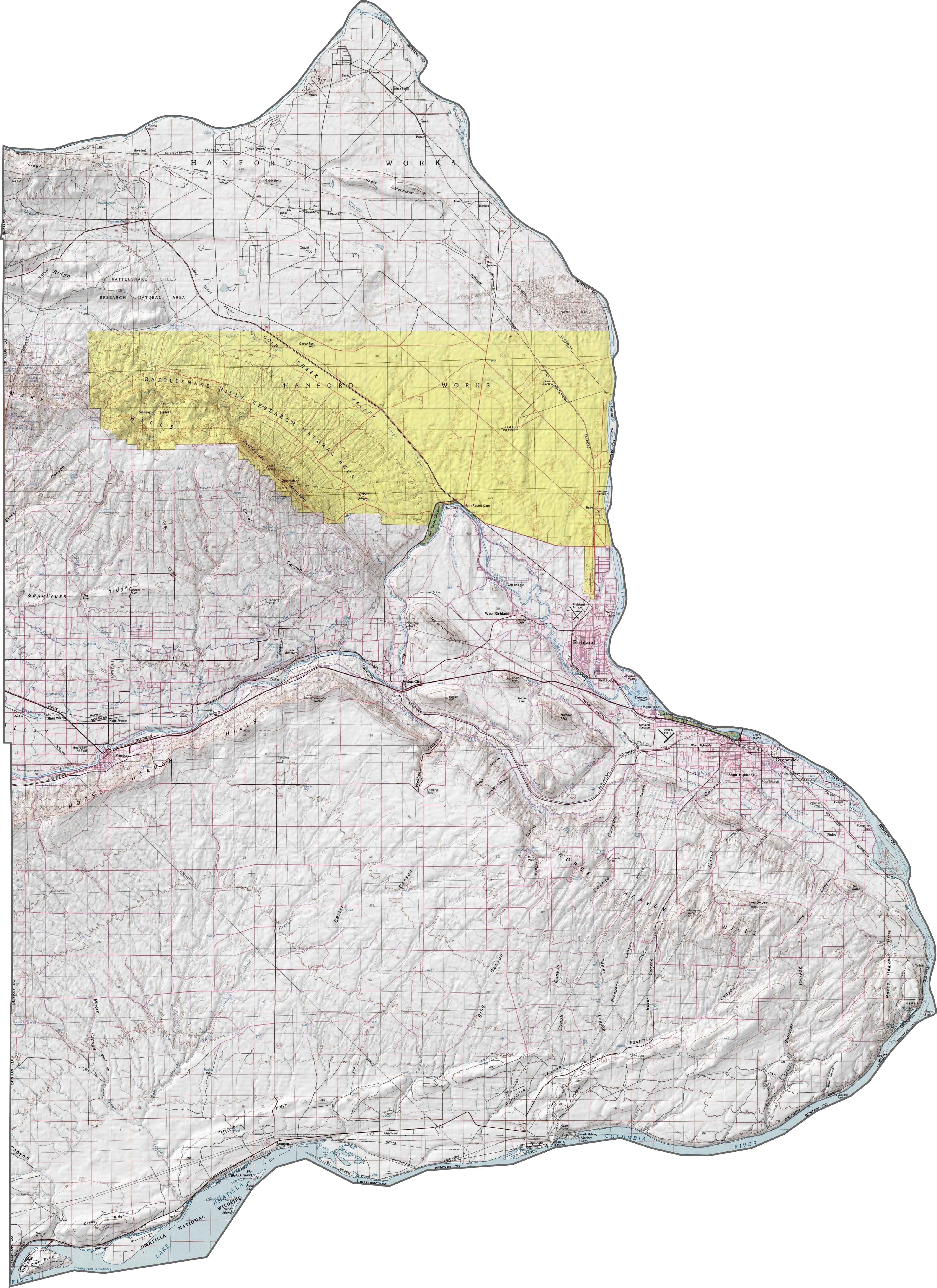
PHYSICAL MAP
Benton County Topographic Map
Benton County is defined by its rivers and arid hills. The entire county is surrounded by rivers which makes its borders, except for the west side.. Though most of the county is dry, the terrain shifts around the rivers. See for yourself with our zoom tool below.
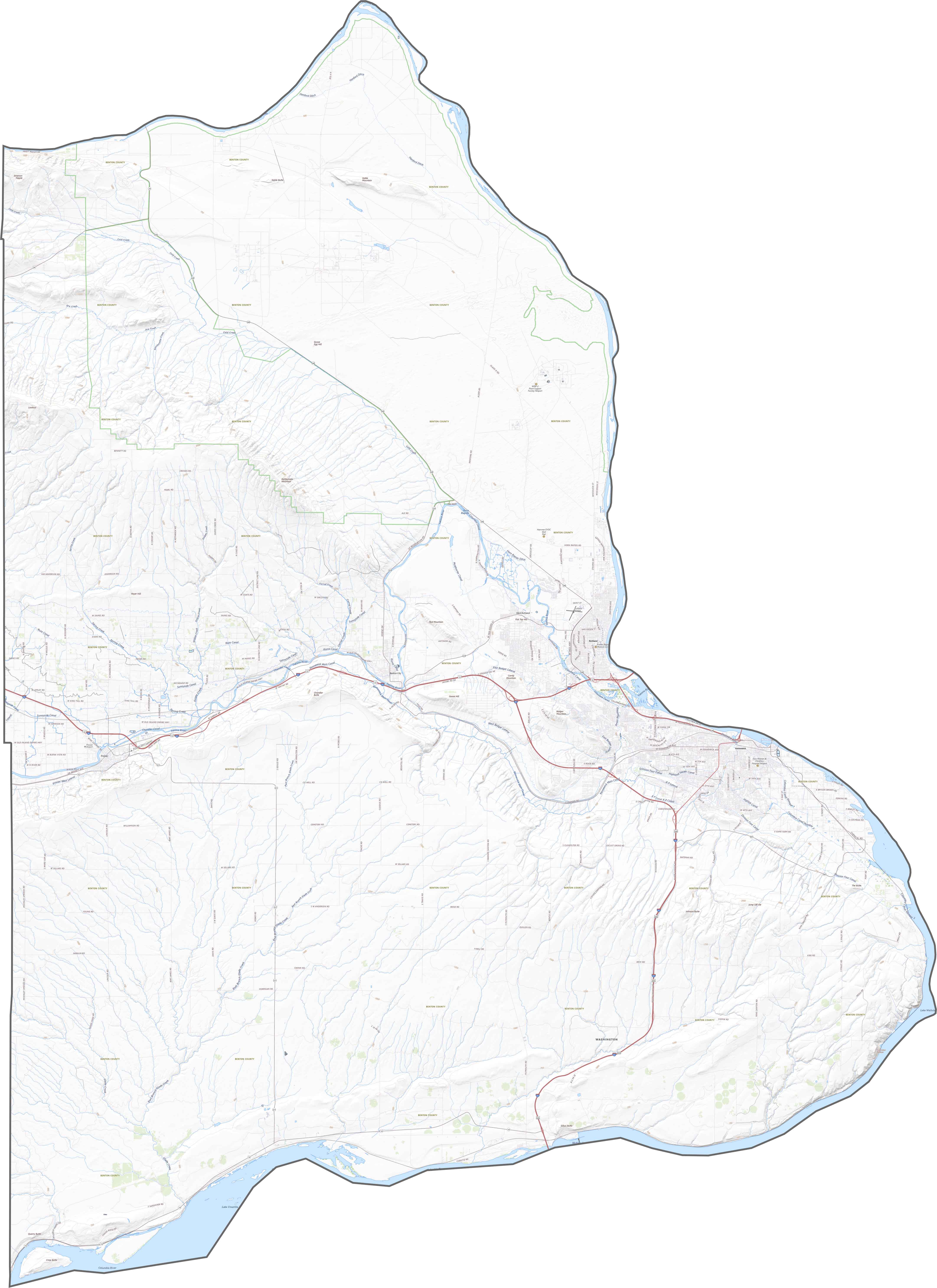
TRANSPORTATION MAP
Benton County Road Map
Benton County has a solid network of roads. Interstate 82 runs through it, connecting the Tri-Cities to Yakima and Oregon. Local routes like Highway 240 also play a big role, traveling north-south.
SATELLITE IMAGERY
Benton County Satellite Map
In our satellite map below, circular irrigated farmland stands out the most in green. You can see them especially in the south. The Tri-Cities area shows up clearly on the east side, with dense development near the river confluence. But beyond that, the county quickly fades into rugged, dry hills.

OUTLINE MAP
Benton County Blank Map
Benton County has a wide, irregular shape, surrounded almost entirely by rivers. The Columbia River marks much of its southern and eastern border. To the south, it touches Oregon across the river. The western boundary is the only straight border in Benton County, neighboring Yakima County to the west.

Neighboring Counties
Here are the 7 neighboring counties of Benton County:


Washington County Map

Seattle takes the spotlight, but the rest of Washington is where the wild still wins. From coast to mountains, Washington’s 39 counties are full of surprises. Find your favorite spot.