Grant County Map, Washington

Grant County Map Collection
We allow you to use our Grant County map. Attribution is required.
Grant County, Washington

Grant County sprawls across central Washington. Massive irrigation projects have transformed this once-arid region into an agricultural powerhouse. You’ll see endless fields of crops alongside stark desert landscapes. It’s pretty wild.
Moses Lake, the largest city, is a hub for manufacturing and aerospace. The Columbia River cuts through the western edge of the county. It’s a big deal for power generation and recreation.
The county hosts the Gorge Amphitheatre, an epic outdoor concert venue with killer views. You can find Grand Coulee Dam at the northern tip of the county. It’s mind-blowingly huge. Grant County is a place of big skies and even bigger potential.
| Category | Details |
|---|---|
| County Name | Grant County |
| County Seat | Ephrata |
| Population | Approximately 105,000 |
| Cities, Towns, and Communities | Moses Lake, Ephrata, Quincy, Warden, Soap Lake |
| Interstates and Highways | I-90, WA-17, WA-28 |
| FIPS Code | 53-025 |
| Total Area (Land and Water) | 2,791 sq mi (Land: 2,679 sq mi; Water: 112 sq mi) |
| Adjacent Counties (and Direction) | Douglas County (North), Okanogan County (Northeast), Adams County (East), Lincoln County (East), Franklin County (Southeast), Benton County (South), Yakima County (Southwest), Kittitas County (West) |
| Time Zone | Pacific Time Zone (PT) |
| State | Washington |
| Coordinates | 47.1983° N, 119.3733° W |
| Etymology | Named after Ulysses S. Grant, the 18th President of the United States |
| Major Landmarks | Grand Coulee Dam, Moses Lake Sand Dunes, Potholes State Park |
| Website | Grant County Website |
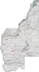
PHYSICAL MAP
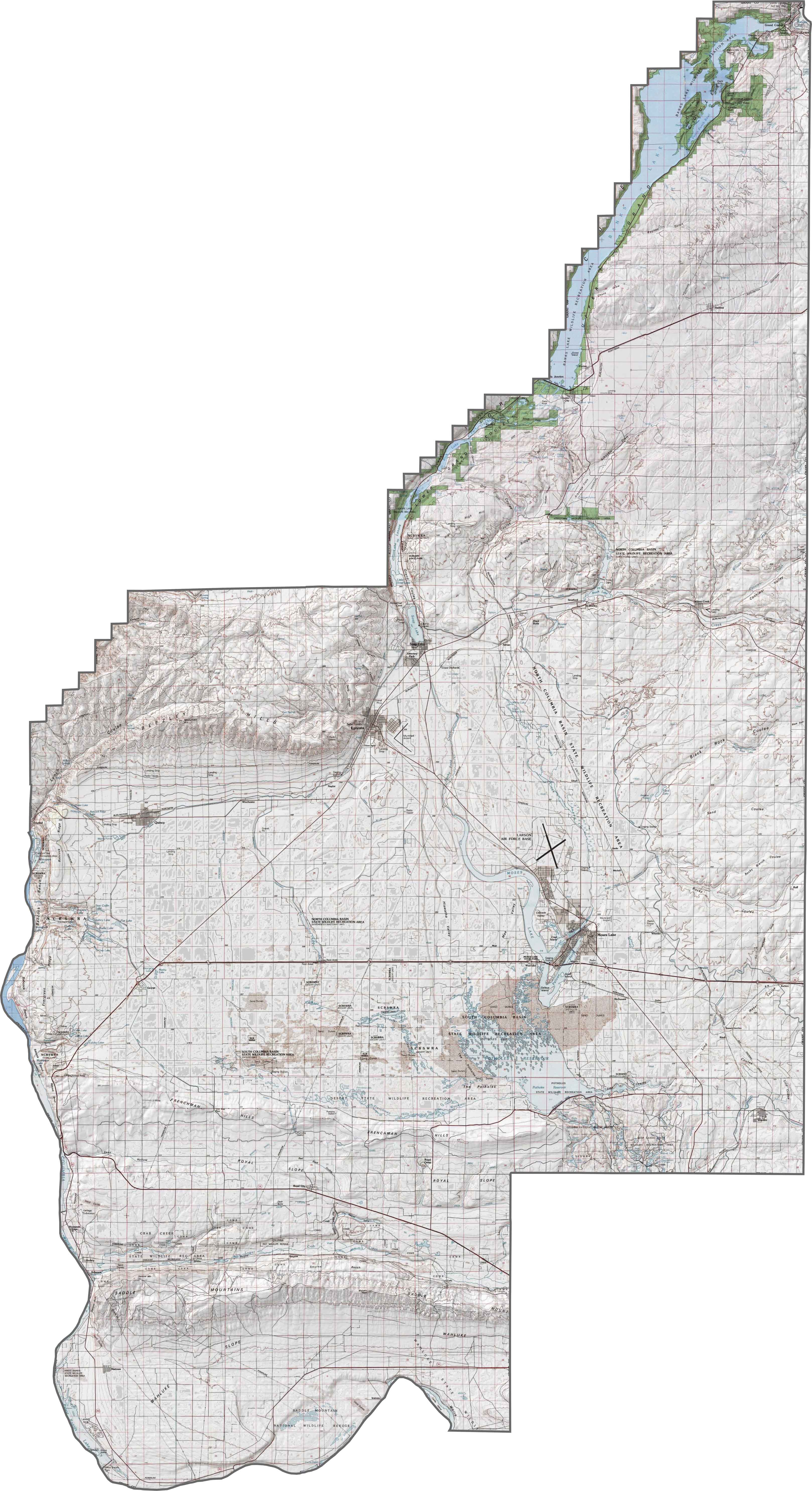
Grant County Topographic Map
Grant County’s topography is full of surprises. The county contains part of the Grand Coulee and the Saddle Mountains in the south. Much of the terrain is dry and flat. But coulees and buttes break the monotony here.
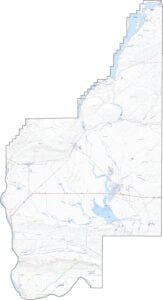
TRANSPORTATION MAP
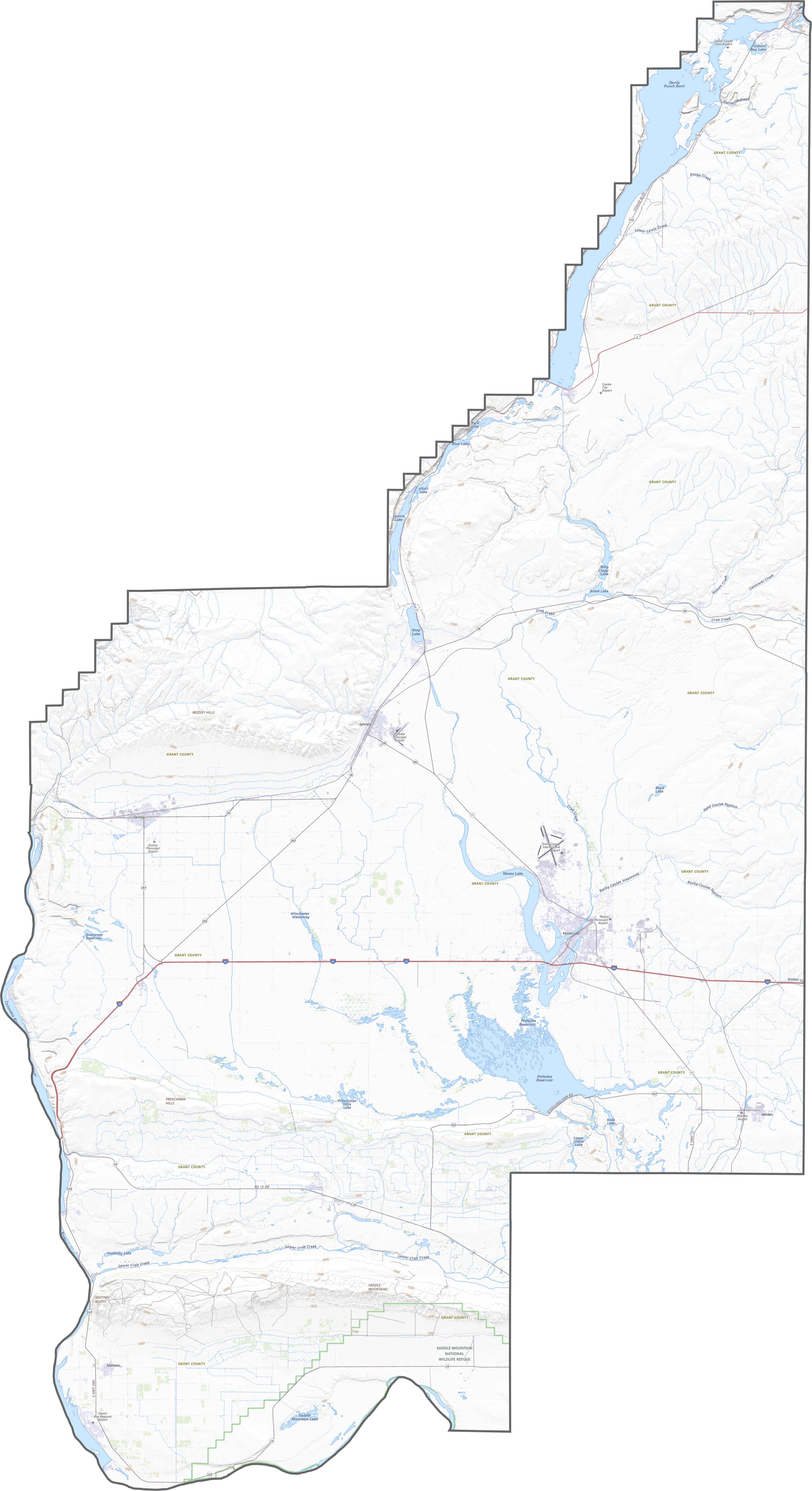
Grant County Road Map
Highways slice through the farmland here, with U.S. Route 2 and State Route 17 doing most of the work. I-90 also cuts east-west in the central region too. Some roads feel remote here, especially out by the canyons. Explore it all using our zoom tool on our map below.
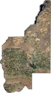
SATELLITE IMAGERY
Grant County Satellite Map
Grant County looks like farmland organized by geometry. Crop circles, long pivots, and checkerboard plots stretch for miles. But cliffs and canyons appear suddenly, especially where the coulees twist through the plateau.

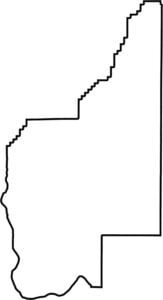
OUTLINE MAP
Grant County Blank Map
Grant County is long in the north-south direction. It borders no other states, and sits close to the center of Washington state. The Columbia River forms its southwestern edge, but most of the lines are ruler-straight.

Neighboring Counties
Here are the 8 neighboring counties of Grant County:


Washington County Map

Seattle takes the spotlight, but the rest of Washington is where the wild still wins. From coast to mountains, Washington’s 39 counties are full of surprises. Find your favorite spot.