Burlington County Map, New Jersey

Burlington County Map Collection
We allow you to use our Burlington County map. Attribution is required.
Burlington County, New Jersey

Burlington County lies in the heart of South Jersey. It’s big. Really big. In fact, it’s the largest county by area in the state. Burlington stretches from the Delaware River all the way to the Pine Barrens.
You’ll find a mix of suburban towns, farmland, and forests here. The county has deep roots in American history. Ever heard of Mount Holly? It was a key spot during the Revolutionary War. Today, it’s the county seat.
Agriculture is still a big deal in Burlington. Blueberries, cranberries, peaches. You name it, they grow it. Towns like Mount Laurel and Evesham are main suburban centers. For nature lovers, there’s the Wharton State Forest. Yep. It’s a great place to hike, canoe, or just enjoy the outdoors.
| Category | Details |
|---|---|
| County Name | Burlington County |
| County Seat | Mount Holly |
| Population | Approximately 450,000 |
| Cities, Towns, and Communities | Mount Laurel, Moorestown, Evesham Township, Medford, Willingboro, Pemberton, Burlington, Bordentown |
| Interstates and Highways | Interstate 295, New Jersey Turnpike, U.S. Route 130, U.S. Route 206, New Jersey Route 70 |
| FIPS Code | 34-005 |
| Total Area (Land and Water) | 819 square miles (798 sq mi land, 21 sq mi water) |
| Adjacent Counties (and Direction) | Mercer County (North), Monmouth County (Northeast), Bucks County, Pennsylvania (West), Ocean County (East), Camden County (Southwest), Philadelphia County, Pennsylvania (Southwest), Atlantic County (Southeast) |
| Time Zone | Eastern Time Zone (ET) |
| State | New Jersey |
| Coordinates | 39.8685° N, 74.6766° W |
| Etymology | Named after Bridlington, England |
| Major Landmarks | Historic Smithville Park, Batsto Village, Rancocas State Park, Mount Holly Historic District |
| Website | Burlington County Website |
PHYSICAL MAP
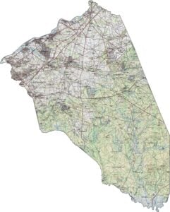
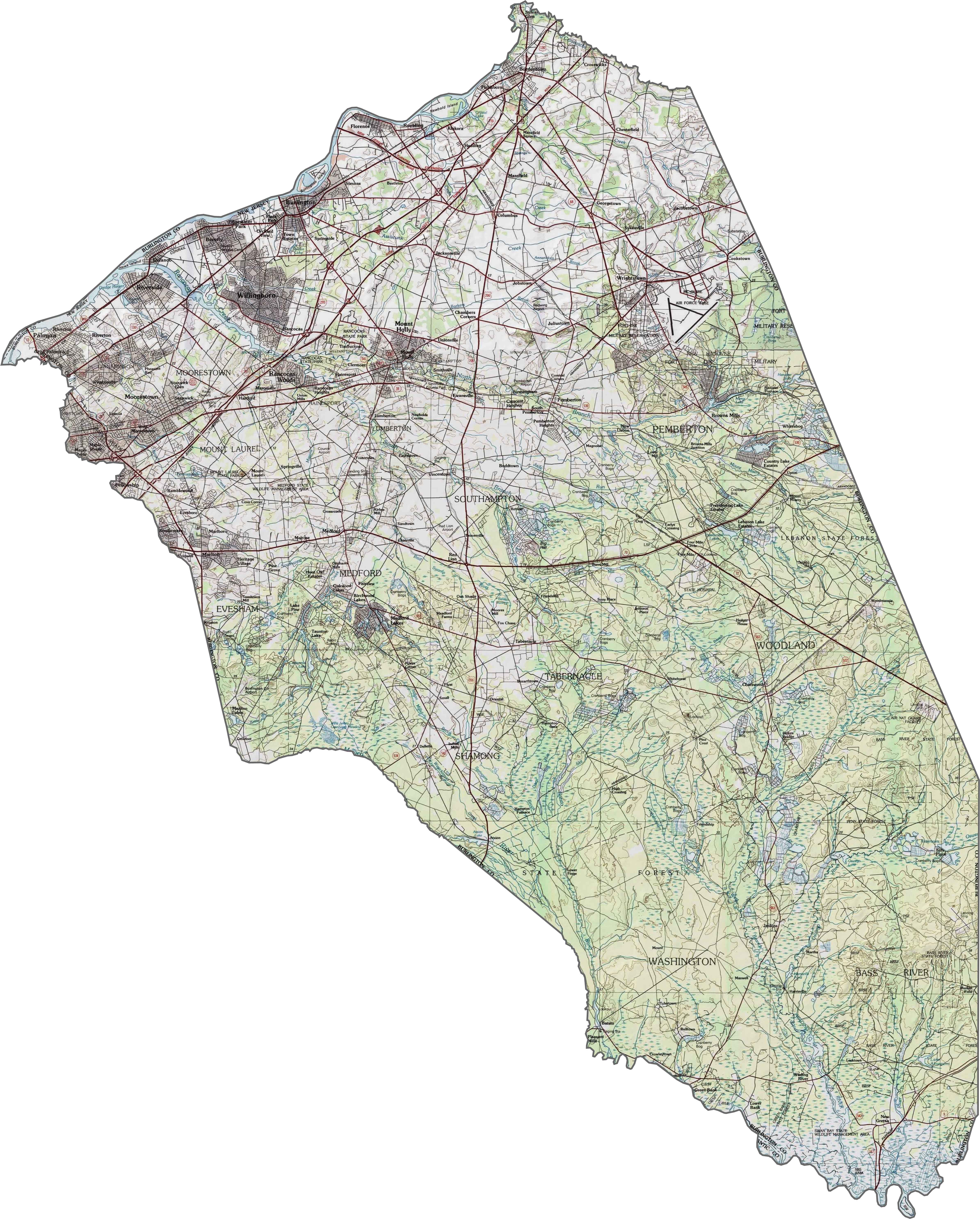
Burlington County Topographic Map
Burlington’s terrain is mostly flat, but it shifts subtly. The western part sits in the river valley. But as you go east, pine forests dominate (especially the inland region). The coastal plain here feels wide and quiet. See it all with our topographic map and zoom tool below.
TRANSPORTATION MAP
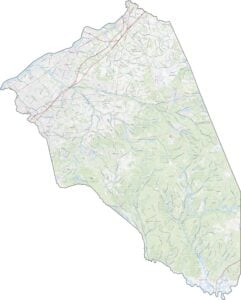
Burlington County Road Map
Burlington is long and stretched out, and so are its highways. I-295 clips the western edge near the Delaware River. Though the New Jersey Turnpike runs through it too, they don’t overlap. Route 70 and Route 206 slice across the interior. You can zoom in and follow each one on our road map below.

SATELLITE IMAGERY
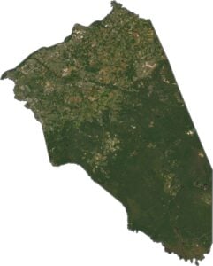
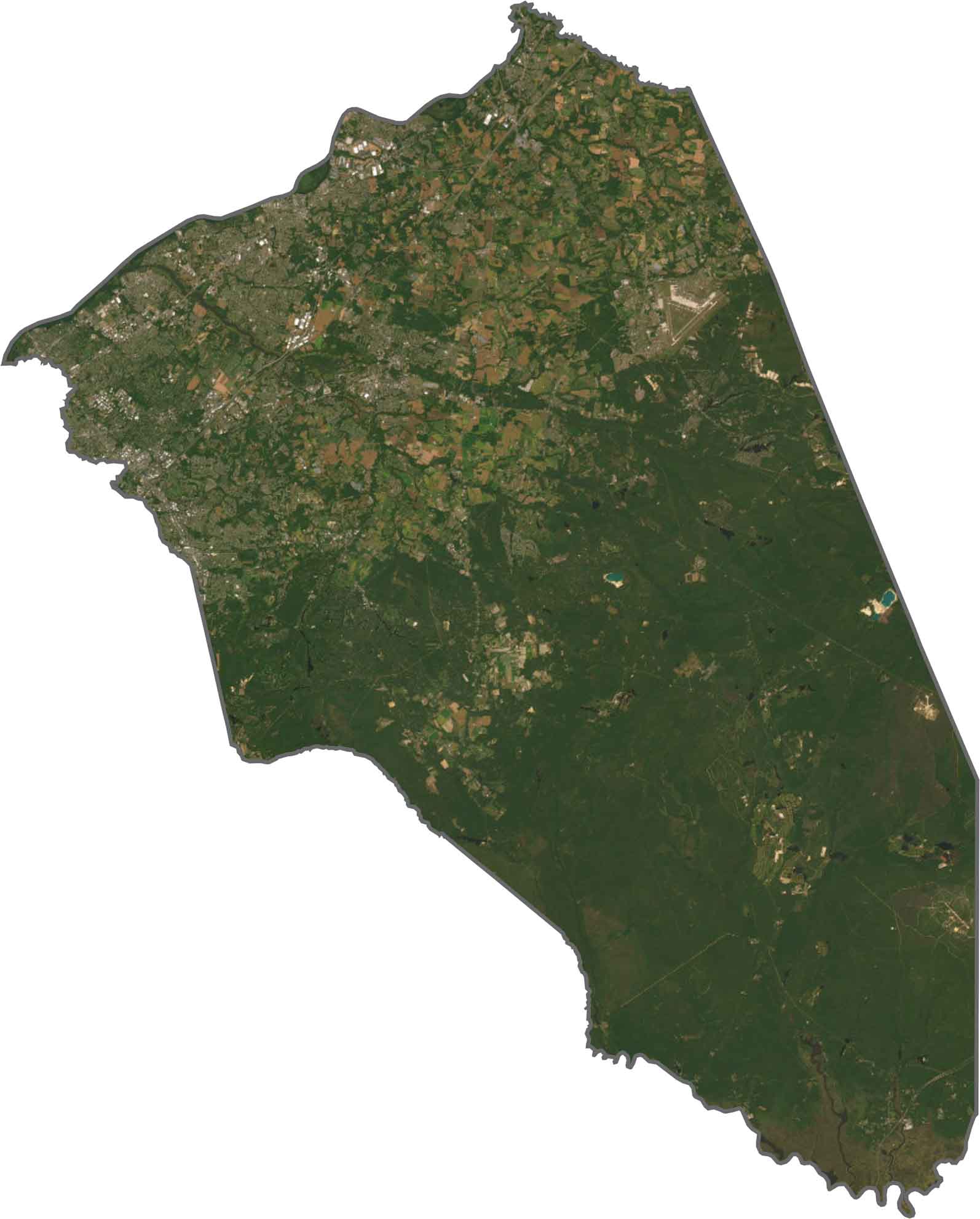
Burlington County Satellite Map
From above, Burlington is a mix of green and tan. The western part looks more like suburbs and farmland. But the eastern side? All forest. Though there are some clearings, the Pine Barrens stretch for miles. The contrast between northwest and southeast is easy to spot.
OUTLINE MAP
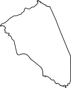
Burlington County Blank Map
Burlington County is one of the largest counties in the state, stretching from river to forest. The Delaware River marks the western border. And yes, that side touches Pennsylvania. The rest of the outline is irregular, especially toward the pine forest areas.

Neighboring Counties
Here are the 7 neighboring counties of Burlington County:


New Jersey County Map

New Jersey packs a lot into 21 counties – beach towns, pine forests and farmland. Trace the colonial history in Hunterdon or walk the boardwalk in Ocean County. There’s more here than meets the Turnpike.