Clay County Map, Missouri

Clay County Map Collection
We allow you to use our Clay County map. Attribution is required.
Clay County, Missouri

Clay County sits just north of Kansas City, right across the Missouri River. It’s been around since 1822, named after Henry Clay, the famous statesman.
Liberty is the county seat and has a square that’s worth a visit. This place has seen its share of Wild West action. In fact, Jesse James robbed his first bank here.
These days, it’s more about suburban living and good schools. The county has a mix of everything such as busy shopping areas, quiet neighborhoods, and rural farmland.
| Category | Details |
|---|---|
| County Name | Clay County |
| County Seat | Liberty |
| Population | Approximately 256,000 |
| Cities, Towns, and Communities | Liberty, Gladstone, North Kansas City, Excelsior Springs, Smithville, Kearney, Claycomo, Mosby |
| Interstates and Highways | I-35, I-435, US-69, US-169, MO-1, MO-92, MO-152, MO-210 |
| FIPS Code | 29-047 |
| Total Area (Land and Water) | 409 sq mi (land: 397 sq mi, water: 12 sq mi) |
| Adjacent Counties (and Direction) | Clinton County (North), Ray County (East), Jackson County (South), Wyandotte County, Kansas (Southwest), Platte County (West) |
| Time Zone | Central Time Zone (CST) |
| State | Missouri |
| Coordinates | 39.2986° N, 94.4182° W |
| Etymology | Named after Henry Clay, a prominent American statesman |
| Major Landmarks | Liberty Jail Historic Site, Jesse James Bank Museum, Smithville Lake |
| Website | Clay County Website |
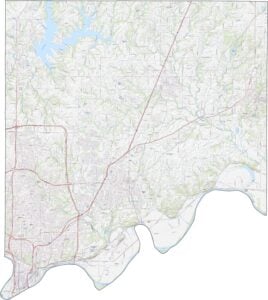
TRANSPORTATION MAP
Clay County Road Map
Clay County is filled with busy roads thanks to its location near Kansas City. I-35 cuts right through the middle, making travel fast, while I-435 loops the southern end. Even though interstates dominate the south, scenic rural drives still exist farther out. Our road map zoom tool below lets you check out every road and shortcut.
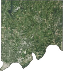
SATELLITE IMAGERY
Clay County Satellite Map
In our satellite map, Clay County blends city and countryside. Dense urban patches pop up in the south near Liberty and Gladstone. Although housing developments fill parts of the south, the north stays wide open and green.

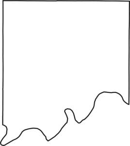
OUTLINE MAP
Clay County Blank Map
Clay County’s southern border follows the Missouri River closely. The northern and eastern edges are much straighter, giving it a boxy top half and a wavy lower edge.

Neighboring Counties
Here are the 5 neighboring counties of Clay County:


Missouri County Map

Explore the Show-Me State. We have all 114 county maps as your guide to smoky BBQ, Ozark trails, and sunsets over the mighty Mississippi. From St. Louis to Branson, Missouri has something on every road.