Cumberland County Map, New Jersey

Cumberland County Map Collection
We allow you to use our Cumberland County map. Attribution is required.
Cumberland County, New Jersey

Cumberland County is down in South Jersey, along the Delaware Bay. It’s off the beaten path, but that’s part of its charm. Vineland is the biggest city, known for its rich agricultural heritage. Farms are all across the landscape here so fresh produce is a way of life.
The Delaware Bay coastline offers a different kind of shore experience than the Jersey Shore. I find it’s quieter and more rugged. Birdwatching is popular here, especially during migration seasons.
The county has some quirky claims to fame too. Ever heard of the Palace of Depression? It’s a wild folk art castle built during the Great Depression. History runs deep in places like Greenwich and Bridgeton. The latter has one of the largest historic districts in the state.
| Category | Details |
|---|---|
| County Name | Cumberland County |
| County Seat | Bridgeton |
| Population | Approximately 145,000 |
| Cities, Towns, and Communities | Vineland, Millville, Bridgeton, Maurice River, Upper Deerfield, Fairfield Township, Commercial Township |
| Interstates and Highways | New Jersey Route 47, New Jersey Route 49, New Jersey Route 55, U.S. Route 40 |
| FIPS Code | 34-011 |
| Total Area (Land and Water) | 677 square miles (484 sq mi land, 193 sq mi water) |
| Adjacent Counties (and Direction) | Gloucester County (Northwest), Atlantic County (Northeast), Salem County (West), Cape May County (East) |
| Time Zone | Eastern Time Zone (ET) |
| State | New Jersey |
| Coordinates | 39.3715° N, 75.1655° W |
| Etymology | Named after the historic English county of Cumberland |
| Major Landmarks | Maurice River, Cohanzick Zoo, East Point Lighthouse, Parvin State Park |
| Website | Cumberland County Website |
TRANSPORTATION MAP
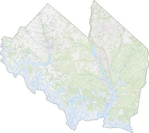
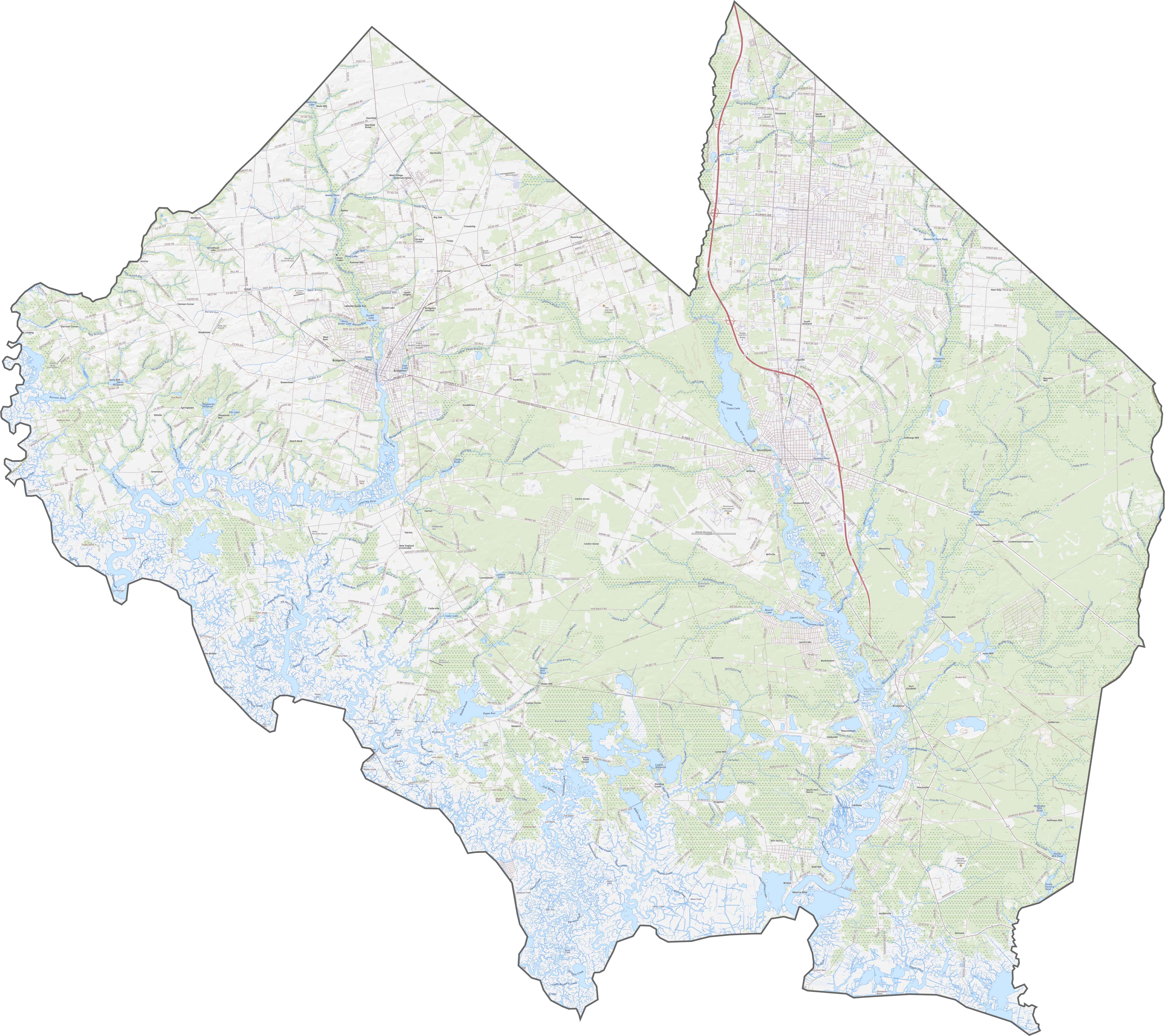
Cumberland County Road Map
Cumberland keeps things a bit low-key. Route 55 is the main highway, slicing north to south. Though Route 49 and Route 47 also cross through, they’re more rural. It’s not built for speed but for access. Some roads wind through farms; others cut through forests. Zoom in on our map to see how they stretch across the county.
SATELLITE IMAGERY
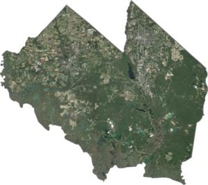
Cumberland County Satellite Map
Cumberland looks patchy from above. Blocks of farmland break up stretches of forest. Though some towns are visible, most of the county appears green or tan. The coast in the south looks muddy, with twisting inlets and marshes. The Maurice River is easy to spot as it cuts a wide path to the bay.

OUTLINE MAP
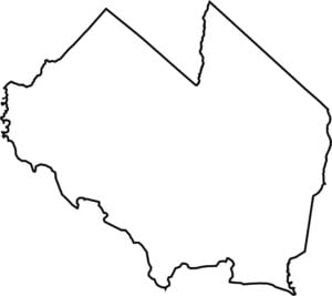
Cumberland County Blank Map
The western edge of Cumberland County hugs the Delaware Bay, with several fingers of land reaching into the water. Though it doesn’t border another state directly, the bay separates it from Delaware. Inland, the shape is jagged but wide. Some boundaries follow rivers and others just curve through forest and field.

Neighboring Counties
Here are the 4 neighboring counties of Cumberland County:


New Jersey County Map

New Jersey packs a lot into 21 counties – beach towns, pine forests and farmland. Trace the colonial history in Hunterdon or walk the boardwalk in Ocean County. There’s more here than meets the Turnpike.