Delaware County Map, Indiana

Delaware County Map Collection
We allow you to use our Delaware County map. Attribution is required.
Delaware County, Indiana

If you’re looking for a slice of Indiana that’s equal parts college town and rust belt revival, Delaware County fits the bill. It’s in the east-central part of the state.
Muncie is the county seat and it’s home to Ball State University. The White River cuts through the county, providing scenic spots and recreation.
Summers here are hot. It was perfect for festivals like Muncie Gras, when they were a thing. Delaware County has grit and determination.
| Category | Details |
|---|---|
| County Name | Delaware County |
| County Seat | Muncie |
| Population | 111,000 (estimated) |
| Cities, Towns, and Communities | Muncie, Yorktown, Albany, Eaton, Selma, Gaston, Daleville (partially), Shideler |
| Interstates and Highways | I-69, US-35, IN-3, IN-28, IN-32, IN-67, IN-332 |
| FIPS Code | 18-035 |
| Total Area (Land and Water) | 395 square miles (Land: 393 sq mi, Water: 2 sq mi) |
| Adjacent Counties (and Direction) | Blackford County (North), Jay County (Northeast), Randolph County (East), Henry County (South), Madison County (West), Grant County (Northwest) |
| Time Zone | Eastern Time Zone (ET) |
| State | Indiana |
| Coordinates | 40.2536° N, 85.3978° W |
| Etymology | Named after the Delaware Native American tribe |
| Major Landmarks | Ball State University, Minnetrista Cultural Center, Muncie Children’s Museum, Westside Park |
| Website | Delaware County Website |
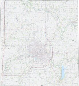
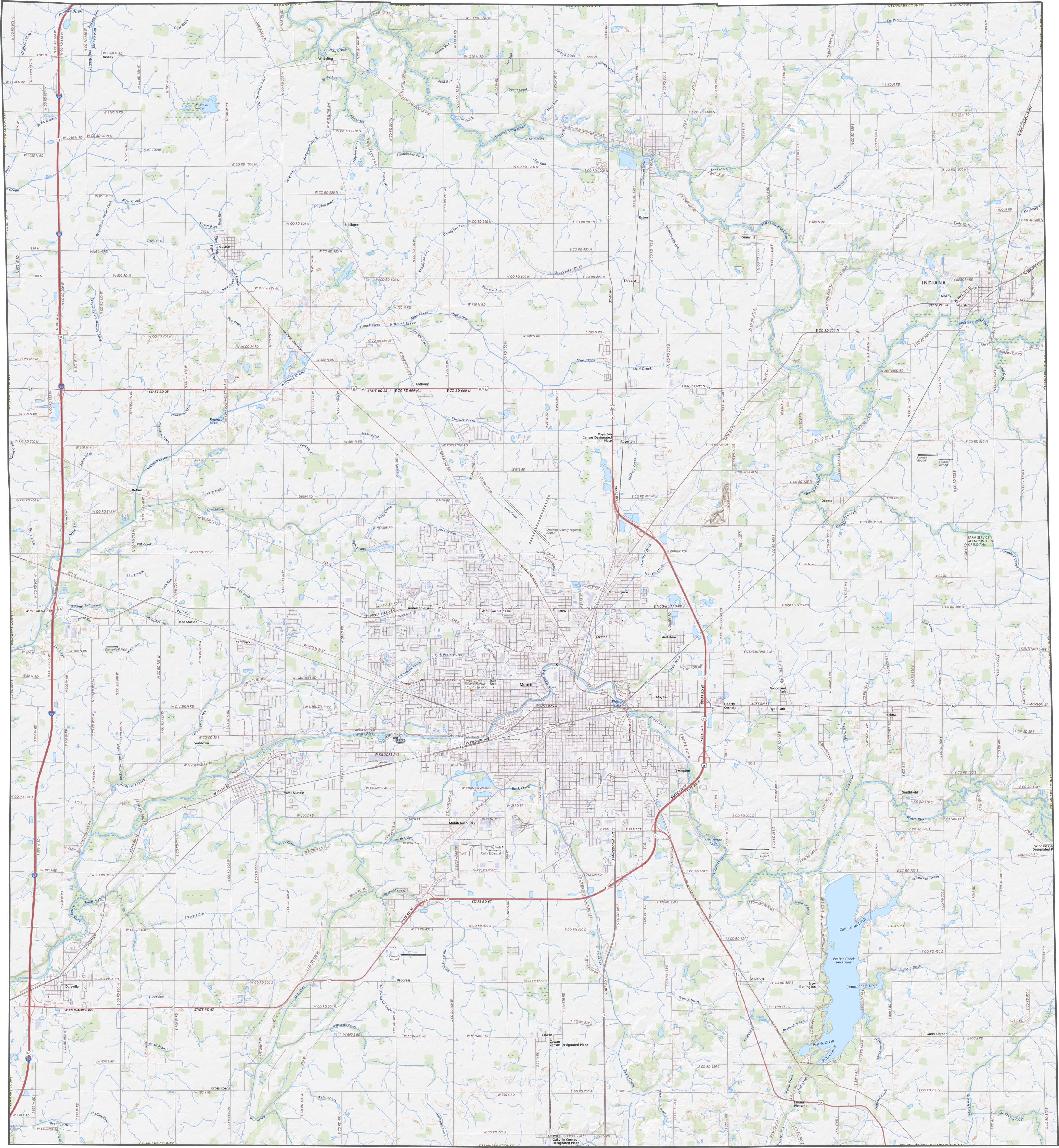
TRANSPORTATION MAP
Delaware County Road Map
The land features gently rolling hills, with the White River creating a noticeable valley through the center. While the eastern sections are flatter, there are more pronounced slopes near the riverbanks. The terrain transitions from urban to rural landscapes.
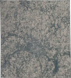
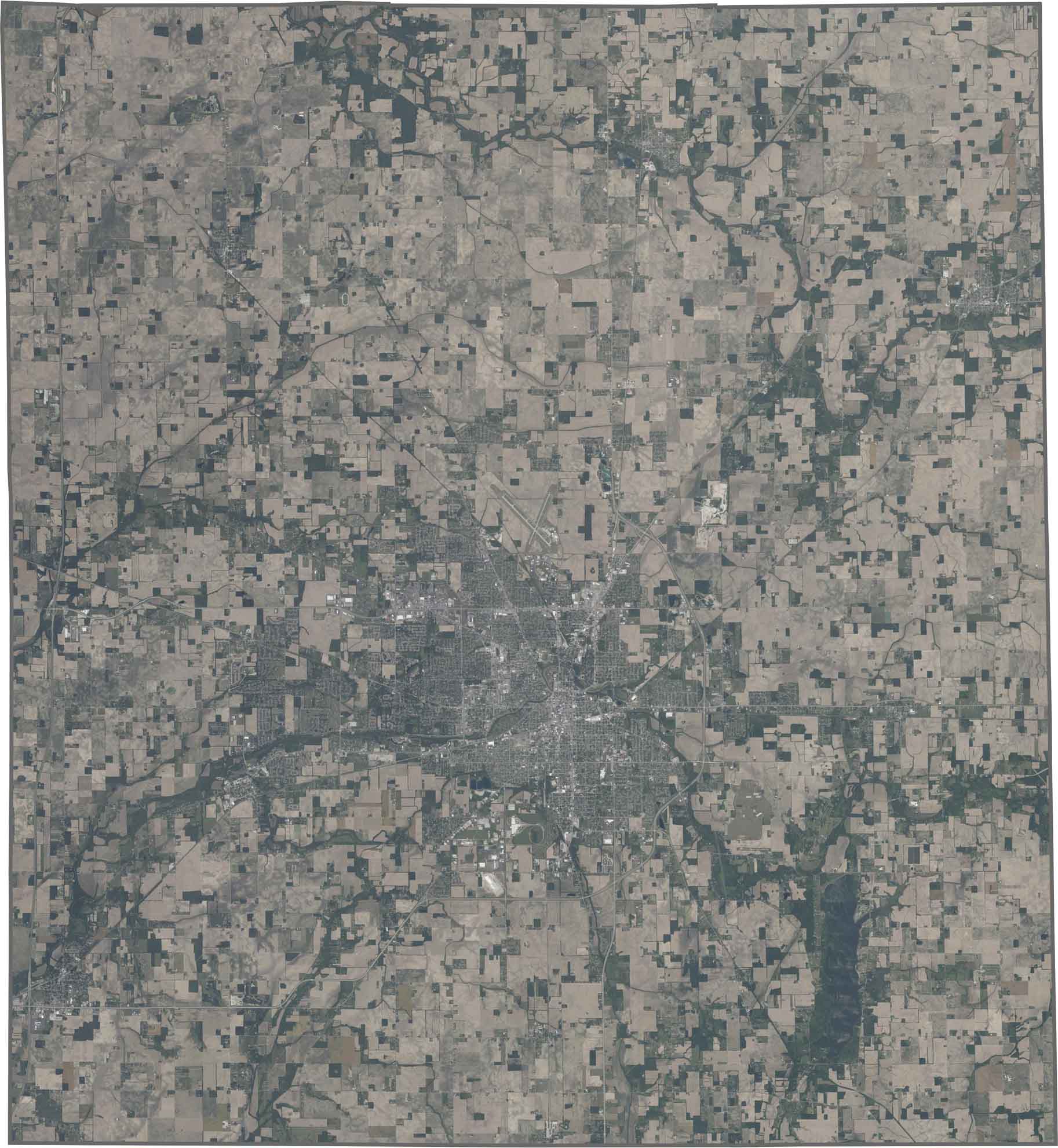
SATELLITE IMAGERY
Delaware County Satellite Map
Muncie stands out as the dominant urban center. There are winding tributaries feeding into the White River, creating finger-like patterns across the countryside. Farmland radiates outward from the city in patchwork squares.
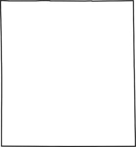
OUTLINE MAP
Delaware County Blank Map
Delaware County forms a rectangle shape. The White River flows through but doesn’t define its borders. It’s entirely surrounded by other Indiana counties with no state boundaries.

Neighboring Counties
Here are the 6 neighboring counties of Delaware County:


Indiana County Map

Explore the Hoosier State. 92 counties worth of backroads, skyline views, and small-town magic. This is your glovebox passport to diner pies, covered bridges, and Lake Michigan sunsets.