Forsyth County Map, Georgia

Forsyth County Map Collection


We allow you to use our Forsyth County map. Attribution is required.
Forsyth County, Georgia

Long story short, Forsyth County has transformed from a rural backwater to one of Atlanta’s most desirable suburbs. It’s nestled in north Georgia, bordering Lake Lanier to the northeast. Cumming, the county seat, has grown from a small town into a bustling city.
Forsyth’s excellent schools and low crime rates attract families in droves so the county’s population has exploded in recent decades. In fact, it’s one of the fastest-growing areas in the nation. Even though it has experienced rapid development, Forsyth still has pockets of natural beauty, like Sawnee Mountain Preserve.
The county’s economy is diverse, with tech companies setting up alongside more traditional businesses. Lake Lanier provides opportunities for water recreation. Forsyth’s history isn’t all rosy, but the county’s working to move beyond its troubled past.
| Category | Details |
|---|---|
| County Name | Forsyth County |
| County Seat | Cumming |
| Population | Approximately 300,000 |
| Cities, Towns, and Communities | Cumming (county seat), Alpharetta (partly), Buford (partly), and several unincorporated communities |
| Interstates and Highways | Interstate 985 (I-985), U.S. Route 19, State Route 20 |
| FIPS Code | 13-117 |
| Total Area (Land and Water) | 247 square miles (land: 244 sq mi, water: 3 sq mi) |
| Adjacent Counties (and Direction) | Dawson County (North), Hall County (East), Gwinnett County (Southeast), Fulton County (Southwest), Cherokee County (Northwest) |
| Time Zone | Eastern Time Zone (ET) |
| State | Georgia |
| Coordinates | 34.1983° N, 84.1474° W |
| Etymology | Named after John Forsyth, a governor of Georgia |
| Major Landmarks | Lake Lanier, Sawnee Mountain Preserve, Cumming Fairgrounds |
| Website | Forsyth County Website |
PHYSICAL MAP
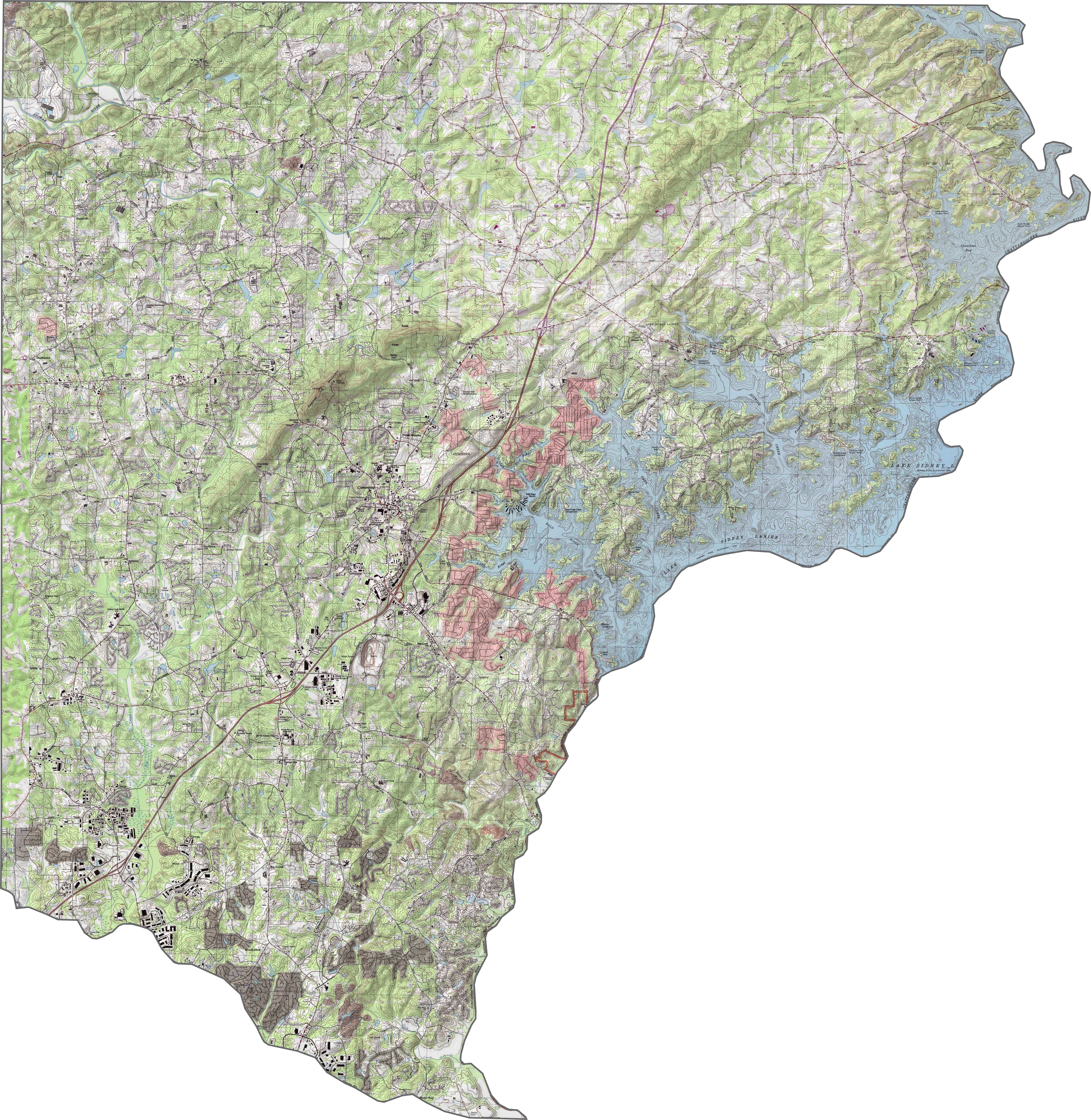
Forsyth County Topographic Map
This Forsyth County topographic map shows its varied terrain with generally higher elevations in the north. Sawnee Mountain really sticks out here in the center. Lake Lanier dominates the eastern border with numerous coves and peninsulas creating a complex shoreline.
SATELLITE IMAGERY
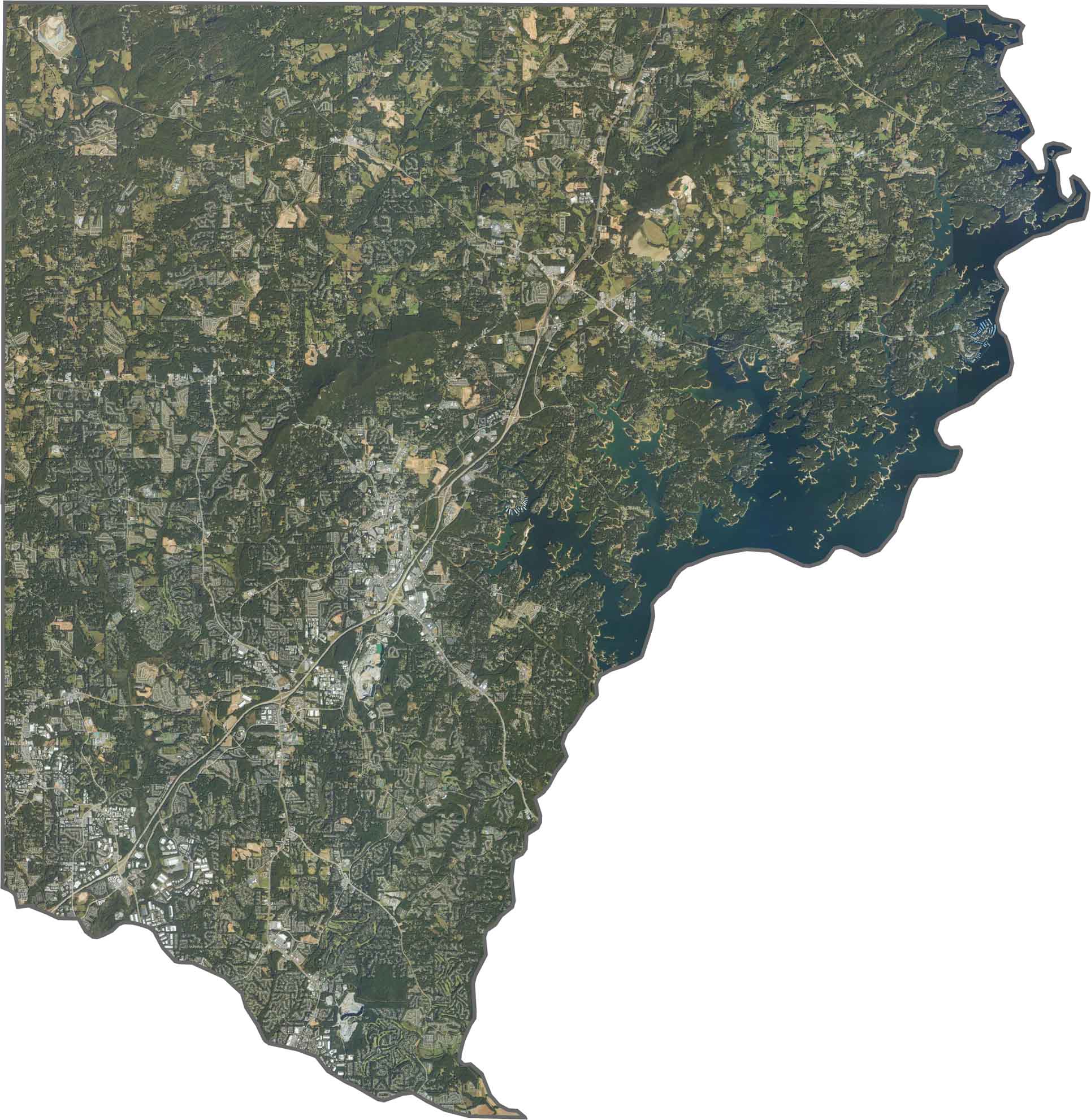
Forsyth County Satellite Map
Our satellite map shows Forsyth’s rapid transformation from rural to suburban landscape. The southern region contains dense housing developments. The northern areas still maintain some forests and farms bordering the Chattahoochee National Forest.
OUTLINE MAP
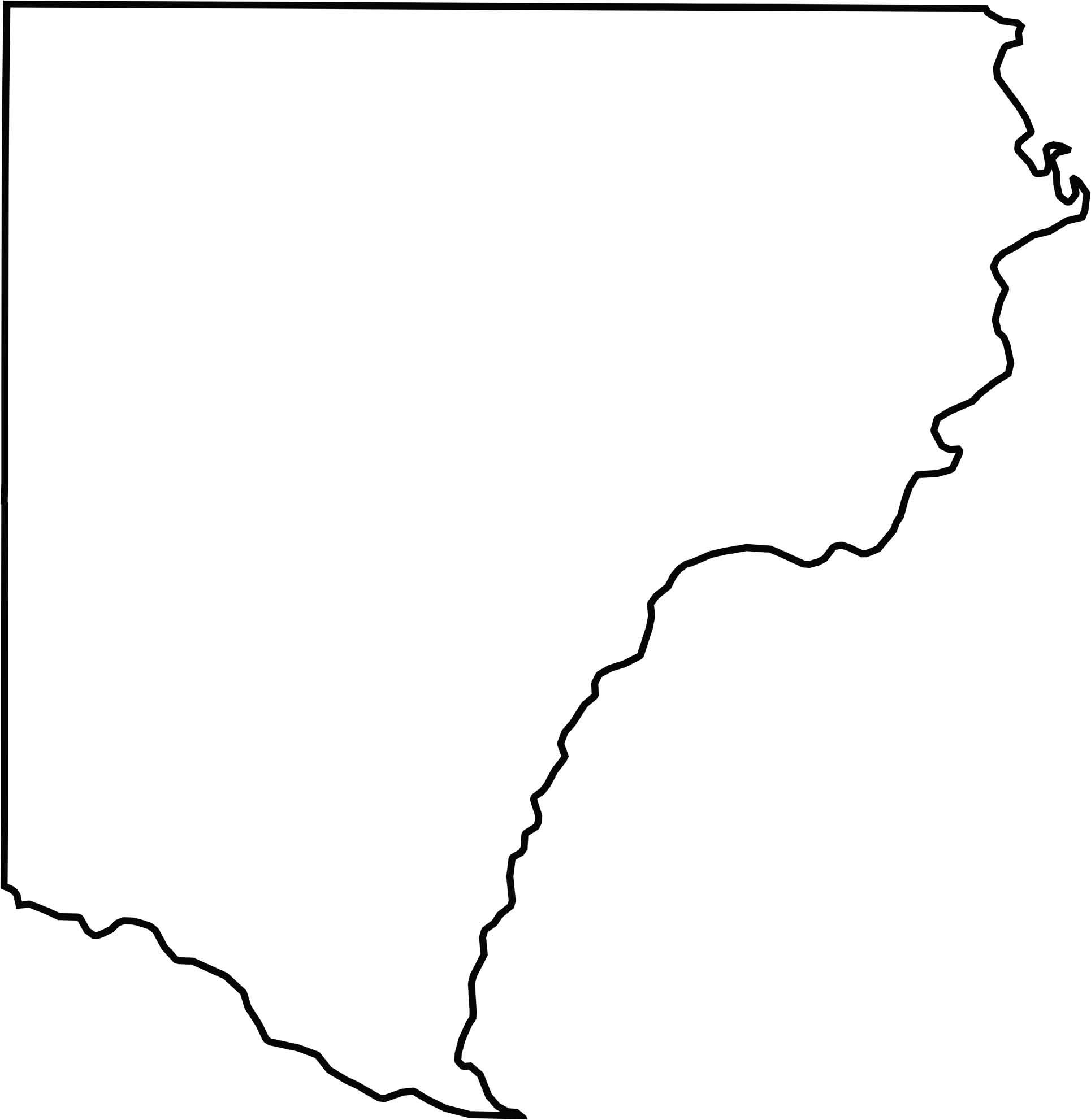
Forsyth County Blank Map
Forsyth County has a shape resembling a triangle (but with four sides). Its eastern border follows the irregular shoreline of Lake Lanier. The Chattahoochee River influenced the county’s early boundaries.
Neighboring Counties
Here are the 5 neighboring counties of Forsyth County:


Georgia County Map

Just launched! Our Georgia county map shows all 159 counties in stunning detail. It’s the perfect resource you’ve been waiting for. Don’t miss out on the Peach State.