Guadalupe County Map, Texas

Guadalupe County Map Collection


We allow you to use our Guadalupe County map. Attribution is required.
Guadalupe County, Texas

Guadalupe County is just east of San Antonio. It’s where the blackland prairies meet the Texas Hill Country. Seguin is the county seat and is home to some quirky attractions. There’s a giant pecan statue.
The Guadalupe River cuts through the county with some great spots for tubing and fishing. New Braunfels, partly in Guadalupe County, is famous for its German heritage and the Schlitterbahn water park.
The county is growing fast, but it hasn’t lost its charm. Schertz, Cibolo, Marion, and New Berlin are other major communities. You can still find quiet country roads and old pecan groves. The local BBQ is top-notch.
| Category | Details |
|---|---|
| County Name | Guadalupe County |
| County Seat | Seguin |
| Population | Approximately 180,000 |
| Cities, Towns, and Communities | Seguin, Schertz, Cibolo, Marion, New Berlin |
| Interstates and Highways | Interstate 10, Interstate 35, U.S. Highway 90, State Highway 46 |
| FIPS Code | 48-187 |
| Total Area (Land and Water) | 715 square miles (711 sq mi land, 4 sq mi water) |
| Adjacent Counties (and Direction) | Hays County (North), Caldwell County (Northeast), Gonzales County (Southeast), Wilson County (South), Bexar County (Southwest), Comal County (Northwest) |
| Time Zone | Central Time Zone (CST) |
| State | Texas |
| Coordinates | 29°35’N, 97°57’W |
| Etymology | Named after Guadalupe River, which runs through the county |
| Major Landmarks | ZDT’s Amusement Park, The Heritage Museum, Sebastopol House Historic Site |
| Website | Guadalupe County Website |
PHYSICAL MAP
Guadalupe County Topographic Map
Guadalupe County has varied terrain for its size. The key feature is the Guadalupe River, which winds through the southern portion and brings wide, wooded floodplains. Elevation increases toward the edge of the Hill Country, but much of the land is still good, flat farmland. See for yourself in our topographic map below.

TRANSPORTATION MAP
Guadalupe County Road Map
This county’s roads serve both urban and rural. Highways like I-10 link Seguin to San Antonio and stretch east toward smaller towns. Although growth is creeping in from the west, you can still find open stretches with little traffic. To get a better view of it all, try the zoom feature on our road map below.

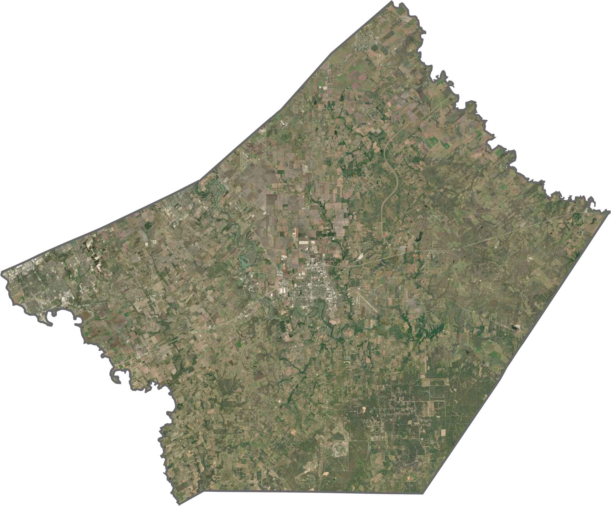
SATELLITE IMAGERY
Guadalupe County Satellite Map
Seguin is the brightest cluster, basically in the center of the county. You can see it best because of its residential growth and green belts. To the north, you’ll see pastures and wooded patches. South of the river, farmland also dominates. Development follows it but rarely overtakes it.
OUTLINE MAP
Guadalupe County Blank Map
Guadalupe County has a rectangular shape, tilted on its side. The northern and southern borders are straight. Whereas the Guadalupe River helps define its northeast border. To the southwest, it’s the Cibolo Creek that makes its boundary.

Neighboring Counties
Here are the 6 neighboring counties of Guadalupe County:


Texas County Map

254 legendary Texas county maps. From the Panhandle to the Rio Grande, we’ve got the Lone Star State mapped. That means more rodeos, honky-tonk, and Texas BBQ.