Harford County Map, Maryland
Harford County Map Collection


We allow you to use our Harford County map. Attribution is required.
Harford County, Maryland
Harford County sits in the northeast corner of Maryland, bordering Pennsylvania. The county’s got a bit of everything. It has busy towns, quiet farms, and waterfront views.
Bel Air, the county seat, is where most of the action happens. You’ll find old buildings rubbing shoulders with new developments.
The area’s got deep roots in the American Revolution, and history buffs will have a field day exploring. On weekends, locals frequent Susquehanna State Park for hiking and fishing.
| Category | Details |
|---|---|
| County Name | Harford County |
| County Seat | Bel Air |
| Population | 290,000 |
| Cities, Towns, and Communities | Bel Air, Aberdeen, Havre de Grace, Edgewood, Aberdeen Proving Ground, and several unincorporated communities |
| Interstates and Highways | Interstate 95, U.S. Route 1, Maryland Route 22, Maryland Route 24 |
| FIPS Code | 24-025 |
| Total Area (Land and Water) | 527.4 square miles (land: 521.6 sq mi, water: 5.8 sq mi) |
| Adjacent Counties (and Direction) | York County, Pennsylvania (North), Lancaster County, Pennsylvania (Northeast), Cecil County (East), Kent County (South), Baltimore County (West) |
| Time Zone | Eastern Time Zone (EST) |
| State | Maryland |
| Coordinates | 39.53°N, 76.38°W |
| Etymology | Named in honor of Henry Harford |
| Major Landmarks | Susquehanna State Park, Harford County Historical Museum, Ladew Topiary Gardens, Havre de Grace Maritime Museum |
| Website | Harford County Website |
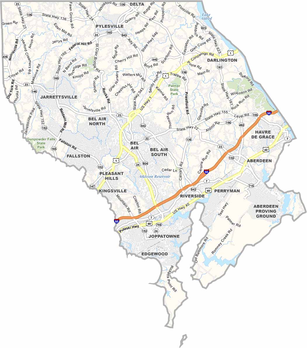
TRANSPORTATION MAP
Harford County Road Map
I-95 is the main highway here, which clips the eastern edge. Whereas Route 24 turns inland toward Bel Air. Many roads follow colonial-era paths. In fact, some still marked by historic stone mile markers. Get a closer look at important details with our interactive zoom feature.

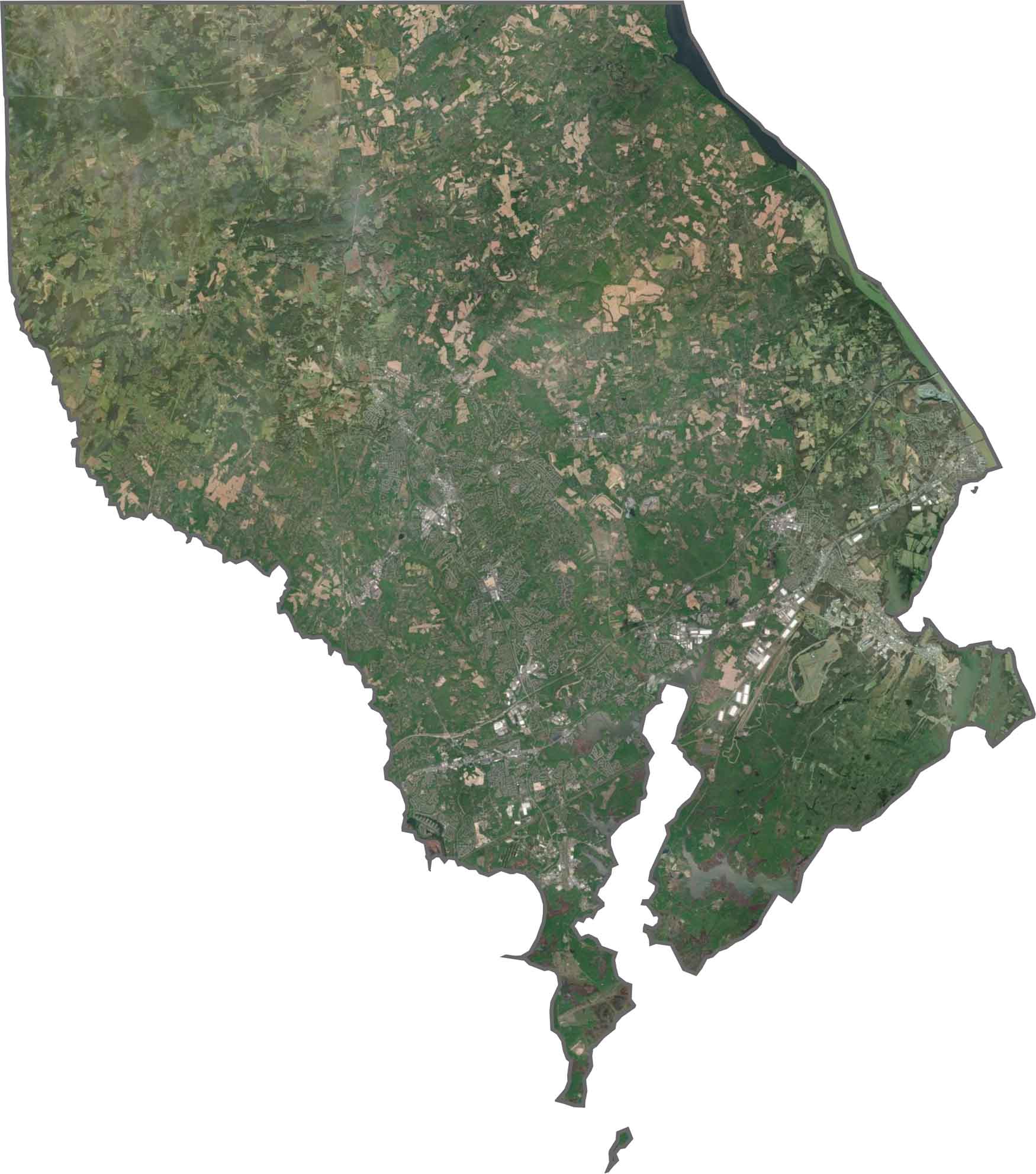
SATELLITE IMAGERY
Harford County Satellite Map
Harford County contains suburbs, farms, and forest with the Susquehanna’s broad mouth dominating the south. Aberdeen Proving Ground appears as a mysterious blank space along the bay.
OUTLINE MAP
Harford County Blank Map
The Susquehanna River forms a border with Cecil County to the east, while Pennsylvania provides a straight line boundary to the north. Oddly, only a thin strip connects it to Baltimore County.

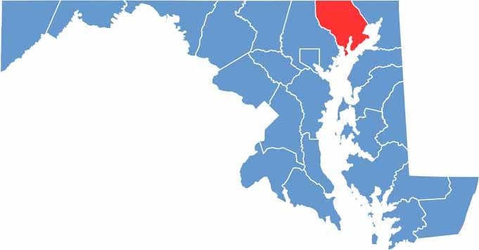
Neighboring Counties
Here are the 8 neighboring counties of Harford County:


Maryland County Map

With 23 counties and Baltimore City, Maryland gives you a distinct experience in every corner. City life, small towns, and outdoor adventures all come together. Learn more in our Maryland county maps.