Hidalgo County Map, Texas

Hidalgo County Map Collection


We allow you to use our Hidalgo County map. Attribution is required.
Hidalgo County, Texas

Hidalgo County is down where the Rio Grande meets Texas. It’s part of the Rio Grande Valley, right on the Mexican border. McAllen is the biggest city, but Edinburg is the county seat.
It’s hot here. Really hot. But the winters are mild. Agriculture is huge. Citrus groves are everywhere. The county’s population has exploded in recent years. It’s one of the fastest-growing areas in the country.
Birding is world-class. So is the Tex-Mex food. The culture is a blend of American and Mexican influences. You’ll hear as much Spanish as English here. Hidalgo County is a dynamic place, always changing, always growing.
| Category | Details |
|---|---|
| County Name | Hidalgo County |
| County Seat | Edinburg |
| Population | Approximately 1,060,000 |
| Cities, Towns, and Communities | McAllen, Edinburg, Mission, Pharr, Weslaco, Alamo, Donna, Mercedes |
| Interstates and Highways | Interstate 2, U.S. Highway 281, State Highway 107 |
| FIPS Code | 48-215 |
| Total Area (Land and Water) | 1,583 square miles (1,571 sq mi land, 12 sq mi water) |
| Adjacent Counties (and Direction) | Brooks County (North), Kenedy County (Northeast), Willacy County (East), Cameron County (East), Starr County (West) |
| Time Zone | Central Time Zone (CST) |
| State | Texas |
| Coordinates | 26°26’N, 98°12’W |
| Etymology | Named after Miguel Hidalgo y Costilla, a leader in the Mexican War of Independence |
| Major Landmarks | Santa Ana National Wildlife Refuge, Museum of South Texas History, La Plaza Mall |
| Website | Hidalgo County Website |
PHYSICAL MAP
Hidalgo County Topographic Map
It doesn’t get much flatter than this. Hidalgo County’s defining feature is its broad, low floodplain along the Rio Grande. The land slopes gently southward, barely rising in the north. Use our zoom tool to explore every elevation contour.

TRANSPORTATION MAP
Hidalgo County Road Map
Hidalgo’s highway system is built for cross-border flow and regional traffic. Roads here run east-west more than north-south, keeping close to the Rio Grande. U.S. Highways 281 and 83 are the main highways here to help traffic flow smoothly though the county.

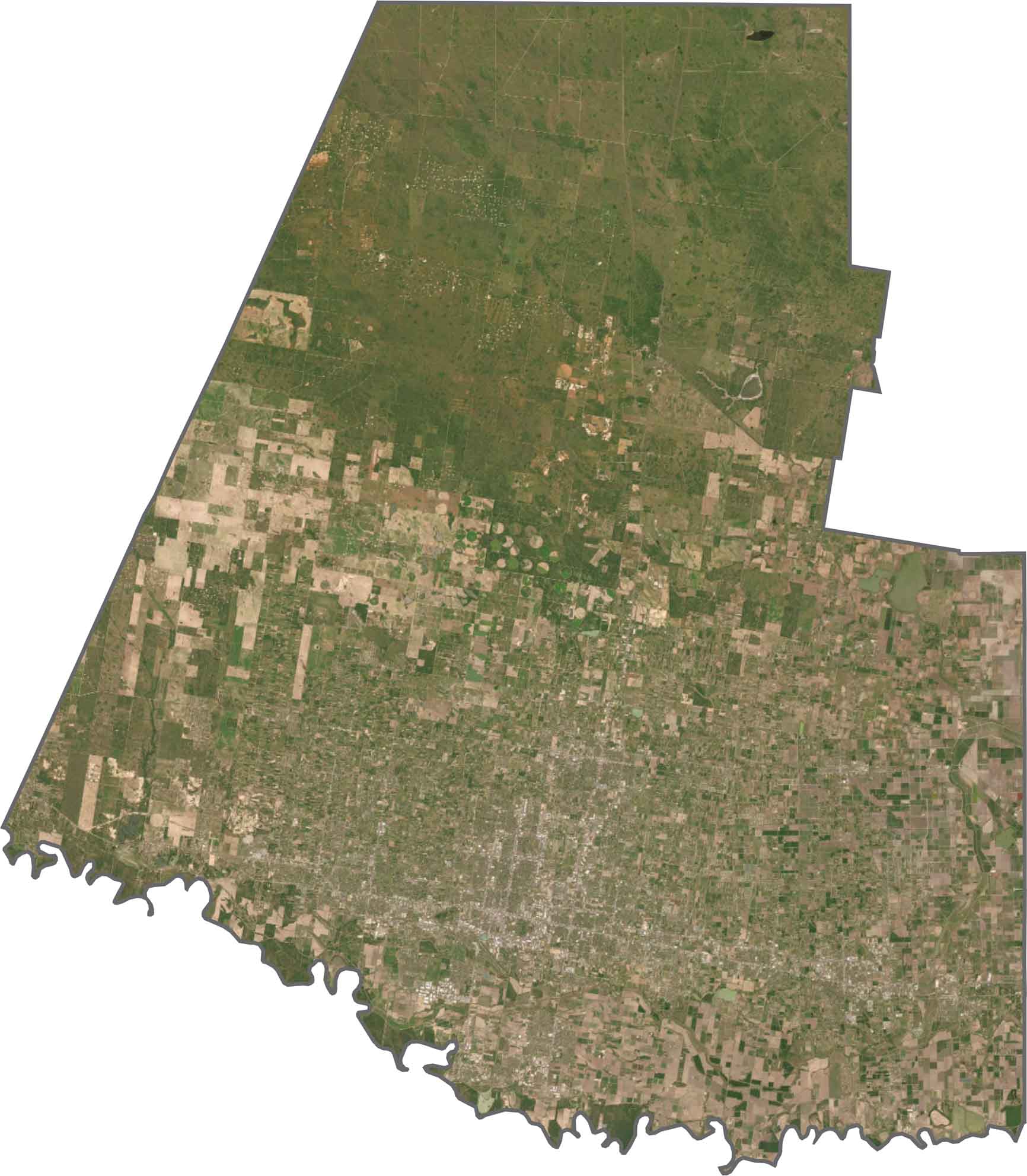
SATELLITE IMAGERY
Hidalgo County Satellite Map
Urban sprawl fills much of the southern half, with McAllen, Edinburg, and Mission blending together. Agriculture takes over in the central area with rows of crops, citrus groves, and irrigated fields. Finally, the northern section has the most oil and gas activity.
OUTLINE MAP
Hidalgo County Blank Map
Hidalgo County is wide, flat, and horizontal, with its southern edge defined by the Rio Grande. It shares a long international border with Mexico. The rest of the outline is mostly straight, drawn with survey lines. It’s one of Texas’s southernmost counties and one of the easiest to recognize on a map.

Neighboring Counties
Here are the 5 neighboring counties of Hidalgo County:


Texas County Map

254 legendary Texas county maps. From the Panhandle to the Rio Grande, we’ve got the Lone Star State mapped. That means more rodeos, honky-tonk, and Texas BBQ.