Jefferson County Map, Missouri

Jefferson County Map Collection

We allow you to use our Jefferson County map. Attribution is required.
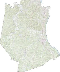
Jefferson County, Missouri

Jefferson County is just south of St. Louis. The Mississippi River forms its eastern border, separating it from the state of Illinois. Old towns, new subdivisions. It’s all here.
This place has been around since 1818, and it shows in the best ways. People love exploring the area’s past, from Native American sites to Civil War battlefields.
Did someone say fishing? Oh yeah. The Big River’s a hotspot and several of its lakes. De Soto might be the biggest town, but don’t sleep on the smaller spots.
| Category | Details |
|---|---|
| County Name | Jefferson County |
| County Seat | Hillsboro |
| Population | Approximately 230,000 |
| Cities, Towns, and Communities | Arnold, Festus, De Soto, Pevely, Hillsboro, Crystal City, Byrnes Mill, Herculaneum |
| Interstates and Highways | I-55, US 61, MO 21, MO 30, MO 141 |
| FIPS Code | 29-099 |
| Total Area (Land and Water) | 664 square miles (Land: 657 sq mi, Water: 7 sq mi) |
| Adjacent Counties (and Direction) | St. Louis County (North), Monroe County, Illinois (East), Ste. Genevieve County (Southeast), St. Francois County (South), Washington County (Southwest), Franklin County (West) |
| Time Zone | Central Time Zone (CT) |
| State | Missouri |
| Coordinates | 38.2157° N, 90.5258° W |
| Etymology | Named after Thomas Jefferson, the third President of the United States |
| Major Landmarks | Mastodon State Historic Site, Sandy Creek Covered Bridge, Jefferson Barracks Historic Park |
| Website | Jefferson County Website |
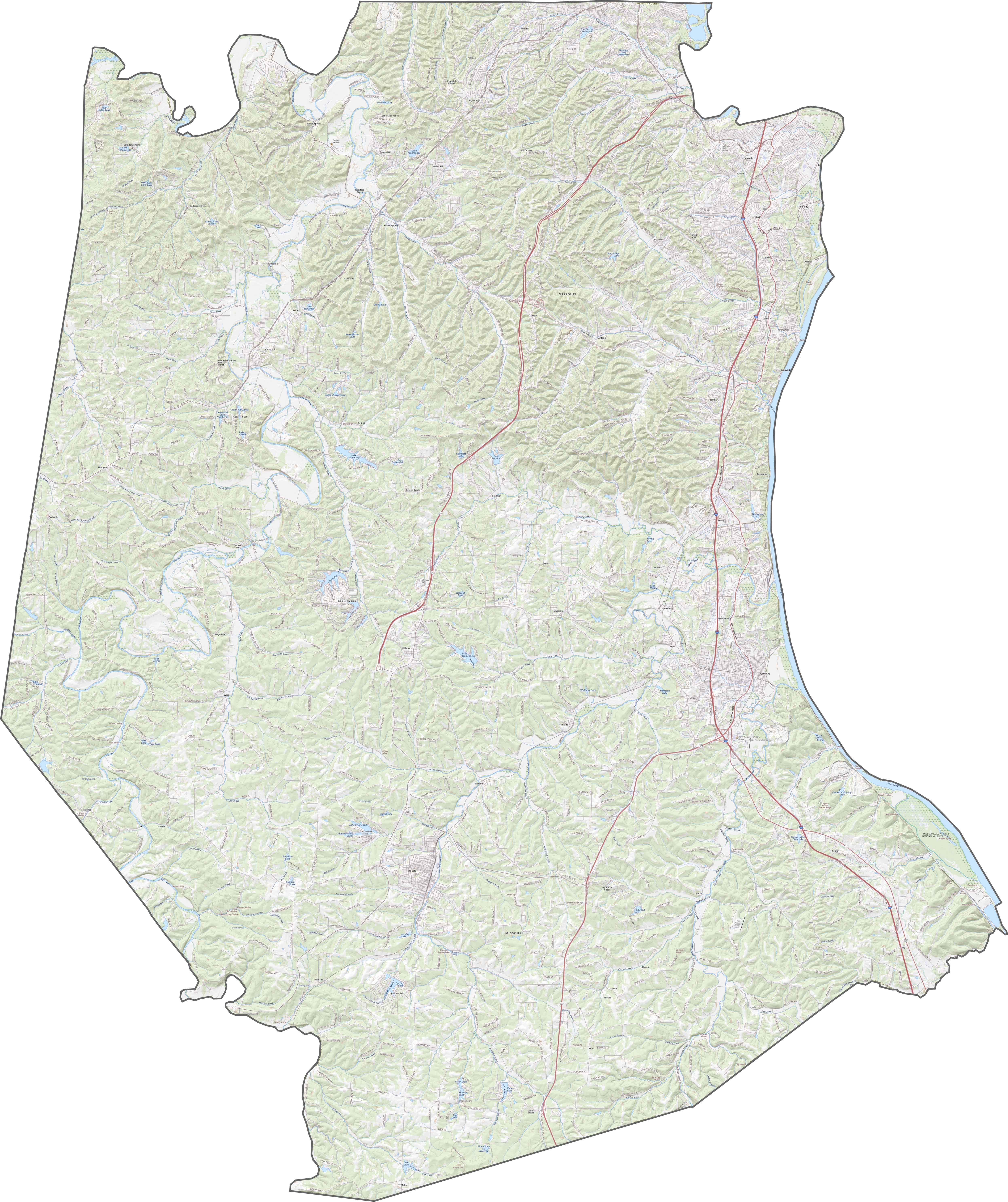
TRANSPORTATION MAP
Jefferson County Road Map
Jefferson County’s road network gives you plenty of ways to get around. I-55 runs north-south, connecting it quickly to St. Louis. You can zoom in on our road map below to pick the best route through the hills.
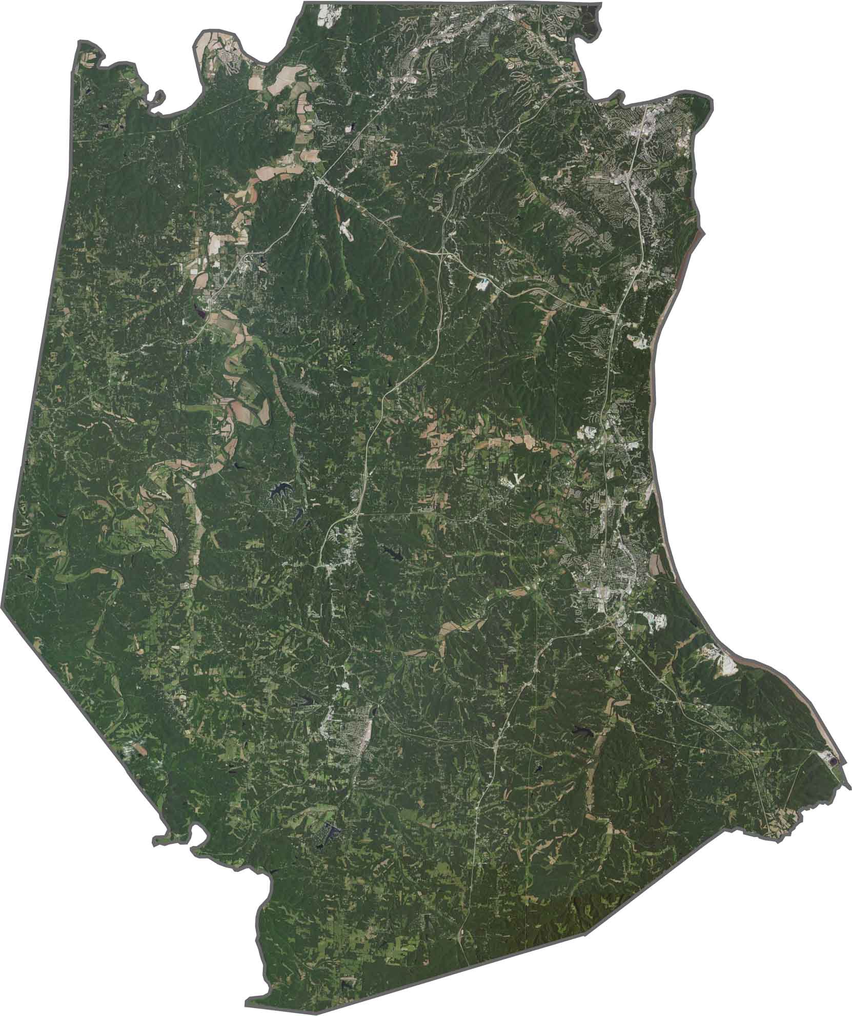
SATELLITE IMAGERY
Jefferson County Satellite Map
Jefferson County looks wild and green in our satellite map. Thick forests cover much of the land, especially in the southern half. Although suburbs creep southward from St. Louis, wide stretches of trees still dominate the view.
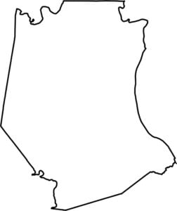
OUTLINE MAP
Jefferson County Blank Map
Jefferson County’s outline is anything but regular. Its eastern border follows the Mississippi River. That means plenty of bends and curves, not straight survey lines. It’s next to Illinois, located to the east.

Neighboring Counties
Here are the 6 neighboring counties of Jefferson County:


Missouri County Map

Explore the Show-Me State. We have all 114 county maps as your guide to smoky BBQ, Ozark trails, and sunsets over the mighty Mississippi. From St. Louis to Branson, Missouri has something on every road.